Twin Lakes | |
---|---|
Coordinates: 38°9′56″N119°19′36″W / 38.16556°N 119.32667°W | |
Country | United States |
State | California |
County | Mono |
Area | |
• Total | 5.22 sq mi (13.52 km2) |
• Land | 4.17 sq mi (10.80 km2) |
• Water | 1.05 sq mi (2.72 km2) 0% |
Elevation | 7,090 ft (2,160 m) |
Population (2020) [3] | |
• Total | 45 |
• Density | 11/sq mi (4.2/km2) |
Time zone | UTC-8 (Pacific (PST)) |
• Summer (DST) | UTC-7 (PDT) |
ZIP Code | 93517 (Bridgeport) |
Area code(s) | 442/760 |
FIPS code | 06-81048 |
GNIS feature ID | 2804105 [2] |
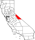
Twin Lakes is an unincorporated community and census-designated place (CDP) in Mono County, California, United States. It is located on the east side of the Sierra Nevada, encompassing the lakes of the same name and extending north down the outlet valley of Robinson Creek. The area is part of Toiyabe National Forest and is 10 miles (16 km) southwest of Bridgeport. It was first listed as a CDP for the 2020 census, with a population of 45. [3]
Mono Village Resort is part of the community. The resortt attracts hundreds of fishermen and outdoor enthusiasts every year. [4]
The main tourist attraction of the settlement is the two lakes known as Twin Lakes. Both of these lakes are filled with water from Robinson's Creek which flows down from the top of the mountains and ends at the Bridgeport Reservoir. Both lakes have boat access and the Upper Twin allows for water sports. The area has trailheads for many backcountry hiking trails. The settlement is on the back side of Yosemite which makes it attractive to expert backpackers and horseback tours.
Census | Pop. | Note | %± |
---|---|---|---|
2020 | 45 | — | |
[5] |
Twin Lakes first appeared as a census designated place in the 2020 U.S. Census. [6]
Race / Ethnicity (NH = Non-Hispanic) | Pop 2020 [5] | % 2020 |
---|---|---|
White alone (NH) | 40 | 88.89% |
Black or African American alone (NH) | 0 | 0.00% |
Native American or Alaska Native alone (NH) | 0 | 0.00% |
Asian alone (NH) | 0 | 0.00% |
Pacific Islander alone (NH) | 0 | 0.00% |
Other race alone (NH) | 0 | 0.00% |
Mixed race or Multiracial (NH) | 1 | 2.22% |
Hispanic or Latino (any race) | 4 | 8.89% |
Total | 45 | 100.00% |
Mono County is a county located in the east central portion of the U.S. state of California. As of the 2020 census, the population was 13,195, making it the fourth-least populous county in California. The county seat is Bridgeport. The county is located east of the Sierra Nevada between Yosemite National Park and Nevada. The only incorporated town in the county is Mammoth Lakes, which is located at the foot of Mammoth Mountain. Other locations, such as June Lake, are also famous as skiing and fishing resorts. Located in the middle of the county is Mono Lake, a vital habitat for millions of migratory and nesting birds. The lake is located in a wild natural setting, with pinnacles of tufa arising out of the salty and alkaline lake. Also located in Mono County is Bodie, the official state gold rush ghost town, which is now a California State Historic Park.
Almanor is a census-designated place (CDP) in Plumas County, California, United States. The population was 0 at the 2010 Census, but as of 2020, the population was reported as 3. Almanor is located 7 miles (11.3 km) south-southeast of Chester.
Sunset is a census-designated place (CDP) in Miami-Dade County, Florida, United States. It is part of the Miami metropolitan area of South Florida. The population was 15,912 at the 2020 census. The U.S. Postal Service uses the ZIP Codes of 33173 and 33183 for Sunset.
Boykin is an unincorporated community and census-designated place (CDP) in Miller County, Georgia, United States. The 2020 census listed a population of 151.
Atlantic is a census-designated place (CDP) in Accomack County, Virginia. Per the 2020 census, the population was 808.
Deep Creek is a census-designated place (CDP) in Accomack County, Virginia, United States. Per the 2020 census, the population was 94.
Harborton is a census-designated place (CDP) in Accomack County, Virginia, United States. Per the 2020 census, the population was 130.
Mappsburg is a census-designated place (CDP) in Accomack County, Virginia, United States. Per the 2020 census, the population was 51.
Quinby is a census-designated place (CDP) in Accomack County, Virginia, United States. It was first listed as a CDP in 2010. Per the 2020 census, the population was 285.
Bayside is a census-designated place (CDP) in Accomack County, Virginia, United States. Per the 2020 census, the population was 107.
Bobtown is a census-designated place (CDP) in Accomack County, Virginia, United States. Per the 2020 census, the population was 267.
Roland is a census-designated place in Pulaski County, Arkansas, United States. It is part of the Central Arkansas metropolitan area. Per the 2020 census, the population was 820.
Maysville is an unincorporated community and census-designated place (CDP) in Benton County, Arkansas, United States. It is the westernmost settlement in the state of Arkansas. Per the 2020 census, the population was 117. It is located in the Northwest Arkansas region.
Evergreen is a census-designated place (CDP) in Starr County, Texas, United States. It is a new CDP, formed from part of the Roma Creek CDP prior to the 2010 census, with a population of 73.
Fronton Ranchettes is a census-designated place (CDP) in Starr County, Texas, United States. It is a new CDP, formed from part of the Roma Creek CDP prior to the 2010 census, with a population of 113.
Ten Mile Creek is a census-designated place in Montgomery County, Maryland, United States. It was first listed as a CDP for the 2020 census, when it had a population of 1,012.
Virginia Lakes is an unincorporated community and census-designated place (CDP) in Mono County, California, United States. It is located on the eastern side of the Sierra Nevada in the area of the Virginia Lakes basin, at the southwest end of Virginia Lakes Road, which leads northeast 6 miles (10 km) to U.S. Route 395 at Conway Summit. The community was first listed as a CDP for the 2020 census, when it had a population of 7.
Plum Valley is an unincorporated community and census-designated place (CDP) in Will County, Illinois, United States. It is in the northeast corner of the county, bordered to the north by Cook County and to the east by Lake County, Indiana. To the south is unincorporated Willow Brook Estates. Plum Creek flows from southwest to northeast through the center of the CDP.
Pine Ridge is an unincorporated community and census-designated place (CDP) in Darlington County, South Carolina, United States. It was first listed as a CDP prior to the 2020 census with a population of 807.
Schooner Bay is a census-designated place (CDP) in Accomack County, Virginia, United States. It was first listed as a CDP in 2010. As of the 2020 census, it had a population of 97.