Urayasu

Last updated • 6 min readFrom Wikipedia, The Free Encyclopedia
Urayasu
浦安市
Urayasu-city.jpg
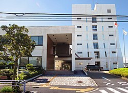
Urayasu City Hall
Flag of Urayasu, Chiba.svg
Emblem of Urayasu, Chiba.svg
Urayasu in Chiba Prefecture Ja.svg
Location of Urayasu in Chiba Prefecture
Japan location map with side map of the Ryukyu Islands.svg
Red pog.svg
Urayasu
 
Coordinates: 35°39′14.2″N139°54′7.8″E / 35.653944°N 139.902167°E / 35.653944; 139.902167
Country Japan
Region Kantō
Prefecture Chiba
First official history1157[ citation needed ]
City SettledApril 1, 1981
Government
  MayorHideki Matsuzaki (since November 1998)
Area
  Total
17.30 km2 (6.68 sq mi)
Population
 (April 1, 2021)
  Total
170,091
  Density9,800/km2 (25,000/sq mi)
Time zone UTC+9 (Japan Standard Time)
-Tree Ginkgo biloba
- Flower Azalea
Phone number047-351-1111
Address1-1-1 Nekozane, Urayasu-shi, Chiba-ken 279-8501
Website Official website
Old Urayasu Old part of urayasu city chiba.JPG
Old Urayasu

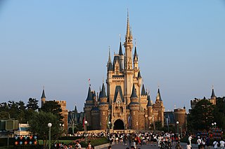
Urayasu (浦安市, Urayasu-shi) is a city located in Chiba Prefecture, Japan. As of 1 November 2020, the city had an estimated population of 170,533 in 81,136 households and a population density of 9,900 inhabitants per square kilometre (26,000/sq mi). [1] The total area of the city is 17.30 square kilometres (6.68 sq mi). Urayasu is best known as the home of Tokyo Disney Resort, which opened in April 1983, [2] and the headquarters of The Oriental Land Company. [3]

Contents

History

Early history

The area around Urayasu was tenryō territory within Shimōsa Province controlled directly by the Tokugawa shogunate during the Edo period. Urayasu served as an important fishing village for the Edo capitol. [2] Until the industrialization of the city it was a major center of production of nori , an edible seaweed, hamaguri, and asari clams. [4] All three are important elements of the traditional Japanese diet.

Timeline

Meiji and Taisho eras

Showa and Heisei eras

  • 1944 - Many of the residents of Urayasu perished during the 1944 Bombing of Tokyo. [4]
  • 1961 - Urayasu grew in the 1960s and 1970s with massive landfill projects along the shores of Tokyo Bay, public housing projects, and increasing infrastructure.
  • 1962 - Urayasu became part of the Keiyō Industrial Zone in this period, which spans from the city across the Tokyo Bay coast of Chiba Prefecture to Futtsu to the south. [4] An area of the Tokyo Bay near the town was reclaimed form the sea in 1960s called Maihama. [5]
  • 1971 - Fishing was abandoned in Urayasu due to the industrialization of the city. [4]
  • 1981 - Urayasu was elevated to city status on April 1, 1981. [6]
  • 1983 - Tokyo Disneyland opened on 15 April 1983 on 200 acres in Maihama. [5]
  • 2000 - Disney Ambassador Hotel was opened on 20 July 2000 as the first official Disney hotel in the resort, featuring art deco theming.
  • 2001 - Tokyo DisneySea was opened on 4 September 2001.
  • 2005 - Tokyo Disneyland park would continue to operate until 2006.
  • 2008 - Tokyo Disneyland Hotel was opened on July 8, 2008, as part of Tokyo Disney Resort's 25th anniversary celebrations.
  • 2011:
    • 11 March: Urayasu was greatly affected by earthquake, tsunami, and subsequent Fukushima nuclear disaster.[ citation needed ]
    • 8 April - Following the triple disaster, Urayasu with major areas of reclaimed land, had as much as 85% of the utility infrastructure, roads, buildings, and houses damaged or affected to some degree by soil liquefaction caused by earthquake. The damage cost the city approximately ¥73.4 billion to repair. [7] [8]
    • 11 April - Urayasu was affected by April 2011 Fukushima earthquake.
    • 12 April - Tokyo Disneyland was officially reopened following the triple disaster.
  • 2013 - Tokyo Disneyland commemorates 30th anniversary of opened.
  • 2016 - Tokyo Disney Celebration Hotel was opened on 1 June 2016 outside of the resort in nearby Shin-Urayasu. The hotel was refurbished from the former Palm & Fountain Terrace Hotel. The hotel is divided across two buildings called Wish and Discover. The two properties complement each other but vary in theming. This is the only official Disney hotel not located in the Resort area. A free 15-minute shuttle is available for guests.

Geography

Urayasu is located in the northwestern part of Chiba Prefecture, about 20 kilometers from the prefectural capital at Chiba and within 10 to 20 kilometers from the center of Tokyo. It consists of a low-lying natural levee, a delta and a reclaimed land on the left bank of the mouth of the Edo River. The river runs along the western side of the city and separates it from the Edogawa ward of Tokyo. [4] There are two parts to Urayasu: the original fishing village on natural levee on both banks of the Sakai River, which is a tributary of the Edo River, and the newer reclaimed land portion which occupies about three-quarters of the city area, created since the 1960s. The new landfill area is called "Shin-Urayasu" (New-Urayasu), and has an "American" inspired layout, with a grid-like map of wide streets, large sidewalks, palm trees and parks. The buildings are tall, modern apartments, some having views on Tokyo Bay. Urayasu is one of the most sought after areas in the metropolitan area for young families to live.

Climate

Urayasu has a humid subtropical climate (Köppen Cfa) characterized by warm summers and cool winters with light to no snowfall. The average annual temperature in Urayasu is 15.6 °C. The average annual rainfall is 1435 mm with September as the wettest month. The temperatures are highest on average in August, at around 27.0 °C, and lowest in January, at around 6.2 °C. [9]

Neighboring municipalities

Chiba Prefecture

Tokyo Metropolis

Government

Urayasu has a mayor-council form of government with a directly elected mayor and a unicameral city council of 21 members. Urayasu contributes two members to the Chiba Prefectural Assembly. In terms of national politics, the city is part of Chiba 5th district of the lower house of the Diet of Japan.

Demographics

Per Japanese census data, [10] the population of Urayasu has increased more than eighteen-fold over the past century, and grew especially rapidly between 1970 and 2010.

Historical population
YearPop.±%
1920 9,146    
1930 10,537+15.2%
1940 12,116+15.0%
1950 15,679+29.4%
1960 16,847+7.4%
1970 21,880+29.9%
1980 64,673+195.6%
1990 115,675+78.9%
2000 132,894+14.9%
2010 164,877+24.1%
2020 171,362+3.9%

Economy

Tokyo Bay NK Hall, Urayasu Tokyo Bay NK Hall.jpg
Tokyo Bay NK Hall, Urayasu

Urayasu is a regional commercial center and a bedroom community for nearby Chiba and Tokyo. The commuting rate to the central Tokyo is 49.0% per the 2015 interim census. The primary local employer in the city is The Oriental Land Company and businesses related to Tokyo Disney Resort.

Education

Universities

High schools

Public (operated by Chiba Prefectural Board of Education):

Private schools:

Primary and middle schools

Urayasu has 17 public elementary schools and nine public junior high schools operated by the city government and two private middle schools.

Municipal junior high schools: [11]

Municipal elementary schools: [12]

Transportation

Railway

JR logo (east).svg JR EastKeiyō Line

Tokyo Metro logo (full).svg Tokyo Metro - Tokyo Metro Tōzai Line

Disney Resort Line.svg Maihama Resort Line - Disney Resort Line

Highway

Sister cities

Notable people from Urayasu

Related Research Articles

<span class="mw-page-title-main">Tokyo Disney Resort</span> Theme park and vacation resort in Chiba, Japan

The Tokyo Disney Resort (東京ディズニーリゾート) is a theme park and vacation resort located in Urayasu, Chiba, Japan, just east of Tokyo. The resort is fully owned and operated by The Oriental Land Company under a license from The Walt Disney Company, which constructed and designed the resort and its various attractions through its Imagineering research & development arm.
<span class="mw-page-title-main">Chiba Prefecture</span> Prefecture of Japan

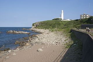
Chiba Prefecture is a prefecture of Japan located in the Kantō region of Honshu. Chiba Prefecture has a population of 6,278,060 and has a geographic area of 5,157 km2 (1,991 sq mi). Chiba Prefecture borders Ibaraki Prefecture to the north, Saitama Prefecture to the northwest, and Tokyo to the west.

<span class="mw-page-title-main">Ōta, Tokyo</span> Special ward in Kantō, Japan

Ōta is a special ward in the Tokyo Metropolis in Japan. The ward refers to itself in English as Ōta City. It was formed in 1947 as a merger of Ōmori and Kamata following Tokyo City's transformation into Tokyo Metropolis. The southernmost of the 23 special wards, Ōta borders the special wards of Shinagawa, Meguro and Setagaya to the north, and Kōtō to the east. Across the Tama River in Kanagawa Prefecture is the city of Kawasaki, forming the boundaries to the south and west.

<span class="mw-page-title-main">Fukaya, Saitama</span> City in Kantō, Japan

Fukaya is a city located in Saitama Prefecture, Japan. As of 1 January 2021, the city had an estimated population of 229,517 in 142,803 households in 60804 households and a population density of 1023 persons per km2. The total area of the city is 138.37 square kilometres (53.42 sq mi). It is famous for a variety of welsh onions or Fukaya-negi (深谷ネギ).

<span class="mw-page-title-main">Hamura, Tokyo</span> City in Kantō, Japan

Hamura is a city located in the western portion of the Tokyo Metropolis, Japan. As of 1 May 2010, the neighborhood had an estimated population of 57,174, and a population density of 5770 persons per km². The total area of the city was 9.90 square kilometres (3.82 sq mi).
<span class="mw-page-title-main">Akiruno, Tokyo</span> City in Kantō, Japan

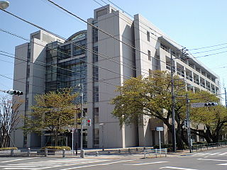
Akiruno is a city located in the western portion of the Tokyo Metropolis, Japan. As of 1 April 2021, the city had an estimated population of 80,177, and a population density of 1100 persons per km2. The total area of the city is 73.47 square kilometres (28.37 sq mi).

<span class="mw-page-title-main">Arakawa, Tokyo</span> Special ward in Kantō, Japan

Arakawa is a special ward in the Tokyo Metropolis in Japan. The ward takes its name from the Arakawa River, though the river does not run through or touch the ward. Its neighbors are the wards of Adachi, Kita, Bunkyo, Taito and Sumida. In English, the ward calls itself Arakawa City.
<span class="mw-page-title-main">Katsushika</span> Special ward in Kantō, Japan

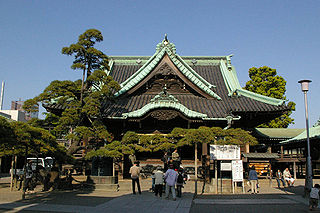
Katsushika is a special ward in the Tokyo Metropolis in Japan. It is known as Katsushika City in English.
<span class="mw-page-title-main">Edogawa, Tokyo</span> Special ward in Kantō, Japan

Edogawa is a special ward in the Tokyo Metropolis in Japan. It takes its name from the Edo River that runs from north to south along the eastern edge of the ward. In English, it uses the name Edogawa City.

<span class="mw-page-title-main">Urawa-ku, Saitama</span> Ward in Kantō, Japan

Urawa is one of ten wards of the city of Saitama, in Saitama Prefecture, Japan. Located in the northeast of the city, Urawa is the governmental center of Saitama and houses most of the city's administrative offices including the city hall, as well as the offices of Saitama Prefectural government. Also, there are several newspaper branch offices and three broadcasting stations.
<span class="mw-page-title-main">Kyonan</span> Town in Kantō, Japan

Kyonan is a town located in Chiba Prefecture, Japan. As of 1 November 2020, the town had an estimated population of 7,409 in 3543 households and a population density of 160 persons per km². The total area of the city is 45.16 square kilometres (17.44 sq mi).

<span class="mw-page-title-main">The Oriental Land Company</span> Japanese leisure and tourism company

The Oriental Land Company, Limited, also known as Oriental Land is a Japanese leisure and tourism subsidiary of the Keisei Electric Railway Company, headquartered in Urayasu, Chiba, Japan where it also owns and operates the Tokyo Disney Resort. The company operates in three segments, divided as theme parks, hotels, and other business. It is a component of the TOPIX Large70 index.

<span class="mw-page-title-main">Mihama-ku</span> Ward in Kantō, Japan

Mihama Ward is one of the six wards of the city of Chiba in Chiba Prefecture, Japan. As of April 2012, the ward had an estimated population of 149,314 and a population density of 7,060 persons per km2. The total area was 21.16 km2.

<span class="mw-page-title-main">Kawasaki-ku, Kawasaki</span> Ward in Kantō, Japan

Kawasaki-ku (川崎区) is one of the seven wards of the city of Kawasaki in Kanagawa Prefecture, Japan. As of 2010, the ward had an estimated population of 216,826 and a density of 5,530 persons per km2. The total area was 39.21 square kilometres (15.14 sq mi). Kawasaki-ku has the home to the second largest Koreatown in Japan.

<span class="mw-page-title-main">Kumagaya</span> Special city in Kantō, Japan

Kumagaya is a city located in Saitama Prefecture, Japan. As of 1 February 2021, the city had an estimated population of 195,277 in 87,827 households and a population density of 1200 persons per km2. The total area of the city is 159.82 square kilometres (61.71 sq mi).

<span class="mw-page-title-main">Inage-ku</span> Ward in Kantō, Japan

Inage Ward is one of the six wards of the city of Chiba in Chiba Prefecture, Japan. As of April 2012, the ward had an estimated population of 156,860 and a population density of 7,380 persons per km2. The total area was 21.25 square kilometres (8.20 sq mi).

<span class="mw-page-title-main">Midori-ku, Chiba</span> Ward in Kantō, Japan

Midori Ward is one of the six wards of the city of Chiba in Chiba Prefecture, Japan. As of February 2016, the ward had an estimated population of 127,368 and a population density of 1920 persons per km2. The total area was 66.25 square kilometres (25.58 sq mi).

<span class="mw-page-title-main">Tokyo Bay City Bus</span> Bus company in Urayasu, Chiba Prefecture

The Tokyo Bay City Koutsu Co., Ltd. is a bus company in Urayasu, Chiba Prefecture. The company was established in 1976 by The Oriental Land Company. It is jointly owned by the Keisei Group and the Oriental Land Company. The company headquarters and bus depot is located in Chidori in Urayasu.
References

  1. "Urayasu city official statistics" (in Japanese). Japan.
  2. 1 2 "Urayasu". Encyclopedia of Japan. Tokyo: Shogakukan. 2012. Retrieved 16 May 2012.
  3. "Summary." OLC Group. Retrieved on October 1, 2009.
  4. 1 2 3 4 5 "Urayasu". Nihon Daihyakka Zensho (Nipponika) (in Japanese). Tokyo: Shogakukan. 2012. Archived from the original on 2007-08-25. Retrieved 2012-05-16.
  5. 1 2 Shapiro, Margaret (December 16, 1989). "Unlikely Tokyo Bay Site Is a Holiday Hit : Disneyland: For millions of Japanese, Mickey Mouse and Space Mountain are a vacationer's dream". Los Angeles Times. Retrieved August 20, 2015.
  6. 沿革と市域の変遷. Urayasu city official home page (in Japanese). 2015. Retrieved 26 February 2016.
  7. Fukue, Natsuko, "Urayasu still dealing with liquefaction", Japan Times , 8 April 2011, p. 4.
  8. Yomiuri Shimbun , "Liquefaction Damage Widespread", 10 April 2011.
  9. Urayasu climate data
  10. Urayasu population statistics
  11. "中学校". Urayasu City. Retrieved 2022-12-27.
  12. "小学校". Urayasu City. Retrieved 2022-12-27.