Wagon Mound, New Mexico

Last updated

Wagon Mound, New Mexico
Wagonmound.jpg
Village of Wagon Mound
Mora County New Mexico Incorporated and Unincorporated areas Wagon Mound Highlighted.svg
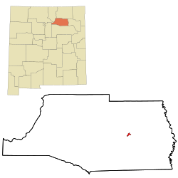
Location of Wagon Mound, New Mexico
Usa edcp location map.svg
Red pog.svg
Wagon Mound, New Mexico
Location in the United States
Coordinates: 36°0′26″N104°42′26″W / 36.00722°N 104.70722°W / 36.00722; -104.70722
Country United States
State New Mexico
County Mora
Area
[1]
  Total1.01 sq mi (2.62 km2)
  Land1.01 sq mi (2.62 km2)
  Water0.00 sq mi (0.00 km2)
Elevation
6,201 ft (1,890 m)
Population
 (2020) [2]
  Total266
  Density262.85/sq mi (101.52/km2)
Time zone UTC−07:00 (Mountain (MST))
  Summer (DST) UTC−06:00 (MDT)
ZIP Codes
87735, 87752
Area code 575
FIPS code 35-83340
GNIS feature ID0915913
Website sangres.com/newmexico/mora/wagonmound.htm
Wagon Mound sign Wagon Mound sign Picture 1940.jpg
Wagon Mound sign

Wagon Mound is a village in Mora County, New Mexico, United States. It is named after and located at the foot of a butte called Wagon Mound, which was a landmark for covered wagon trains and traders going up and down the Santa Fe Trail and is now Wagon Mound National Historic Landmark. It was previously an isolated ranch that housed four families that served as local traders. [3] The shape of the mound is said to resemble a Conestoga wagon. As of the 2010 census, the village population was 314. It was also called Santa Clara for many years. The village, with brightly painted houses and several stores and shops, is located on the plains of northeastern New Mexico. Interstate 25, which skirts the western side of town, gives a view of the majority of the town. Wagon Mound is not growing rapidly, but it has seen new construction along I-25, with new buildings on the northeast side of town as well.

Contents

Geography

Wagon Mound is located at 36°0′26″N104°42′26″W / 36.00722°N 104.70722°W / 36.00722; -104.70722 (36.007223, -104.707194). [4]

According to the United States Census Bureau, the village has a total area of 1.0 square mile (2.6 km2), all land.

Demographics

Historical population
CensusPop.Note
1920 875
1930 852−2.6%
1940 97914.9%
1950 1,12014.4%
1960 760−32.1%
1970 630−17.1%
1980 416−34.0%
1990 319−23.3%
2000 36915.7%
2010 314−14.9%
2020 266−15.3%
U.S. Decennial Census [5] [2]

As of the census [6] of 2000, there were 369 people, 172 households, and 99 families residing in the village. The population density was 364.1 inhabitants per square mile (140.6/km2). There were 230 housing units at an average density of 226.9 per square mile (87.6/km2). The racial makeup of the village was 45.53% White, 51.22% from other races, and 3.25% from two or more races. Hispanic or Latino of any race were 87.80% of the population.

There were 172 households, out of which 26.7% had children under the age of 18 living with them, 36.0% were married couples living together, 18.0% had a female householder with no husband present, and 42.4% were non-families. 36.0% of all households were made up of individuals, and 18.0% had someone living alone who was 65 years of age or older. The average household size was 2.15 and the average family size was 2.81.

In the village, the population was spread out, with 23.3% under the age of 18, 6.5% from 18 to 24, 22.5% from 25 to 44, 24.4% from 45 to 64, and 23.3% who were 65 years of age or older. The median age was 43 years. For every 100 females, there were 98.4 males. For every 100 females age 18 and over, there were 92.5 males.

The median income for a household in the village was $17,273, and the median income for a family was $21,667. Males had a median income of $20,357 versus $16,964 for females. The per capita income for the village was $10,459. About 23.8% of families and 22.8% of the population were below the poverty line, including 23.2% of those under age 18 and 28.4% of those age 65 or over.

Education

Wagon Mound Public Schools is the only school in Wagon Mound, serving kindergarten through 12th grade. The population of the school has been steadily decreasing and the student population is an estimated 67 as of the beginning of the 2008–2009 school year. Wagon Mound Public Schools is working with Luna Community College in Las Vegas, New Mexico to provide students with opportunities for college credit.

Notable people

1930 Tornado

On May 31, 1930, a deadly tornado struck the town, killing two men at an auto repair garage that was destroyed. As of 2022, this tornado and the March 23, 2007 Clovis EF2 tornado are the deadliest tornadoes to ever occur in New Mexico. [7]

Related Research Articles

<span class="mw-page-title-main">San Miguel County, New Mexico</span> County in New Mexico, United States

San Miguel County is a county in the U.S. state of New Mexico. As of the 2020 census, the population was 27,201. Its county seat is Las Vegas.

<span class="mw-page-title-main">Mora County, New Mexico</span> County in New Mexico, United States

Mora County is a county in the U.S. state of New Mexico. As of the 2020 census, the population was 4,189. Its county seat is the census-designated place (CDP) Mora. The county has another CDP, Watrous, a village, Wagon Mound, and 12 smaller unincorporated settlements. Mora became a formal county in the US, in what was then the New Mexico Territory, on February 1, 1860. Ecclesiastically, the county is within the Roman Catholic Archdiocese of Santa Fe. County population peaked at approximately 14,000 circa 1920, declining to about 4,000 to 5,000 since the 1970s; the 2018 estimate was 4,506.

<span class="mw-page-title-main">Guadalupe County, New Mexico</span> County in New Mexico, United States

Guadalupe County is a county in the U.S. state of New Mexico. As of the 2020 census, the population was 4,452. Its county seat is Santa Rosa.

<span class="mw-page-title-main">Colfax County, New Mexico</span> County in New Mexico, United States

Colfax County is a county in the U.S. state of New Mexico. As of the 2020 census, the population was 12,387. Its county seat is Raton. It is south from the Colorado state line. This county was named for Schuyler Colfax (1823–1885), seventeenth Vice President of the United States under U.S. President Ulysses S. Grant.

<span class="mw-page-title-main">Baca County, Colorado</span> County in Colorado, United States

Baca County is a county located in the U.S. state of Colorado. As of the 2020 census, the population was 3,506. The county seat is Springfield. Located at the southeast corner of Colorado, the county shares state borders with Kansas, New Mexico, and Oklahoma.

<span class="mw-page-title-main">Cordova, Alabama</span> City in Alabama, United States

Cordova is a city in Walker County, Alabama, United States. It was formerly a textile mill town. It was incorporated in 1897. At the 2010 census the population was 2,095, down from 2,423 in 2000.

<span class="mw-page-title-main">Stonington, Illinois</span> Village in Illinois, United States

Stonington is a village in Christian County, Illinois, United States. The population was 837 at the 2020 census.

<span class="mw-page-title-main">Coal City, Illinois</span> Village in Illinois, United States

Coal City is a village in Grundy and Will Counties in the U.S. state of Illinois. It is considered a fringe town of the Chicago metropolitan area. The population was 5,587 at the 2010 census.

<span class="mw-page-title-main">New Salem, Pike County, Illinois</span> Village in Illinois, United States

New Salem is a village in Pike County, Illinois, United States. The population was 136 at the 2000 census.

<span class="mw-page-title-main">New Minden, Illinois</span> Village in Illinois, United States

New Minden is a village in Washington County, Illinois, United States. The population was 215 at the 2010 census. It possessed a post office from 1868 to 1976.

<span class="mw-page-title-main">Eureka, Kansas</span> City in Greenwood County, Kansas

Eureka is a city in and the county seat of Greenwood County, Kansas, United States. As of the 2020 census, the population of the city was 2,332.

<span class="mw-page-title-main">Ashby, Minnesota</span> City in Minnesota, United States

Ashby is a city in northeastern Grant County, Minnesota, United States. The population was 469 at the 2020 census.

<span class="mw-page-title-main">St. Olaf Township, Otter Tail County, Minnesota</span> Township in Minnesota, United States

St. Olaf Township is a township in Otter Tail County, Minnesota, United States. The population was 395 at the time of the 2020 census.

<span class="mw-page-title-main">Maxwell, New Mexico</span> Village in New Mexico, United States

Maxwell is a village in Colfax County, New Mexico, United States. The population was 254 at the 2010 census, down from 274 in 2000. Maxwell was established in 1879 as a railroad town on the Atchison, Topeka and Santa Fe Railway. It was named in honor of Lucien Maxwell, who provided the land for the original townsite from his Maxwell Land Grant.

<span class="mw-page-title-main">Springer, New Mexico</span> Town in New Mexico, United States

Springer is a town in Colfax County, New Mexico, United States. Its population was 1,047 at the 2010 census.

<span class="mw-page-title-main">Santa Clara, New Mexico</span> Village in New Mexico, United States

Santa Clara is a village in Grant County, New Mexico, United States. The population was 1,686 at the 2010 census, down from 1,944 in 2000. Today it is a bedroom community for nearby Silver City.

<span class="mw-page-title-main">Northwood, North Dakota</span> City in North Dakota, United States

Northwood is a city in Grand Forks County, North Dakota, United States. It is part of the "Grand Forks, ND-MN Metropolitan Statistical Area" or "Greater Grand Forks." The population was 982 at the 2020 census.

<span class="mw-page-title-main">Cole, Oklahoma</span> Town in Oklahoma, United States

Cole is a town in McClain County, Oklahoma, United States. The population was 624 at the 2020 census, up from 555 at the 2010 census.

Sycamore is a town in Allendale County, South Carolina, United States. The population was 180 as of the 2010 census. On April 5, 2022, the town was hit by an EF3 tornado, although it had weakened to EF1 strength by the time it moved through town and only minor damage occurred. One person was injured by this tornado south of Allendale, South Carolina.

<span class="mw-page-title-main">Verona, Wisconsin</span> City in Wisconsin, United States

Verona is a city in Dane County, Wisconsin, in the United States and is a suburb of Madison. The population was 14,030 at the 2020 census. The city is located ten miles southwest of downtown Madison within the Town of Verona. It is part of the Madison Metropolitan Statistical Area.

References

  1. "ArcGIS REST Services Directory". United States Census Bureau. Retrieved October 12, 2022.
  2. 1 2 "Census Population API". United States Census Bureau. Retrieved October 12, 2022.
  3. La gente : hispano history and life in Colorado. C. de Baca, Vincent., Colorado Historical Society. Denver, Colo.: Colorado Historical Society. 1998. ISBN   9780870815386. OCLC   40678337.{{cite book}}: CS1 maint: others (link)
  4. "US Gazetteer files: 2010, 2000, and 1990". United States Census Bureau. February 12, 2011. Retrieved April 23, 2011.
  5. "Census of Population and Housing". Census.gov. Retrieved June 4, 2015.
  6. "U.S. Census website". United States Census Bureau . Retrieved January 31, 2008.
  7. "The Most 'Important' US Tornadoes by State". www.tornadoproject.com. Retrieved June 9, 2022. "New Mexico Event Report: EF2 Tornado". National Centers for Environmental Information. National Weather Service. Retrieved June 9, 2022. "New Mexico Event Report: EF2 Tornado". National Centers for Environmental Information. National Weather Service. Retrieved June 9, 2022.