Walnut Bottom, West Virginia

Last updated

Walnut Bottom, West Virginia
Walnut Bottom, West Virginia 2020.jpg
USA West Virginia location map.svg
Red pog.svg
Walnut Bottom
Usa edcp location map.svg
Red pog.svg
Walnut Bottom
Coordinates: 39°6′21″N79°0′58″W / 39.10583°N 79.01611°W / 39.10583; -79.01611
Country United States
State West Virginia
County Hardy
Time zone UTC-5 (Eastern (EST))
  Summer (DST) UTC-4 (EDT)
GNIS feature ID1555911 [1]

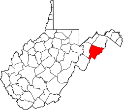
Walnut Bottom is an unincorporated community in Hardy County, West Virginia, United States.

Related Research Articles

<span class="mw-page-title-main">Logan County, West Virginia</span> County in West Virginia, United States

Logan County is a county in the U.S. state of West Virginia. As of the 2020 census, the population was 32,567. Its county seat is Logan. Logan County comprises the Logan, WV Micropolitan Statistical Area, which is also included in the Charleston–Huntington–Ashland, WV–OH–KY Combined Statistical Area.

<span class="mw-page-title-main">Hardy County, West Virginia</span> County in West Virginia, United States

Hardy County is a county in the U.S. state of West Virginia. As of the 2020 census, the population was 14,299. Its county seat is Moorefield. The county was created from Hampshire County in 1786 and named for Samuel Hardy, a distinguished Virginian.

Walnut Grove may refer to:

<span class="mw-page-title-main">Springfield, West Virginia</span> Census-designated place in West Virginia, United States

Springfield is a census-designated place (CDP) in northwestern Hampshire County in the U.S. state of West Virginia. As of the 2010 census, Springfield had a population of 477. Springfield is located north of Romney along West Virginia Route 28 at its junction with Green Spring Road and Springfield Pike. It is currently considering incorporation.

<span class="mw-page-title-main">Grafton National Cemetery</span> Historic cemetery in Taylor County, West Virginia

Grafton National Cemetery is a United States National Cemetery located in Grafton, West Virginia. It encompasses a total of 3.2 acres (1.3 ha). Along with West Virginia National Cemetery, it is one of two United States Department of Veterans Affairs national cemeteries in West Virginia, both of which are located in Grafton. The first interments took place in 1867 for casualties of the American Civil War in West Virginia.

<span class="mw-page-title-main">Pennsylvania Route 174</span> State highway in Cumberland County, Pennsylvania, US

Pennsylvania Route 174 is a 28-mile-long (45 km) state highway located in Cumberland County, Pennsylvania. The western terminus is at U.S. Route 11 and PA 533 in Shippensburg. The eastern terminus is at PA 641 in Monroe Township. PA 174 is a two-lane undivided road that runs through farmland in southern Cumberland County. The route heads east from Shippensburg and comes to an interchange with Interstate 81 (I-81). PA 174 continues through rural land, intersecting PA 233 in Dickinson, PA 465 in Mooredale, and PA 34 north of Mount Holly Springs before passing through Boiling Springs. From here, the route heads northeast and crosses PA 74 before coming to its end at PA 641 west of Mechanicsburg.

<span class="mw-page-title-main">Pennsylvania Route 465</span> State highway in Cumberland County, Pennsylvania, US

Pennsylvania Route 465 is a 6.64-mile-long (10.69 km) state highway located in Cumberland County, Pennsylvania. The southern terminus is at PA 174 in Mooredale. The northern terminus is at PA 641 outside of Carlisle. PA 464 heads northeast from PA 174 along Walnut Bottom Road, passing through farmland. The route reaches developed areas on the western edge of Carlisle and turns north onto Allen Road, intersecting Interstate 81 (I-81) and U.S. Route 11 before ending at PA 641. Walnut Bottom Road became part of US 11 and PA 13 in 1926, with the latter designation removed two years later. US 11 and PA 33 switched alignments between Shippensburg and Carlisle in 1941, with PA 33 designated onto Walnut Bottom Road. PA 465 was designated to its present alignment in the 1960s, replacing the PA 33 designation along Walnut Bottom Road.

<span class="mw-page-title-main">South Jefferson, Roanoke, Virginia</span> Roanoke Neighborhood in Virginia, United States

South Jefferson is a Roanoke, Virginia neighborhood located in southeast Roanoke, surrounded roughly by the Roanoke River to the south and east and the Roy L. Webber Expressway to the west, centered on South Jefferson Street. It borders the neighborhoods of Old Southwest on the west, Belmont and Downtown on the north, and Riverland/Walnut Hills via the Walnut Street Bridge on the east.

Riverland/Walnut Hills is a Roanoke, Virginia neighborhood located in southeast Roanoke south of the Roanoke River. It borders the neighborhoods of South Jefferson and South Roanoke on the west, Morningside on the east and Mill Mountain on the south. The neighborhood is divided into the Walnut Hill area at the base of Mill Mountain, and the Riverland area along the Roanoke River, with Virginia State Route 116 running through the entire area. As of the 2000 U.S. Census, Riverland/Walnut Hills has a population of 1,033.

<span class="mw-page-title-main">Green Bottom Wildlife Management Area</span> State Wildlife Management Area in Cabell and Mason counties, West Virginia

Green Bottom Wildlife Management Area is located on former plantation lands of U.S. Congressman and Confederate General Albert G. Jenkins. The 1,096 acres (444 ha) in Cabell County and Mason County are located along the banks of the Ohio River about 16 miles (26 km) north of Huntington, West Virginia. The Green Bottom WMA land is a mixture of farmland, mixed hardwood forest, wetlands, and open water. The Jenkins Plantation Museum is located on Corps of Engineers land adjacent to the WMA. The museum is located in the original 1835 Green Bottom Plantation House, and is operated by the West Virginia Division of Culture and History.

Whitman is an unincorporated community in Logan County, West Virginia, United States. Whitman is 3 miles (4.8 km) southwest of Logan. Whitman has a post office with ZIP code 25652.

Walnut is an unincorporated community in Pocahontas County, West Virginia, United States. Walnut is 14 miles (23 km) north of Marlinton.
<span class="mw-page-title-main">Superior Bottom, West Virginia</span> Unincorporated community in West Virginia, United States

Superior Bottom is an unincorporated community in Logan County, West Virginia, United States. Superior Bottom is located along West Virginia Route 44 and Island Creek, 7 miles (11 km) south of Logan.

Gillman Bottom is an unincorporated community in Logan County, West Virginia, United States. Gillman Bottom is located along Huff Creek and West Virginia Route 10, 4.7 miles (7.6 km) east-southeast of Man. It is part of the Mallory census-designated place.

Black Bottom is an unincorporated community in Logan County, West Virginia, United States. Black Bottom is located along West Virginia Route 73, 0.6 miles (0.97 km) west of Logan. It is part of the Mount Gay-Shamrock census-designated place.

Walnut Hill is an unincorporated community in Logan County, West Virginia, United States.

Walgrove is an unincorporated community in Kanawha County, in the U.S. state of West Virginia.

References