Winter, Wisconsin

Last updated
Winter, Wisconsin
Winter Wisconsin.jpg
Winter in autumn
Sawyer County Wisconsin Incorporated and Unincorporated areas Winter Highlighted.svg
Location of Winter in Sawyer County, Wisconsin.
Coordinates: 45°49′15″N91°0′40″W / 45.82083°N 91.01111°W / 45.82083; -91.01111 Coordinates: 45°49′15″N91°0′40″W / 45.82083°N 91.01111°W / 45.82083; -91.01111
Country Flag of the United States.svg  United States
State Flag of Wisconsin.svg  Wisconsin
County Sawyer
Area
[1]
  Total0.79 sq mi (2.05 km2)
  Land0.79 sq mi (2.05 km2)
  Water0.00 sq mi (0.00 km2)
Elevation
[2]
1,401 ft (427 m)
Population
 (2010) [3]
  Total313
  Estimate 
(2019) [4]
300
  Density378.79/sq mi (146.25/km2)
Time zone UTC-6 (Central (CST))
  Summer (DST) UTC-5 (CDT)
Area code(s) 715 & 534
FIPS code 55-88000 [5]
GNIS feature ID1576887 [2]

Winter is a village in Sawyer County, Wisconsin, United States. The population was 233 at the 2010 census. The village is within the Town of Winter.

Contents

History

Winter was founded in 1904. [6] It was named for W. C. Winter, a railroad official. [6] A post office has been in operation in Winter since 1904. [7]

Geography

Winter from the International Space Station on May 28, 2006 ISS013-E-27844, view of Winter, Wisconsin small.jpg
Winter from the International Space Station on May 28, 2006

Winter is located at 45°49′15″N91°0′40″W / 45.82083°N 91.01111°W / 45.82083; -91.01111 (45.821014, -91.011118). [8]

According to the United States Census Bureau, the village has a total area of 0.80 square miles (2.07 km2), all of it land. [9]

Climate

Climate data for Winter, Wisconsin, 1991–2020 normals, extremes 19152021
MonthJanFebMarAprMayJunJulAugSepOctNovDecYear
Record high °F (°C)52
(11)
60
(16)
79
(26)
88
(31)
92
(33)
102
(39)
107
(42)
98
(37)
95
(35)
85
(29)
79
(26)
60
(16)
107
(42)
Mean maximum °F (°C)39.0
(3.9)
46.3
(7.9)
60.3
(15.7)
74.4
(23.6)
83.3
(28.5)
87.4
(30.8)
88.1
(31.2)
87.6
(30.9)
83.4
(28.6)
75.1
(23.9)
58.0
(14.4)
43.0
(6.1)
90.3
(32.4)
Average high °F (°C)20.1
(−6.6)
25.6
(−3.6)
37.8
(3.2)
51.3
(10.7)
65.0
(18.3)
74.0
(23.3)
77.7
(25.4)
75.9
(24.4)
68.0
(20.0)
53.8
(12.1)
37.6
(3.1)
25.1
(−3.8)
51.0
(10.5)
Daily mean °F (°C)10.9
(−11.7)
15.5
(−9.2)
27.7
(−2.4)
40.6
(4.8)
53.5
(11.9)
62.5
(16.9)
66.6
(19.2)
64.7
(18.2)
57.2
(14.0)
44.3
(6.8)
30.4
(−0.9)
17.3
(−8.2)
40.9
(4.9)
Average low °F (°C)1.6
(−16.9)
5.4
(−14.8)
17.6
(−8.0)
29.9
(−1.2)
41.9
(5.5)
51.1
(10.6)
55.4
(13.0)
53.6
(12.0)
46.4
(8.0)
34.9
(1.6)
23.2
(−4.9)
9.6
(−12.4)
30.9
(−0.6)
Mean minimum °F (°C)−23.9
(−31.1)
−20.0
(−28.9)
−10.1
(−23.4)
13.5
(−10.3)
25.7
(−3.5)
35.6
(2.0)
43.2
(6.2)
40.2
(4.6)
28.5
(−1.9)
19.3
(−7.1)
2.5
(−16.4)
−16.8
(−27.1)
−27.0
(−32.8)
Record low °F (°C)−52
(−47)
−46
(−43)
−40
(−40)
−7
(−22)
14
(−10)
24
(−4)
29
(−2)
28
(−2)
17
(−8)
1
(−17)
−27
(−33)
−45
(−43)
−52
(−47)
Average precipitation inches (mm)1.02
(26)
1.10
(28)
1.71
(43)
3.04
(77)
3.78
(96)
5.00
(127)
4.30
(109)
3.99
(101)
4.46
(113)
3.67
(93)
1.78
(45)
1.32
(34)
35.17
(892)
Average snowfall inches (cm)10.7
(27)
10.2
(26)
9.3
(24)
4.2
(11)
0.1
(0.25)
0.0
(0.0)
0.0
(0.0)
0.0
(0.0)
0.0
(0.0)
0.9
(2.3)
7.9
(20)
14.0
(36)
57.3
(146.55)
Average precipitation days (≥ 0.01 in)9.27.08.110.811.512.311.210.210.811.18.99.8120.9
Average snowy days (≥ 0.1 in)9.16.54.42.40.00.00.00.00.00.85.09.037.2
Source 1: NOAA [10]
Source 2: National Weather Service [11]

Demographics

Historical population
CensusPop.Note
1980 376
1990 3831.9%
2000 344−10.2%
2010 313−9.0%
2019 (est.)300 [4] −4.2%
U.S. Decennial Census [12]

2010 census

At the 2010 census there were 313 people, 153 households, and 75 families living in the village. The population density was 391.3 inhabitants per square mile (151.1/km2). There were 209 housing units at an average density of 261.3 per square mile (100.9/km2). The racial makup of the village was 91.7% White, 1.3% African American, 1.3% Native American, 0.3% Asian, 1.0% from other races, and 4.5% from two or more races. Hispanic or Latino of any race were 5.1%. [3]

Of the 153 households 26.8% had children under the age of 18 living with them, 29.4% were married couples living together, 12.4% had a female householder with no husband present, 7.2% had a male householder with no wife present, and 51.0% were non-families. 43.1% of households were one person and 22.3% were one person aged 65 or older. The average household size was 2.05 and the average family size was 2.87.

The median age in the village was 41.6 years. 25.6% of residents were under the age of 18; 5.5% were between the ages of 18 and 24; 22.7% were from 25 to 44; 25.2% were from 45 to 64; and 21.1% were 65 or older. The gender makeup of the village was 51.4% male and 48.6% female.

2000 census

At the 2000 census there were 344 people, 164 households, and 83 families living in the village. The 2010 Census revealed the population to be 233 - a nearly 1/3 decline since 2000. The population density was 430.9 people per square mile (166.0/km2). There were 200 housing units at an average density of 250.5 per square mile (96.5/km2). The racial makup of the village was 96.51% White, 0.58% Black or African American, 2.03% Native American, 0.29% from other races, and 0.58% from two or more races. 1.45%. [5] were Hispanic or Latino of any race.

Of the 164 households 26.8% had children under the age of 18 living with them, 37.2% were married couples living together, 10.4% had a female householder with no husband present, and 48.8% were non-families. 44.5% of households were one person and 23.2% were one person aged 65 or older. The average household size was 2.10 and the average family size was 2.92.

The age distribution was 24.1% under the age of 18, 6.7% from 18 to 24, 24.7% from 25 to 44, 20.9% from 45 to 64, and 23.5% 65 or older. The median age was 40 years. For every 100 females, there were 111.0 males. For every 100 females age 18 and over, there were 102.3 males.

The median household income was $22,955 and the median family income was $25,625. Males had a median income of $23,333 versus $15,000 for females. The per capita income for the village was $15,404. About 13.2% of families and 17.5% of the population were below the poverty line, including 15.4% of those under age 18 and 25.0% of those age 65 or over.

Notable residents

Related Research Articles

<span class="mw-page-title-main">Danforth, Illinois</span> Village in Illinois, United States

Danforth is a village in Danforth Township, Iroquois County, Illinois, United States. The population was 604 at the 2010 census.

<span class="mw-page-title-main">Winona Lake, Indiana</span> Town in Indiana, United States

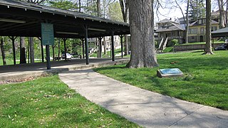
Winona Lake is a town in Wayne Township, Kosciusko County, in the U.S. state of Indiana, and the major suburb of Warsaw. The population was 4,908 at the 2010 census.

<span class="mw-page-title-main">Hillsboro, Iowa</span> City in Iowa, United States

Hillsboro is a city in Henry County, Iowa, United States. The population was 163 at the time of the 2020 census.

<span class="mw-page-title-main">Wyoming, Iowa</span> City in Iowa, United States

Wyoming is a city in Jones County, Iowa, United States. The population was 523 at the time of the 2020 census. It is part of the Cedar Rapids Metropolitan Statistical Area.

<span class="mw-page-title-main">St. Paul, Iowa</span> City in Iowa, United States

St. Paul is a city in Lee County, Iowa, United States. The population was 109 at the time of the 2020 census. It is part of the Fort Madison–Keokuk, IA-MO Micropolitan Statistical Area.

<span class="mw-page-title-main">Birmingham, Iowa</span> City in Iowa, United States

Birmingham is a city in Van Buren County, Iowa, United States. The population was 367 at the 2020 census.

<span class="mw-page-title-main">Spring Hill, Iowa</span> City in Iowa, United States

Spring Hill is a city in Warren County, Iowa, United States. The population was 68 at the time of the 2020 census. It is part of the Des Moines–West Des Moines Metropolitan Statistical Area.

<span class="mw-page-title-main">Crawfordsville, Iowa</span> City in Iowa, United States

Crawfordsville is a city in Washington County, Iowa, United States. It is part of the Iowa City, Iowa Metropolitan Statistical Area. The population was 277 at the 2020 census.

<span class="mw-page-title-main">West Chester, Iowa</span> City in Iowa, United States

West Chester is a city in Washington County, Iowa, United States. It is part of the Iowa City, Iowa Metropolitan Statistical Area. The population was 144 at the time of the 2020 census.

<span class="mw-page-title-main">Mosby, Missouri</span> City in Missouri, United States

Mosby is a city in Clay County, Missouri, United States, along the Fishing River. The population was 101 at the 2020 census. It is part of the Kansas City metropolitan area.

<span class="mw-page-title-main">Morrison, Missouri</span> City in Missouri, United States

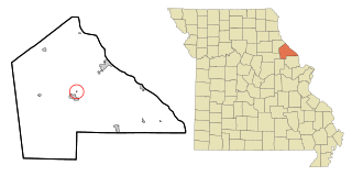
Morrison is a town in Gasconade County, Missouri, United States. The first permanent settlement in the town was made by Robert Shobe circa 1828. The population was 93 at the 2020 census.

<span class="mw-page-title-main">Unity Village, Missouri</span> Village in Missouri, United States

Unity Village is a village in Jackson County, Missouri, United States, bordering Kansas City and Lee's Summit. Its population was 99 at the 2010 census. It is the world headquarters of Unity Church, which has over 2 million followers. The Unity Tower was designed by the Kansas City firm Boillot & Lauck and built in 1929 to store water. Unity Village is part of the Kansas City metropolitan area.

<span class="mw-page-title-main">Tarrants, Missouri</span> Inactive Village in Missouri, United States

Tarrants is an inactive village in central Pike County, Missouri, United States. The population was 22 at the 2010 census.

<span class="mw-page-title-main">Clearwater, Nebraska</span> Village in Nebraska, United States

Clearwater is a village in Antelope County, Nebraska, United States. The population was 419 at the 2010 census.

<span class="mw-page-title-main">Milligan, Nebraska</span> Village in Nebraska, United States

Milligan is a village in Fillmore County, Nebraska, United States. The population was 241 at the 2020 census.

<span class="mw-page-title-main">Regan, North Dakota</span> City in North Dakota, United States

Regan is a city in Burleigh County, North Dakota, United States. Its population was 35 at the 2020 census. Regan was founded in 1912.

<span class="mw-page-title-main">Whitewood, South Dakota</span> City in South Dakota, United States

Whitewood is a city in Lawrence County, South Dakota, United States. The population was 879 at the 2020 census.

<span class="mw-page-title-main">Sherwood, Wisconsin</span> Village in Wisconsin, United States

Sherwood is a village in Calumet County, Wisconsin, United States. The population was 2,713 at the 2010 census. The former historical unincorporated community of High Cliff is located within present-day Sherwood.

<span class="mw-page-title-main">Readstown, Wisconsin</span> Village in Wisconsin, United States

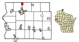
Readstown is a village in Vernon County, Wisconsin, United States. The population was 415 at the 2010 census.

<span class="mw-page-title-main">Star Prairie, Wisconsin</span> Village in Wisconsin, United States

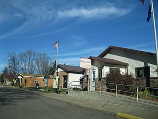
Star Prairie is a village in St. Croix County in the U.S. state of Wisconsin. The population was 561 at the 2010 census. The village is located along the Apple River on the boundary between the Town of Star Prairie and the Town of Stanton.

References

  1. "2019 U.S. Gazetteer Files". United States Census Bureau. Retrieved August 7, 2020.
  2. 1 2 "US Board on Geographic Names". United States Geological Survey. 2007-10-25. Retrieved 2008-01-31.
  3. 1 2 "U.S. Census website". United States Census Bureau . Retrieved 2012-11-18.
  4. 1 2 "Population and Housing Unit Estimates". United States Census Bureau. May 24, 2020. Retrieved May 27, 2020.
  5. 1 2 "U.S. Census website". United States Census Bureau . Retrieved 2008-01-31.
  6. 1 2 Chicago and North Western Railway Company (1908). A History of the Origin of the Place Names Connected with the Chicago & North Western and Chicago, St. Paul, Minneapolis & Omaha Railways. p. 197.
  7. "Sawyer County". Jim Forte Postal History. Retrieved 5 April 2015.
  8. "US Gazetteer files: 2010, 2000, and 1990". United States Census Bureau. 2011-02-12. Retrieved 2011-04-23.
  9. "US Gazetteer files 2010". United States Census Bureau . Retrieved 2012-11-18.
  10. "U.S. Climate Normals Quick Access – Station: Winter, WI". National Oceanic and Atmospheric Administration. Retrieved March 5, 2023.
  11. "NOAA Online Weather Data – NWS Duluth". National Weather Service. Retrieved March 5, 2023.
  12. "Census of Population and Housing". Census.gov. Retrieved June 4, 2015.