Wonogiri Regency is a regency (kabupaten) in the southeastern part of Central Java province in Indonesia. It is bordered to the north by Sukoharjo Regency and Karanganyar Regency, to the east by East Java Province (mainly Pacitan Regency), to the south by the Indian Ocean, and to the west by the Special Region of Yogyakarta. It covers an area of 1,904.32km2, and its population was 928,904 at the 2010 Census[2] and 1,043,177 at the 2020 Census;[3] the official estimate as at mid 2024 was 1,054,145 (comprising 525,877 males and 528,268 females).[1] The capital and largest town is Wonogiri, around 33 km southeast of the large Central Java metropolis of Surakarta. The regency includes the large Gajah Mungkur Reservoir in the upper reaches of the Solo River, with a surface area of 88km2.
Wonogiri Regency is divided into twenty-five administrative districts (Indonesian: kecamatan), tabulated below with their areas and their populations at the 2010 Census[2] and the 2020 Census,[3] together with the official estimates as at mid 2024.[1] The table also includes the locations of the district administrative centres, the number of administrative villages in each district (totaling 251 rural desa and 43 urban kelurahan), and its post code.
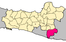
Notes: (a) Paranggupito District includes the whole of the Regency's sea coast (off the southern coast of Java). (b) these four districts form a salient stretching eastwards into East Java Province.
The 43 kelurahan comprise 1 in Pracimantoro District (Gedong), 2 in Giritontro District (Bayemharjo and Giritontro), 2 in Giriwoyo District (Girikikis and Giriwoyo), 1 in Batuwarno District (Selopuro), 2 in Tirtomoyo District (Ngarjosari and Tirtomoyo), 2 in Nguntoronadi District (Beji and Kedungrejo), 2 in Eromoko District (Ngadirejo and Puloharjo), 2 in Wuryantoro District (Mojopuro and Wuryantoro), 2 in Manyaran District (Pagutan and Punduhsari), 1 in Selogiri District (Kaliancar), 6 in Wonogiri District (Giripurwo, Giritirto, Giriwono, Wonoboyo, Wonokarto and Wuryorejo), 2 in Ngadirojo District (Kasihan and Mlokomanis Kulon), 2 in Sidoharjo District (Kayuloko and Sidoharjo), 2 in Jatiroto District (Jatiroto and Sanggrong), 2 in Kismantoro District (Gesing and Kismantoro), 2 in Purwantoro District (Purwantoro and Tegalrejo), 1 in Bulukerto District (Bulukerto), 1 in Puhpelem District (Giriharjo), 2 in Slogohimo District (Bulusari and Karang), 2 in Jatisrono District (Pelem and Tanjungsari), 2 in Jatipurno District (Balepanjang and Jatipurno), and 2 in Girimarto District (Gemawang and Sidokarto).
Agriculture
Gading Purba beach
Wonogiri Regency is an area of agriculture and plantation, so most of people in the regency work as farmers. Generally, all areas of the regency produce much agriculture and plantation output. Casava, cacao, and cashew are examples of the plantation output that are relatively good. Wonogiri also has many special foods. They include nasi tiwul, emping, bakso, mie ayam, gudangan, etc.[29]
Topography
Most of Wonogiri Regency's area is rocky and hilly due to its location on the Sewuhighlands. Since these highlands are of the karst type, many caves can easily be found in Wonogiri Regency and at least 41 caves have been discovered so far starting with the famous Song Gilap cave, Song Putri cave at Pracimantoro, Ngantap cave, Putri Kencana cave at Giritontro and including many unnamed caves all over the regency.
↑Badan Pusat Statistik, Jakarta, 26 September 2024, Kecamatan Pracimantoro Dalam Angka 2024 (Katalog-BPS 1102001.3312010
↑Badan Pusat Statistik, Jakarta, 26 September 2024, Kecamatan Paranggupito Dalam Angka 2024 (Katalog-BPS 1102001.3312020
↑Badan Pusat Statistik, Jakarta, 26 September 2024, Kecamatan Giritontro Dalam Angka 2024 (Katalog-BPS 1102001.3312030
↑Badan Pusat Statistik, Jakarta, 26 September 2024, Kecamatan Giriwoyo Dalam Angka 2024 (Katalog-BPS 1102001.3312040
↑Badan Pusat Statistik, Jakarta, 26 September 2024, Kecamatan Batuwarno Dalam Angka 2024 (Katalog-BPS 1102001.3312050
↑Badan Pusat Statistik, Jakarta, 26 September 2024, Kecamatan Karangtengah Dalam Angka 2024 (Katalog-BPS 1102001.3312060
↑Badan Pusat Statistik, Jakarta, 26 September 2024, Kecamatan Tirtomoyo Dalam Angka 2024 (Katalog-BPS 1102001.3312070
↑Badan Pusat Statistik, Jakarta, 26 September 2024, Kecamatan Nguntoronadi Dalam Angka 2024 (Katalog-BPS 1102001.3312080
↑Badan Pusat Statistik, Jakarta, 26 September 2024, Kecamatan Baturetno Dalam Angka 2024 (Katalog-BPS 1102001.3312090
↑Badan Pusat Statistik, Jakarta, 26 September 2024, Kecamatan Eromoko Dalam Angka 2024 (Katalog-BPS 1102001.3312100
↑Badan Pusat Statistik, Jakarta, 26 September 2024, Kecamatan Wuryantoro Dalam Angka 2024 (Katalog-BPS 1102001.3312110
↑Badan Pusat Statistik, Jakarta, 26 September 2024, Kecamatan Manyaran Dalam Angka 2024 (Katalog-BPS 1102001.3312120
↑Badan Pusat Statistik, Jakarta, 26 September 2024, Kecamatan Selogiri Dalam Angka 2024 (Katalog-BPS 1102001.3312130
↑Badan Pusat Statistik, Jakarta, 26 September 2024, Kecamatan Wonogiri Dalam Angka 2024 (Katalog-BPS 1102001.3312140
↑Badan Pusat Statistik, Jakarta, 26 September 2024, Kecamatan Ngadirojo Dalam Angka 2024 (Katalog-BPS 1102001.3312150
↑Badan Pusat Statistik, Jakarta, 26 September 2024, Kecamatan Sidoharjo Dalam Angka 2024 (Katalog-BPS 1102001.3312160
↑Badan Pusat Statistik, Jakarta, 26 September 2024, Kecamatan Jatiroto Dalam Angka 2024 (Katalog-BPS 1102001.3312170
↑Badan Pusat Statistik, Jakarta, 26 September 2024, Kecamatan Kismantoro Dalam Angka 2024 (Katalog-BPS 1102001.3312180
↑Badan Pusat Statistik, Jakarta, 26 September 2024, Kecamatan Purwantoro Dalam Angka 2024 (Katalog-BPS 1102001.3312190
↑Badan Pusat Statistik, Jakarta, 26 September 2024, Kecamatan Bulukerto Dalam Angka 2024 (Katalog-BPS 1102001.3312200
↑Badan Pusat Statistik, Jakarta, 26 September 2024, Kecamatan Puhpelem Dalam Angka 2024 (Katalog-BPS 1102001.3312201
↑Badan Pusat Statistik, Jakarta, 26 September 2024, Kecamatan Slogohimo Dalam Angka 2024 (Katalog-BPS 1102001.3312210
↑Badan Pusat Statistik, Jakarta, 26 September 2024, Kecamatan Jatisrono Dalam Angka 2024 (Katalog-BPS 1102001.3312220
↑Badan Pusat Statistik, Jakarta, 26 September 2024, Kecamatan Jatipurno Dalam Angka 2024 (Katalog-BPS 1102001.3312230
↑Badan Pusat Statistik, Jakarta, 26 September 2024, Kecamatan Girimarto Dalam Angka 2024 (Katalog-BPS 1102001.3312240
↑ in addition Wonogiri popular with their Jamu (traditional Medicine) such as Air Mancur, which is located near terminal of bus in Wonokarto, Wonogiri.beside those in recent year *2017, The special product of fruit is melon, it is very popular and developed by the Wonogiri government "Kembangkan Pariwisata, Disbudparpora Gandeng ASITA", Solo Pos, accessed Oktober 2011
This page is based on this Wikipedia article Text is available under the CC BY-SA 4.0 license; additional terms may apply. Images, videos and audio are available under their respective licenses.