Worsley and Eccles South (UK Parliament constituency)

Last updated

Worsley and Eccles South
County constituency
for the House of Commons
WorsleyEcclesSouth2007Constituency.svg
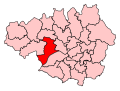
Boundary of Worsley and Eccles South in Greater Manchesterfor the 2010 general election
EnglandGreaterManchester.svg
Location of Greater Manchester within England
County Greater Manchester
Electorate 73,409 (December 2010) [1]
Major settlements Worsley, Walkden, Little Hulton, Irlam, Cadishead
Current constituency
Created 2010
Member of Parliament Barbara Keeley (Labour)
SeatsOne
Created from Worsley
Eccles

Worsley and Eccles South is a county constituency represented in the House of Commons of the Parliament of the United Kingdom. The seat is currently held by Barbara Keeley MP of the Labour Party. It elects one Member of Parliament (MP) by the first past the post system of election.

Contents

Further to the completion of the 2023 Periodic Review of Westminster constituencies, the seat will be subject to boundary changes which will incorporate the whole of the town of Eccles. As a consequence, it will be renamed Worsley and Eccles , to be first contested at the next general election. [2]

Constituency profile

The constituency covers the western half of the City of Salford, mostly safe Labour territory, but the seat also contains two of the Conservatives' strongest wards in the relatively affluent areas of Worsley and Boothstown & Ellenbrook; these are also the only two Remain-voting wards in the constituency. Worsley itself is a desirable area with attractions including historic manor houses along the Bridgewater Canal and the recently-opened 150-acre RHS Garden Bridgewater.

The largest town is actually the town of Walkden, mostly Labour-leaning, and it also includes the Little Hulton council estate. The "Eccles South" signifies the Barton and Winton suburbs of the town of Eccles. In the far south-west of the constituency along the ship canal are the villages of Irlam and Cadishead, separated from the other settlements by swathes of green belt land and farms in the form of Chat Moss, a protected peatland area.

In the 2019 general election, the BBC's exit poll forecast it as a Conservative gain, but it was not in fact among the many leave-supporting red wall seats to fall, and Labour held on although with a reduced, albeit comfortable, majority. [3]

Boundaries

Worsley and Eccles South (UK Parliament constituency)
Map of current boundaries

Following its 2006 review of parliamentary representation in Greater Manchester, the Boundary Commission for England recommended the creation of a modified Worsley constituency, incorporating a part of Eccles, to be called Worsley and Eccles South. [4]

Following council boundary changes that took effect in 2021, [5] the electoral wards included in the Worsley and Eccles South constituency are currently Barton & Winton, Boothstown and Ellenbrook, Cadishead & Lower Irlam, Higher Irlam & Peel Green Ward, Little Hulton, Walkden North, Walkden South, Worsley & Westwood Park.

The electoral wards originally making up the seat were named Barton, Boothstown and Ellenbrook, Cadishead, Irlam, Little Hulton, Walkden North, Walkden South, Winton, Worsley.

Members of Parliament

ElectionMember [6] Party
2010 Barbara Keeley Labour

Elections

Elections in the 2010s

General election 2019: Worsley and Eccles South [7]
PartyCandidateVotes%±%
Labour Barbara Keeley 20,446 45.7 ―11.4
Conservative Arnie Saunders17,22738.5―0.2
Brexit Party Seamus Martin3,2247.2New
Liberal Democrats Joe Johnson-Tod2,5105.6+3.2
Green Daniel Towers1,3002.9+1.1
Majority3,2197.2―11.2
Turnout 44,70759.4―2.5
Labour hold Swing ―5.6
General election 2017: Worsley and Eccles South [8]
PartyCandidateVotes%±%
Labour Barbara Keeley 26,046 57.1 +12.8
Conservative Iain Lindley17,66738.7+8.6
Liberal Democrats Kate Clarkson1,0872.4―0.2
Green Tom Dylan8421.8―1.1
Majority8,37918.4+4.3
Turnout 45,64261.9+3.6
Labour hold Swing +2.1
General election 2015: Worsley and Eccles South [9] [10]
PartyCandidateVotes%±%
Labour Barbara Keeley 18,600 44.2 +1.3
Conservative Iain Lindley12,65430.1―2.4
UKIP Owen Hammond7,68818.3+13.4
Green Chris Bertenshaw1,2423.0New
Liberal Democrats Kate Clarkson1,1002.6―13.9
TUSC Steve North3800.9New
Reality PartyMags McNally2000.5New
Independent Geoffrey Berg1840.4New
Majority5,94614.1+3.7
Turnout 42,04858.3+0.8
Labour hold Swing +1.9
General election 2010: Worsley and Eccles South [11] [12]
PartyCandidateVotes%
Labour Barbara Keeley 17,892 42.9
Conservative Iain Lindley13,55532.5
Liberal Democrats Richard Gadsden6,88316.5
UKIP Andrew Townsend2,0374.9
English Democrat Paul Whitelegg1,3343.2
Majority4,33710.4
Turnout 41,70157.5
Labour win (new seat)

See also

Related Research Articles

<span class="mw-page-title-main">City of Salford</span> Borough and City in Greater Manchester, England

Salford, also known as the City of Salford, is a metropolitan borough with city status in Greater Manchester, England. The borough is named after its main settlement, Salford, but covers a larger area which includes the towns of Eccles, Swinton, Walkden and Pendlebury. The borough had a population of 270,764 in 2021, and is administered from the Salford Civic Centre in Swinton.

<span class="mw-page-title-main">Worsley</span> Village in Greater Manchester, England

Worsley is a village in the City of Salford, Greater Manchester, England, which in 2014 had a population of 10,090. It lies along Worsley Brook, 6 miles (9.7 km) west of Manchester.

<span class="mw-page-title-main">Boothstown</span> Human settlement in England

Boothstown is a suburban village in the City of Salford in Greater Manchester, England. Boothstown forms part of the Boothstown and Ellenbrook ward, which had a population at the 2011 Census of 9,599. The village is within the boundaries of the historic county of Lancashire, west of the City of Salford, bordered to the north by the East Lancashire Road A580 and to the south by the Bridgewater Canal. Historically, it was a hamlet partly in Worsley township in the parish of Eccles, and partly in Tyldesley in the parish of Leigh.

<span class="mw-page-title-main">Bolton South East (UK Parliament constituency)</span> UK Parliament constituency in England since 1983

Bolton South East is a constituency represented in the House of Commons of the UK Parliament since 2010 by Yasmin Qureshi of the Labour Party.

<span class="mw-page-title-main">Eccles (UK Parliament constituency)</span> Parliamentary constituency in the United Kingdom, 1885–2010

Eccles was a parliamentary constituency of the United Kingdom, centred on the town of Eccles in Greater Manchester, England. It returned one Member of Parliament (MP) to the House of Commons of the Parliament of the United Kingdom, elected by the first past the post system.

<span class="mw-page-title-main">Worsley (UK Parliament constituency)</span> Parliamentary constituency in the United Kingdom, 1983–2010

Worsley was a parliamentary constituency represented in the House of Commons of the Parliament of the United Kingdom. It elected one Member of Parliament (MP) by the first past the post system of election.

<span class="mw-page-title-main">Walkden</span> Town in City of Salford, Greater Manchester, England

Walkden is a town in the City of Salford in Greater Manchester, England, six miles northwest of central Salford, and seven miles of Manchester.

Farnworth was a county constituency in Lancashire which returned one Member of Parliament (MP) to the House of Commons of the Parliament of the United Kingdom from 1918 until it was abolished for the 1983 general election.

<span class="mw-page-title-main">Little Hulton</span> Area of Greater Manchester, England

Little Hulton is an area in the City of Salford, Greater Manchester, England, 3.4 miles (5.5 km) south of Bolton, 7 miles (11.3 km) northwest of Salford, and 9 miles (14.5 km) northwest of Manchester. Within the boundaries of the historic county of Lancashire, Little Hulton is bordered by Farnworth to the north, Walkden to the east and Tyldesley to the south.

<span class="mw-page-title-main">Ellenbrook, Greater Manchester</span> Human settlement in England

Ellenbrook is a suburb of Worsley, in the City of Salford in Greater Manchester, England. Ellenbrook is 6.8 miles (10.9 km) west of Manchester, 5 miles (8.0 km) west of Salford and 4.6 miles (7.4 km) south of Bolton. Historically a part of Lancashire, it is close to Astley, Mosley Common and Walkden, by the East Lancashire Road.

The Salford Advertiser is a weekly newspaper serving the villages, suburbs and districts of the City of Salford in Greater Manchester, England.

<span class="mw-page-title-main">New Manchester</span>

New Manchester or The City was an isolated mining community on the Manchester Coalfield north of Mosley Common in the Tyldesley township, England. It lies west of a boundary stone at Ellenbrook which marks the ancient boundary of the Hundreds of Salford and West Derby, the boundary of Eccles and Leigh ecclesiastical parishes, Tyldesley, Worsley and Little Hulton townships and the metropolitan districts of Wigan and Salford. The route of the Roman road from Manchester to Wigan and the Tyldesley Loopline passed south of the village. The Lancashire and Yorkshire Railway's Manchester to Southport line passed to the north.

<span class="mw-page-title-main">Boothstown and Ellenbrook (ward)</span> Electoral ward in England

Boothstown and Ellenbrook is an electoral ward of Salford, England. The ward was created in 2004 following recommendations made by the Boundary Committee for England. It is represented in Westminster by Barbara Keeley MP for Worsley and Eccles South. The 2011 Census recorded a population of 9,532. Following extensive boundary changes to wards across the City of Salford, Boothstown and Ellenbrook was expanded to include the village of Roe Green. These new boundaries were first contested on 6 May 2021 in all-out elections, requiring all three ward councillors to stand for re-election.

<span class="mw-page-title-main">Irlam (ward)</span> Former electoral ward of Salford, England

Irlam was an electoral ward of Salford, England. It was represented in Westminster by the constituency of Worsley and Eccles South. A profile of the ward conducted by Salford City Council in 2014 recorded a population of 9,857.

Cadishead and Lower Irlam is an electoral ward of Salford, England created by the Local Government Boundary Commission for England (LGBCE) replacing the previous electoral wards of Cadishead and Irlam for the 2021 local elections.

Bolton South and Walkden is a proposed constituency of the House of Commons in the UK Parliament. Further to the completion of the 2023 Periodic Review of Westminster constituencies, it will first be contested at the next general election.

Worsley and Eccles is a proposed constituency of the House of Commons in the UK Parliament. Further to the completion of the 2023 Periodic Review of Westminster constituencies, it will first be contested at the next general election.

References

  1. "Electorate Figures – Boundary Commission for England". 2011 Electorate Figures. Boundary Commission for England. 4 March 2011. Archived from the original on 6 November 2010. Retrieved 13 March 2011.
  2. "North West | Boundary Commission for England". boundarycommissionforengland.independent.gov.uk. Retrieved 15 June 2023.
  3. Dalton, Tara (12 December 2019). "Regional exit polls show predicted Labour defeat in Worsley and Eccles South". Salford Now. Retrieved 7 August 2023.
  4. "Final Recommendations for Parliamentary Constituency Boundaries in Greater Manchester". Boundary Commission for England (North West). Government News Network. 19 July 2006. Archived from the original (HTTP) on 30 September 2007. Retrieved 5 April 2007.
  5. "Electoral review of ward boundaries".
  6. Leigh Rayment's Historical List of MPs – Constituencies beginning with "W" (part 5)
  7. "Statement of persons nominated 2019" (PDF).
  8. "Worsley & Eccles South parliamentary constituency". BBC News.
  9. "Election Data 2015". Electoral Calculus. Archived from the original on 17 October 2015. Retrieved 17 October 2015.
  10. "Worsley & Eccles South". BBC News. Retrieved 11 May 2015.
  11. "Election Data 2010". Electoral Calculus. Archived from the original on 26 July 2013. Retrieved 17 October 2015.
  12. "Worsley & Eccles South". BBC News Online . Retrieved 7 May 2010.

53°30′34″N2°23′09″W / 53.509560°N 2.385972°W / 53.509560; -2.385972