Worsthorne-with-Hurstwood

Last updated

Worsthorne-with-Hurstwood
Salterford Lane - geograph.org.uk - 685493.jpg
Entering the parish across Salterford Bridge
Location map United Kingdom Borough of Burnley.svg
Red pog.svg
Worsthorne-with-Hurstwood
Shown within Burnley Borough
Lancashire UK location map.svg
Red pog.svg
Worsthorne-with-Hurstwood
Location within Lancashire
Area5.60 sq mi (14.5 km2)  [1]
Population2,963 (2011) [1]
  Density 529/sq mi (204/km2)
OS grid reference SD875325
Civil parish
  • Worsthorne-with-Hurstwood
District
Shire county
Region
Country England
Sovereign state United Kingdom
Post town BURNLEY
Postcode district BB10
Dialling code 01282
Police Lancashire
Fire Lancashire
Ambulance North West
UK Parliament
List of places
UK
England
Lancashire
53°47′N2°11′W / 53.78°N 2.18°W / 53.78; -2.18

Worsthorne-with-Hurstwood is a civil parish in the Borough of Burnley, in Lancashire, England. Situated on the eastern outskirts of Burnley, in 2011 it had a population of 2,963. [1]

Contents

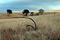
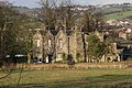
The parish contains part of the Pike Hill and Brownside suburbs of Burnley, the village of Worsthorne and the hamlet of Hurstwood and the rural area east of the town.

The parish adjoins the Borough of Burnley parishes of Briercliffe and Cliviger, the unparished area of Burnley and the West Yorkshire district of Calderdale.

History

The second element in the name Worsthorne is probably from the Old English þorn, a thorny bush. Its first is less certain, possibly worþ (homestead) or a personal name as in Worthing. With Hurstwood, hyrst is thought to mean a wooded prominence, as 'wood' (OE wudu) has been appended, it may just mean a prominence in this case. [2]

A Bronze Age round cairn and bowl barrow are located on Hameldon Pasture, with a ring cairn nearby on Slipper Hill. [3] [4] [5] The remains of two Romano-British farmsteads known as Ring Stones camp is also in the area. [6] All are protected as Scheduled monuments. Traces of a Roman road have been reported heading north-west from Ring Stones. [7]

After the Norman conquest of England, the area may have been part of Briercliffe township, and the lords of Clitheroe appear to have divided Worsthorne among a number of free tenants. In 1292 Henry de Lacy granted the homage and service of the free tenants of Worsthorne to Oliver de Stansfield, his receiver for Pontefract. In 1311 Worsthorne was listed as a manor, and by 1332 it was regarded as an independent township. Control of the manor would stay with the Stansfield family until 1560. [8]

During World War II a Starfish site bombing decoy was constructed off Gorple Road to the east of Worsthorne, part of a network designed to protect Accrington. [9] Also a B-24 Liberator from the 491st Bombardment Group USAAF crashed on Black Hameldon in February 1945. [10]

Geography

Hurstwood and Cant Clough reservoirs are in the south-east of the parish, both are passed by the Mary Towneley Loop section of the Pennine Bridleway National Trail and the Burnley Way footpath. [11] Swinden and Lea Green reservoirs are in the north on the boundary with Briercliffe. [12]

Governance

Worsthorne-with-Hurstwood was once a township in the ancient parish of Whalley. This became a civil parish in 1866, forming part of the Burnley Rural District from 1894. [13] Since 1974 Worsthorne-with-Hurstwood has formed part of the Borough of Burnley.

The parish is part of the Cliviger with Worsthorne ward of the borough council, along with the neighbouring parish of Cliviger. [14] The ward elects three councillors, currently Scott Cunliffe, Beki Hughes and Jack Launer of the Green Party. [15] The parish is represented on Lancashire County Council as part of the Burnley Rural division, represented since 2017 by Cosima Towneley (Conservative). [16]

The Member of Parliament for Burnley, the constituency into which the parish falls, is Antony Higginbotham (Conservative), who was first elected in 2019.

Demography

According to the United Kingdom Census 2011, the parish has a population of 2,963, a decrease from 2,986 in the 2001 census. This represents a decline of

In 2011 the average (mean) age of residents was 44.7 years, with a distribution of 51.1% female and 48.9% male. The racial composition was 99% White (98% White British), 0.6% Asian and 0.6% Mixed. The largest religious groups were Christian (77.6%) and Muslim (0.2%). 71.6% of adults between the ages of 16 and 74 were classed as economically active and in work. [1]

Year19011911192119311951196120012011
Population8521,1011,3261,2391,6061,6402,9862,963
[13] [17] [1]

See also

Related Research Articles

<span class="mw-page-title-main">Burnley</span> Town in England

Burnley is a town and the administrative centre of the wider Borough of Burnley in Lancashire, England, with a 2001 population of 73,021. It is 21 miles (34 km) north of Manchester and 20 miles (32 km) east of Preston, at the confluence of the River Calder and River Brun.

<span class="mw-page-title-main">Borough of Burnley</span> Borough in Lancashire, England

<span class="mw-page-title-main">Brierfield, Lancashire</span> Town in Lancashire, England

Brierfield is a town and civil parish in the Borough of Pendle, in Lancashire, England. It is 2.5 miles (4.0 km) north east of Burnley, 1 mile (1.6 km) south west of Nelson, and 0.5 miles (0.8 km) north east of Reedley. The parish had a population of 8,193, at the census of 2011.

<span class="mw-page-title-main">Blackburn Hundred</span> Former sub-division of Lancashire, UK

Blackburn Hundred is a historic sub-division of the county of Lancashire, in northern England. Its chief town was Blackburn, in the southwest of the hundred. It covered an area similar to modern East Lancashire, including the current districts of Ribble Valley, Pendle, Burnley, Rossendale, Hyndburn, Blackburn with Darwen, and South Ribble.

<span class="mw-page-title-main">Dunnockshaw</span> Human settlement in England

Dunnockshaw or Dunnockshaw and Clowbridge is a civil parish in the borough of Burnley, in Lancashire, England. The parish is situated between Burnley and Rawtenstall. According to the United Kingdom Census 2011, the parish has a population of 185.

<span class="mw-page-title-main">Blacko</span> Human settlement in England

Blacko is a village and civil parish in the Pendle district of Lancashire, England. Before local government reorganisation in 1974 the village lay on the border with the West Riding of Yorkshire. The parish has a population of 672. The village is on the old turnpike road from Nelson to Gisburn (A682). The village enjoys views towards Boulsworth Hill to its southeast, the former cotton town of Nelson, about two miles to its south and Pendle Hill to its west across the valley of Pendle Water.

Burnley was a Rural district of Lancashire, England from 1894 to 1974. It was named after but did not include the large town of Burnley, which was a county borough.

<span class="mw-page-title-main">River Calder, Lancashire</span> Tributary of the River Ribble in England

The River Calder is a major tributary of the River Ribble in Lancashire, England and is around 20 miles (32 km) in length.

<span class="mw-page-title-main">River Brun</span> River in eastern Lancashire, England

The River Brun is a river in eastern Lancashire. It is approximately 4.5 miles (7.2 km) long and has a catchment area of 9.32 square miles (24.134 km2).

<span class="mw-page-title-main">Cliviger</span> Human settlement in England

Cliviger is a civil parish in the Borough of Burnley, in Lancashire, England. It is situated to the southeast of Burnley, and northwest of Todmorden. According to the 2011 census, the parish has a population of 2,238.

<span class="mw-page-title-main">Worsthorne</span> Village in Lancashire, England

Worsthorne is a rural village on the eastern outskirts of Burnley in Lancashire, England. It is in the civil parish of Worsthorne-with-Hurstwood and the borough of Burnley. At the 2011 census the village had a population of 1,028.

<span class="mw-page-title-main">Ightenhill</span> Parish in Burnley, England

Ightenhill is a civil parish in the Borough of Burnley in Lancashire, England, with a population of 1,975.

<span class="mw-page-title-main">Hapton, Lancashire</span> Human settlement in England

Hapton is a village and civil parish in the Borough of Burnley in Lancashire, England, 3 miles (4.8 km) west of Burnley, with a railway station on the East Lancashire Line. At the United Kingdom Census 2011, it had a population of 1,979.

<span class="mw-page-title-main">Burnley Way</span> Long-distance footpath in Lancashire, England

<span class="mw-page-title-main">Briercliffe</span> Human settlement in England

Briercliffe is a civil parish in the borough of Burnley, in Lancashire, England. It is situated 3 miles (4.8 km) north of Burnley. The parish contains suburbs of Burnley, and the rural area north east of the town. Hamlets in the parish include Cockden, Lane Bottom and in the Extwistle area, the tiny hamlet of Roggerham. According to the United Kingdom Census 2011, the parish has a population of 4,031.

<span class="mw-page-title-main">Habergham Eaves</span> Human settlement in England

Habergham Eaves is a civil parish in the borough of Burnley, in Lancashire, England. The parish consists of a rural area south of Burnley, and suburban areas on the outskirts of the town, including a large industrial estate in the north-west corner of the parish. Habergham is also the name of an area west of Burnley, although it is no longer within the parish. According to the United Kingdom Census 2011, the parish has a population of 1,466.

<span class="mw-page-title-main">Horton, Lancashire</span> Village in Lancashire, England

Horton, historically known as Horton-in-Craven, is a village and a civil parish in the Ribble Valley district of the English county of Lancashire. Population details are now included in the civil parish of Newsholme. It is near the town of Barnoldswick. Horton has a place of worship, anciently called a chapelry or chapel of ease. For transport, there is the A59 nearby.

<span class="mw-page-title-main">Hameldon Hill</span>

Hameldon Hill is a Carboniferous sandstone hill with a summit elevation of 409 metres (1,342 ft), situated between the towns of Burnley and Accrington in Lancashire, England. It is listed as a "HuMP" or "Hundred Metre Prominence", its parent being Freeholds Top, a Marilyn near Bacup.

Worsthorne-with-Hurstwood is a civil parish in the borough of Burnley, Lancashire, England. The parish contains 22 buildings that are recorded in the National Heritage List for England as designated listed buildings. Of these, four are listed at Grade II*, the middle grade, and the others are at Grade II, the lowest grade. Apart from the village of Worsthorne and the settlement of Hurstwood, the parish is rural. Most of the listed buildings are farmhouses, or originated as farmhouses or farm buildings. Other listed buildings include large houses and associated structures, a row of former back-to-back cottages, a church, and a telephone kiosk.

<span class="mw-page-title-main">Hurstwood</span> Human settlement in England

Hurstwood is a rural hamlet on the eastern outskirts of Burnley in Lancashire, England. It is in the civil parish of Worsthorne-with-Hurstwood and the borough of Burnley.

References

  1. 1 2 3 4 5 6 UK Census (2011). "Local Area Report – Worsthorne-with-Hurstwood Parish (1170214987)". Nomis. Office for National Statistics . Retrieved 28 March 2021.
  2. Ekwall, Eilert (1922). The place-names of Lancashire. Manchester University Press. pp. 78, 84. Retrieved 23 January 2016.
  3. Historic England. "Ring cairn on Slipper Hill (1009112)". National Heritage List for England . Retrieved 31 July 2015.
  4. Historic England. "Bowl barrow on Hameldon Pasture (1008918)". National Heritage List for England. Retrieved 31 July 2015.
  5. Historic England. "Round cairn on Hameldon Pasture (1008919)". National Heritage List for England. Retrieved 31 July 2015.
  6. Historic England. "Two Romano-British farmsteads known as Ring Stones (1009488)". National Heritage List for England. Retrieved 31 July 2015.
  7. Historic England. "MONUMENT NO. 45320 (45320)". Research records (formerly PastScape). Retrieved 31 July 2015.
  8. Farrer, William; Brownbill, John, eds. (1911), The Victoria History of the County of Lancaster Vol 6, Victoria County History, - Constable & Co, pp. 473–478, OCLC   832215477
  9. Historic England. "STARFISH BOMBING DECOY SF35D (1469070)". Research records (formerly PastScape). Retrieved 31 July 2015.
  10. Historic England. "42-50668 (1436774)". Research records (formerly PastScape). Retrieved 31 July 2015.
  11. MKH Computer Services Ltd. "Burnley Way — LDWA Long Distance Paths". ldwa.org.uk. Retrieved 21 March 2017.
  12. "103" (Map). Blackburn & Burnley (C2 ed.). 1:50,000. Landranger. Ordnance Survey. 2006. ISBN   978-0-319-22829-6.
  13. 1 2 "Worsthorne with Hurstwood Tn/CP through time". visionofbritain.org.uk. GB Historical GIS / University of Portsmouth. Retrieved 25 July 2015.
  14. "Wards and parishes map". MARIO. Lancashire County Council. Retrieved 28 March 2021.
  15. "Your Councillors". burnley.moderngov.co.uk. Burnley Borough Council. Retrieved 5 August 2023.
  16. "County Councillors by Local Community". Lancashire County Council. Retrieved 5 August 2023.
  17. 1 2 UK Census (2001). "Local Area Report – Worsthorne-with-Hurstwood Parish (30UD007)". Nomis. Office for National Statistics . Retrieved 28 March 2021.
  18. UK Census (2011). "Local Area Report – Burnley Built-up area (E34004743)". Nomis. Office for National Statistics. Retrieved 6 March 2021.

Commons-logo.svg Media related to Worsthorne-with-Hurstwood at Wikimedia Commons