| This article is part of a series on |
| Income in the United States of America |
|---|
 |
Colorado is the fifth-richest state in the United States of America, with a per capita income of $24,049 (2000) and a personal per capita income of $34,283 (2003).
| This article is part of a series on |
| Income in the United States of America |
|---|
| |
Colorado is the fifth-richest state in the United States of America, with a per capita income of $24,049 (2000) and a personal per capita income of $34,283 (2003).
Note: Data is from the 2010 United States Census Data and the 2006-2010 American Community Survey 5-Year Estimates. [1] [2]
| Rank | County | Per capita income | Median household income | Median family income | Population | Number of households |
|---|---|---|---|---|---|---|
| 1 | Pitkin | $64,381 | $64,502 | $103,438 | 17,148 | 8,152 |
| 2 | Mineral | $46,358 | $53,438 | $66,071 | 712 | 355 |
| 3 | Hinsdale | $43,293 | $74,659 | $88,920 | 843 | 362 |
| 4 | Douglas | $42,418 | $99,198 | $108,613 | 285,465 | 102,018 |
| 5 | San Miguel | $38,247 | $66,399 | $82,708 | 7,359 | 3,454 |
| 6 | Boulder | $36,947 | $64,839 | $87,860 | 294,567 | 119,300 |
| 7 | Eagle | $36,753 | $71,337 | $80,621 | 52,197 | 19,236 |
| 8 | Broomfield | $35,836 | $75,590 | $94,135 | 55,889 | 21,414 |
| 9 | Summit | $35,770 | $68,750 | $86,701 | 27,994 | 11,754 |
| 10 | El Paso | $34,782 | $78,958 | $83,074 | 622,263 | 235,959 |
| 11 | Jefferson | $34,714 | $66,075 | $81,136 | 534,543 | 218,160 |
| 12 | Clear Creek | $34,506 | $60,426 | $73,134 | 9,088 | 4,208 |
| 13 | Gilpin | $33,591 | $58,036 | $82,632 | 5,441 | 2,460 |
| 14 | Routt | $33,079 | $60,876 | $74,547 | 23,509 | 9,892 |
| 15 | Arapahoe | $31,898 | $58,719 | $72,459 | 572,003 | 224,011 |
| 16 | Park | $31,663 | $64,098 | $73,815 | 16,206 | 7,174 |
| 17 | San Juan | $31,232 | $43,783 | $62,917 | 699 | 344 |
| 18 | Denver | $30,806 | $45,501 | $57,182 | 600,158 | 263,107 |
| Colorado | $30,151 | $56,456 | $70,046 | 5,029,196 | 1,972,868 | |
| 19 | Grand | $30,055 | $60,433 | $69,395 | 14,843 | 6,469 |
| 20 | Larimer | $30,046 | $56,447 | $73,771 | 299,630 | 120,295 |
| 21 | Lake | $29,836 | $56,422 | $69,089 | 51,334 | 21,100 |
| 22 | Ouray | $29,051 | $58,393 | $65,804 | 4,436 | 2,022 |
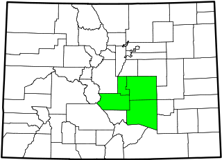
| 23 | Teller | $28,726 | $58,080 | $68,328 | 23,350 | 9,805 |
| 24 | Gunnison | $28,490 | $49,356 | $69,139 | 15,324 | 6,516 |
| 25 | Garfield | $28,457 | $64,902 | $70,123 | 56,389 | 20,359 |
| 26 | Rio Blanco | $28,382 | $57,992 | $68,327 | 6,666 | 2,647 |
| 27 | Elbert | $27,945 | $56,268 | $68,813 | 23,086 | 8,380 |
| United States | $27,334 | $51,914 | $62,982 | 308,745,538 | 116,716,292 | |
| 28 | Mesa | $27,067 | $52,067 | $63,049 | 146,723 | 58,095 |
| 29 | Custer | $26,860 | $39,909 | $48,505 | 4,255 | 1,925 |
| 30 | Chaffee | $26,110 | $42,941 | $54,353 | 17,809 | 7,601 |
| 31 | Archuleta | $25,421 | $56,068 | $65,489 | 12,084 | 5,267 |
| 32 | Weld | $24,732 | $55,596 | $64,996 | 252,825 | 89,349 |
| 33 | Montezuma | $24,616 | $44,103 | $52,999 | 25,535 | 10,541 |
| 34 | Moffat | $24,563 | $53,587 | $62,074 | 13,795 | 5,465 |
| 35 | Adams | $23,999 | $54,666 | $62,864 | 441,603 | 153,764 |
| 36 | Jackson | $23,814 | $37,222 | $44,286 | 1,394 | 649 |
| 37 | Montrose | $23,613 | $46,590 | $52,640 | 41,276 | 16,484 |
| 38 | Phillips | $23,453 | $44,084 | $54,583 | 4,442 | 1,819 |
| 39 | Lincoln | $23,440 | $41,616 | $54,643 | 5,467 | 1,948 |
| 40 | Huerfano | $23,139 | $30,058 | $44,401 | 6,711 | 3,137 |
| 41 | Washington | $23,125 | $39,735 | $48,965 | 4,814 | 1,980 |
| 42 | Cheyenne | $22,999 | $47,125 | $68,125 | 1,836 | 786 |
| 43 | Kiowa | $22,877 | $40,089 | $58,594 | 1,398 | 619 |
| 44 | Logan | $22,564 | $40,961 | $52,169 | 22,709 | 8,047 |
| 45 | Delta | $22,080 | $40,451 | $48,395 | 30,952 | 12,703 |
| 46 | Las Animas | $21,887 | $38,134 | $49,347 | 15,507 | 6,384 |
| 47 | Yuma | $21,872 | $42,114 | $48,602 | 10,043 | 3,952 |
| 48 | Sedgwick | $21,652 | $37,625 | $52,292 | 2,379 | 1,093 |
| 49 | Pueblo | $21,609 | $40,699 | $50,503 | 159,063 | 62,972 |
| 50 | Baca | $21,472 | $36,017 | $43,466 | 3,788 | 1,685 |
| 51 | Kit Carson | $21,086 | $41,678 | $55,742 | 8,270 | 3,038 |
| 52 | La Plata | $20,437 | $41,103 | $44,934 | 7,310 | 2,953 |
| 53 | Morgan | $20,181 | $43,111 | $48,673 | 28,159 | 10,294 |
| 54 | Dolores | $19,244 | $43,058 | $49,167 | 2,064 | 899 |
| 55 | Fremont | $19,083 | $37,847 | $45,664 | 46,824 | 16,582 |
| 56 | Crowley | $18,966 | $38,189 | $44,095 | 5,823 | 1,306 |
| 57 | Alamosa | $18,820 | $35,935 | $45,742 | 15,445 | 5,995 |
| 58 | Saguache | $18,686 | $30,430 | $36,988 | 6,108 | 2,640 |
| 59 | Prowers | $18,429 | $33,969 | $47,052 | 12,551 | 4,935 |
| 60 | Otero | $18,056 | $34,142 | $41,269 | 18,831 | 7,729 |
| 61 | Conejos | $17,541 | $33,627 | $38,950 | 8,256 | 3,118 |
| 62 | Rio Grande | $17,199 | $39,871 | $48,115 | 11,982 | 4,779 |
| 63 | Costilla | $16,525 | $24,388 | $38,005 | 3,524 | 1,550 |
| 64 | Bent | $16,505 | $36,412 | $43,472 | 6,499 | 1,832 |

Torrance County is a county located in the center of the U.S. state of New Mexico. As of the 2020 census, the population was 15,045. The county seat is Estancia.
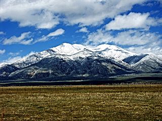
Taos County is a county in the U.S. state of New Mexico. As of the 2020 census, the population was 34,489. Its county seat is Taos. The county was formed in 1852 as one of the original nine counties in New Mexico Territory.

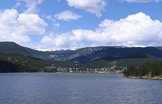
Teller County is a county located in the U.S. state of Colorado. As of the 2020 census, the population was 24,710. The county seat is Cripple Creek, and the most populous city is Woodland Park.

The City of Federal Heights is a home rule municipality located in western Adams County, Colorado, United States. The city population was 14,382 at the 2020 United States Census, a +25.42% increase since the 2010 United States Census. Federal Heights is a part of the Denver–Aurora–Lakewood, CO Metropolitan Statistical Area and the Front Range Urban Corridor. The current Mayor is Linda S. Montoya, who was elected to a four-year term in 2019.
Nederland is a statutory town located near Barker Meadow Reservoir in the foothills of southwest Boulder County, Colorado, United States. As of the 2020 United States Census it had a population of 1,471.

The North Central Colorado Urban Area comprises the four contiguous metropolitan statistical areas in the north central region of the State of Colorado: the Denver–Aurora Metropolitan Statistical Area, the Boulder Metropolitan Statistical Area, the Fort Collins-Loveland Metropolitan Statistical Area, and the Greeley Metropolitan Statistical Area. With the exception of southeastern Elbert County, southeastern Park County, and tiny portions of southern Douglas County, the entire North Central Colorado Urban Area is drained by the South Platte River and its tributaries. The North Central Colorado Urban Area is the central, and the most populous, of the three primary subregions of the Front Range Urban Corridor.
The South Central Colorado Urban Area comprises the Colorado Springs Metropolitan Statistical Area, the Pueblo Metropolitan Statistical Area, and the Cañon City Micropolitan Statistical Area in the central and south central region of the State of Colorado. With the exception of northern Teller County and small portions of northern El Paso County, the entire South Central Colorado Urban Area is drained by the Arkansas River and its tributaries. The South Central Colorado Urban Area is the southernmost of the three primary subregions of the Front Range Urban Corridor.

The Town of Coal Creek is a Statutory Town located in Fremont County, Colorado, United States. The town population was 364 at the 2020 United States Census. Coal Creek is a part of the Cañon City, CO Micropolitan Statistical Area and the Front Range Urban Corridor.

This is a population history of the 210 census-designated places in the US state of Colorado since the 2000 United States census. The United States Census Bureau defines certain unincorporated communities as census-designated places (CDPs) for enumeration in each decennial census. The Census Bureau defined 85 CDPs in Colorado for the 2000 Census, 187 CDPs for the 2010 Census, and 210 CDPs for the 2020 Census.