| # | Places | Population [1] [2] | Outlying areas |
|---|
| 2001 | 2011 | 2021 |
|---|
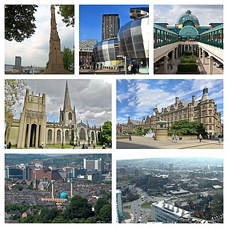
| 1 | Sheffield | 479,460 | 518,090 | 525,142 | Excludes Butterthwaite, Catcliffe, Oughtibridge, Ringinglow, Stopes, Storrs, Thorpe Hesley, Treeton, Whitley, Worrall [lower-alpha 1] |
| 2 | Doncaster | 101,940 | 109,805 | 113,566 | Excludes Barnby Dun, Bentley, Branton, Loversall, Old Cantley, Old Edlington, Sprotbrough |
| 3 | Rotherham | 105,720 | 109,691 | 109,697 | Excludes Hellaby |
| 4 | Barnsley | 87,460 | 91,297 | 96,888 | Cudworth, Dodworth, Royston, Wombwell, Worsbrough counted separately. |
| 5 | Wath-upon-Dearne | 31,730 | 33,427 | 37,103 | Includes Bow Broom, Brampton, Kilnhurst, Newhill, Swinton, West Melton |
| 6 | Bentley | 26,573 | 27,145 | 27,040 | Includes Arksey, Cusworth, Scawthorpe, Stockbridge |
| 7 | Wombwell | 21,560 | 23,355 | 25,520 | Includes Darfield, Hemingfield. Excludes Smithley |
| 8 | Chapeltown | 23,080 | 23,056 | 22,543 | Includes Burncross, Charltonbrook, High Green, Mortomley, Warren |
| 9 | Dinnington | 19,090 | 19,860 | 20,345 | Includes Laughton Common, North Anston, South Anston, Throapham |
| 10 | Rawmarsh | 18,210 | 18,498 | 18,908 | Includes Parkgate, Ryecroft, Upper Haugh |
| 11 | Adwick-le-Street | 18,656 | 19,222 | 18,693 | Includes Carcroft, Highfields, Skellow, Woodlands |
| 12 | Hoyland | 16,567 | 17,710 | 17,951 | Includes Blacker Hill, Elsecar, Jump, Milton. Excludes Birdwell |
| 13 | Maltby | 17,094 | 16,688 | 16,316 | Includes Wood Lee. Excludes Braithwell, Hellaby, Hooton Leevit |
| 14 | Mexborough | 14,750 | 15,244 | 15,855 | Includes Dolecliffe Common, Highwoods, Roman Terrace, Windhill. Excludes Adwick-upon-Dearne |
| 15 | Conisbrough | 15,360 | 15,934 | 15,773 | Includes Denaby Main, Windgate Hill. Excludes Clifton Common, Conisbrough Common, Hill Top, Old Denaby |
| 16 | Swallownest | 13,860 | 15,022 | 14,517 | Includes Aston, Aughton, Netherthorpe. Excludes Beighton, Treeton, Ulley, Woodhouse |
| 17 | Armthorpe | 12,630 | 14,457 | 14,163 | Includes Nutwell. Excludes Cantley, Edenthorpe, Wheatley Hills |
| 18 | Dunscroft / Hatfield | 13,890 | 14,326 | 13,993 | Includes Dunsville, Hatfield Woodhouse |
| 19 | New Rossington | 13,260 | 13,537 | 13,920 | Includes Littleworth |
| 20 | Stocksbridge | 13,316 | 13,069 | 12,911 | Includes Deepcar. Excludes Bolsterstone, Midhopestone, Waldershaigh |
| 21 | Cudworth | 11,644 | 12,635 | 12,791 | Includes Shafton. Excludes Brierley, Grimethorpe, North Field Laith, West Green |
| 22 | Thorne | 11,387 | 11,840 | 12,295 | Includes Canal Side. Moorends, Hatfield, Stainsforth counted separately. Excludes Fishlake, Waterside |
| 23 | Royston | 9,375 | 10,069 | 10,757 | Excludes Carlton, Notton |
| 24 | Penistone | 8,940 | 9,817 | 10,730 | Includes Broad Hill, Bridge End, Cubley, Oxspring, Scout Bridge, Spring Vale, Thurlstone, Water Hall. Excludes Millhouse Green, Scout Dike, Hill Side |
| 25 | Thurnscoe | 9,122 | 8,687 | 9,517 | Excludes Clayton, Goldthorpe, Great Houghton, Hickleton, Stotfold |
| 26 | Worsbrough | 9,158 | 9,119 | 9,157 | Includes Lewden Hill. Ward Green. Excludes Kendray, Lower Lewden, Oustlethwaite, Swaithe, Worsbrough Common |
| 27 | Kiveton Park | 6,460 | 7,069 | 7,510 | Includes Wales. Excludes Kiveton Bridge, Harthill, Todwick, Woodall |
| 28 | Bolton-upon-Dearne | 6,530 | 6,744 | 6,826 | Excludes Goldthorpe |
| 29 | Stainforth | 6,342 | 6,282 | 6,380 | Excludes Hatfield, Far Bank and Fishlake |
| 30 | Goldthorpe | 5,958 | 6,051 | 6,367 | Includes Highgate. Excludes Barnburgh and Harlington |
| 31 | Thurcroft | 4,702 | 5,115 | 6,101 | Excludes Brampton-en-le-Morthen, Morthen, Springvale |
| 32 | Askern | 5,434 | 5,570 | 6,094 | Includes Instoneville |
| 33 | Dodworth | 5,742 | 5,900 | 5,977 | Includes Gilroyd |
| 34 | Moorends | 5,205 | 5,455 | 5,801 | |
| 34 | Finningley | 3,206 | 3,525 | 5,305 | Excludes Blaxton, Auckley |
| 35 | Grimethorpe | 3,740 | 4,672 | 5,068 | |
| 36 | Tickhill | 5,112 | 4,992 | 4,913 | |