Bridesburg, Philadelphia

Last updated
Bridesburg
St. John Cantius Church.jpg
St. John Cantius Church in Bridesburg
USA Pennsylvania location map.svg
Red pog.svg
Bridesburg
Location of Bridesburg in Pennsylvania
Usa edcp location map.svg
Red pog.svg
Bridesburg
Bridesburg (the United States)
Coordinates: 40°00′11″N75°04′08″W / 40.00306°N 75.06889°W / 40.00306; -75.06889
CountryUnited States
StatePennsylvania
County Philadelphia
Time zone UTC-5 (EST)
  Summer (DST) UTC-4 (EDT)
Area codes 215, 267 and 445

Bridesburg is the northernmost neighborhood in the River Wards section of Philadelphia, Pennsylvania, United States. [1] A mostly working-class neighborhood, Bridgesburg is an historically German and Irish community, with a significant community of Polish immigrants who arrived mostly in the early- to mid-twentieth century. The community is home to two Catholic churches: All Saints Church, designed by Edwin Forrest Durang [2] and built in 1889; and Saint John Cantius Church, built in 1898 in Polish cathedral style.

Contents

Boundaries

The historic boundaries of the former borough of Bridesburg were the original course of Frankford Creek around the south and west, the Delaware River to the southeast, and Port Richmond to the southwest, along a border at Pike Street near Wheatsheaf Lane. Aramingo Avenue/I-95 is the border to the western edge of the neighborhood that borders Frankford. Adjacent neighborhoods are Wissinoming to the northeast, Whitehall to the north, Frankford to the northwest, and Port Richmond to the southwest.

The 19137 ZIP Code, of which Bridesburg forms the major part, extends as far to the southwest as Castor Avenue, and includes some area to the northwest of I-95 and the original course of Frankford Creek. [3] A small portion of Bridesburg (also 19137) is situated directly next to the 19124 ZIP code known as Frankford. Physical boundaries of Bridesburg are: Bridge Street on the north, Aramingo Avenue and I-95 to the northwest, Frankford Creek to the south, and the Delaware River to the east.

History

Before the arrival of Europeans, the Lenni Lenape Indians inhabited the region. Explorer Henry Hudson in 1609 was the first European to set foot in this region, and based on his findings these Indians were considered to be the first inhabitants of the area.

New Sweden

In 1638, the Swedes bought land east of the Delaware River from the Indians and named it New Sweden. The Swedes lived with the Indians on friendly terms. By 1645 the Swedes had expanded to the Northeast of modern-day Philadelphia, and in 1647 the Dutch arrived. But it was not until the 1680s when the English came with William Penn that the area was actually developed. After 1750, Germans then settled the area, particularly in Bridesburg and Frankford.

Founded in the early 19th century, Bridesburg, a tract of land formerly belonging to Point-no-Point, took its name from Joseph Kirkbride, who for many years owned land there and was proprietor of a ferry over Frankford Creek, and to whom the Legislature gave the right to build a bridge and receive toll for passage over the same by act of March 20, 1811. On April 1, 1833, Philadelphia County bought the Kirkbride bridge and two-and-a-half acres of land annexed for $5,500. Kirkbridesburg was considered too long a name for convenience, and the shorter "Bridesburg" was adopted. Bridesburg was incorporated as a borough on April 1, 1848. In 1854, the borough was annexed to the city of Philadelphia in the Act of Consolidation.

Point-No-Point

The region was known in Colonial times as Point-no-Point, due to the deceptive appearance of the blunt cape at the mouth of Frankford Creek. When first seen going northward it appeared to be a point, sharply jutting into the stream, but upon approaching, it lost its character and seemed to be an ordinary portion of the right bank; on further approach it seemed to again jut out into a point.

Principal T. Worcester Worrell used to teach his pupils the ditty:

Point look out, point look in,
Point no Point, and point ag'in.

Many famous personalities in history have passed through the lands of Point-no-Point. The second President of the United States wrote a letter to his wife Abigail describing his travels in Point-no-Point.

On 25 May 1777 John Adams wrote:

The road to Point-no-point lies along the river Delaware, in fair sight of it and its opposite shore. For near four miles the road is as strait as the streets of Philadelphia. On each side, are beautiful rows of trees, buttonwoods, oaks, walnuts, cherries and willows, especially down towards the banks of the river. The meadows, pastures and grass plats are as green as leeks. There are many fruit trees and fine orchards set with the nicest regularity. But the fields of grain, the rye and wheat exceed all description. These fields are all sown in ridges and the furrow between each couple of ridges is as plainly to be seen as if a swath had been mown along. Yet it is no wider than a ploughshare and it is as strait as an arrow. It looks as if the sower had gone along the furrow with his spectacles to pick up every grain that should accidentally fall into it. The corn is just coming out of the ground. The furrows struck out for the hills to be planted in, are each way as straight, as mathematical right lines ; and the squares between every four hills as exact as they could be done by plumb and line, or scale and compass. [4]

Bridesburg Borough

VFW Post 2 VFW Post2.jpg
VFW Post 2

Bridesburg was incorporated as a borough on April 1, 1848; [5] it included the peninsula between the lower Frankford Creek and the Delaware River, and beyond Richmond district, the boundary lying near the projected line of Pike street, not far from Wheat Sheaf Lane.

It was first called Kirkbridesburg, for Joseph Kirkbride, who operated a ferry to New Jersey, and in 1811 built a toll bridge at Bridge street over Frankford Creek. About one-hundred forty years ago, the villagers decided the name was too long, and shortened it to Bridesburg. In 1854, the borough was annexed to the city of Philadelphia in the Act of Consolidation.

Bridesburg is home to the second oldest VFW Post in the world, founded in 1899.

Bridesburg is also home to the Joseph A. Ferko String Band. The Ferko String Band is a member of the Philadelphia String Band Association, which is a division of the Philadelphia Mummers Parade.

Population

As of the 2010 Census, Bridesburg had a population of 8,638, of which 90% was white, 5.5% Hispanic, 1.9% was black or African-American, 0.6% was Asian, and the remaining 2% was other or mixed races. [6]

Notable occupants and landmarks

Churches

For its size, Bridesburg is the home of a large number of churches:

Cemeteries

Education

The School District of Philadelphia operates Bridesburg Elementary School, which serves elementary school students. [11] Residents are also zoned to Warren G. Harding Middle School and Frankford High School. [12] [13]

At one time, the Roman Catholic Archdiocese of Philadelphia operated two Catholic schools in Bridesburg: All Saints School (1864-2004) and St. John Cantius School. Pope John Paul II Regional Catholic School (formerly St. John Cantius Elementary School) was in operation from 2004 until 2012. Students choosing Catholic education in a Catholic school attend Blessed Trinity Regional School (formerly St. Timothy's School) in Mayfair since September 2012.

Charter schools include:

Government and infrastructure

The United States Post Office operates the Bridesburg Post Office at 2734 Orthodox Street. [14]

Public transportation

SEPTA bus routes 25, 73, J, and 84 all run in/near the neighborhood. Bridesburg station of the Trenton Line of SEPTA Regional Rail is located in the neighborhood.

See also

Related Research Articles

<span class="mw-page-title-main">Fishtown, Philadelphia</span> Neighborhood of Philadelphia in Philadelphia County, Pennsylvania, United States

Fishtown is a neighborhood in the River Wards section of Philadelphia, Pennsylvania, United States. Located northeast of Center City Philadelphia, its borders are somewhat disputed today due to many factors, but are roughly defined by the triangle created by the Delaware River, Front Street, and York Street. Some newer residents expand the area to Lehigh Avenue to the northeast, while some older residents shrink the area to Norris Street. It is served by the Market–Frankford Line rapid transit subway/elevated line of the SEPTA system. Fishtown was a largely working class Irish Catholic neighborhood, but has recently seen a large influx of young urban professionals and gentrification.

<span class="mw-page-title-main">Northern Liberties, Philadelphia</span> Former District in Pennsylvania, United States

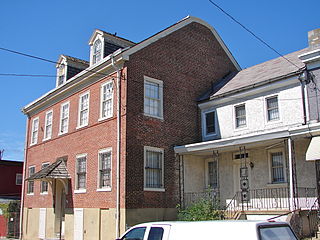
Northern Liberties is a neighborhood in Philadelphia, Pennsylvania, United States. It is north of Center City along the Delaware River. Prior to its incorporation into Philadelphia in 1854, it was among the top 10 largest cities in the U.S. in every census from 1790 to 1850. It was a major manufacturing area that attracted many European immigrants in the late 19th and early 20th centuries. In the early 21st century, it has attracted many young professionals and new commercial and residential development.

<span class="mw-page-title-main">Northeast Philadelphia</span> Neighborhood of Philadelphia in Philadelphia, Pennsylvania, United States

Northeast Philadelphia, nicknamed Northeast Philly, the Northeast and the Great Northeast, is a section of Philadelphia, Pennsylvania. According to the 2000 census, Northeast Philadelphia has a population of between 300,000 and 450,000, depending on how the area is defined. The Northeast is known as being home to a large working class Irish American population, but it is also home to Polish, German, Jewish, Russian, African American, Brazilian, Puerto Rican, Dominican, Guatemalan, Ukrainian, Indian, Chinese, and Vietnamese neighborhoods.

<span class="mw-page-title-main">Frankford, Philadelphia</span> Former Borough in Pennsylvania, United States

Frankford is a neighborhood in the Northeast section of Philadelphia situated about six miles (10 km) northeast of Center City. Although its borders are vaguely defined, the neighborhood is bounded roughly by the original course of Frankford Creek on the south to Castor Avenue on the northwest and southwest, to Cheltenham Avenue on the north, and to Aramingo Avenue and I-95 on the east. Adjacent neighborhoods are Bridesburg, Juniata, Northwood, Summerdale, and Wissinoming.

Lawncrest is a neighborhood in the "Near" (lower) Northeast Philadelphia, Pennsylvania. The name is an amalgam of Lawndale and Crescentville, the two primary communities that make up the neighborhood. The Philadelphia Inquirer does not consider Lawncrest to be a neighborhood.

<span class="mw-page-title-main">Holmesburg, Philadelphia</span> Neighborhood of Philadelphia, Pennsylvania, US

Holmesburg began as a Village within Lower Dublin Township, Pennsylvania. It is now a neighborhood in the Northeast section of Philadelphia, Pennsylvania, United States. Holmesburg was named in Honor of Surveyor General of Pennsylvania Thomas Holme, who was a cartographer.

<span class="mw-page-title-main">Kensington, Philadelphia</span> Neighborhood in Philadelphia, Pennsylvania

Kensington is a neighborhood in Philadelphia that belongs to Lower Northeast. As with all neighborhoods in the city, the lack of any official designation means the boundaries of the area vary between sources over time and are disputed among locals. Kensington, as most long-term residents view it, refers generally to the area consisting of Kensington, East Kensington, West Kensington, and Harrowgate. The adjacent Fairhill and Norris Square neighborhoods are more separate but may be included in Kensington; Fishtown and South (Olde) Kensington were historically included. The most conservative boundaries of the neighborhood, shown in the map below, are Front Street and 5th Street to the west, the Amtrak train tracks to the North, Trenton Avenue, the Trenton Avenue train tracks, and Frankford Avenue to the east, and Cecil B. Moore Avenue to the south.

<span class="mw-page-title-main">Port Richmond, Philadelphia</span> Neighborhood in Philadelphia, Pennsylvania, United States

Port Richmond is a neighborhood in the River Wards section of Philadelphia, Pennsylvania, United States. It is notable for its extremely large Polish immigrant and Polish American community, and it has been known as the Little Poland of Philadelphia. The neighborhood is also home to a large Irish American community and sizable German, Lithuanian, Italian, and Puerto Rican communities, along with a historic Jewish community, as represented in the various churches and organizations. In more recent years, a sizable Albanian community has moved in. The Richmond Zip Code is 19134. A small portion of the neighborhood, north of Castor Avenue, falls into the 19137 ZIP code.

<span class="mw-page-title-main">Torresdale, Philadelphia</span> Neighborhood of Philadelphia in Philadelphia County, Pennsylvania, United States

Torresdale, also formerly known as Torrisdale, is a neighborhood in the Far Northeast section of Philadelphia, Pennsylvania, United States. Torresdale is located along the Delaware River between Holmesburg and Bensalem Township in neighboring Bucks County.

<span class="mw-page-title-main">Frankford Creek</span> River in Pennsylvania, United States

Frankford Creek is a minor tributary of the Delaware River in southeast Pennsylvania. It derived its name from today's Frankford, Philadelphia neighborhood.

<span class="mw-page-title-main">Juniata, Philadelphia</span> Neighborhood of Philadelphia in Philadelphia County, Pennsylvania, United States

Juniata is a working class, predominantly Hispanic and Caucasian neighborhood in North Philadelphia, which is a section of the city of Philadelphia, Pennsylvania, United States. Juniata is located south of the Juniata Golf Club in Tacony Creek Park. It is bordered to the east by Frankford, to the west by Feltonville, and to the south by Harrowgate and Port Richmond. The neighborhood is bordered by G Street to the west, Juniata Park to the north, Tacony Creek to the east, and by SEPTA rail tracks to the south. Juniata shares the ZIP code of 19124 with the nearby neighborhood of Frankford.

<span class="mw-page-title-main">Northern Liberties Township, Pennsylvania</span> Former Township in Pennsylvania, United States

Northern Liberties Township was a township that was located in Philadelphia County, Pennsylvania. The township was later incorporated into the City of Philadelphia after the passage of the Act of Consolidation, 1854.

<span class="mw-page-title-main">Oxford Township, Philadelphia County, Pennsylvania</span> Former Township in Pennsylvania, United States

Oxford Township was a township in Philadelphia County, Pennsylvania, United States. The township ceased to exist and was incorporated into the City of Philadelphia following the passage of the Act of Consolidation, 1854.

<span class="mw-page-title-main">Oxford Circle, Philadelphia</span> Neighborhood of Philadelphia in Philadelphia County, Pennsylvania, United States

Oxford Circle is a neighborhood in the lower Northeast section of Philadelphia, Pennsylvania, United States. Its namesake is the much used traffic circle at Roosevelt Boulevard and Oxford Avenue. The Oxford Circle neighborhood has traditionally included the areas up to Rhawnhurst and Mayfair but does not really have a fixed boundary, other than in publications about Philadelphia which are of a public relations or informational nature.

<span class="mw-page-title-main">Interstate 95 in Pennsylvania</span> Section of Interstate Highway in United States

Interstate 95 (I-95) is a major north–south Interstate Highway that runs along the East Coast of the United States from Miami, Florida, north to the Canada–United States border at Houlton, Maine. In the state of Pennsylvania, it runs 51.00 miles (82.08 km) from the Delaware state line near Marcus Hook in Delaware County in the southeastern part of the state northeast to the Delaware River–Turnpike Toll Bridge at the New Jersey state line near Bristol in Bucks County, closely paralleling the New Jersey state line for its entire length through Pennsylvania.

Wissinoming is a neighborhood in the Near Northeast section of Philadelphia, United States. It was the site of locomotive builder Matthias Baldwin's estate "Wissinoming", which was located near Tacony and Van Kirk Streets. The current Wissinoming is bordered by Mayfair on the west and Tacony on the north, Bridesburg on the south, I-95 and the Delaware River on the east, and Frankford on the southwest. Wissinoming has two ZIP codes: 19124 and 19135. Physical boundaries are: Levick Street on the north, Bridge Street on the south, I-95 and the Delaware River on the east, and Frankford Avenue on the west.

<span class="mw-page-title-main">U.S. Route 13 in Pennsylvania</span> Highway in Pennsylvania

U.S. Route 13 (US 13) is a United States Numbered Highway running from Fayetteville, North Carolina, north to Morrisville, Pennsylvania. The route runs for 49.359 miles (79.436 km) through the Delaware Valley in the U.S. state of Pennsylvania. The route enters the state from Delaware in Marcus Hook, Delaware County. It continues northeast through Delaware County, passing through the city of Chester before heading through suburban areas along Chester Pike to Darby. US 13 enters the city of Philadelphia on Baltimore Avenue and runs through West Philadelphia to University City, where it turns north along several city streets before heading east across the Schuylkill River along Girard Avenue. The route turns north and heads to North Philadelphia, where it runs northeast along Hunting Park Avenue. US 13 becomes concurrent with US 1 on Roosevelt Boulevard, continuing into Northeast Philadelphia. US 13 splits southeast on a one-way pair of streets before heading northeast out of the city on Frankford Avenue. The route continues into Bucks County as Bristol Pike, heading northeast to Bristol, where it turns into a divided highway. US 13 becomes a freeway in Tullytown and continues north to its terminus at US 1 in Falls Township, near Morrisville. US 13 roughly parallels Interstate 95 (I-95) through its course in Pennsylvania.

<span class="mw-page-title-main">St. John Cantius Roman Catholic Church, Philadelphia</span> Church in Philadelphia, Pennsylvania

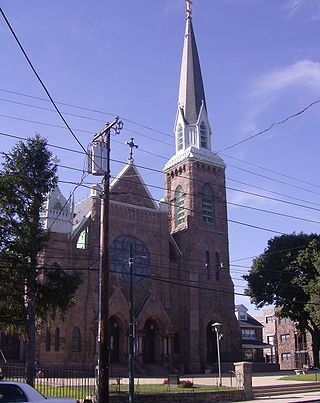
St. John Cantius Roman Catholic Church, Philadelphia, is located in Northeast Philadelphia in Bridesburg and serves the local Polish-speaking population in the area. It is located at 4415 Almond Street.

Olde Richmond is a neighborhood in the River Wards section of Philadelphia, Pennsylvania. It is notable for its historically large Polish immigrant, Polish American community, and Irish American community. The U.S. ZIP Code for Olde Richmond is 19125 and its post office is located at 1602 Frankford Avenue.

References

  1. "City of Philadelphia, PA - Planning Districts" (PDF). Delaware Valley Regional Planning Commission. 2013.
  2. 1 2 "All Saints Church". www.philadelphiabuildings.org. Retrieved 26 May 2017.
  3. "19137 Zip Code (Philadelphia, Pennsylvania) Profile - homes, apartments, schools, population, income, averages, housing, demographics, location, statistics, sex offenders, residents and real estate info". www.city-data.com. Retrieved 26 May 2017.
  4. "Adams Family Papers : An Electronic Archive". www.masshist.org. Archived from the original on 16 July 2012. Retrieved 26 May 2017.
  5. "County Political Subdivisions". www.phila.gov. Retrieved 26 May 2017. (Daly, John; Weinberg, Allen (October 1966). Genealogy of Philadelphia County Subdivisions (Second ed.). Philadelphia Dept. of Records.)
  6. "Zip Code 19137 - 2010 Census for Philadelphia, PA". www.zip-codes.com. Retrieved 26 May 2017.
  7. "Locations - Dow". www.dow.com. Retrieved 26 May 2017.
  8. "Honeywell". Honeywell. Archived from the original on 17 July 2013. Retrieved 26 May 2017.
  9. "Bridesburg M. E. Church". www.philadelphiabuildings.org. Retrieved 26 May 2017.
  10. "First Presbyterian Church of Bridesburg". www.philadelphiabuildings.org. Retrieved 26 May 2017.
  11. "Bridesburg Elementary School Geographic Boundaries Archived 2012-05-13 at the Wayback Machine ." School District of Philadelphia. Retrieved on October 4, 2011.
  12. "Warren G. Harding Middle School Geographic Boundaries Archived 2012-03-28 at the Wayback Machine ." School District of Philadelphia. Retrieved on October 4, 2011.
  13. "Frankford High School Geographic Boundaries Archived 2012-03-28 at the Wayback Machine ." School District of Philadelphia. Retrieved on October 4, 2011.
  14. "Post Office Location - BRIDESBURG." United States Post Office. Retrieved on January 16, 2009.

Further reading