Wynnefield, Philadelphia

Last updated
Wynnefield
Wynnefield Pa.jpg
4900 block of Wynnefield Avenue
Street map of Philadelphia and surrounding area.png
Red pog.svg
Wynnefield
Coordinates: 39°59′20″N75°13′59″W / 39.989°N 75.233°W / 39.989; -75.233
CountryFlag of the United States (23px).png  United States
State Pennsylvania
County Philadelphia County
City Philadelphia
Area code(s) 215, 267 and 445

Wynnefield is a diverse middle-class neighborhood in West Philadelphia. Its borders are 53rd Street at Jefferson to the south, Philadelphia's Fairmount Park to the east, City Avenue (commonly referred to as "City Line") to the north and the Amtrak Philadelphia Main Line tracks to the west.

Contents

Surrounding neighborhoods include Bala Cynwyd to the north, Wynnefield Heights and Belmont Village to the east, Parkside to the south, and Overbrook to the west. [1] Its main commercial arteries are North 54th Street, Bryn Mawr Avenue (2200 block), and City Avenue. It is the home of the television station WPHL-TV (PHL 17).

History

Like the nearby suburban community of Wynnewood, Wynnefield takes its name from William Penn's physician, Thomas Wynne, who built his home Wynnestay at 52nd Street and Woodbine Avenue in 1690. The former Woodside Amusement Park was located in nearby Fairmount Park and is now the separate community of Wynnefield Heights. [2]

Before Wynnefield's expansion in the early twentieth century, it was largely a rural and undeveloped area of farms dating back to the late 1600s. However, this changed with the construction of the Market-Frankford Elevated Train and the various trolley lines. With the creation of the lines it suddenly became easier for people to live farther from their jobs, and into the undeveloped areas of the city. Today, all but one of Philadelphia's trolley lines are exclusively operational in West Philadelphia.

In Philadelphia, the Jewish-American community were discriminated in certain neighborhoods in Philadelphia, prompting them to create their own community in Wynnefield. From about 1900, Wynnefield was considered an upscale community with predominantly Jewish-American residents. However, there were large groups of non-Jewish immigrants from Russia, Germany, and other Eastern European countries that formed the Wynnefield community.

In the 1920s Wynnefield expanded again, through the purchasing of rural lots, and their conversion into smaller plotted neighborhoods of row houses. Additional streets, such as Diamond Street were put in 1923 and additional row housing increasing the population of the neighborhood. German-Catholics moved into the neighborhood, prompting the founding of Saint Barbara's Roman Catholic Church in January 1921 on Georges Lane and Lebanon Ave near 54th Street.

Until the 1960s, an area near Wynnefield, Bala Cynwyd, across City Avenue in Lower Merion Township, was known as an upscale shopping district. Small, local boutiques thrived alongside of The Blum Store, Bonwit Teller, and Lord & Taylor. Betty's hat shop was a popular destination for the Main Line elite and Jackie Kennedy fans. Suburbanites would bring their families to spend the day shopping and to enjoy a meal at local haunts such as Pub Tiki and Williamson's Restaurant. Women from areas such as nearby Bucks County would ride into Bala Cynwyd on SEPTA buses, donning their best garb and wearing their white gloves.

In the mid-1960s, the neighborhood began the transition into being largely African American. As of 2006, changes to the neighborhood include the expansion of St. Joseph's University, and an influx of students and new residents of non-African descent moving into the area. Today Wynnefield closely parallels highly regarded Mt. Airy as being one of the most racially diverse neighborhoods in Philadelphia. [3]

Much of the development of Wynnefield after the 1960s is due to the influence of the late Katie B. Jackson (1929–1993). Known by the African-American community as "Queen of Wynnefield," Jackson founded the Wynnefield Academy, a private, co-educational PK-4 elementary school in 1975. The Katie B. Jackson Development Corporation and Katie B. Jackson Senior Citizens Complex bear her name.

Har Zion Synagogue, built at 54th & Wynnefield Ave in 1924, was a longtime resident of the area before moving to larger facilities in Penn Valley, PA in 1976.

The William Mann School and Wynnestay are listed on the National Register of Historic Places. [4]

Demographic

According the U.S. Census from the 2019 American Community Survey 5-Year Estimates, the total population of 19131, which include Overbrook, Wynnfield, Belmont Village, and Wynnefield Heights, was 44,723 [5] where 44.5% is male and 55.5% is female. [6] Per the 2019 U.S. Census data, the community is 82.2% African-American, 13.4% Caucasian, 4.1% Asian/Pacific Islander and 3.6% Hispanic/Latino. [7]

The mean household income in the past 12 months (in 2019 inflation-adjusted dollars) was $49,724. [8]

Of the 21,361 total housing units located in the 19131 zip code per 2019 Census data, 8,544 or 48.8% are owner-occupied units. [9] The neighborhood offers a variety of housing types: two-story brick town homes and row duplexes, garden apartments, and mid-rise and high-rise apartment homes.

Education

Colleges and universities

Saint Joseph's University is just outside the neighborhood. The boundary of Wynnefield is N. 54th Street. The athletic fields, however, are in Wynnefield at North 54th St. and Overbrook to City Line Avenue

Primary and secondary schools

Public schools

Wynnefield is served by the School District of Philadelphia.

Elementary schools:

High schools:

Charter schools:

Private schools

Public libraries

Free Library of Philadelphia operates the Wynnefield Branch .

Notable people

Wynnefield also has connections to the motion picture and music industries. Wynnefield is the childhood home of actor and rapper Will Smith, film producer Lee Daniels ( Monster's Ball and The Woodsman ), film director Charles Stone III, politico and former Big Brother reality-TV contestant Will Mega and documentary filmmaker Tigre Hill. Also, former basketball player Julius Erving once resided there as well as boxer Michael Spinks.

Local politicians with Wynnefield ties include Philadelphia mayor Michael Nutter, former mayor Wilson Goode, city councilman Curtis Jones, Jr, and councilwoman Blondell Reynolds Brown.

Places of worship

Related Research Articles

<span class="mw-page-title-main">Lower Merion Township, Pennsylvania</span> Township in Pennsylvania, United States

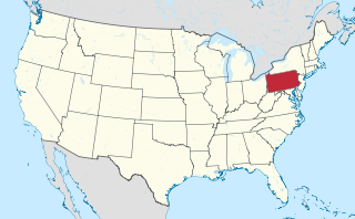
Lower Merion Township is a township in Montgomery County, Pennsylvania, United States. It is part of the Philadelphia Main Line. The township's name originates with the county of Merioneth in north Wales. Merioneth is an English-language transcription of the Welsh Meirionnydd.

<span class="mw-page-title-main">Narberth, Pennsylvania</span> Borough in Montgomery County, Pennsylvania

Narberth is a borough in Montgomery County, Pennsylvania. It is one of many neighborhoods on the historic Philadelphia Main Line. The population was 4,282 at the 2010 census.

<span class="mw-page-title-main">Merion Station, Pennsylvania</span> Census-designated place in Pennsylvania, United States

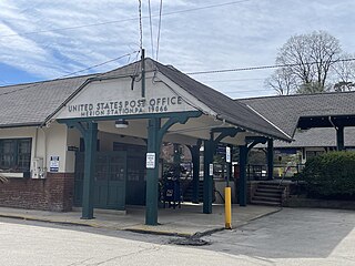
Merion Station, also known as Merion, is an unincorporated community in Montgomery County, Pennsylvania. It borders Philadelphia to its west and is one of the communities that make up the Philadelphia Main Line. Merion Station is part of Lower Merion Township, Montgomery County. The community is known for its grand mansions and for the wealth of its residents.

<span class="mw-page-title-main">Philadelphia Main Line</span> Collection of suburban communities in Pennsylvania, United States

The Philadelphia Main Line, known simply as the Main Line, is an informally delineated historical and social region of suburban Philadelphia, Pennsylvania. Lying along the former Pennsylvania Railroad's once prestigious Main Line, it runs northwest from Center City Philadelphia parallel to Lancaster Avenue, also known as U.S. Route 30.

<span class="mw-page-title-main">Bala Cynwyd, Pennsylvania</span> Census-designated place in Pennsylvania, United States

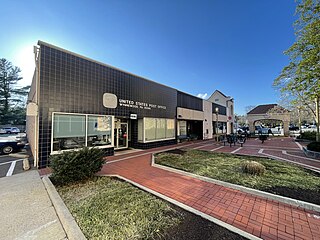
Bala Cynwyd is a community and census-designated place in Lower Merion Township, Pennsylvania, United States. It is located on the Philadelphia Main Line in Southeastern Pennsylvania and borders the western edge of Philadelphia at U.S. Route 1. The present-day community was originally two separate towns, Bala and Cynwyd, but was united as a singular community largely because the U.S. Post Office, the Bala Cynwyd branch, served both towns using ZIP Code 19004. The combining of the communities gives a total population of 9,285 as of the 2020 census. The community was long known as hyphenated Bala-Cynwyd. Bala and Cynwyd are currently served by separate stations on SEPTA's Cynwyd Line of Regional Rail.

<span class="mw-page-title-main">Bath Beach, Brooklyn</span> Neighborhood of Brooklyn in New York City

Bath Beach is a neighborhood in the New York City borough of Brooklyn, located at the southwestern edge of the borough on Gravesend Bay. The neighborhood borders Bensonhurst and New Utrecht to the northeast across 86th Street; Dyker Beach Park and Golf Course to the northwest across 14th Avenue; and Gravesend to the east across Stillwell Avenue.

<span class="mw-page-title-main">Overbrook, Philadelphia</span> Neighborhood of Philadelphia in Philadelphia County, Pennsylvania, United States

Overbrook is an historic neighborhood that is located in the Commonwealth of Pennsylvania, United States. It is situated northwest of West Philadelphia, Philadelphia.

<span class="mw-page-title-main">West Philadelphia</span> Neighborhood of Philadelphia, Pennsylvania

West Philadelphia, nicknamed West Philly, is a section of the city of Philadelphia. Although there are no officially defined boundaries, it is generally considered to reach from the western shore of the Schuylkill River, to City Avenue to the northwest, Cobbs Creek to the southwest, and the SEPTA Media/Wawa Line to the south. An alternate definition includes all city land west of the Schuylkill; this would also include Southwest Philadelphia and its neighborhoods. The eastern side of West Philadelphia is also known as University City.

<span class="mw-page-title-main">Overbrook Park, Philadelphia</span> Neighborhood of Philadelphia in Pennsylvania, United States

Overbrook Park is a neighborhood in the West Philadelphia section of Philadelphia, Pennsylvania, United States. It was founded in the 1940s on the site of a former farm known as Supio's farm, offering new housing for returning GIs and their families. Overbrook Park is a largely middle-class African-American and historically Jewish-American neighborhood.

<span class="mw-page-title-main">Wynnewood, Pennsylvania</span> Place in Pennsylvania, United States

Wynnewood is a suburban unincorporated community, located west of Philadelphia, straddling Lower Merion Township in Montgomery County, Pennsylvania and Haverford Township in Delaware County, Pennsylvania, United States.

<span class="mw-page-title-main">Bustleton, Philadelphia</span> Neighborhood of Philadelphia in Philadelphia County, Pennsylvania, United States

The Bustleton section of Northeast Philadelphia, United States is located in the Far Northeast, north of Rhawnhurst and Fox Chase and south of Somerton; sitting between Roosevelt Boulevard to the east, the city boundary to the west, Red Lion Road to the north, and Pennypack Park to the south, it is centered at the intersection of Grant Avenue and Bustleton Avenue (PA-532) and is completely included in the 19115 postal ZIP code.

<span class="mw-page-title-main">Overbrook Farms, Philadelphia</span> United States historic place

Overbrook Farms is a neighborhood that is situated on the western edge of the West Philadelphia section of Philadelphia, Pennsylvania, United States. It is roughly bounded by City Avenue, 58th Street, Woodbine Avenue, and 66th Street at Morris Park.

<span class="mw-page-title-main">Juniata, Philadelphia</span> Neighborhood of Philadelphia in Philadelphia County, Pennsylvania, United States

Juniata is a working class, predominantly Hispanic and Caucasian neighborhood in North Philadelphia, which is a section of the city of Philadelphia, Pennsylvania, United States. Juniata is located south of the Juniata Golf Club in Tacony Creek Park. It is bordered to the east by Frankford, to the west by Feltonville, and to the south by Harrowgate and Port Richmond. The neighborhood is bordered by G Street to the west, Juniata Park to the north, Tacony Creek to the east, and by SEPTA rail tracks to the south. Juniata shares the ZIP code of 19124 with the nearby neighborhood of Frankford.

<span class="mw-page-title-main">Wynnefield Heights, Philadelphia</span> Neighborhood of Philadelphia in Pennsylvania, United States

Wynnefield Heights is a middle class neighborhood that is located in the greater West Philadelphia area of Philadelphia, Pennsylvania, United States. The neighborhood is bounded by City Avenue to the north, Belmont Avenue to the west, Fairmount Park to the south and east, and the Schuylkill Expressway to the east.

<span class="mw-page-title-main">Belmont Hills, Pennsylvania</span> Town near Philadelphia

Located in Lower Merion Township, Montgomery County, Pennsylvania, United States, Belmont Hills is a suburb of Philadelphia. Belmont Hills is a neighborhood within the village of Bala Cynwyd. It is a distinct community with its own public elementary school, public pool, fire department and public library. Belmont Hills is known for its hilly terrain. Belmont means "Beautiful Mountain" so its literal name is "Beautiful Mountain Hills".

<span class="mw-page-title-main">Spring Garden, Philadelphia</span> Historic neighborhood in Pennsylvania, United States

Spring Garden is a neighborhood in central Philadelphia, Pennsylvania, bordering Center City on the north. Spring Garden is a neighborhood that combines diverse residential neighborhoods and significant cultural attractions.

<span class="mw-page-title-main">Cynwyd Line</span> SEPTA Regional Rail line

The Cynwyd Line is a SEPTA Regional Rail line from Center City Philadelphia to Cynwyd in Montgomery County, Pennsylvania. Originally known as the Ivy Ridge Line, service was truncated on May 17, 1986, at its current terminus at Cynwyd.

<span class="mw-page-title-main">Belmont Village</span> Neighborhood of Philadelphia in Pennsylvania, United States

Belmont Village is a middle class neighborhood located in the West Philadelphia section of Philadelphia, Pennsylvania, United States. The zip code is 19131.

The Wynne Theater was a movie theater that was located on 54th and Wynnefield Avenue in the Wynnefield neighborhood of Philadelphia, Pennsylvania, United States.

References

  1. http://www.philaplanning.org/cpdiv/WPPpartTwo.pdf Page 5, Retrieved 10-31-2010.
  2. "Digital Collections: Free Library of Philadelphia". Free Library of Philadelphia. Retrieved 2017-06-27.
  3. "Wynnefield, Philadelphia, PA Demographics". AreaVibes . Retrieved 2013-08-24.
  4. "National Register Information System". National Register of Historic Places . National Park Service. July 9, 2010.
  5. "Explore Census Data". data.census.gov. Retrieved 2021-07-29.
  6. "Explore Census Data". data.census.gov. Retrieved 2021-07-29.
  7. "Explore Census Data". data.census.gov. Retrieved 2021-07-29.
  8. "Explore Census Data". data.census.gov. Retrieved 2021-07-29.
  9. "Explore Census Data". data.census.gov. Retrieved 2021-07-29.