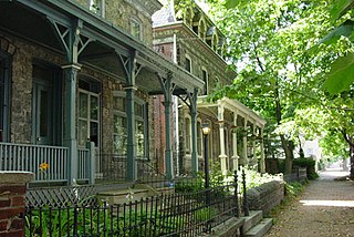
Powelton Village is a neighborhood of mostly Victorian, mostly twin homes in the West Philadelphia section of the United States city of Philadelphia, Pennsylvania. It is a national historic district that is part of University City. Powelton Village extends north from Market Street to Spring Garden Street, east to 32nd Street, west to 40th and Spring Garden Streets, and to 44th and Market Streets.

Rittenhouse Square is a neighborhood, including a public park, in Center City Philadelphia, Pennsylvania, United States. Rittenhouse Square often specifically refers to the park, while the neighborhood as a whole is referred to simply as Rittenhouse. The park is one of the five original open-space parks planned by William Penn and his surveyor Thomas Holme during the late 17th century.

University City is the easternmost portion of West Philadelphia, encompassing several Philadelphia universities. It is situated directly across the Schuylkill River from Center City.

West Philadelphia, nicknamed West Philly, is a section of the city of Philadelphia. Alhough there are no officially defined boundaries, it is generally considered to reach from the western shore of the Schuylkill River, to City Avenue to the northwest, Cobbs Creek to the southwest, and the SEPTA Media/Wawa Line to the south. An alternate definition includes all city land west of the Schuylkill; this would also include Southwest Philadelphia and its neighborhoods. The eastern side of West Philadelphia is also known as University City.

Center City includes the central business district and central neighborhoods of Philadelphia. It comprises the area that made up the City of Philadelphia prior to the Act of Consolidation, 1854, which extended the city borders to be coterminous with Philadelphia County.

Petworth is a residential neighborhood in the Northwest quadrant of Washington, D.C. It is bounded to the east by the Armed Forces Retirement Home and Rock Creek Cemetery, to the west by Arkansas Avenue NW, to the south by Rock Creek Church Road NW and Spring Road NW, and to the north by Kennedy Street NW.
Cobbs Creek is a neighborhood located in the West Philadelphia section of Philadelphia, Pennsylvania, United States, named for the creek which forms part of Philadelphia's western border. Cobbs Creek is generally bounded by Market Street to the north, Baltimore Avenue to the south, 52nd Street to the east, and the border of Upper Darby along Cobbs Creek to the West.
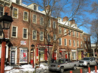
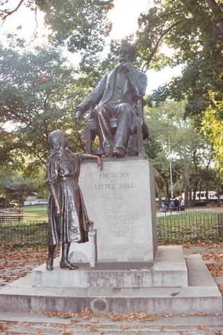
Society Hill is a historic neighborhood in Center City Philadelphia, Pennsylvania, United States, with a population of 6,215 as of the 2010 United States Census. Settled in the early 1680s, Society Hill is one of the oldest residential neighborhoods in Philadelphia. After urban decay developed between the late 19th and early 20th centuries, an urban renewal program began in the 1950s, restoring the area and its many historic buildings. Society Hill has since become one of the most expensive neighborhoods with the highest average income and second-highest real estate values in Philadelphia. Society Hill's historic colonial architecture, along with planning and restoration efforts, led the American Planning Association to designate it, in 2008, as one of the great American neighborhoods and a good example of sustainable urban living.

Black Bottom was a predominantly African American and poor neighborhood in West Philadelphia, Pennsylvania. It was mostly razed for urban renewal in the 1960s.
Spruce Hill is a neighborhood in the University City section of West Philadelphia, Pennsylvania, United States. It is situated between 40th and 46th streets and stretches from Market Street south to Woodland Avenue.

Walnut–Locust/Avenue of the Arts is a subway station on SEPTA's Broad Street Line in Philadelphia, Pennsylvania. The station is located between Walnut Street and Locust Street at 200 South Broad Street in the Avenue of the Arts district of Center City, Philadelphia.

The Institute of Pennsylvania Hospital, also known as Kirkbride's Hospital or the Pennsylvania Hospital for Mental and Nervous Diseases, was a psychiatric hospital located at 48th and Haverford Streets in Philadelphia, Pennsylvania, USA. It operated from its founding in 1841 until 1997. The remaining building, now called the Kirkbride Center is now part of the Blackwell Human Services Campus.
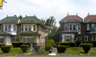
Garden Court is a neighborhood in the West Philadelphia section of Philadelphia, Pennsylvania, United States. It is located west of Spruce Hill, north of Cedar Park, east of Cobbs Creek, and south of Walnut Hill.
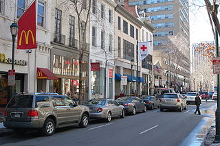
Walnut Street is located in Center City Philadelphia and extends to the Delaware River waterfront and West Philadelphia. Walnut Street has been characterized as "the city's premier shopping district" by The Philadelphia Inquirer. A portion of the street commonly called Rittenhouse Row was ranked 12th in 2005 by Women's Wear Daily among its list of the most expensive retail streets in North America, with rents of $90 per square foot, and is home to several "upscale dining, retail and cultural" establishments. In 2013, rents rose to an average of $107 a foot, a growth of 34% over 2012 and the largest percentage growth of any retail corridor in the country.

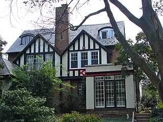
Spring Garden is a neighborhood in central Philadelphia, Pennsylvania, United States, bordering Center City on the north. Spring Garden is a neighborhood that combines diverse residential neighborhoods and significant cultural attractions. The residential areas on the north side of the neighborhood are composed mostly of brick and brownstone three-story townhouses built during the mid-to-late 19th century. The houses include townhouses in the Italianate style, Second Empire, Queen Anne, and Venetian Gothic. Many streets include "terraced" set ups, which include a small gardened plot, often raised, in front of the house. The residential areas to the south are dominated by taller, multi-family buildings built during the 20th century. The museum area, also to the south of Spring Garden Street, includes the Rodin Museum, the Central Library of Philadelphia, and the Barnes Museum. Before consolidation of Philadelphia, Spring Garden was a district of Philadelphia County.

West Philadelphia High School is a secondary school located in the West Philadelphia section of Philadelphia, Pennsylvania at the intersection of 49th Street and Chestnut Street.
Callowhill Depot is a bus and trolley barn operated by the Southeastern Pennsylvania Transportation Authority (SEPTA), located in West Philadelphia, near the Delaware County border. It was built in 1913 by the Philadelphia Rapid Transit Company (PRT) and was later operated by the Philadelphia Transportation Company (PTC) before being taken over by SEPTA. The depot was constructed as part of the Thomas E. Mitten modernization program. Since its construction, the depot has suffered fire damage and reconstruction in 1949, 1950, and 1995.

The Paul Robeson House was the home of internationally renowned American bass-baritone concert singer, actor of film and stage, All-American and professional athlete, writer, multi-lingual orator, human rights activist, and lawyer Paul Robeson from 1966 until 1976. Located in West Philadelphia, the Robeson House produces, presents and promotes traveling lectures, concerts and exhibits so that learning about Robeson is accessible to all ages and cultures.