
Fairmount Park is the largest municipal park in Philadelphia, Pennsylvania and the historic name for a group of parks located throughout the city. Fairmount Park consists of two park sections named East Park and West Park, divided by the Schuylkill River, with the two sections together totalling 2,052 acres (830 ha). Management of Fairmount Park and the entire citywide park system is overseen by Philadelphia Parks & Recreation, a city department created in 2010 from the merger of the Fairmount Park Commission and the Department of Recreation.

Fox Chase is a neighborhood in Northeast Philadelphia, Pennsylvania.

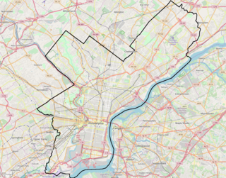
Northeast Philadelphia, nicknamed Northeast Philly, the Northeast and the Great Northeast, is a section of the City of Philadelphia, Pennsylvania. According to the 2000 Census, the Northeast has a sizable percentage of the city's 1.547 million people—a population of between 300,000 and 450,000, depending on how the area is defined. Beginning in the 1980s, many of the Northeast's middle class children graduated from college and settled in suburbs, especially nearby Bucks County. The Northeast is known as being home to a large working class Irish American population, but it is also home to Polish, German, Jewish, Italian, African American, Portuguese, Russian, Puerto Rican, and Dominican neighborhoods.
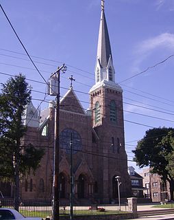
Holmesburg is a neighborhood in the Northeast section of Philadelphia, Pennsylvania. Holmesburg was named for the descendants of Judge John Holme (1632–1704) who immigrated to Philadelphia in the 1680s and had no apparent relation to Surveyor General Thomas Holme. John Holme's descendants acquired land in Lower Dublin, north and south of Frankford Avenue and west of the Pennypack Creek. At the turn of the 19th century they began selling numerous small parcels of their holdings in what became a real estate boom. Also at this time, John Holme, the great grandson of the first John Holme, renamed his lumber yard the Holmesburg Lumber Yard. This renaming coupled with the multitude of Holme family real estate transactions identified this area as 'Holmesburg', the title surviving more than two hundred years later.

Mayfair, centered on the intersection of Cottman and Frankford Avenues. It is bordered by Tacony and Wissinoming to the south and east, Holmesburg to the east, Pennypack Park to the north, and Oxford Circle and Rhawnhurst to the west. Mayfair is home to a large Irish American population.
Rhawnhurst is a residential neighborhood in the Northeast section of Philadelphia, named for George and William Rhawn by area real estate developers. Roughly bordered by Cottman Avenue to the south, Pennway Street to the west, the Pennypack Creek to the north, and Roosevelt Boulevard to the east, Rhawnhurst encompasses ZIP codes 19152 and part of ZIP code 19111. The geographic center of Rhawnhurst is at the intersection of Castor Avenue and Rhawn Street.
Burholme is a neighborhood in the Northeast section of Philadelphia, Pennsylvania, United States.
The Bustleton section of Northeast Philadelphia is located in the Far Northeast, north of Rhawnhurst and Fox Chase and south of Somerton; sitting between Roosevelt Boulevard to the east, the city boundary to the west, Red Lion Road (PA-63) to the north, and Pennypack Park to the south, it is centered at the intersection of Grant Avenue and Bustleton Avenue (PA-532) and is completely included in the 19115 postal ZIP code.
Ashton-Woodenbridge is a neighborhood in Northeast Philadelphia, in the U.S. state of Pennsylvania. It is located on the eastern side of the far northeast, in the vicinity of Northeast Philadelphia Airport, including Wooden Bridge Run west to Academy Gardens, and south to Pennypack Park. Originally farm land, it was part of the holdings of Thomas Holme, surveyor for Philadelphia's founder, William Penn. The area was part of one of the original townships, Lower Dublin Township, until the 1854 Act of Consolidation incorporated it into the City of Philadelphia.

Pennypack Creek is a 22.6-mile-long (36.4 km) creek in southeastern Pennsylvania in the United States. It runs southeast through lower Bucks County, eastern Montgomery County and the northeast section of Philadelphia, before emptying into the Delaware River.
Lexington Park is a neighborhood in the Northeast section of Philadelphia, Pennsylvania. It is bounded on the west by Roosevelt Boulevard, and on the north, east and south by Pennypack Park. The neighborhood is made up mostly of twin and single homes built in the years following the Second World War, and a few apartment buildings built not long thereafter. There are some commercial establishments along Rhawn Street and Roosevelt Boulevard. Convenience to the park makes it an attractive location for families with children. Lexington Park is also home to Nazareth Hospital.
The Frankford Avenue Bridge, also known as the Pennypack Creek Bridge, the Pennypack Bridge, the Holmesburg Bridge, and the King's Highway Bridge, erected in 1697 in the Holmesburg section of Northeast Philadelphia, in the U.S. state of Pennsylvania, is the oldest surviving roadway bridge in the United States. The three-span, 73-foot-long (22 m) twin stone arch bridge carries Frankford Avenue, just north of Solly Avenue, over Pennypack Creek in Pennypack Park.
Oxford Circle is a neighborhood in the lower Northeast section of Philadelphia, Pennsylvania, United States. Its namesake is the much used traffic circle at Roosevelt Boulevard and Oxford Avenue. The Oxford Circle neighborhood has traditionally included the areas up to Rhawnhurst and Mayfair but does not really have a fixed boundary other than in publications about Philadelphia which are of a public relations or informational nature.

Pennypack Park is a municipal park, part of the Philadelphia Parks & Recreation system, in Northeast Philadelphia in the U.S. state of Pennsylvania. Established in 1905 by ordinance of the City of Philadelphia, it includes about 1,600 acres (6 km2) of woodlands, meadows and wetlands. The Pennypack Creek runs through the park from Pine Road to the Delaware River. The park has playgrounds, hiking and bike trails, and bridle paths for horseback riding. An adjunct to the park is the Pennypack Environmental Center on Verree Road.

Holme Circle is a neighborhood in Northeast Philadelphia. It is located in the loop of Pennypack Creek at Holme Avenue and Welsh Road. The area is generally composed of two-story twin homes north of the Holme Circle, one-story twins southeast of the Circle and single homes south of Welsh Road and Holme Avenue. St Jerome Parish serves the area; the Robert B. Pollock Elementary School is at Welsh Road and Tolbut Street.

Huntingdon Valley is a village, as well as a suburban mailing address located in Lower Moreland Township, Upper Moreland Township and Abington Township all in Montgomery County, and in small sections of Upper Southampton Township and Lower Southampton Township in Bucks County, Pennsylvania bordering the Fox Chase section of Philadelphia County, Pennsylvania, United States.
The Holme Avenue Bridge is a closed-spandrel concrete arch bridge that carries Holme Avenue across Wooden Bridge Run in Philadelphia, Pennsylvania.
Winchester Park is a neighborhood in Far Northeast Philadelphia. It is located in the vicinity of Pennypack Park, north and west of Holmesburg.
Greenbelt Knoll is a residential development in the Northeast section of Philadelphia, Pennsylvania. Planned and built from 1952 to 1957, it is notable as the first planned racially integrated development in Philadelphia and among the first in the United States.

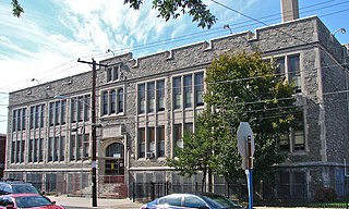
William W. Axe School is a historic school building located in the Frankford neighborhood of Philadelphia, Pennsylvania. It was designed by Lloyd Titus and built in 1903–1904. It is a two-story, three-bay, stone building on a raised basement in the Colonial Revival style. It has a one-story, rear brick addition. It features stone lintels and sashes and a projecting center section with gable.

