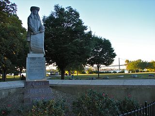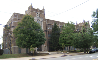
Northeast Philadelphia, nicknamed Northeast Philly, the Northeast and the Great Northeast, is a section of Philadelphia, Pennsylvania. According to the 2000 census, Northeast Philadelphia has a population of between 300,000 and 450,000, depending on how the area is defined. The Northeast is known as being home to a large working class Irish American population, but it is also home to Polish, German, Jewish, Russian, African American, Brazilian, Puerto Rican, Dominican, Guatemalan, Ukrainian, Indian, Chinese, and Vietnamese neighborhoods.

Chicago's demographics show that it is a large, and ethnically and culturally diverse metropolis. It is the third largest city and metropolitan area in the United States by population. Chicago was home to over 2.7 million people in 2020, accounting for over 25% of the population in the Chicago metropolitan area, home to approximately 9.6 million.

Kensington is a neighborhood in Philadelphia that belongs to Lower Northeast. As with all neighborhoods in the city, the lack of any official designation means the boundaries of the area vary between sources over time and are disputed among locals. Kensington, as most long-term residents view it, refers generally to the area consisting of Kensington, East Kensington, West Kensington, and Harrowgate. The adjacent Fairhill and Norris Square neighborhoods are more separate but may be included in Kensington; Fishtown and South (Olde) Kensington were historically included. The most conservative boundaries of the neighborhood, shown in the map below, are Front Street and 5th Street to the west, the Amtrak train tracks to the North, Trenton Avenue, the Trenton Avenue train tracks, and Frankford Avenue to the east, and Cecil B. Moore Avenue to the south.

North Philadelphia, nicknamed North Philly, is a section of Philadelphia, Pennsylvania. It is immediately north of Center City. Though the full extent of the region is somewhat vague, "North Philadelphia" is regarded as everything north of either Vine Street or Spring Garden Street, between Northwest Philadelphia and Northeast Philadelphia. It is bordered to the north by Olney Ave along Broad Street, Spring Garden Street to the south, 35th Street to the west and Adams Avenue to the east. The Philadelphia Police Department patrols five districts located within North Philadelphia: the 22nd, 25th, 26th, 35th and 39th districts. There are thirteen ZIP codes for North Philadelphia: 19120, 19121, 19122, 19123, 19125, 19126, 19130, 19132, 19133, 19134, 19137, 19140 and 19141.

Port Richmond is a neighborhood in the River Wards section of Philadelphia, Pennsylvania, United States. It is notable for its extremely large Polish immigrant and Polish American community. The neighborhood is also home to a large Irish American community and sizable German and Italian communities as represented in the various churches and organizations. In more recent years, a sizable Albanian community has moved in. The Richmond Zip Code is 19134. A small portion of the neighborhood, north of Castor Avenue, falls into the 19137 ZIP code.

Mayfair is a working class neighborhood in lower Northeast Philadelphia, Pennsylvania, United States, centered on the intersection of Cottman and Frankford Avenues. It is bordered by Tacony and Wissinoming to the south and east, Holmesburg to the east, Pennypack Park to the north, and Oxford Circle and Rhawnhurst to the west. Mayfair is historically home to a large Irish American population, but more recently has seen accelerated growth of Asian American population

Olney is a neighborhood in the North Philadelphia section of Philadelphia. It is roughly bounded by Roosevelt Boulevard to the south, Tacony Creek to the east, Godfrey Avenue to the north, and the railroad right-of-way west of 7th Street to the west.

West Kensington is a neighborhood in the North Philadelphia section of Philadelphia, Pennsylvania, United States. It is north of Olde Kensington. The Market Frankford El above Front Street forms the line between West Kensington and Kensington. Its bordering neighborhoods are Kensington to the east, Hartranft to the west, and Olde Kensington to the south. It is bounded by Front Street to the east, 6th Street to the west, Cecil B. Moore Avenue to the South and Lehigh Avenue to the north. It falls into the 19122 and 19133 ZIP Codes.

Hartranft is a neighborhood in the central part of North Philadelphia section of Philadelphia, Pennsylvania.

Fairhill is a neighborhood on the east side of the North Philadelphia section of Philadelphia, Pennsylvania, United States. Fairhill is bordered by Front Street to the east, Germantown Avenue to the west, Allegheny Avenue to the north, and Cumberland Street to the south. The neighborhood serves as the center of the Hispanic community of Philadelphia, and is known for its "El Centro de Oro" commercial strip along North 5th Street. Fairhill is adjacent to Harrowgate and West Kensington to the east, Hartranft to the south, Glenwood to the west, and Hunting Park to the north.

Juniata is a working class, predominantly Hispanic and Caucasian neighborhood in North Philadelphia, which is a section of the city of Philadelphia, Pennsylvania, United States. Juniata is located south of the Juniata Golf Club in Tacony Creek Park. It is bordered to the east by Frankford, to the west by Feltonville, and to the south by Harrowgate and Port Richmond. The neighborhood is bordered by G Street to the west, Juniata Park to the north, Tacony Creek to the east, and by SEPTA rail tracks to the south. Juniata shares the ZIP code of 19124 with the nearby neighborhood of Frankford.
Olde Kensington, also known as South Kensington, is a neighborhood located in North Philadelphia section of Philadelphia, Pennsylvania, United States. South Kensington is north of Northern Liberties, south of Norris Square, east of Ludlow, and west of Fishtown. The boundaries of the neighborhood are Berks St. (north), Girard Ave (south), Front St (east) and 6th St. (west).

At the 2010 census, there were 1,526,006 people, 590,071 households, and 352,272 families residing in the consolidated city-county of Philadelphia, Pennsylvania. The population density was 4,337.3/km2 (11,233.6/mi2). There were 661,958 housing units at an average density of 1,891.9/km2 (4,900.1/mi2).

Oxford Circle is a neighborhood in the lower Northeast section of Philadelphia, Pennsylvania, United States. Its namesake is the much used traffic circle at Roosevelt Boulevard and Oxford Avenue. The Oxford Circle neighborhood has traditionally included the areas up to Rhawnhurst and Mayfair but does not really have a fixed boundary, other than in publications about Philadelphia which are of a public relations or informational nature.
The demographics of Brooklyn reveal a very diverse borough of New York City and a melting pot for many cultures, like the city itself. Since 2010, the population of Brooklyn was estimated by the Census Bureau to have increased 3.5% to 2,592,149 as of 2013, representing 30.8% of New York City's population, 33.5% of Long Island's population, and 13.2% of New York State's population. If the boroughs of New York City were separate cities, Brooklyn would be the third largest city in the United States after Los Angeles and Chicago.

The River Wards is a section of Philadelphia, Pennsylvania, United States located along the Delaware River to the northeast of Center City Philadelphia. 'River Wards' is the commonly used name for an area including several neighborhoods, such as Fishtown, Kensington, Port Richmond and Olde Richmond. The River Wards are located at the border of North Philadelphia and Northeast Philadelphia, and may be considered part of one or the other, or as a separate entity. The area is sometimes also known as 'Kensington-Richmond'.

Upper North Philadelphia is a section of Philadelphia that is immediately north of Lower North Philadelphia, and can be described as an area that has a "...large and rapidly growing Puerto Rican population".

Philadelphia has the second largest Puerto Rican community outside of Puerto Rico after New York City. As of the 2010 U.S. Census, an estimated 121,643 Puerto Ricans were living in Philadelphia, up from 91,527 in 2000. Recent 2017 estimates by the U.S. Census Bureau put the number of Puerto Ricans living in Philadelphia at 134,934. In 2019, estimates put the number of Puerto Ricans at 146,153. Many Puerto Ricans in the Philadelphia area have engaged in circular migration in which they spend periods of time living in Philadelphia and periods of time living in Puerto Rico.
North Philadelphia East is a neighborhood that is located in the eastern central part of North Philadelphia section of Philadelphia, Pennsylvania, United States.


