Chestnut Hill, Philadelphia

Last updated
Chestnut Hill
The Chestnut Hill, Philadelphia, business district with its cobblestone streets.jpg
The Chestnut Hill business district
Street map of Philadelphia and surrounding area.png
Red pog.svg
Chestnut Hill
Coordinates: 40°04′12″N75°12′22″W / 40.070°N 75.206°W / 40.070; -75.206
CountryFlag of the United States.svg  United States
State Pennsylvania
County Philadelphia
City Philadelphia
ZIP code
19118
Area code(s) 215, 267 and 445

Chestnut Hill is a neighborhood in the Northwest Philadelphia section of Philadelphia, Pennsylvania, United States. It is known for the high incomes of its residents and high real estate values, as well as its private schools.

Contents

Geography

Boundaries

Chestnut Hill is bounded as follows:

ZIP code

The USPS does not officially correlate neighborhood names to Philadelphia ZIP codes (all are called simply "Philadelphia" or "Phila"). [1] However, the 19118 ZIP code is almost entirely coterminous with the cultural-consensus boundaries of Chestnut Hill.

History

Chestnut Hill Baptist Church built 1835 Chestnut Hill Baptist.JPG
Chestnut Hill Baptist Church built 1835
Old Cress Hotel at 8501 Germantown Avenue in Chestnut Hill 8501 Gtown Cress Hotel.JPG
Old Cress Hotel at 8501 Germantown Avenue in Chestnut Hill

The village of Chestnut Hill was part of the German Township laid out by Francis Daniel Pastorius and came to include the settlements originally known as Sommerhausen and Crefeld, as well as part of Cresheim. It served as a gateway between Philadelphia and the nearby farmlands. During the American Revolutionary War era (late 18th century), the area was one of many summer vacation spots due to its higher elevation, 400–500 feet (120 to 150 m) above sea level, and cooler temperatures than the historic Center City. Chestnut Hill is still stereotypically known as one of the more affluent sections of Philadelphia. However, there are many residents who fall within lower/middle class incomes.

Chestnut Hill (along with many other towns and farmlands of Philadelphia County) became part of the City of Philadelphia in 1854 as part of the Act of Consolidation, when the County and the City became completely coterminous. In the same year, the Chestnut Hill Railroad (Chestnut Hill East Line) opened, making an easy commute to and from Center City. In 1884, a second railway line was added by the Philadelphia, Germantown and Chestnut Hill Railroad (Connecting Railway).

During the American Civil War, Chestnut Hill was home to Mower U.S. Army General Hospital, constructed to serve Union army soldiers.

From the mid-19th century through the mid-20th, the neighborhood served as both a "railroad suburb" and a "streetcar suburb" of Center City; although it was part of Philadelphia, it was a leafy outlying part functioning as a bedroom community. The neighborhood contains a wide variety of 19th and early 20th century residential buildings by many of the most prominent Philadelphia architects.

In 1985, the neighborhood was designated as the Chestnut Hill Historic Distric with the National Register of Historic Places. [2] Citing its natural resources, architectural character, and thoughtful planning, the American Planning Association has recognized it among its Great Places in America. [3]

Historic and notable architecture

Thomas Mill Covered Bridge Thomas Mill Covered Bridge.JPG
Thomas Mill Covered Bridge
Inglewood Cottage on Bethlehem Pike Inglewood Cottage 2008.jpg
Inglewood Cottage on Bethlehem Pike

The Chestnut Hill listings on the National Register of Historic Places:

Other historic and notable properties include:

Public transportation

Public transportation in southeastern Pennsylvania, which includes Philadelphia and the surrounding counties, is provided by SEPTA, the region's mass transit authority.

Regional rail (commuter rail)

Chestnut Hill West SEPTA Station on Germantown Avenue 8608 Chestnut Hill SEPTA.JPG
Chestnut Hill West SEPTA Station on Germantown Avenue

Two SEPTA Regional Rail commuter train lines serve Chestnut Hill: the Chestnut Hill East Line and Chestnut Hill West Line.

Buses

Chestnut Hill is served by SEPTA bus routes from both the City Transit Division (23, 77 and L) and the Suburban Division (94 and 97).

Trolleys

Trams in the southeastern Pennsylvania region are known as trolleys. The trolley network of this region was very extensive prior to World War II, but has shrunk since that era. Chestnut Hill was formerly served by trolleys. Trolley service to Chestnut Hill began in 1894, and trolley tracks still run down the Belgian-block-paved main street of the neighborhood, Germantown Avenue, which was served by SEPTA Route 23. SEPTA "temporarily suspended" regular trolley service in 1992. From 1992 until 1996, weekend-only service ran between Chestnut Hill and Mount Airy, re-branded The "Chestnut Hill Trolley." [4] Sporadic trolley charter trips ran down Germantown Avenue and into North Philadelphia until 2003. [5]

In 2010, the Pennsylvania Department of Transportation completed work on restoring segments of the trolley infrastructure and streetscape in Chestnut Hill, Mount Airy and Germantown. As of 2011, SEPTA spokespeople publicly state that there are no plans to reinstate trolley service on Route 23, [6] despite claims to the contrary in their annual capital budget reports. [7] The dismantling of Route 23 infrastructure is unpopular with a large segment of local residents. [6]

Education

Colleges and universities

Primary and secondary schools

Public education

John Story Jenks School 8301 Germantown Jenks School.JPG
John Story Jenks School

Residents are zoned to schools in the School District of Philadelphia. Students in grades kindergarten through 8 are zoned to John Story Jenks School, [8] while students in grades 9 through 12 are zoned to Roxborough High School. [9]

Students were previously zoned to Germantown High School. [10] [11]

Private education

Chestnut Hill is home to several private schools. The Pre-K-12 Springside Chestnut Hill Academy, educates single-sex Pre-K-8 and coed 9–12, formed in 2010 through the merger of Springside School and Chestnut Hill Academy. Other private schools in Chestnut Hill are The Crefeld School (7-12), and the K-8 Norwood-Fontbonne Academy. [ citation needed ] Nearby private schools in adjacent neighborhoods that attract some Chestnut Hill residents include Germantown Friends School, William Penn Charter School, and Germantown Academy.

Public libraries

Chestnut Hill Library Phila FLP ChestnutHill01.jpg
Chestnut Hill Library

Free Library of Philadelphia operates the Chestnut Hill Branch at 8711 Germantown Avenue. [12]

Parks, arboretums, and recreation

The community previously held the Chestnut Hill Harry Potter Festival, but in 2018 the event was canceled since the copyright owners cracked down on for-profit uses of the brand. [13] In 2017 there were 50,000 attendees to that year's 7th annual event. [14] [15]

In 2019, the festival resumed as the Witches & Wizards Festival. [16]

Other notable civic institutions

Philadelphia Cricket Club Philly Cricket Club.JPG
Philadelphia Cricket Club

Notable people

Related Research Articles

<span class="mw-page-title-main">Germantown, Philadelphia</span> Neighborhood of Philadelphia in Pennsylvania, United States

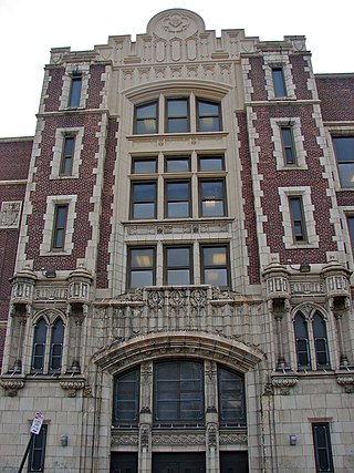
Germantown is an area in Northwest Philadelphia, Pennsylvania. Founded by Palatine, Quaker, and Mennonite families in 1683 as an independent borough, it was absorbed into Philadelphia in 1854. The area, which is about six miles northwest from the city center, now consists of two neighborhoods: 'Germantown' and 'East Germantown'.

<span class="mw-page-title-main">Roxborough, Philadelphia</span> Neighborhood in Philadelphia, Pennsylvania, United States

Roxborough is a neighborhood in Northwest Philadelphia, Pennsylvania, United States. It is bordered to the southwest, along the Schuylkill River, by the neighborhood of Manayunk, along the northeast by the Wissahickon Creek section of Fairmount Park, and to the southeast by the neighborhood of East Falls. Beyond Roxborough to the northwest is Montgomery County. Roxborough's ZIP Code is 19128. Most of Roxborough is in Philadelphia's 21st Ward.

<span class="mw-page-title-main">West Philadelphia</span> Neighborhood of Philadelphia, Pennsylvania

West Philadelphia, nicknamed West Philly, is a section of the city of Philadelphia. Although there are no officially defined boundaries, it is generally considered to reach from the western shore of the Schuylkill River, to City Avenue to the northwest, Cobbs Creek to the southwest, and the SEPTA Media/Wawa Line to the south. An alternate definition includes all city land west of the Schuylkill; this would also include Southwest Philadelphia and its neighborhoods. The eastern side of West Philadelphia is also known as University City.

<span class="mw-page-title-main">Mount Airy, Philadelphia</span> Neighborhood of Philadelphia in Philadelphia County, Pennsylvania, United States

Mount Airy is a neighborhood of Northwest Philadelphia in the U.S. state of Pennsylvania.

<span class="mw-page-title-main">West Oak Lane, Philadelphia</span> Neighborhood of Philadelphia in Pennsylvania, United States

West Oak Lane is a neighborhood in the Northwest Philadelphia, Pennsylvania, United States. The neighborhood was developed primarily between the early 1920s and late 1930s, with the areas near to Cedarbrook constructed after World War II. At the northeast corner of Limekiln Pike and Washington Lane was the site of the Cedar Park Inn, a historic tavern built in the early 19th century, which was torn down sometime after 1931 as the neighborhood was being fully developed.

<span class="mw-page-title-main">East Falls, Philadelphia</span> Neighborhood of Philadelphia in Philadelphia County, Pennsylvania, United States

East Falls is a neighborhood in Lower Northwest, Philadelphia, Pennsylvania, United States. It lies on the east bank of the "Falls of the Schuylkill," cataracts submerged in 1822 by the Schuylkill Canal and Fairmount Water Works projects. East Falls sits next to the Germantown, Roxborough, Allegheny West, and the Nicetown-Tioga neighborhoods. Wissahickon Valley Park separates it from Manayunk, Philadelphia.

<span class="mw-page-title-main">Wayne Junction station</span> SEPTA junction station in Nicetown, Philadelphia, Pennsylvania, United States

Wayne Junction station is a SEPTA Regional Rail junction station located at 4481 Wayne Avenue, extending along Windrim Avenue to Germantown Avenue. The station is located in the Nicetown neighborhood of Philadelphia. Wayne Junction serves as a multi-modal transfer point between six of SEPTA's regional rail lines as well as three major transit routes – the Route 75 Trackless Trolley and the Route 23 and 53 bus lines. The station served more than 321,000 riders annually in 2018.

<span class="mw-page-title-main">Cresheim Creek</span>

Cresheim Creek is a creek in southeastern Pennsylvania. Rising at Wyndmoor in Springfield Township, it runs about 2.7 miles (4.3 km) southwest, passing through part of Northwest Philadelphia and forming the boundary between Mount Airy and Chestnut Hill, before emptying into the Wissahickon Creek at Devil's Pool not far south of the Valley Green Inn.

<span class="mw-page-title-main">SEPTA Route 23</span> Philadelphia SEPTA Bus Line

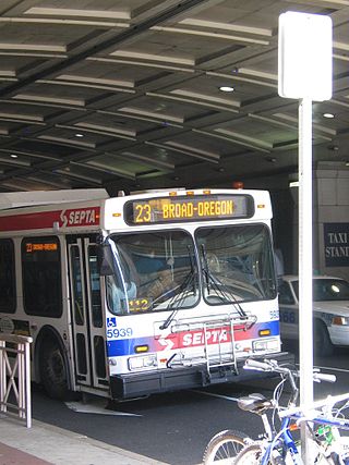
SEPTA Trolley Route 23 is a former streetcar line now operated with buses. It is operated by the Southeastern Pennsylvania Transportation Authority (SEPTA) in Philadelphia, Pennsylvania, United States. The line runs between the Chestnut Hill and Center City neighborhoods via Germantown Avenue, 11th, and 12th Streets.

SEPTA Route 38 is a bus and former streetcar route operated by the Southeastern Pennsylvania Transportation Authority (SEPTA) in Philadelphia, Pennsylvania, United States.

<span class="mw-page-title-main">SEPTA Route 60</span> Bus route in Philadelphia

SEPTA's Trolley Route 60, the Allegheny Avenue Line is a former streetcar line and current bus route, operated by the Southeastern Pennsylvania Transportation Authority (SEPTA) in Northwest and Northeast Philadelphia, Pennsylvania, United States. It connects to the East Falls to the Port Richmond, and runs primarily along Allegheny Avenue.

<span class="mw-page-title-main">Wissahickon, Philadelphia</span> Neighborhood of Philadelphia in Philadelphia County, Pennsylvania, United States

Wissahickon is a neighborhood in the section of Lower Northwest Philadelphia in the state of Pennsylvania, United States. Wissahickon is located adjacent to the neighborhoods of Roxborough and Manayunk, and it is bounded by the Wissahickon Valley Park, Ridge Avenue, Hermit Street, and Henry Avenue. The name of the neighborhood is derived from the Lenni Lenape word wisameckham, for "catfish creek", a reference to the fish that were once plentiful in the Wissahickon Creek.

<span class="mw-page-title-main">SEPTA Route 53</span>

SEPTA Route 53 is a former street car line and current bus route, operated by the Southeastern Pennsylvania Transportation Authority (SEPTA) in Philadelphia, Pennsylvania, United States. The line runs between the West Mount Airy and Hunting Park neighborhoods primarily along Wayne Avenue.

<span class="mw-page-title-main">Chestnut Hill Historic District (Philadelphia)</span> Historic district in Pennsylvania, United States

The Chestnut Hill Historic District is a historic area covering all the Chestnut Hill section of Philadelphia, Pennsylvania.

Callowhill Depot is a bus and trolley barn operated by the Southeastern Pennsylvania Transportation Authority (SEPTA), located in West Philadelphia, near the Delaware County border. It was built in 1913 by the Philadelphia Rapid Transit Company (PRT) and was later operated by the Philadelphia Transportation Company (PTC) before being taken over by SEPTA. The depot was constructed as part of the Thomas E. Mitten modernization program. Since its construction, the depot has suffered fire damage and reconstruction in 1949, 1950, and 1995.

<span class="mw-page-title-main">Edmund Gilchrist</span>

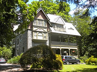
Edmund Beaman Gilchrist was an American architect, best remembered for his English-Cotswold and French-Norman suburban houses.

Route 35 is a bus route operated by the Southeastern Pennsylvania Transportation Authority (SEPTA) in Philadelphia, Pennsylvania, United States.

Ridge Pike is a major historic road in the U.S. state of Pennsylvania that opened in 1706 that originally connected Wissahickon Creek to Perkiomen Creek. Inside Philadelphia, it is called Ridge Avenue. Going westward, it traverses many eastern Pennsylvania neighborhoods in Montgomery County including Conshohocken and beyond, connecting with Germantown Pike near Collegeville and continuing to Pottstown. In Montgomery County, Ridge Pike is called Main Street in the Norristown area and again in Collegeville and Trappe, and is called High Street in the Pottstown area.

Germantown Pike is a historic road in Pennsylvania that opened in 1687, running from Philadelphia northwest to Collegeville. The road is particularly notable for the "imposing mansions" that existed in the Germantown neighborhood in Philadelphia. The road was left in ruins after the British destroyed it in the Revolutionary War during the 1777 Battle of Germantown, and was not rebuilt until 1809. Portions of Germantown Pike were signed as U.S. Route 422 (US 422) before the latter was rerouted along a freeway alignment to King of Prussia.

References

  1. USPS "Find All Cities in a ZIP Code".
  2. Department of the Interior. National Park Service. (3/2/1934 - ) (2013–2017). Pennsylvania SP Chestnut Hill Historic District. File Unit: National Register of Historic Places and National Historic Landmarks Program Records: Pennsylvania, 1964 - 2013.{{cite book}}: CS1 maint: numeric names: authors list (link)
  3. "Chestnut Hill: Philadelphia, Pennsylvania". American Planning Association. Retrieved September 16, 2019.
  4. "Chestnut Hill Trolley".
  5. "Philadelphia Trolley Tracks: Route 23 in 2003".
  6. 1 2 "Tracking the history of the Route 23 trolley — NewsWorks". Archived from the original on 2012-02-22. Retrieved 2012-02-01.
  7. "Archived copy" (PDF). Archived from the original (PDF) on 2012-03-07. Retrieved 2012-02-01.{{cite web}}: CS1 maint: archived copy as title (link)
  8. "John S. Jenks Elementary School Geographic Boundaries" (Archive). School District of Philadelphia. Retrieved on November 29, 2015.
  9. "High School Directory Fall 2017 Admissions" (Archive). School District of Philadelphia. p. 57/70. Retrieved on November 16, 2016.
  10. "A Directory of High Schools for 2009 Admissions Archived 2015-11-06 at the Wayback Machine ." School District of Philadelphia . Accessed November 6, 2008.
  11. "Germantown High School Geographic Boundaries" (Archive). School District of Philadelphia. Retrieved on November 29, 2015.
  12. "Chestnut Hill Branch Archived October 6, 2008, at the Wayback Machine ." Free Library of Philadelphia . Accessed November 7, 2008.
  13. "Harry who? Chestnut Hill Witches and Wizards fest carries on without its famous namesake". WHYY. Retrieved 2023-02-08.
  14. Chestnut Hill Harry Potter Festival 2017 , retrieved 2023-02-08
  15. Rolen, Emily (2018-06-06). "Warner Bros. cracking down, Chestnut Hill Harry Potter Festival no more". Philly Voice . Retrieved 2018-06-11.
  16. "2019 Witches and Wizards Festival". Chestnut Hill. Retrieved 2019-09-16.
  17. Diana (January 22, 1899). "Athletic Woman: Diana talks of Complexions, Waists, Corsets and Other Things Which Man, Proud Man, Admires from Afar". The Philadelphia Inquirer.
  18. Girard (April 21, 1939). "Will Dick Williams Create a Wimbledon in Phila.?". The Philadelphia Inquirer. The Philadelphia Inquirer.