1117 Verona earthquake

Last updated

1117 Verona earthquake
Alps location map.png
Bullseye1.png
Local date3 January 1117 (1117-01-03)
Magnitude6,9
Epicenter 45°30′N11°00′E / 45.500°N 11.000°E / 45.500; 11.000
Max. intensity IX (Violent)
The remnant of the outer wall of the Arena di Verona. Verona Arena Crown Remanant.jpg
The remnant of the outer wall of the Arena di Verona.

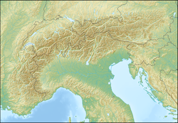
An earthquake, rated at IX (Violent) on the Mercalli intensity scale, struck northern Italy and Germany on 3 January 1117. [1] [2] The epicentre of the first shock was near Verona, the city which suffered the most damage. The outer wall of the Verona Arena partially collapsed, and the standing portion was damaged in a later earthquake of 1183. After the first shock of 3 January, seismic activity persisted for months, striking on 12 January 4 June, 1 July 1 October, and 30 December.

Contents

A single earthquake or several?

Recent studies, however, suggest that it was not a major, single event, but instead a series of shocks in the areas of Verona (west Veneto) and Cremona (Lower Lombardy), which happened over a period of a few days or within a few hours. Other earthquakes may have hit as far south as Pisa (northwest Tuscany) and as north as Augsburg (southwest Bavaria), as distinct events, on the same days. [3] The earthquake was recorded in the catalogs of 7 countries: Italy, Germany, Austria, France, Belgium, Switzerland, and the Iberian Peninsula. [4] In a study published in 2005 in one of the leading scientific journals in the field, [5] the Verona earthquake was shown to be a sequence of 3 different earthquakes, unrelated to each other, in different sub-regions that occurred on the same date - 3 January 1117: the first occurred between 02:00 and 03:00 in the morning (UTC). The earthquake mainly affected the area of southern Germany and Salzburg, Austria today. Its magnitude was about 6.4 and the maximum seismic intensity was VII-VIII on the MCS scale. [6] The second was that of Verona, which was the largest and most powerful of the three, and it took place in the afternoon around 14:30 - 15:30 (UTC). Its magnitude was approximately a level 7, and the maximum seismic intensity was IX on the MCS scale. [7] The third earthquake also occurred at a similar time to the second earthquake, but in the area of Pisa in northern Tuscany. The earthquake caused the collapse of many towers, buildings, and bell towers in Pisa, which resulted in the loss of life. The distance between the second and third earthquake zones is about 180 kilometers, and the Apennine mountain range separates them. For this reason, some scientists [need citation] believe that it is a separate earthquake, despite the coincidence of the time of the earthquake and the area. The maximum seismic intensity in the third quake was VII-VIII on the MCS scale. The magnitude of the quake could not be estimated. This earthquake was preceded by a foreshock early in the morning that did not cause any damage. [8]

Damage

The earthquake in Verona in 1117 was the strongest recorded in the history of northern Italy. [1] [9] It was not only felt in Verona, but across northern Italy, from Cividale to Pavia, south to Pisa and north to Switzerland. [10] Outside of Verona, the most damaged areas were Milan, Bergamo, Brescia, Venice, Treviso, Modena, Parma, and Cremona. The main churches of Padua all suffered major damage. News of the earthquake reached Montecassino and Reims. [11] The Milanese chronicler Landolfo Iuniore reported that the church synods needed to be carried out in the open air due to the destruction. In Germany, damage was also extensive. The Michaelskirche in Bamberg, the abbey at Brauweiler, and buildings in Rottenburg am Neckar, Constance, Meersburg, and Fénis were all reported damaged. [12] Many churches, monasteries, and ancient monuments were destroyed or seriously damaged in Verona itself, eliminating much of Verona's early medieval architecture and providing space for a massive Romanesque rebuilding. [13] In the province of Veneto, many churches were severely damaged: in Brescia, Cremona, in the northern part of the Emilia plain and along the central route of the Adige river, and partial collapse of churches in Padua, Piacenza, Parma, and Modena. [14]

See also

Notes

  1. 1 2 Carlo Doglioni; et al. (20 January 2017). "Conference on the great 1117 Veronese earthquake (see intensity map)". Archaeology of Medieval Earthquakes in Europe.
  2. Guidoboni E., Comastri A., 2005. Catalogue of earthquakes and tsunamis in the Mediterranean area from the 11th to the 15th century . INGV-SGA, Bologna, 1037 pp. (see the table at the link)
  3. P. Galli, The earthquakes of January 1117 in northern Italy. Hypothesis for an epicentre in the southern Po Plain (Cremona)
  4. Emanuela Guidoboni, Alberto Comastri and Enzo Boschi. "The exceptional earthquake of 3 January 1117in the Verona area (northern Italy): A critical time review and detection of two lost earthquakes". AGU: Advancing Earth & Space Science. Bibcode:2005JGRB..11012309G. doi:10.1029/2005JB003683.
  5. Journal of Geophisical Research, 2005. Vol. 110 pp. 1-20.
  6. .Emanuela Guidoboni, Alberto Comastri, Enzo Boschi, 2005. “The exceptional earthquake of 3 January 1117 in the Verona area (northern Italy): A critical time review and detection of two lost earthquakes (lower Germany and Tuscany). Journal of Geophisical Research, 110: p.8, article 4.1
  7. .Emanuela Guidoboni, Alberto Comastri, Enzo Boschi, 2005. “The exceptional earthquake of 3 January 1117 in the Verona area (northern Italy): A critical time review and detection of two lost earthquakes (lower Germany and Tuscany). Journal of Geophisical Research, 110: pp. 1, 10-11
  8. .Emanuela Guidoboni, Alberto Comastri, Enzo Boschi, 2005. “The exceptional earthquake of 3 January 1117 in the Verona area (northern Italy): A critical time review and detection of two lost earthquakes (lower Germany and Tuscany). Journal of Geophisical Research, 110: pp. 1, 11-12
  9. .Emanuela Guidoboni, Alberto Comastri, Enzo Boschi, 2005. “The exceptional earthquake of 3 January 1117 in the Verona area (northern Italy): A critical time review and detection of two lost earthquakes (lower Germany and Tuscany). Journal of Geophisical Research, 110 pp. 1-20
  10. http://www.ips.it/scuola/concorso/terremoti/home4.htm
  11. Emanuela Guidoboni-Enzo Boschi (1989), "I grandi terremoti medioevali in Italia," Le Scienze, 249.
  12. Thomas Glade, Malcolm Anderson, Michael J. Crozier (2005), Landslide Hazard and Risk (John Wiley and Sons, ISBN   0-471-48663-9), 261.
  13. G. Solinas (1981), Storia di Verona (Verona: Centro Rinascita), 244. The late eight- or early ninth-century Versus de Verona contains a now indispensable description of Verona's early medieval architecture, including Roman ruins.
  14. .Emanuela Guidoboni, Alberto Comastri, Enzo Boschi, 2005. “The exceptional earthquake of 3 January 1117 in the Verona area (northern Italy): A critical time review and detection of two lost earthquakes (lower Germany and Tuscany). Journal of Geophisical Research, 110: p11

Sources

Related Research Articles

The 1138 Aleppo earthquake was among the deadliest earthquakes in history. Its name was taken from the city of Aleppo, in northern Syria, where the most casualties were sustained. The earthquake also caused damage and chaos to many other places in the area around Aleppo. The quake occurred on 11 October 1138 and was preceded by a smaller quake on the 10th. It is frequently listed as the third deadliest earthquake in history, following on from the Shensi and Tangshan earthquakes in China. However, the figure of 230,000 deaths reported by Ibn Taghribirdi in the fifteenth century is most likely based on a historical conflation of this earthquake with earthquakes in November 1137 on the Jazira plain and the large seismic event of 30 September 1139 in the Transcaucasian city of Ganja.

<span class="mw-page-title-main">1693 Sicily earthquake</span> 1693 earthquake in Sicily

The 1693 Sicily earthquake struck parts of southern Italy near Sicily, Calabria, and Malta on 11 January at around 21:00 local time. This earthquake was preceded by a damaging foreshock on 9 January. The main quake had an estimated magnitude of 7.4 on the moment magnitude scale, the most powerful in Italian recorded history, and a maximum intensity of XI (Extreme) on the Mercalli intensity scale, destroying at least 70 towns and cities, seriously affecting an area of 5,600 square kilometres (2,200 sq mi) and causing the death of about 60,000 people.

The Catalan earthquake of February 2, 1428, known in Catalan as the terratrèmol de la candelera because it took place during Candlemas, struck the Principality of Catalonia, especially Roussillon, with an epicentre near Camprodon. The earthquake was one of a series of related seismic events that shook Catalonia in a single year. Beginning on February 23, 1427, tremors were felt in March, April, May 15 at Olot, June, and December. They caused relatively minor visible damage to property, notably to the monastery of Amer; but they probably caused severe weakening of building infrastructure. This would account for the massive and widespread destruction that accompanied the subsequent 1428 quake.

The 1348 Friuli earthquake, centered in the South Alpine region of Friuli, was felt across Europe on 25 January. The earthquake hit in the same year that the Great Plague ravaged Italy. According to contemporary sources, it caused considerable damage to structures; churches and houses collapsed, villages were destroyed and foul odors emanated from the earth.

The 1703 Apennine earthquakes were a sequence of three earthquakes of magnitude ≥6 that occurred in the central Apennines of Italy, over a period of 19 days. The epicenters were near Norcia, Montereale and L'Aquila, showing a southwards progression over about 36 kilometres (22 mi). These events involved all of the known active faults between Norcia and L'Aquila. A total of about 10,000 people are estimated to have died as a result of these earthquakes, although because of the overlap in areas affected by the three events, casualty numbers remain highly uncertain.

The 1968 Belice earthquake sequence took place in Sicily between 14 and 15 January. The largest shock measured 5.5 on the moment magnitude scale, with five others of magnitude 5+. The maximum perceived intensity was X (Extreme) on the Mercalli intensity scale. The earthquake sequence, centred between the towns of Gibellina, Salaparuta and Poggioreale, killed at least 231 people, possibly more than 400, with between 632 and about 1,000 injured and left 100,000 homeless. It is known in Italy as Terremoto del Belice.

<span class="mw-page-title-main">1930 Irpinia earthquake</span> July 1930 earthquake in Southern Italy

The 1930 Irpinia earthquake occurred at 00:08 UTC on 23 July, chiefly in an area known as Irpinia. It had a surface wave magnitude of 6.6 and a maximum intensity of X . The event caused 1,404 deaths and 4,624–7,000 injuries. The epicenter was near the boundaries between the regions of Basilicata, Apulia, and Campania.

On 5 February AD 62, an earthquake of an estimated magnitude of between 5 and 6 and a maximum intensity of IX or X on the Mercalli scale struck the towns of Pompeii and Herculaneum, severely damaging them. The earthquake may have been a precursor to the eruption of Mount Vesuvius in AD 79, which destroyed the same two towns. The contemporary philosopher and dramatist Seneca the Younger wrote an account of the earthquake in the sixth book of his Naturales quaestiones, entitled De Terrae Motu.

<span class="mw-page-title-main">1570 Ferrara earthquake</span> Earthquake in Italy

The 1570 Ferrara earthquake struck the Italian city of Ferrara on November 16 and 17, 1570. After the initial shocks, a sequence of aftershocks continued for four years, with over 2,000 in the period from November 1570 to February 1571.

The 1920 Garfagnana earthquake occurred on 7 September in Garfagnana and Lunigiana, both agricultural areas in the Italian Tuscany region. The quake hypocenter was located 14 kilometres (8.7 mi) beneath Villa Collemandina. The maximum felt intensity was rated as X (Extreme) on the Mercalli intensity scale, and 6.6 on the Richter magnitude scale. It was one of the most destructive seismic events recorded in the Apenninic region in the twentieth century. Due to good news coverage, availability of official documents on the damage and abundance of recordings from surveillance stations throughout Europe, it was regarded as a first-rate case study to improve knowledge of tectonics and macroseismic analysis.

The 1930 Senigallia earthquake struck the city of Senigallia in central Italy on October 30. It occurred just a few months after the destructive 1930 Irpinia earthquake, which had caused over 1,400 casualties in the southern part of the country.

The 1936 Cansiglio earthquake occurred on October 18 in the region between the provinces of Belluno, Treviso and Pordenone, in northern Italy. It caused 19 deaths and an unknown number of injuries.

The 1873 Alpago earthquake occurred near the Italian city of Belluno on June 29 in the geologically active Alpago Valley of the Veneto region; the zone is rated as two on a four-degree risk scale. The 6.3 magnitude quake was rated as IX–X (Violent–Extreme) on the Mercalli intensity scale. Intensities greater than VII were confined to the provinces of Belluno, Treviso and Pordenone.

The 1169 Sicily earthquake occurred on 4 February 1169 at 08:00 local time on the eve of the feast of St. Agatha of Sicily. It had an estimated magnitude of between 6.4 and 7.3 and an estimated maximum perceived intensity of X (Extreme) on the Mercalli intensity scale. The cities of Catania, Lentini and Modica were severely damaged, and the earthquake also triggered a paleotsunami. Overall, the earthquake is estimated to have caused the deaths of at least 15,000 people.

<span class="mw-page-title-main">1170 Syria earthquake</span> 29 June, 1170, earthquake in Syria

The 1170 Syria earthquake was one of the largest earthquakes to hit Syria. It occurred early in the morning of 29 June 1170. It formed part of a sequence of large earthquakes that propagated southwards along the Dead Sea Transform, starting with the 1138 Aleppo earthquake, continuing with the 1157 Hama, 1170 and 1202 Syria events. The estimated magnitude is 7.7 on the moment magnitude scale, with the maximum intensity of X (Extreme) on the Mercalli intensity scale.

On 27 November 1461, a powerful earthquake and series of aftershocks struck Italy's Abruzzo region along the Aterno River. The tremors caused widespread damage to Abruzzo's capital, L'Aquila, and the surrounding villages. At least 80 people are recorded to have died and numerous people were injured by the earthquakes. The quakes also caused major, permanent damage to religious sites and changed politics for L'Aquila and the Abruzzo region.

The 1139 Ganja earthquake was one of the worst seismic events in history. It affected the Seljuk Empire and Kingdom of Georgia; modern-day Azerbaijan and Georgia. The earthquake had an estimated magnitude of 7.7 MLH, 7.5 Ms and 7.0–7.3 Mw. A controversial death toll of 230,000–300,000 came as a consequence of this event.

<span class="mw-page-title-main">801 Apennine earthquake</span>

An earthquake originating in the Central Apennines was felt in Rome and Spoleto on 29 April 801. It is reported in two independent contemporary sources, Einhard's Royal Frankish Annals and the Liber Pontificalis. The information provided by the written sources has been augmented by archaeology.