1877 Atlantic hurricane season | |
---|---|
Seasonal boundaries | |
First system formed | August 1, 1877 |
Last system dissipated | November 29, 1877 |
Strongest storm | |
Name | Four |
• Maximum winds | 115 mph (185 km/h) (1-minute sustained) |
• Lowest pressure | 960 mbar (hPa; 28.35 inHg) |
Seasonal statistics | |
Total storms | 8 |
Hurricanes | 3 |
Major hurricanes (Cat. 3+) | 1 |
Total fatalities | 84 |
Total damage | Unknown |
The 1877 Atlantic hurricane season lasted from mid-summer to late-fall. Records show that in 1877 there were eight cyclones, of which five were tropical storms and three were hurricanes, one of which became a major hurricane (Category 3+). However, in the absence of modern satellite and other remote-sensing technologies, only storms that affected populated land areas or encountered ships at sea were recorded, so the actual total could be higher. An undercount bias of zero to six tropical cyclones per year between 1851 and 1885 and zero to four per year between 1886 and 1910 has been estimated. [1]
The Atlantic hurricane database (HURDAT) recognizes eight tropical cyclones for the 1877 season. Five were tropical storms and three were hurricanes, with winds of 75 mph (119 km/h) or greater. The first storm was a tropical storm which formed near the Turks & Caicos Islands on August 1. It traveled parallel to the US east coast to make landfall in New Brunswick on August 5. The second storm of the season formed as a tropical storm in the Gulf of Mexico on September 14. It developed into a Category 1 hurricane which first struck Louisiana on September 18, then Florida the next day before dissipating in the Atlantic on September 21. Hurricane Three was a Category 1 hurricane that existed between September 16 and 22 without making landfall. Hurricane Four was the strongest and most destructive storm of the season and impacted both Venezuela and Florida. Most notably, Hurricane Four caused 84 fatalities in the United States. Tropical Storm Five existed between September 24 and September 29 in which period it traveled from north of Hispaniola to a point off the south-east coast of the United States. Tropical Storm Six existed for a few days in mid-October without making landfall. Tropical Storm Seven formed in the western Gulf of Mexico, tracked parallel to the US Gulf coast and crossed the Florida peninsula between October 24 and October 28. The last storm of the season was known to have existed for two days in November. It dissipated off the Newfoundland coast on November 29.
Tropical storm (SSHWS) | |
Duration | August 1 – August 5 |
---|---|
Peak intensity | 70 mph (110 km/h) (1-min); |
Mimicking the path created in the 1993 reanalysis led by C. J. Neumann, the track for this cyclone begins north of Turks and Caicos Islands on August 1, one day before Florida reported stormy conditions. [2] It tracked along the eastern edge of the Bahamas, before paralleling the East Coast of the United States. By August 2, the tropical storm was nearly a hurricane, though records show that winds never exceeded 70 mph (110 km/h). [3] A schooner known as Vanname recorded sustained winds of 69 mph (110 km/h) on the following day. [4] The cyclone then gradually weakened while heading generally northeast, making landfall near Cape Spencer, New Brunswick, with winds of 60 mph (95 km/h) on August 5. Shortly thereafter, the storm was last noted over the western Gulf of St. Lawrence. [3]
Three people drowned as the Vanname capsized, while seven people survived by clinging to the remnants of the ship until being rescued by the schooner Minnie Reppelier. On land, the storm produced elevated winds in the United States from Florida to New York. Nova Scotia recorded falling barometric pressures. [2] Climate researcher Michael Chenoweth could not confirm the existence of this storm due to potentially unreliable accounts, erring on the side of proposing the removal of this cyclone from HURDAT. [5]
Category 1 hurricane (SSHWS) | |
Duration | September 14 – September 21 |
---|---|
Peak intensity | 80 mph (130 km/h) (1-min); 982 mbar (hPa) |
Although the Monthly Weather Review reported decreasing atmospheric pressures over the Gulf of Mexico as early as the night of September 12, [2] the track for this storm begins on September 14 about 110 mi (175 km) west-northwest of the Yucatán Peninsula. Initially moving northwestward, the cyclone turned northward on September 16, roughly 24 hours before it intensified into a hurricane. Later on September 17, the hurricane curved east-northeastward while just offshore Texas. [3] At 16:00 UTC the next day, the storm made landfall to the southwest of Cocodrie, Louisiana, with maximum sustained winds of 80 mph (130 km/h) and an estimated minimum pressure of 982 mbar (29.0 inHg). [3] [6] On September 19 the hurricane made another landfall at Fort Walton Beach, Florida. It quickly weakened back to a tropical storm while still in the state of Florida. After emerging into the Atlantic on September 20, the storm was last noted the next day roughly 175 mi (280 km) southeast of Cape Fear, North Carolina. [3]
The entire coast of Texas experienced impacts from this storm. Galveston observed sustained winds up to 60 mph (95 km/h) and tides reached up to 5.2 ft (1.6 m) above mean low water. Additionally, 4.64 in (118 mm) of rainfall in 24-hour period, setting the daily rainfall record for September 17. [7] Parts of Galveston became submerged by tides for a few hours and a few unoccupied buildings were severely impacted by the storm. Other locations reporting coastal flooding included Brazos Island and Lynchburg. [8] Extensive crop losses occurred in portions of Louisiana. Many barns, plantations, and crops suffered damage St. John the Baptist Parish, with about 30% of rice crops ruined. In New Orleans, the hurricane downed numerous trees and fences and destroyed gardens. [9] Damage in Texas and Louisiana alone reached nearly $500,000. [10] Heavy rains fell over Alabama, causing the Black Warrior River to rise significantly. [2] Chenoweth proposed few changes to the track or duration of this storm, but indicated that the cyclone became a hurricane on September 15 and added a tropical depression stage from September 20 onward. [5]
Category 1 hurricane (SSHWS) | |
Duration | September 16 – September 22 |
---|---|
Peak intensity | 80 mph (130 km/h) (1-min); |
Although the steamer Antonio Lopez may have encountered this storm as early as September 11, a track could not be constructed as far back as that date because the location of the ship was not logged. [2] Instead, the Atlantic hurricane database (HURDAT) initiates the track as a Category 1 hurricane about 900 mi (1,450 km) northeast of the Lesser Antilles on September 16. [3] Reports from the ship Harley John and an unnamed vessel indicated the cyclone possessed sustained winds of 80 mph (130 km/h). [4] [3] The hurricane moved generally northwestward for a few days until turning northward on September 20. Curving northeastward on the following day, the cyclone weakened to a tropical storm on September 22 before being last noted several hours later just offshore Newfoundland's Burin Peninsula. [3]
In Nova Scotia, St. Paul Island recorded a sustained wind speed of 81 mph (130 km/h). [4] Canso reportedly experienced its worst gale in years. [2] The ship Helene became stranded at St. Esprit, while the storm beached the steamship Rowland at Holyrood, Newfoundland. [11] Chenoweth proposed significant changes to the storm's track and duration, showing a long-lived cyclone that developed east of the Capo Verde Islands on September 3. After crossing through the islands and moved generally westward, the system meandered around the central and north Atlantic before becoming extratropical well east of Newfoundland on September 24. [5]
Category 3 hurricane (SSHWS) | |
Duration | September 21 – October 4 |
---|---|
Peak intensity | 115 mph (185 km/h) (1-min); 955 mbar (hPa) |
On September 21, a tropical storm was first observed east of Grenada and Saint Vincent. [2] Moving westward at a low latitude, the cyclone intensified into a hurricane early the next day while moving between Grenada and Tobago. The storm then remained close to the coast of South America while strengthening, becoming a Category 2 hurricane on the present-day Saffir–Simpson scale on September 23. Early on the next day, the system curved west-northwestward before striking Venezuela's Paraguaná Peninsula and Colombia's Guajira Peninsula. The cyclone turned northwestward by September 26, passing near the northeast tip of the Yucatán Peninsula of Mexico. [3] Upon reaching the central Gulf of Mexico, the storm began trekking to the north-northeast on October 1 and then to the northeast by the next day. [3]
Early on October 3, the system intensified into a Category 3 hurricane, shortly before making landfall near present-day Mexico Beach, Florida, [3] with winds of 115 mph (185 km/h) and a minimum pressure of 955 mbar (28.2 inHg). [6] The storm rapidly weakened after moving inland, falling to tropical storm intensity over south-central Georgia several hours later. While passing over North Carolina on October 4, the system transitioned into an extratropical cyclone, which continued northeastward until dissipating offshore Nova Scotia on the next day. [3] Chenoweth's study extends the track of this storm back to the central Atlantic on September 16. Following a similar path through the eastern and central Caribbean, Chenoweth proposed a major hurricane from September 23 to September 27. Unlike in HURDAT, however, Chenoweth also suggested that the cyclone crossed part of Central America and the Gulf of Honduras before striking the Yucatán Peninsula and then reaching the Gulf of Mexico. [5]
Strong winds generated by the storm on Grenada downed some trees and telegraph lines and damaged some roofs. Saint Vincent also reported strong winds and heavy rains, but little damage occurred. The cyclone left catastrophic impacts on Curaçao. The New York Times noted that in Willemstad, "many of the most solid structures were crushed as if they were things of paper and many persons were buried in their ruins." [2] Waves completely swept away a nunnery, with only one nun surviving. Numerous ships were lost in the vicinity of Curaçao. It is estimated that the storm caused at least 70 deaths and about $2 million on the island. [12] In Cuba, winds and rains generated by the storm left damage and the loss of some lives in the western portion of Pinar del Río Province. [2] It caused a storm tide of 12 feet (3.7 m) at St. Marks, Florida. [6] The storm caused heavy rain and flooding throughout North Carolina. Numerous ships were wrecked along the United States Atlantic coast. [13] Overall, the hurricane was responsible for at least 84 deaths. [14]
Tropical storm (SSHWS) | |
Duration | September 24 – September 29 |
---|---|
Peak intensity | 60 mph (95 km/h) (1-min); |
Observations from Cuba and Jamaica indicated that a storm existed to their northeast on September 24. [2] Consequently, the track listed in HURDAT begins about 150 mi (240 km) northeast of the Dominican Republic. The cyclone moved west-northwestward, crossing through the Turks and Caicos Islands and the Bahamas, striking or passing near many islands including Acklins, Crooked Island, and Long Island before turning in a general northward direction east of Andros on September 26. Thereafter, the storm passed near or over islands such as New Providence and Grand Bahama before exiting the Bahamas on the next day. After passing the Bahamas, the cyclone moved parallel to the southeastern coast of the United States and intensified to sustained winds of 60 mph (95 km/h) on September 28, [3] based on reports from the ships Magnolia and Gulf Stream and Cape Henry, Virginia. [4] On September 29, the storm was last noted about 115 mi (185 km) east-southeast of Buxton, North Carolina. [3]
The storm produced high seas and gales from Cape Lookout, North Carolina, to Cape Henry, Virginia, [15] with the latter observing sustained winds of 63 mph (101 km/h). [4] Heavy rains fell in the Wilmington area of North Carolina, flooding many roads and raising many local waterways. [15] Chenoweth's study completely removes the Bahamian portion of the track and instead shows a storm developing near North Carolina on September 27. After approaching the Outer Banks, the storm moves in the semicircle out to sea, passing south of Bermuda during the process, before becoming extratropical on October 1. [5]
Tropical storm (SSHWS) | |
Duration | October 13 – October 16 |
---|---|
Peak intensity | 60 mph (95 km/h) (1-min); |
While no information exists on this storm prior to October 17, [2] after it already became extratropical HURDAT features a track beginning on October 13 about 1,075 mi (1,730 km) northeast of the Leeward Islands to resemble a path constructed by Neumann. It headed generally northwestward for a few days and likely did not intensify much beyond sustained winds of 60 mph (95 km/h), if at all. By October 16, the cyclone turned northeastward and transitioned into an extratropical cyclone later that day about 285 mi (460 km) southeast of Cape Race, Newfoundland. This extratropical storm lasted until October 18. [3] Chenoweth instead declared this storm a slow-moving extratropical low-pressure area associated with a frontal system. [5]
Tropical storm (SSHWS) | |
Duration | October 24 – October 28 |
---|---|
Peak intensity | 60 mph (95 km/h) (1-min); |
Heavy rainfall at Galveston, Texas, suggests the existence of a tropical storm over the west-central Gulf of Mexico on October 24. [2] Following an initial motion to the north, the cyclone gradually curved to the east-northeast later that day. Around 21:00 UTC on October 26, the storm made landfall near Cedar Key, Florida, with sustained winds of 45 mph (75 km/h), [3] based on St. Marks recording sustained winds of 40 mph (65 km/h). [2] After the cyclone emerged into the Atlantic from the First Coast early the next day, [3] further intensification occurred according to observations from the ship Camina, [4] with the cyclone reaching maximum sustained winds of 60 mph (95 km/h). The cyclone was last noted on October 28 about 215 mi (345 km) north of Bermuda. [3] Chenoweth proposed the removal of this storm from HURDAT, arguing that evidence supported a cold front moving across Florida, followed by the development of an extratropical low offshore the Southeastern United States. [5]
Tropical storm (SSHWS) | |
Duration | November 28 – November 29 |
---|---|
Peak intensity | 60 mph (95 km/h) (1-min); |
A ship known as the Princess Beatrice may have encountered this storm near the Leeward Islands between November 23 and November 25. [2] However, the track listed in HURDAT does not begin until November 28 about 40 mi (65 km) southwest of Exuma in the Bahamas, [3] when weather stations along the coast of the Southeastern United States reported decreasing atmospheric pressures. [2] The cyclone moved northeastward for most of its duration, passing through the central Bahamas later that day before reaching the open Atlantic. Slight intensification occurred, with the storm peaking with winds of 60 mph (95 km/h) early on November 29, several hours before becoming extratropical approximately 125 mi (200 km) south of Cape Sable Island, Nova Scotia. The extratropical remnants crossed Atlantic Canada before dissipating on the following day. [3] The 2014 study by Chenoweth also suggested that this system was extratropical. [5]
Chenoweth proposed three other storms not currently listed in HURDAT: [5]
The 1929 Atlantic hurricane season was a near average season in terms of accumulated cyclone energy, but is among the least active Atlantic hurricane seasons on record in terms of storms forming, with only five tropical cyclones forming. Three of them intensified into a hurricane, with one strengthening further into a major hurricane. The first tropical cyclone of the season developed in the Gulf of Mexico on June 27. Becoming a hurricane on June 28, the storm struck Texas, bringing strong winds to a large area. Three fatalities were reported, while damage was conservatively estimated at $675,000 (1929 USD).
The 1905 Atlantic hurricane season featured five known tropical cyclones, two of which made landfall in the United States. The first system was initially observed near the Windward Islands on September 6. The last system to dissipate, the fourth storm, transitioned into an extratropical cyclone on October 11, while located well southeast of Newfoundland. These dates fall within the period with the most tropical cyclone activity in the Atlantic. Between October 5 and October 10, the fourth and fifth system existed simultaneously.
The 1898 Atlantic hurricane season marked the beginning of the Weather Bureau operating a network of observation posts across the Caribbean Sea to track tropical cyclones, established primarily due to the onset of the Spanish–American War. A total of eleven tropical storms formed, five of which intensified into a hurricane, according to HURDAT, the National Hurricane Center's official database. Further, one cyclone strengthened into a major hurricane. However, in the absence of modern satellite and other remote-sensing technologies, only storms that affected populated land areas or encountered ships at sea were recorded, so the actual total could be higher. An undercount bias of zero to six tropical cyclones per year between 1851 and 1885 and zero to four per year between 1886 and 1910 has been estimated. The first system was initially observed on August 2 near West End in the Bahamas, while the eleventh and final storm dissipated on November 4 over the Mexican state of Veracruz.
The 1897 Atlantic hurricane season was an inactive season, featuring only six known tropical cyclones, four of which made landfall. There were three hurricanes, none of which strengthened into major hurricanes, which are Category 3 or higher on the modern-day Saffir–Simpson hurricane wind scale. The first system was initially observed south of Cape Verde on August 31, an unusually late date. The storm was the strongest of the season, peaking as a Category 2 hurricane with winds of 100 mph (155 km/h). While located well north of the Azores, rough seas by the storm sunk a ship, killing all 45 crewmen. A second storm was first spotted in the Straits of Florida on September 10. It strengthened into a hurricane and tracked northwestward across the Gulf of Mexico, striking Louisiana shortly before dissipating on September 13. This storm caused 29 deaths and $150,000 (1897 USD) in damage.
The 1895 Atlantic hurricane season was a fairly inactive one, featuring only six known tropical cyclones, although each of them made landfall. Of those six systems, only two intensified a hurricane, while none of those strengthened into a major hurricane. However, in the absence of modern satellite and other remote-sensing technologies, only storms that affected populated land areas or encountered ships at sea were recorded, so the actual total could be higher. An undercount bias of zero to six tropical cyclones per year between 1851 and 1885 and zero to four per year between 1886 and 1910 has been estimated.
The 1894 Atlantic hurricane season ran through the summer and the first half of fall in 1894. The 1894 season was a fairly inactive one, with seven storms forming, five of which became hurricanes.
The 1893 Atlantic hurricane season featured the only known instance of more than one tropical cyclone causing at least 1,000 deaths in the United States. It was a fairly active season, with 12 tropical storms forming, 10 of which became hurricanes. Of those, five became major hurricanes. The season is considered hyper-active in terms of accumulated cyclone energy, achieving a total of 231 units, which remains the third-highest ever recorded in the Atlantic basin. Additionally, 1893 became one of two seasons on record to see four Atlantic hurricanes active simultaneously, along with 1998. In the absence of modern satellite and other remote-sensing technologies, only storms that affected populated land areas or encountered ships at sea were recorded, so the actual total could be higher. An undercount bias of zero to six tropical cyclones per year between 1851 and 1885 and zero to four per year between 1886 and 1910 has been estimated. The first system was initially observed on June 12 in the Bay of Campeche, while the twelfth and final storm transitioned into an extratropical cyclone on November 9 over the northwestern Atlantic.
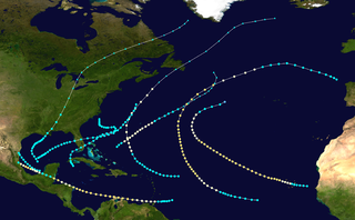
The 1892 Atlantic hurricane season included the last tropical cyclone on record to pass through the Cabo Verde Islands at hurricane intensity until 2015. A total of nine tropical storms developed, five of which strengthened into a hurricane, though none of them became a major hurricane. However, in the absence of modern satellite and other remote-sensing technologies, only storms that affected populated land areas or encountered ships at sea were recorded, so the actual total could be higher. An undercount bias of zero to six tropical cyclones per year between 1851 and 1885 and zero to four per year between 1886 and 1910 has been estimated. Three tropical storms made landfall on the United States.
The 1891 Atlantic hurricane season began during the summer and ran through the late fall of 1891. The season had ten tropical cyclones. Seven of these became hurricanes; one becoming a major Category 3 hurricane.
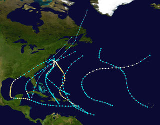
The 1889 Atlantic hurricane season was a relatively quiet season, with nine tropical storms and six hurricanes and no major hurricanes. However, due to scarce technology and the fact that only storms that affected populated land or ships were recorded, the actual total could be higher. An undercount bias of zero to six tropical cyclones per year between 1851 and 1885 and zero to four per year between 1886 and 1910 has been estimated.
The 1880 Atlantic hurricane season ran through the summer and fall of 1880. This is the period of each year when most tropical cyclones form in the Atlantic basin. In the 1880 Atlantic season there were two tropical storms, seven hurricanes, and two major hurricanes (Category 3+). However, in the absence of modern satellite and other remote-sensing technologies, only storms that affected populated land areas or encountered ships at sea were recorded, so the actual total could be higher. An undercount bias of zero to six tropical cyclones per year between 1851 and 1885 and zero to four per year between 1886 and 1910 has been estimated. Of the known 1880 cyclones, Hurricane Six was first documented in 1995 by José Fernández-Partagás and Henry Díaz. They also proposed large changes to the known tracks of several other storms for this year and 're-instated' Hurricane Ten to the database. A preliminary reanalysis by Michael Chenoweth, published in 2014, found thirteen storms, nine hurricanes, and four major hurricanes.
The 1887 Atlantic hurricane season was the most active Atlantic hurricane season on record at the time in terms of the number of known tropical storms that had formed, with 19. This total has since been equaled or surpassed multiple times. The 1887 season featured five off-season storms, with tropical activity occurring as early as May, and as late as December. Eleven of the season's storms attained hurricane status, while two of those became major hurricanes. It is also worthy of note that the volume of recorded activity was documented largely without the benefit of modern technology. Consequently, tropical cyclones during this era that did not approach populated areas or shipping lanes, especially if they were relatively weak and of short duration, may have remained undetected. Thus, historical data on tropical cyclones from this period may not be comprehensive, with an undercount bias of zero to four per year between 1886 and 1910 estimated. The first system was initially observed on May 15 near Bermuda, while the final storm dissipated on December 12 over Costa Rica.
The 1888 Atlantic hurricane season was significantly less active compared to the previous season, with two tropical storms, four hurricanes, and two major hurricanes. However, in the absence of modern satellites and other remote-sensing technologies, only storms that affected populated land areas or encountered ships at sea are known, so the actual total could be higher. An undercount bias of zero to six tropical cyclones per year between 1851 and 1885 and zero to four per year between 1886 and 1910 has been estimated.
The 1885 Atlantic hurricane season ran through the summer and the first half of fall in 1885. This is the period of each year when most tropical cyclones form in the Atlantic basin. In 1885 there were two tropical storms and six hurricanes in the Atlantic basin. However, in the absence of modern satellite monitoring and remote-sensing technologies, only storms that affected populated land areas or encountered ships at sea were recorded, so the actual total could be higher. An undercount bias of zero to six tropical cyclones per year between 1851 and 1885 and zero to four per year between 1886 and 1910 has been estimated.
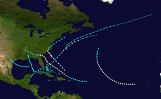
The 1881 Atlantic hurricane season ran through the summer and early fall of 1881. This is the period of each year when most tropical cyclones form in the Atlantic basin. In the 1881 Atlantic season there were three tropical storms and four hurricanes, none of which became major hurricanes. However, in the absence of modern satellite and other remote-sensing technologies, only storms that affected populated land areas or encountered ships at sea were recorded, so the actual total could be higher. An undercount bias of zero to six tropical cyclones per year between 1851 and 1885 and zero to four per year between 1886 and 1910 has been estimated. Of the known 1881 cyclones, Hurricane Three and Tropical Storm Seven were both first documented in 1996 by Jose Fernandez-Partagas and Henry Diaz. They also proposed changes to the known tracks of Hurricane Four and Hurricane Five.
The 1882 Atlantic hurricane season ran through the summer and early fall of 1882. This is the period of each year when most tropical cyclones form in the Atlantic basin. In the 1882 Atlantic season there were two tropical storms, two Category 1 hurricanes, and two major hurricanes. However, in the absence of modern satellite and other remote-sensing technologies, only storms that affected populated land areas or encountered ships at sea were recorded, so the actual total could be higher. An undercount bias of zero to six tropical cyclones per year between 1851 and 1885 and zero to four per year between 1886 and 1910 has been estimated. Of the known 1882 cyclones, Hurricane One and Hurricane Five were both first documented in 1996 by Jose Fernandez-Partagas and Henry Diaz, while Tropical Storm Three was first recognized in 1997 and added to HURDAT in 2003. Partagas and Diaz also proposed large changes to the known track of Hurricane Two while further re-analysis, in 2000, led to the peak strengths of both Hurricane Two and Hurricane Six being increased. In 2011 the third storm of the year was downgraded from a hurricane to a tropical storm.
The 1879 Atlantic hurricane season ran from the summer to near the end of autumn in 1879. In 1879 there were two tropical storms, four hurricanes, and two major hurricanes. However, in the absence of modern satellite and other remote-sensing technologies, only storms that affected populated land areas or encountered ships at sea were recorded, so the actual total could be higher. An undercount bias of zero to six tropical cyclones per year between 1851 and 1885 and zero to four per year between 1886 and 1910 has been estimated. Of the known 1879 cyclones, Hurricane One were first documented in 1995 by Jose Fernandez-Partagas and Henry Diaz. They also proposed large changes to the known tracks of Hurricanes Two, Three, Seven and Eight. Later one storm was deemed not to be a tropical cyclone at all and was dropped from the database.
The 1875 Atlantic hurricane season featured three landfalling tropical cyclones. However, in the absence of modern satellite and other remote-sensing technologies, only storms that affected populated land areas or encountered ships at sea were recorded, so the actual total could be higher. An undercount bias of zero to six tropical cyclones per year between 1851 and 1885 has been estimated. There were five recorded hurricanes and one major hurricane – Category 3 or higher on the modern-day Saffir–Simpson scale.
The 1872 Atlantic hurricane season included a storm whose track became one of the first to be published by the United States Army Signal Service, a predecessor of the National Weather Service. The season was quiet, with only five documented tropical cyclones, of which four attained hurricane status. None of them intensified into a major hurricane. However, in the absence of modern satellite and other remote-sensing technologies, only storms that affected populated land areas or encountered ships at sea were recorded, so the actual total could be higher. An undercount bias of zero to six tropical cyclones per year between 1851 and 1885 has been estimated.
The 1863 Atlantic hurricane season featured five landfalling tropical cyclones. In the absence of modern satellite and other remote-sensing technologies, only storms that affected populated land areas or encountered ships at sea were recorded, so the actual total could be higher. An undercount bias of zero to six tropical cyclones per year between 1851 and 1885 has been estimated. There were seven recorded hurricanes and no major hurricanes, which are Category 3 or higher on the modern day Saffir–Simpson scale. Of the known 1863 cyclones, seven were first documented in 1995 by José Fernández-Partagás and Henry Diaz, while the ninth tropical storm was first documented in 2003. These changes were largely adopted by the National Oceanic and Atmospheric Administration's Atlantic hurricane reanalysis in their updates to the Atlantic hurricane database (HURDAT), with some adjustments.