Amarambalam

Last updated

Amarambalam (Pookkottumpadam)
village
Amarambalam.TK Colony.jpg
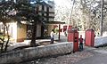
Temple at T.K.Colony
India Kerala location map.svg
Red pog.svg
Amarambalam (Pookkottumpadam)
Location in Kerala, India
India location map.svg
Red pog.svg
Amarambalam (Pookkottumpadam)
Amarambalam (Pookkottumpadam) (India)
Coordinates: 11°14′0″N76°11′0″E / 11.23333°N 76.18333°E / 11.23333; 76.18333
CountryFlag of India.svg  India
State Kerala
District Malappuram
Languages
  Official Malayalam, English
Time zone UTC+5:30 (IST)
Vehicle registration KL-
Coastline0 kilometres (0 mi)
Amarabalam Road Nilambur Railway Station54.jpg
Amarabalam Road

Amarambalam is a forest village near Nilambur town and conjoins Silent Valley National Park.the main town in amarambalam is pookkoottumpadam, pookottumpadam located in Malappuram district of the Indian state of Kerala. It is an emerging commercial hub, and one of the fastest growing towns in Nilambur Taluk.town area is 265.72 km2. Altitude rises sharply from 40 to 2,554 m.

Contents

New Amarambalam Reserved Forest

The New Amarambalam Reserved Forest is noted for 10 species of threatened or restricted bird species including: lesser adjutant ( Leptoptilos javanicus ), white-rumped vulture ( Gyps bengalensis ), Nilgiri wood-pigeon ( Columba elphinstonii ) Malabar parakeet ( Psittacula columboides ) Malabar grey-hornbill ( Ocyceros griseus ), white-bellied treepie ( Dendrocitta leucogastra ), grey-headed bulbul ( Pycnonotus priocephalus ), rufous babbler ( Turdoides subrufus ), white-bellied blue-flycatcher ( Cyornis pallipes ) and crimson-backed sunbird ( Nectarinia minima ). [1]

Villages and Suburbs

http://www.mathrubhumi.com/news/kerala/nilambur-maoist-malayalam-news-1.1529750

Naxalite threat

In November 2016, three Naxalites were killed near Karulai in an encounter with Kerala police. Naxalite leader Kappu Devaraj from Andhra Pradesh is included in the list of killed in the incident. [2] Villages like Mundakkadavu, Kalkullam and Uchakkulam near Karulai are threatened by Naxalite attacks. Naxalites visit the locality regularly and ask for food and shelter from the tribals. The police are also combing the area regularly but have not arrested any Naxalites. On 27 September 2016, there was firing between the Maoists and the Kerala police in this area and no one was injured in this incident. [3]

Tourist attractions

Transportation

Amarambalam village connects to other parts of India through Nilambur town. State Highway No.28 starts from Nilambur and connects to Ooty, Mysore and Bangalore through Highways.12,29 and 181. National highway No.66 passes through Ramanattukara and the northern stretch connects to Goa and Mumbai. The southern stretch connects to Cochin and Trivandrum. State. The nearest airport is at Kozhikode. The nearest major railway station is at Nilambur Road railway station.

Related Research Articles

<span class="mw-page-title-main">Malappuram district</span> District in Kerala, India

Malappuram, is one of the 14 districts in the Indian state of Kerala, with a coastline of 70 km (43 mi). It is the most populous district of Kerala, which is home to around 13% of the total population of the state. The district was formed on 16 June 1969, spanning an area of about 3,554 km2 (1,372 sq mi). It is the third-largest district of Kerala by area, as well as the largest district in the state, bounded by Western Ghats and Arabian Sea to either side. The district is divided into seven Taluks: Eranad, Kondotty, Nilambur, Perinthalmanna, Ponnani, Tirur, and Tirurangadi.

<span class="mw-page-title-main">Nilambur</span> Place in Kerala, India

Nilambur is a major town, a municipality and a Taluk in the Malappuram district of the Indian state of Kerala. It is located close to the Nilgiris range of the Western Ghats on the banks of the Chaliyar River. This place is also known as 'Teak Town' because of the abundance of Nilambur teaks in this area; Which is a variety of a large, deciduous tree that occurs in mixed hardwood forests. Unlike many Municipalities of India; Nilambur is covered with large amounts of vegetation making it close to nature and hence make it very scenic and inspiring.

<span class="mw-page-title-main">Mannarkkad</span> Municipality in Kerala, India

Mannarkkad, formerly known as Mannarghat, is a municipal town in Palakkad district of the Indian state of Kerala. The Silent Valley National Park and the Attappadi Reserve Forest are located in Mannarkkad Taluk. Mannarkkad is situated 36 km away from district headquarters Palakkad on National Highway 966.

<span class="mw-page-title-main">Edakkara</span> Village in Kerala, India

Edakkara is a town located in Malappuram district of the Indian state of Kerala. It is an emerging commercial hub, and one of the busiest towns in Nilambur Taluk.

<span class="mw-page-title-main">Munderi, Malappuram</span> Place in Kerala, India

Munderi is a small village in Nilambur Taluk of Malappuram District, in Kerala. It got the name from "Mount Area" as it is surrounded by mountain ranges. The un-tarred forest road from Munderi towards North through forests lead to Chooralmala in Wayanad district.

<span class="mw-page-title-main">Vazhikkadavu</span> Village in Kerala, India

Vazhikkadavu is a village in Nilambur taluk of Malappuram district, Kerala, India. As of 2011, it has total population of 47,322.

Moothedam is a small town and panchayath in Nilambur taluk of the Malappuram district in the Indian State of Kerala. It is situated on the foothills of the Western Ghats near Mukurthi National Park in the Nilgiris district of Tamil Nadu. The panchayath is surrounded by two rivers, the Punnappuzha to the north and west and the Karimpuzha to the south.

<span class="mw-page-title-main">Karulai</span> Village in Kerala, India

Karulai is a small town and panchayath in Nilambur Taluk of Malappuram district. It is situated on the banks of the Karimpuzha River. Edakkara, Nilambur, Pookkottumpadam, and Vaniyambalam are the nearest towns.

Marutha is a place in Nilambur taluk of Malappuram district. It is also known as village of gold hills.

<span class="mw-page-title-main">Kadampuzha</span> Small town in Kerala, India

Kadampuzha is a small town and a pilgrimage centre in Malappuram district of Kerala situated near the Thrissur-Calicut national highway.

<span class="mw-page-title-main">Karuvarakundu</span> Town in Kerala, India

Karuvarakundu is a semi-urban area in the eastern part of Malappuram district, Kerala, India. It is situated 32 kilometres (20 mi) east of Manjeri, 26 kilometres (16 mi) northeast of Perinthalmanna and 30 km southeast of Nilambur. The Olippuzha River, a tributary of the Kadalundipuzha, flows through the town. Karuvarakundu is close to the Western Ghats and hence prone to landslides.

<span class="mw-page-title-main">Akampadam</span> Town in Kerala, India

Akampadam is a town in Malappuram district in the state of Kerala, India.

<span class="mw-page-title-main">Pothukal</span> Town in Kerala, India

Pothukallu (Pothukal) is located between Palunda and Munderi. Pothukallu is well known for its greenery, hospitality of the natives, and availability of all basic amenities, including schools, hospitals, shopping centers etc. There is a police station,forest station, mosque, church, and temple at nearby locations. Pothukallu is located at the boundary of three districts namely, Wayanad and Malappuram of Kerala state and The Nilgiris of Tamil Nadu.

<span class="mw-page-title-main">New Amarambalam Reserved Forest</span>

New Amarambalam reserved forest is a reserved forest in the Western Ghats, situated in the Malappuram District of Kerala state of India. It extends till Silent Valley National Park of the Palakkad District to the south and to Nadugani in the Nilgiri District of Tamil Nadu to the North. It is under the Karimpuzha Wildlife Sanctuary.

<span class="mw-page-title-main">Nilambur Kingdom</span> Former feudal city-state in Kerala

Nilambur Kingdom, also known as Nilambur Kovilakam, was a former vassal kingdom and royal Kovilakam in present-day Kerala, India, situated near to the Nilgiri range of the Western Ghats. It was ruled by Samantha Kshatriyas who were the family members and representatives of the Samoothiri (Zamorin), and also established marriage relations with the Nambudiris. They served as vassal kings to the Zamorin, with their capital located 25 kilometers north of Manjeri in present-day Malappuram district. They built several aristocratic Tharavads, such as the Nambudiri tharavad of Pootheri Illam in Feroke, and married into the Zamorin's own family from Nediyiruppu Swaroopam. The family-owned Vettakkorumakan Kovil and Nilambur Kovilakam itself are situated on the banks of the Chali river, and the region is also known for its unique teak plantations, as well as the Teak Museum. The Nilambur – Shoranur Railway Line was built by the British Raj to carry timber and other products from these forests to the outside world.

<span class="mw-page-title-main">Areekode</span> Town in Kerala, India

Areekode is a town on the banks of the Chaliyar River in Areekode Grama Panchayat in Malappuram district India. Areekode was part of the Malabar district in British India.

<span class="mw-page-title-main">Cherukavu</span> Census town in Kerala, India

Cherukavu is a census town in Malappuram district in the state of Kerala, India.

Perinthalmanna is a major city and municipality in Malappuram district, Kerala, India. It serves as the headquarters of the Perinthalmanna Taluk, and a block and a Revenue Division by the same name. It was formerly the headquarters of Valluvanad Taluk, which was one of the two Taluks in the Malappuram Revenue Division of the erstwhile Malabar District during the British Raj. The town is located 23 kilometres (14 mi) southwest to the city of Malappuram at the centre of the Kozhikode–Malappuram–Perinthalmanna–Palakkad National Highway 966.

<span class="mw-page-title-main">South Malabar</span> Geographical / Historical Area in Kerala, India

South Malabar refers to a geographical area of the southwestern coast of India covering some parts of the present-day Kerala. South Malabar covers the regions included in present-day Kozhikode taluk of Kozhikode district, the whole area of Malappuram district, Chavakkad taluk of Thrissur district, and Palakkad district, excluding parts of Chittur taluk. The Fort Kochi region of Kochi city also historically belongs to South Malabar. The term South Malabar refers to the region of the erstwhile Malabar District south to the river Korapuzha, and bears a high cultural similarity to both the Cochin and the North Malabar region.

<span class="mw-page-title-main">Karimpuzha Wildlife Sanctuary</span> Wildlife sanctuary near Nilambur, Malappuram district

Karimpuzha Wildlife Sanctuary is a Wildlife sanctuary near Nilambur, Malappuram district in the Indian state of Kerala. It is declared as a wildlife sanctuary on 3 July 2020. It covers an area of 227.97 sq km and comprises the New Amarambalam Reserved Forest and Vadakkekotta vested forest, except the Manjeri colony of the Cholanaikar tribe. It forms a portion of the Nilgiri Biosphere Reserve.

References

  1. BirdLife International (2005) BirdLife's online World Bird Database, Important Bird Areas (IBA) Factsheet IN232, Amarambalam Reserved Forest - Nilambur, accessed 26/3/2007 Birdlife International
  2. "നിലമ്പൂര്‍ ഏറ്റുമുട്ടല്‍: കൊല്ലപ്പെട്ടവരില്‍ മാവോവാദി നേതാവും".
  3. "മുണ്ടക്കടവില്‍ ആദ്യവെടി ഞങ്ങളുടേത് തന്നെയെന്ന് മാവോവാദികള്‍". Archived from the original on 1 October 2016. Retrieved 25 November 2016.