Arabat Spit

Last updated • 4 min readFrom Wikipedia, The Free Encyclopedia
Arabat Spit
Arabat arrow.jpg
Relief map of Crimea (disputed status).jpg
Red pog.svg
Arabat Spit
Reliefkarte Ukraine 2022.png
Red pog.svg
Arabat Spit
Coordinates: 45°42′N35°00′E / 45.700°N 35.000°E / 45.700; 35.000
Location Henichesk Raion, Autonomous Republic of Crimea, Ukraine/Russian Federation (disputed [nb 1] )
Part of
Arabat Spit
Native name
The southern part of the spit viewed from Arabat Fortress Arabatskaya strelka.JPG
The southern part of the spit viewed from Arabat Fortress
Aerial view of the spit between the Syvash lagoons (left) and Sea of Azov (right) Arabatskaia strelka 2019.jpg
Aerial view of the spit between the Syvash lagoons (left) and Sea of Azov (right)

The Arabat Spit (Ukrainian : Арабатська коса; Russian : Арабатская коса; Crimean Tatar : Arabat beli) or Arabat Arrow is a barrier spit that separates the large, shallow, salty Syvash lagoons from the Sea of Azov. The spit runs between the Henichesk Strait in the north and the north-eastern shores of Crimea in the south. [3] It is the largest of several spits of the Sea of Azov.

Contents

Name

The spit is commonly called the Arabat Arrow (Ukrainian : Арабатська стрілка, Arabatska strilka; Crimean Tatar : Arabat beli; Russian : Арабатская стрелка, Arabatskaya strelka) in Russia and Ukraine. It has been called an "arrow" since at least the middle of the 19th century.

The Arabat part of the name comes from the Arabat Fortress, a 17th-century Turkish fort at the southern end of the spit. "Arabat" derives from either Arabic "rabat" meaning a "military post" or Arabic "rabad" meaning a "suburb". [4]

Geography and geology

The Arabat Arrow is 112 km (70 mi) long, [5] and from 0.270 to 8 km (0.17 to 5.0 mi) wide. [6] [7] Its surface area is 395 km2 (153 sq mi) and thus the average width is 3.5 km (2.2 mi). The spit is low and straight on the Azov Sea side, whereas its Sivash side is more convoluted. It contains two areas which are 7–8 km (4–5 mi) wide and have brown-clay hills. They are located 7.5 km (4.7 mi) and 32 km (20 mi) from the Henichesk Strait. [8] [9]

The top layers of other parts of the spit are formed by sand and shells washed by the flows of the Azov Sea. Its vegetation mostly consists of various weed grasses, thorn, festuce grasses, spear grass, crambe, salsola, salicornia, Carex colchica, tamarisk, rose hip, liquorice, etc. [8] [9]

Offshore water is shallow with the depth reaching 2 m (7 ft) only some 100–200 m (330–660 ft) from the shore. [10] Its temperature is around 0 °C (32 °F) in winter (near freezing), 10–15 °C (50–59 °F) in spring and autumn, and 25–30 °C (77–86 °F) in summer; air temperature is almost the same. [11]

The spit is very young and was created by sedimentation processes around 1100–1200 AD. [12]

History

The Arabat Arrow was wild until 1835 when a road and five stations at 25–30 km (16–19 mi) intervals were built along it for postal delivery. Later in the 19th century, 25 rural and 3 military settlements and one village named Arabat appeared on the spit. The rural population amounted to some 235 people whose occupation was mostly fishing, farming, and salt production. The latter activity is traditional for the region due to the vast areas of shallow and very saline water in the Sivash lagoons. Salt production in the 19th century was about 24,000 tonnes per year (26,000 short tons per year) on the Arabat Arrow alone. [9]

During the deportation of Crimean Tatars on May 18, 1944, most of the Tatars were forcibly transported from Crimea to Central Asia in freight wagons. The Soviet authorities tried to drown the Crimean Tatars from the Arabat spit in the sea on a barge, and those who tried to swim ashore were shot. [13]

Nowadays, the spit is a health resort and its Azov Sea side is used as a beach.

While the spit is geophysically part of the Crimean Peninsula, politically its northern half belongs to Kherson Oblast, Ukraine, while its southern portion is located within the boundaries of the Autonomous Republic of Crimea, a territory internationally recognized as part of Ukraine, which came under Russian military occupation in 2014. Since then, the Russian Federation administers the peninsula as the Republic of Crimea. [1] [2] The entirety of the spit was occupied during the annexation, although Russia withdrew its forces from the northern Kherson side in December 2014. [14] The entire spit came under Russian control on 25 February 2022, one day after Russia lanuched its full-scale invasion of Ukraine.[ citation needed ]

On 5 January 2023, Vladimir Saldo, head of the Russian occupation authorities in Kherson Oblast, stated that a new city would be planned on the spit. He urged preferential mortgages be offered to attract residents from the Russian Federation.[ citation needed ]

Populated places

The rural communities of Henicheska Hirka, Shchaslyvtseve and Strilkove are located in the northern section of the spit, within the Kherson Oblast. The community of Solyane is located in the southern part of the spit, administered as part of the Republic of Crimea.

Tourism

Arabat Spit is a popular place for summer vacation among Ukrainians because of the warm water of the Sea of Azov. There are a variety of hotels and guesthouses on the first line of the sea. Arabat Spit is popular among kitesurfers and windsurfers.

See also

Notes

  1. The status of the Crimea and of the city of Sevastopol is currently under dispute between Russia and Ukraine; Ukraine and the majority of the international community consider the Crimea to be an autonomous republic of Ukraine and Sevastopol to be one of Ukraine's cities with special status, while Russia, on the other hand, considers the Crimea to be a federal subject of Russia and Sevastopol to be one of Russia's three federal cities since the March 2014 annexation of Crimea by Russia. [1] [2]

Related Research Articles

<span class="mw-page-title-main">Sea of Azov</span> Sea on the south of Eastern Europe linked to the Black Sea

The Sea of Azov is an inland shelf sea in Eastern Europe connected to the Black Sea by the narrow Strait of Kerch, and sometimes regarded as a northern extension of the Black Sea. The sea is bounded by Russia on the east, and by Ukraine on the northwest and southwest. It is an important access route for Central Asia, from the Caspian Sea via the Volga–Don Canal.

<span class="mw-page-title-main">Crimea</span> Peninsula in Europe

Crimea is a peninsula in Eastern Europe, on the northern coast of the Black Sea, almost entirely surrounded by the Black Sea and the smaller Sea of Azov. The Isthmus of Perekop connects the peninsula to Kherson Oblast in mainland Ukraine. To the east, the Crimean Bridge, constructed in 2018, spans the Strait of Kerch, linking the peninsula with Krasnodar Krai in Russia. The Arabat Spit, located to the northeast, is a narrow strip of land that separates the Syvash lagoons from the Sea of Azov. Across the Black Sea to the west lies Romania and to the south is Turkey. The population is 2.4 million, and the largest city is Sevastopol. The region has been under Russian occupation since 2014.

<span class="mw-page-title-main">Russo-Turkish War (1735–1739)</span> Conflict between the Ottoman Empire and the Tsardom of Russia

The Russo-Turkish War of 1735–1739 between Russia and the Ottoman Empire was caused by the Ottoman Empire's war with Persia and the continuing raids by the Crimean Tatars. The war also represented Russia's ongoing struggle for access to the Black Sea. In 1737, the Habsburg monarchy joined the war on Russia's side, known in historiography as the Austro-Turkish War of 1737–1739.
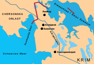
<span class="mw-page-title-main">Isthmus of Perekop</span> Isthmus

The Isthmus of Perekop, literally Isthmus of the Trench, is the narrow, 5–7 kilometres (3.1–4.3 mi) wide strip of land that connects the Crimean Peninsula to the mainland of Ukraine. The isthmus projects between the Black Sea to the west and the Syvash to the east. The isthmus takes its name of "Perekop" from the Tatar fortress of Or Qapi.
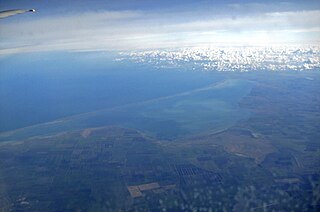
<span class="mw-page-title-main">Bay of Arabat</span>

The Bay of Arabat,, is in the southwestern Azov Sea in eastern Europe.
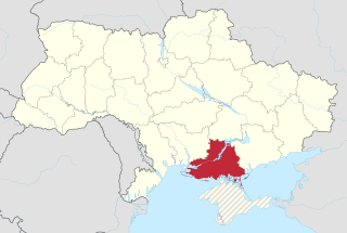
<span class="mw-page-title-main">Kherson Oblast</span> Oblast (region) of Ukraine

Kherson Oblast, also known as Khersonshchyna, is an oblast (province) in southern Ukraine. It is located just north of Crimea. Its administrative center is Kherson, on the northern or right bank of the Dnieper river, which bisects the oblast. The oblast has an area of 28,461 km2 and a population of 1,001,598. It is considered the 'fruit basket' of the country, as much of its agricultural production is dispersed throughout the country, with production peaking during the summer months.

<span class="mw-page-title-main">Syvash</span> Bay of the Sea of Azov

The Syvash or Sivash, also known as the Putrid Sea or Rotten Sea, is a large area of shallow lagoons on the western edge of the Sea of Azov. Separated from the sea by the narrow Arabat Spit, the water of the Syvash covers an area of around 2,560 km2 (990 sq mi) and the entire area spreads over about 10,000 km2 (3,900 sq mi). The Henichesk Strait is its eastern connection to the Sea of Azov. The Syvash borders the northeastern coast of the main Crimean Peninsula. The central and eastern Syvash were registered as wetlands of Ukraine under the Ramsar Convention. Since the 2022 Russian invasion of Ukraine, the entire Syvash has been occupied by Russia.

<span class="mw-page-title-main">Taurida Governorate</span> 1802–1918 unit of Russia

Taurida Governorate was an administrative-territorial unit (guberniya) of the Russian Empire. It included the territory of the Crimean Peninsula and the mainland between the lower Dnieper River with the coasts of the Black Sea and Sea of Azov. It formed after the Taurida Oblast was abolished in 1802 during Paul I's administrative reform of the territories of the former Crimean Khanate, which were annexed by Russia from the Ottoman Empire in 1783. The governorate's centre was the city of Simferopol. The name of the province was derived from Taurida, a historical name for Crimea.

<span class="mw-page-title-main">Kerch Peninsula</span> Eastern portion of Crimea

The Kerch Peninsula is a major and prominent geographic peninsula located at the eastern end of the Crimean Peninsula.

<span class="mw-page-title-main">Tuzla Spit</span> Sandbar in the Black Sea

Tuzla Spit or Kosa Tuzla was a long narrow peninsula or sandy spit in the eastern part of the Strait of Kerch which extended from Cape Tuzla to the north-west in the direction of the city Kerch for almost 11 kilometres (6.8 mi).

<span class="mw-page-title-main">Arabat Fortress</span> Fortress in Ukraine

The Arabat Fortress, built in the 17th century by the Ottoman army, stands at the southernmost part of the Arabat Spit. Its purpose was to guard the spit and Crimea from invasions. It was in use, with intermissions, until the Crimean War of 1853–1856.

<span class="mw-page-title-main">Spits of the Sea of Azov</span>

The spits of the Sea of Azov are narrow peninsulas of sand, silt and shells in the Sea of Azov. They are as long as 112 km, 45 km, 31 km, 30 km and 23 km. Their total length exceeds 300 km which is larger than the width of the sea.

<span class="mw-page-title-main">Henichesk Raion</span> Subdivision of Kherson Oblast, Ukraine

Henichesk Raion is one of the five administrative raions (districts) of Kherson Oblast in southern Ukraine. Its administrative centre is located in the city of Henichesk. Population: 118,059.

<span class="mw-page-title-main">Chonhar Peninsula</span>

The Chonhar Peninsula is on the northern coast of the Syvash, and in the Kherson province of Ukraine.

<span class="mw-page-title-main">Strilkove</span> Rural locality in Kherson Oblast, Ukraine

Strilkove is a Ukrainian village in Henichesk urban hromada, Henichesk Raion, Kherson Oblast. In 2013 its population was 1,415, and was predominantly ethnic Russian.

Shchaslyvtseve is a village in southern Ukraine. The community is located on the Arabat Spit and is geographically in Crimea, but administered as part of Henichesk Raion, Kherson Oblast. It belongs to Henichesk urban hromada, one of the hromadas of Ukraine.

<span class="mw-page-title-main">Henichesk Strait</span> Body of water in Ukraine

The Henichesk Strait is a narrow strait which connects the Syvash with the Sea of Azov. It separates the Arabat Spit from the Ukrainian mainland.

<span class="mw-page-title-main">Isthmus of Ak-Monay</span>

The Isthmus of Ak-Monay or Isthmus of Parpach is a narrowing of the Crimea Peninsula to a 17-km width between the Gulf of Feodosia to the south and Sivash and the Bay of Arabat to the north. The isthmus connects Kerch Peninsula to the rest of Crimea.

<span class="mw-page-title-main">Lacy's campaign to Crimea</span> Peter Lacys 1737 military expedition

Lacy's campaign to Crimea was a military expedition from May to October 1737 by the Don army under the command of Field Marshal Peter Lacy, along with Cossacks and Kalmyk auxiliary cavalry led by Prince Galdan-Narbo, against the forces of the Crimean Khanate led by Fetih II Giray during the Russo-Turkish War of 1735–1739. The battles culminated in Russian victory at the Salgir River in Crimea on July 12, 1737, and in the vicinity of Karasubazar on July 14.

References

  1. 1 2 Gutterman, Steve (18 March 2014). "Putin signs Crimea treaty, will not seize other Ukraine regions". Reuters.com. Retrieved 26 March 2014.
  2. 1 2 "Ukraine crisis timeline". BBC News . 13 November 2014. Retrieved 22 June 2023.
  3. Semenov, p. 624.
  4. "Arabat Fortress" (in Russian). Archived from the original on 2014-03-23. Retrieved 2016-11-25.
  5. Petrov, V.P. (1964). Geography of the Soviet Union: Physical features. p. 112.
  6. V. I. Borisov and E. I. Kapitonov (1973). Azov Sea (in Russian). KKI. Archived from the original on 2010-09-17. Retrieved 2010-06-20.
  7. Сиваш in the Great Soviet Encyclopedia , 1969–1978 (in Russian)
  8. 1 2 Shutov. Арабатка курортная, Part 1. Archived from the original on 2013-02-04. Retrieved 2010-06-17.
  9. 1 2 3 Semenov, p.111
  10. Арабатская стрелка (in Russian). Archived from the original on 2011-02-22. Retrieved 2010-06-17.
  11. Shutov. Арабатка курортная, Part 5. Archived from the original on 2013-02-04. Retrieved 2010-06-17.
  12. Shutov. Немного геологии (Part 4). Archived from the original on 2013-02-04. Retrieved 2010-06-17.
  13. "У Львові вшанували пам'ять жертв депортації кримських татар". www.ukrinform.ua (in Ukrainian). 2021-05-18. Retrieved 2024-02-25.
  14. Россия убрала войска с Арабатской стрелки [Russian troops removed from the Arabat Spit] (in Russian). Ukrinform. 9 December 2014. Archived from the original on 17 July 2015. Retrieved 14 April 2016.

Bibliography