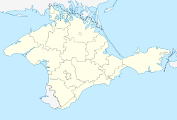
List of cities in Crimea

Last updated

Cities in Crimea
Map of the Crimea.png
Location Crimean peninsula
Number18 [lower-alpha 1] (as of 2014)
Populations7,771–393,304

There are 18 [lower-alpha 1] populated places in the Crimean peninsula that are recognized as having city status. [4] [5] The territory of Crimea, including Sevastopol, has been disputed between Russia and Ukraine since Russia's covert invasion and internationally unrecognised annexation of the peninsula on 18 March 2014. [6] [7] [3] [8] [9] The region is recognised by most countries as Ukraine's Autonomous Republic of Crimea and Sevastopol as one of Ukraine's cities with special status while since its annexation, the region has been de facto governed by Russia as the Republic of Crimea and Sevastopol as a city of federal importance. [3] [10] [11] [12] As of 2014, the largest city on the peninsula by population according to Russia's post-annexation census was Sevastopol, with a recorded population of 393,304 people, while the peninsula's second largest city was Simferopol, with a recorded population of 332,317 people. [5] The least populous city on the peninsula was Alupka, with a recorded population of 7,771 people in the census. [5]

Contents

In Ukraine, city status (Ukrainian : місто, romanized: misto) is granted by the country's parliament, the Verkhovna Rada, to settlements of 10,000 people or more or to settlements of historical or regional importance. [13] [14] Following the occupation and annexation of Crimea, Russia recognised and maintained the existing status of the peninsula's 18 cities. [5] In 2019, Russian officials granted the settlement Balaklava, located in Sevastopol's Balaklava urban district, the status of a city although still keeping it as part of Sevastopol. [15] [16] Due to the international support for UN General Assembly Resolution 68/262, which recognizes Ukrainian sovereignty over Crimea and endorses a policy of non-recognition of Russia's occupation of the peninsula, the new city status is largely not recognised. [1] [3]

Following the passing of decommunization laws, the city Krasnoperekopsk was renamed in 2016 to Yany Kapu (its original Crimean Tatar name) for Krasnoperekopsk's connection to people, places, events, and organizations associated with the Soviet Union. [17] [18] [19] Two cities on the peninsula (Kerch and Sevastopol) were awarded by Soviet officials with the honorary title Hero City of Ukraine in 1973 and 1965, respectively, for their resistance during the Axis invasion of the Soviet Union during World War II; the titles were renewed in 2022 by Ukrainian President Volodymyr Zelenskyy. [20] [21]

Administrative divisions

Following Ukraine's independence and the dissolution of the Soviet Union in 1991, the region's existing subdivisions were maintained, with the autonomous republic divided into 14 districts (raions) and 11 city municipalities (cities of regional significance).[ citation needed ] The territory of Sevastopol, which was governed separately from the rest of Crimea, also maintained its existing divisions; Sevastopol was divided into the four urban districts of Gagarin, Lenin, Nakhimov, and Balaklava.[ citation needed ] On 17 July 2020, the Verkhovna Rada passed a major administrative reform in Ukraine, decreasing the total number of raions throughout the country from 490 to 136 enlarged raions. [22] In Crimea, the autonomous republic's 11 city municipalities and 14 raions, in addition to areas administratively subordinated to Sevastopol (most notably Inkerman) although excluding Sevastopol city itself, were merged into ten reformed raions. [23] [24] [25] The ten enlarged raions that make up the territory of the autonomous republic are Bakhchysarai, Bilohirsk, Dzhankoi, Yevpatoria, Kerch, Kurman, [lower-alpha 2] Perekop, [lower-alpha 3] Simferopol, Feodosia, and Yalta raion. [25] Due to the region's continued occupation since 2014, the new raions have remained solely de jure and Russian officials continue to use the pre-reform administrative divisions.[ citation needed ]

For Sevastopol, following its occupation and annexation, Russian officials imposed its municipal framework on the city.[ citation needed ] Under Ukrainian law, urban districts generally have both administrative and municipal status while under Russian law, urban districts only have administrative status, with municipal powers typically given to municipal okrugs, which are subdivisions of urban districts.[ citation needed ] Russian officials maintained the four existing urban districts as solely administrative areas while further dividing each district into a total of nine municipal okrugs (excluding Inkerman, which remained within the city's Balaklavsky District but was not included in the boundaries of the okrugs).[ citation needed ] The municipal okrugs of each district are Balaklavsky, Orlinovsky, and Ternovsky for Balaklavsky District, Gagarinsky for Gagarinsky District, Leninsky for Leninsky District, and Andreyevsky, Kachinsky, Nakhimovsky, and Verkhnesadovsky for Nakhimovsky District.[ citation needed ]

List of cities

Cities in Crimea
NameName (on Crimean Tatar Wikipedia)Name (on Russian Wikipedia)Name (on Ukrainian Wikipedia) Ukrainian subdivision ( de jure ) Russian subdivision ( de facto )Popu­lation
(2014 census) [5]
Popu­lation
(2001 census) [4]
Popu­lation
change
Alupka Alupka Алупка Алупка Yalta Raion Yalta Municipality 7,7719,018
Alushta Aluşta Алушта Алушта Yalta Raion Alushta Municipality 29,07831,440
Armiansk Ermeni Bazar Армянск Армянськ Perekop Raion Armiansk Municipality 21,98723,869
Bakhchysarai Bağçasaray Бахчисарай Бахчисарай Bakhchysarai Raion Bakhchysarai Raion 27,44827,549
Bilohirsk Qarasuvbazar Белогорск Білогірськ Bilohirsk Raion Bilohirsk Raion 16,35418,790
Dzhankoi Canköy Джанкой Джанкой Dzhankoi Raion Dzhankoy Municipality 38,62243,343
Feodosia Kefe Феодосия Феодосія Feodosia Raion Feodosia Municipality 69,03874,669
Inkerman İnkerman Инкерман Інкерман Bakhchysarai Raion NA (administratively part of the federal city Sevastopol)10,34810,628
Kerch Keriç Керчь Керч Kerch Raion Kerch Municipality 147,033157,007
Krasnoperekopsk Yañı Qapu Красноперекопск Яни Капу [lower-alpha 4] Perekop Raion Krasnoperekopsk Municipality 26,26831,023
Saky Saq Саки Саки Yevpatoria Raion Saky Municipality 25,14629,416
Sevastopol Aqyar Севастополь Севастополь NA (city with special status)NA (federal city)393,304 [lower-alpha 5] 342,451 [lower-alpha 5]
Shcholkine Şçolkino Щёлкино [lower-alpha 6] Щолкіне Kerch Raion Lenine Raion 10,62011,699
Simferopol Aqmescit Симферополь Сімферополь Simferopol Raion Simferopol Municipality 332,317343,644
Staryi Krym Eski Qırım Старый Крым Старий Крим Feodosia Raion Kirovske Raion 9,27710,101
Sudak Sudaq Судак Судак Feodosia Raion Sudak Municipality 16,49214,495
Yalta Yalta Ялта Ялта Yalta Raion Yalta Municipality 76,74681,654
Yevpatoria Kezlev Евпатория Євпаторія Yevpatoria Raion Yevpatoria Municipality 105,719105,915

See also

Notes

  1. 1 2 Due to the continued international recognition of Crimea as sovereign territory of Ukraine and the non-recognition of Russia's jurisdiction over it, the United Nations General Assembly and most of the international community do not recognize administrative changes made by Russian-appointed officials in Crimea, including the granting of city status to Balaklava. [1] [2] [3]
  2. Previously known as Krasnohvardiiske Raion in Ukraine prior to 2016. Due to the occupation of the raion by Russian forces at the time of the renaming, the new name has only de jure status. [26] [27]
  3. Previously known as Krasnoperekopsk Raion in Ukraine prior to 2016. Due to the occupation of the raion by Russian forces at the time of the renaming, the new name has only de jure status. [26] [27]
  4. Transliteration of the Crimean Tatar name Yañı Qapu. Krasnoperekopsk in Ukrainian is Красноперекопськ. [26] [4]
  5. 1 2 Includes population figures for Balaklava and excludes population of Inkerman city. [5] [4]
  6. Spelled as Щелкино (with the letter ё written without diaeresis) in Russia's 2014 Crimean Federal District census. [5]
  7. 1 2 3 4 5 As of 2014, according to Russia's post-annexation census. [5]

Related Research Articles

<span class="mw-page-title-main">Sevastopol</span> City on the Crimean peninsula

Sevastopol, sometimes written Sebastopol, is the largest city in Crimea and a major port on the Black Sea. Due to its strategic location and the navigability of the city's harbours, Sevastopol has been an important port and naval base throughout its history. Since the city's founding in 1783 it has been a major base for Russia's Black Sea Fleet. During the Cold War of the 20th century, it was a closed city. The total administrative area is 864 square kilometres (334 sq mi) and includes a significant amount of rural land. The urban population, largely concentrated around Sevastopol Bay, is 479,394, and the total population is 547,820.

<span class="mw-page-title-main">Crimea</span> Peninsula in Europe

Crimea is a peninsula in Eastern Europe, on the northern coast of the Black Sea, almost entirely surrounded by the Black Sea and the smaller Sea of Azov. The Isthmus of Perekop connects the peninsula to Kherson Oblast in mainland Ukraine. To the east, the Crimean Bridge, constructed in 2018, spans the Strait of Kerch, linking the peninsula with Krasnodar Krai in Russia. The Arabat Spit, located to the northeast, is a narrow strip of land that separates the Syvash lagoons from the Sea of Azov. Across the Black Sea to the west lies Romania and to the south is Turkey. The population is 2.4 million, and the largest city is Sevastopol. The region has been under Russian occupation since 2014.

<span class="mw-page-title-main">Administrative divisions of Ukraine</span> Political divisions of Ukraine

The administrative divisions of Ukraine are under the jurisdiction of the Ukrainian Constitution. Ukraine is a unitary state with three levels of administrative divisions: 27 regions, 136 raions (districts) and 1469 hromadas.

<span class="mw-page-title-main">Crimea in the Soviet Union</span> Status of Crimea in the Soviet Union

During the existence of the Soviet Union, different governments existed within the Crimean Peninsula. From 1921 to 1936, the government in the Crimea was known as the Crimean Autonomous Socialist Soviet Republic and was an Autonomous Soviet Socialist Republic within the Russian Soviet Federative Socialist Republic (SFSR); from 1936 to 1945, the name was slightly altered to the Crimean Autonomous Soviet Socialist Republic.

<span class="mw-page-title-main">Krasnoperekopsk</span> City in Crimea, Ukraine

Krasnoperekopsk or Yañı Qapu is a city in Crimea. Following the 2014 annexation of Crimea, it was incorporated into Russia's Republic of Crimea. However, a majority of countries recognises the territory as part of Ukraine within the Autonomous Republic of Crimea. It is the administrative center of Krasnoperekopsk Raion. Administratively is not a part of the raion (district) and is incorporated separately as a town of regional significance. Population: 26,268 .

<span class="mw-page-title-main">Dzhankoi</span> City in Crimea, Ukraine

Dzhankoi or Jankoy is a city of regional significance in the northern part of Crimea, internationally recognized as part of Ukraine, but since 2014 occupied by Russia. It also serves as administrative centre of Dzhankoi Raion although it is not a part of the raion (district). Population: 38,622 .

<span class="mw-page-title-main">Bakhchysarai Raion</span> Raion in Crimea, Ukraine

Bakhchysarai Raion is one of the 25 regions of Crimea, currently subject to a territorial dispute between the Russian Federation and Ukraine. Population: 90,911 .

<span class="mw-page-title-main">Raions of Ukraine</span> Second-level administrative divisions of Ukraine

A raion, often translated as district, is the second-level administrative division in Ukraine. Raions were created in a 1922 administrative reform of the Soviet Union, to which Ukraine, as the Ukrainian Soviet Socialist Republic, belonged.

<span class="mw-page-title-main">Krasnoperekopsk Raion</span> Raion in Crimea, Ukraine

Krasnoperekopsk Raion is one of the 25 districts of the Autonomous Republic of Crimea, a territory recognized by a majority of countries as part of Ukraine, but currently occupied and incorporated by Russia as the Republic of Crimea. It is situated in the northern part of the republic. The administrative center of the raion is the town of Krasnoperekopsk. The latter is not a part of the raion (district) and incorporated separately as a town of regional significance. Population : 24,738 .

<span class="mw-page-title-main">Lenine Raion</span> Raion in Crimea, Ukraine

Lenine Raion or Yedy-Kuiu Raion was one of the twenty-five districts of the Autonomous Republic of Crimea in Ukraine until its abolition in 2020. It continues to be used by the Russian administration known as the Republic of Crimea, as Russia has occupied Crimea since 2014.

<span class="mw-page-title-main">Simferopol Raion</span> Raion in Crimea, Disputed:

Simferopol Raion is one of the 25 regions of the Crimean peninsula, administered by Russia, but considered by many countries as part of Ukraine. The administrative center of the raion is the city of Simferopol which is incorporated as a town of republican significance and is not a part of the district. The Simferopol Raion is situated in the central part of the peninsula. Population: 152,091 .

<span class="mw-page-title-main">Pervomaiske Raion</span> Raion in Crimea, Ukraine

Pervomaiske Raion was one of the twenty-five regions of the Autonomous Republic of Crimea, Ukraine until its abolition in 2020. Russia, which has occupied the entire Crimean Peninsula since 2014, continues to use it as part of its administration, the Republic of Crimea. It is situated in the north-western part of the peninsula. The raion is named after its administrative center, the urban-type settlement of Pervomaiske. Population: 32,789 .

<span class="mw-page-title-main">City with special status</span> Type of first-level administrative division of Ukraine

A city with special status, formerly a "city of republican subordinance", is a type of first-level administrative division of Ukraine. Kyiv and Sevastopol are the only two such cities. Their administrative status is recognized in the Ukrainian Constitution in Chapter IX: Territorial Structure of Ukraine and they are governed in accordance with laws passed by Ukraine's parliament, the Verkhovna Rada. Most of Ukraine's 27 first-level administrative divisions are oblasts (regions).

<span class="mw-page-title-main">Urban districts of Ukraine</span>

An urban district or urban raion is the second-level administrative division in certain cities in Ukraine. There are 118 districts in 20 cities across Ukraine. The cities that contain districts are mostly administrative centers in addition to the two cities with special status. The number of city districts per region varies between a minimum of two and a high of 21 in Donetsk Oblast. The maximum districts for a single city in the country is Kyiv, which has 10 districts.

<span class="mw-page-title-main">Autonomous Republic of Crimea</span> De jure autonomous republic of Ukraine

The Autonomous Republic of Crimea is an administrative division of Ukraine encompassing most of Crimea that was unilaterally annexed by Russia in 2014. The Autonomous Republic of Crimea occupies most of the peninsula, while the City of Sevastopol occupies the rest.

<span class="mw-page-title-main">Republic of Crimea (Russia)</span> First-level administrative division of Russia, annexed territory of Ukraine

The Republic of Crimea is a republic of Russia, comprising most of the Crimean Peninsula, but excluding Sevastopol. Its territory corresponds to the pre-2023 territory of the Autonomous Republic of Crimea, a de jure subdivision of Ukraine. Russia occupied and annexed the peninsula in 2014, although the annexation remains internationally unrecognized.

<span class="mw-page-title-main">Administrative divisions of Crimea</span>

The Crimean Peninsula is a disputed area which as a result of the 2014 Crimean crisis is controlled and recognized by Russia as the Republic of Crimea, a federal subject of Russia. At the same time, Ukraine and most UN countries around the world recognize the territory as the Autonomous Republic of Crimea, a part of Ukraine.

<span class="mw-page-title-main">Kalanchak</span> Rural locality in Kherson Oblast, Ukraine

Kalanchak is a rural settlement in Skadovsk Raion, Kherson Oblast, southern Ukraine. It hosts the administration of the Kalanchak settlement hromada, one of the hromadas of Ukraine. It has a population of 8,977.

<span class="mw-page-title-main">Ahtem Chiygoz</span> Ukrainian Crimean Tatar politician

Ahtem Chiygoz is a Ukrainian Crimean Tatar politician. He is the Deputy Chairman of the Mejlis of the Crimean Tatar People, a People's Deputy of Ukraine in the current convocation, Chairman of the Bakhchysaray regional Mejlis, and delegate to the Qurultay of the Crimean Tatar People.

References

  1. 1 2 "Resolution adopted by the General Assembly on 27 March 2014" (PDF). United Nations Department of General Assembly and Conference Management. 1 April 2014. Retrieved 2024-06-27.
  2. "Ukraine's president pledges to 'return' Russia-annexed Crimea". Al Jazeera . 23 August 2021. Retrieved 2024-06-27.
  3. 1 2 3 4 "Temporary Occupation of Crimea and City of Sevastopol". Ministry of Foreign Affairs of Ukraine . 22 July 2022. Retrieved 8 July 2024.
  4. 1 2 3 4 Кількість та територіальне розміщення населення України [The number and territorial distribution of the population of Ukraine](RAR). 2001.ukrcensus.gov.ua (in Ukrainian). State Statistics Service of Ukraine. 5 December 2001. Retrieved 2024-06-22. To access the statistics, scroll down to the section titled "Кількість та територіальне розміщення населення України" (transl.Number and territorial distribution of the population of Ukraine). Then, click on the linked text "Публікація у електронному вигляді" (transl.Publication in electronic form). This will download the statistics as a RAR file from which it can be accessed using RAR file converters such as 7-Zip.
  5. 1 2 3 4 5 6 7 8 9 10 11 12 Таблицы с итогами Федерального статистического наблюдения "Перепись населения в Крымском федеральном округе" [Tables with the results of the Federal Statistical Observation "Population Census in the Crimean Federal District"](.xlsx). gks.ru (in Russian). Rosstat. 14–25 October 2014. Retrieved 8 July 2024. To access the statistics, click on the Microsoft Excel spreadsheet icon in the right column in the row "1.3 Численность населения Крымского федерального округа, городских округов, муниципальных районов, городских и сельских поселений" (transl.1.3 Population of the Crimean Federal District, urban districts, municipal areas, urban and rural settlements). This will download the statistics as a standard Microsoft Excel spreadsheet file (.xlsx) which can be accessed using Microsoft Excel or similar applications.
  6. Simpson, John (19 March 2014). "Russia's Crimea plan detailed, secret and successful". BBC . Retrieved 8 July 2024.
  7. Mirovalev, Mansur (20 February 2024). "Ten years ago Russia annexed Crimea, paving the way for war in Ukraine". Al Jazeera . Retrieved 8 July 2024.
  8. Pifer, Steven (17 March 2020). "Crimea: Six years after illegal annexation". Brookings . Retrieved 8 July 2024.
  9. "How Russia's grab of Crimea 10 years ago led to war with Ukraine and rising tensions with the West". Associated Press . 18 March 2024. Retrieved 8 July 2024.
  10. Конституция Российской Федерации [Constitution of the Russian Federation]. archive.government.ru (in Russian). Government of the Russian Federation . Retrieved 8 July 2024.
  11. Конституція України - Розділ IX [Constitution of Ukraine - Chapter IX]. Office of the President of Ukraine . Retrieved 8 July 2024.
  12. Адміністрацію Криму змінять ще до деокупації - Рада затвердила закон [Administration of Crimea will be changed before deoccupation - Rada approved the law]. Dzerkalo Tyzhnia (in Ukrainian). 23 August 2023. Retrieved 8 July 2024.
  13. Povalyaev, Ivan (2023-07-31). Дерадянизація: в Україні скасували смт та міста районного чи обласного значення [De-Sovietization: Ukraine abolishes urban-type settlements and cities of district or regional significance]. umoloda.kyiv.ua (in Ukrainian). Archived from the original on 2024-05-20. Retrieved 2024-05-20.
  14. Закон України від 28.07.2023 р. № 3285-IX “Про порядок вирішення окремих питань адміністративно-територіального устрою України” [Law of Ukraine of 28.07.2023 № 3285-IX "On the Procedure for Resolving Certain Issues of the Administrative and Territorial Structure of Ukraine"]. document.vobu.ua (in Ukrainian). 2023-10-26. Archived from the original on 2024-05-20. Retrieved 2024-05-20.
  15. Балаклава официально стала городом [Balaklava officially became a city]. Argumenty Nedeli – Krym (in Russian). 7 October 2019. Retrieved 2024-06-27.
  16. Закон города Севастополя от 23.07.2019 № 518-ЗС: "О внесении изменений в Закон города Севастополя от 3 июня 2014 года № 19-ЗС "Об административно-территориальном устройстве города Севастополя" [Law of the city of Sevastopol from 23.07.2019 № 518-ZS: "On Amendments to the Law of the city of Sevastopol from 3 June 2014 № 19-ZS "On the administrative-territorial structure of the city of Sevastopol"]. www.pravo.gov.ru (in Russian). Federal Protective Service of the Russian Federation. 24 July 2019. Retrieved 2024-06-27.
  17. Про засудження комуністичного та націонал-соціалістичного (нацистського) тоталітарних режимів в Україні та заборону пропаганди їхньої символіки [On the condemnation of communist and national socialist (Nazi) totalitarian regimes in Ukraine and the prohibition of propaganda of their symbols]. Official Website of the Parliament of Ukraine (in Ukrainian). July 27, 2023. Archived from the original on 2024-05-26. Retrieved 2024-05-20.
  18. Понад 50 тисяч вулиць змінили назви впродовж 2016 року [Over 50 thousand streets changed their names in 2016]. www.kmu.gov.ua (in Ukrainian). December 27, 2016. Archived from the original on 2024-05-20. Retrieved 2024-05-20.
  19. "Crimea - Second-order administrative divisions" (PDF). assets.publishing.service.gov.uk. PCGN. February 2022. Retrieved 8 July 2024.
  20. Mayorov, Maksym (25 March 2022). Міф "Місто-Герой" [Myth of the "Hero City"]. Istorychna Pravda (in Ukrainian). Retrieved 2024-06-27.
  21. Указ Президента України №171/2023: Питання почесної відзнаки "Місто-герой України" [Decree of the President of Ukraine No. 171/2023: About the award "Hero City of Ukraine"]. Office of the President of Ukraine (in Ukrainian). 21 March 2023. Retrieved 2024-06-27.
  22. Про утворення та ліквідацію районів [On the formation and liquidation of districts]. Official Website of the Parliament of Ukraine (in Ukrainian). 17 July 2020. Retrieved 2024-01-28.
  23. State Statistics Service of Ukraine. Кількість адміністративно-територіальних одиниць за регіонами України на 1 січня 2016 року* [Number of administrative-territorial units by regions of Ukraine as of 1 January 2016*]. ukrstat.gov.ua (in Ukrainian). Retrieved 2024-06-21.
  24. Povalyaev, Ivan (2023-07-31). Дерадянизація: в Україні скасували смт та міста районного чи обласного значення [De-Sovietization: Ukraine abolishes urban-type settlements and cities of district or regional significance]. umoloda.kyiv.ua (in Ukrainian). Archived from the original on 2024-05-20. Retrieved 2024-05-20.
  25. 1 2 Про утворення та ліквідацію районів [On the formation and liquidation of districts]. Official Website of the Parliament of Ukraine (in Ukrainian). 17 July 2020. Retrieved 2024-06-21.
  26. 1 2 3 Рада перейменувала 70 населених пунктів у Криму [Rada renamed 70 settlements in Crimea]. LB.ua (in Ukrainian). 12 May 2016. Retrieved 8 July 2024.
  27. 1 2 Shevel, Oxana (January 2016). "Decommunization in Post-Euromaidan Ukraine" (PDF). PONARS Eurasia. Archived (PDF) from the original on 20 May 2024. Retrieved 20 May 2024.
  28. "Sevastopol Ukraine". Encyclopædia Britannica . 23 June 2024. Retrieved 8 July 2024.
  29. "Simferopol Ukraine". Encyclopædia Britannica . 31 October 2023. Retrieved 8 July 2024.
  30. "Kerch Ukraine". Encyclopædia Britannica . 17 November 2023. Retrieved 8 July 2024.
  31. "Yevpatoriya Ukraine". Encyclopædia Britannica . 18 January 2024. Retrieved 8 July 2024.
  32. "Yalta Ukraine". Encyclopædia Britannica . 1 August 2023. Retrieved 8 July 2024.