Arabi, Georgia

Last updated

Arabi, Georgia
Arabi City Hall, Fire Dept, Police Dept.jpg
Arabi City Hall, May 2018
Crisp County Georgia Incorporated and Unincorporated areas Arabi Highlighted.svg
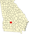
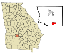
Location in Crisp County and the state of Georgia
Coordinates: 31°50′1″N83°44′6″W / 31.83361°N 83.73500°W / 31.83361; -83.73500
Country United States
State Georgia
County Crisp
Government
  Mayor Brooke Huckaby (R)
Area
[1]
  Total
6.44 sq mi (16.69 km2)
  Land6.29 sq mi (16.30 km2)
  Water0.15 sq mi (0.38 km2)
Elevation
440 ft (134 m)
Population
 (2020)
  Total
447
  Density71.01/sq mi (27.42/km2)
Time zone UTC-5 (Eastern (EST))
  Summer (DST) UTC-4 (EDT)
ZIP code
31712
Area code 229
FIPS code 13-02564 [2]
GNIS feature ID0331047 [3]
Website cityofarabi.com

Arabi is a town in Crisp County, Georgia, United States. As of 2020 its population was 447.

Contents

History

The first permanent settlement at Arabi was made in 1888. [4] According to tradition, the name "Arabi" was coined after a local surname. [4] The town was chartered in 1891. [5]

Demographics

Historical population
CensusPop.Note
1900 505
1910 433−14.3%
1920 53222.9%
1930 452−15.0%
1940 388−14.2%
1950 376−3.1%
1960 303−19.4%
1970 3050.7%
1980 37623.3%
1990 43315.2%
2000 4565.3%
2010 58628.5%
2020 447−23.7%
U.S. Decennial Census [6]

As of the census [2] of 2000, there were 456 people, 185 households, and 120 families residing in the town. By the 2020 census, its population was 447.

Geography

Arabi is located in southern Crisp County at 31°50′1″N83°44′6″W / 31.83361°N 83.73500°W / 31.83361; -83.73500 (31.833473, -83.734912). [7] U.S. Route 41 passes through the center of the town as Bedgood Avenue, leading north 9 miles (14 km) to Cordele, the county seat, and south 10 miles (16 km) to Ashburn. Interstate 75 passes through the eastern side of the town, with access from Exit 92, and leads north 73 miles (117 km) to Macon and south 75 miles (121 km) to Valdosta.

According to the United States Census Bureau, Arabi has a total area of 6.4 square miles (16.6 km2), of which 6.3 square miles (16.3 km2) is land and 0.12 square miles (0.3 km2), or 1.81%, is water. [8]

Notable people

See also

References

  1. "2020 U.S. Gazetteer Files". United States Census Bureau. Retrieved December 18, 2021.
  2. 1 2 "U.S. Census website". United States Census Bureau . Retrieved January 31, 2008.
  3. "US Board on Geographic Names". United States Geological Survey. October 25, 2007. Retrieved January 31, 2008.
  4. 1 2 Krakow, Kenneth K. (1975). Georgia Place-Names: Their History and Origins (PDF). Macon, GA: Winship Press. p. 6. ISBN   0-915430-00-2.
  5. "Arabi". New Georgia Encyclopedia. Retrieved March 31, 2018.
  6. "Census of Population and Housing". Census.gov. Retrieved June 4, 2015.
  7. "US Gazetteer files: 2010, 2000, and 1990". United States Census Bureau. February 12, 2011. Retrieved April 23, 2011.
  8. "Geographic Identifiers: 2010 Demographic Profile Data (G001): Arabi town, Georgia". U.S. Census Bureau, American Factfinder. Archived from the original on February 12, 2020. Retrieved July 31, 2014.