Redwing, Saskatchewan, Canada, is a small community in the rural municipality (RM) of Buckland No. 491, located on Saskatchewan Highway 2. Redwing and Red Wing Terrace are both localities of Buckland No. 491. Red Wing Terrace is north of the locality of Green Acres on Green Acres Road and south of both Red Wing Terrace Road, and White Star. White Star is located on White Star Road, which is concurrent with Township Road 502 and Saskatchewan Highway 780.
Beatty is a village in the Canadian province of Saskatchewan within the Rural Municipality of Flett's Springs No. 429 and Census Division No. 15. The village is located approximately 13 km (8 mi) northwest of the City of Melfort. It is at the junction of Highway 3 and Highway 368. In 1925, Beatty was a Canadian National Railways (CNR) rail station on the Swan River - Prince Albert branch line. The area surrounding Beatty is predominantly farmland and the main source of employment is agriculture.

Weldon is a village in the Canadian province of Saskatchewan within the Rural Municipality of Kinistino No. 459 and Census Division No. 15. The area is part of the aspen parkland biome. The village is located 2 km (1.2 mi) north of Highway 3 at the midway point between the cities of Prince Albert and Melfort, Saskatchewan. The village is just 20 km (12 mi) south of the Weldon Ferry linking it to Highway 302 and is often used as an access point to the historic Saskatchewan River Forks where the North and South Saskatchewan rivers join just 25 km (16 mi) to the northeast.
Prud'homme is a village in the Canadian province of Saskatchewan within the Rural Municipality of Bayne No. 371 and Census Division No. 15. It is approximately 60 kilometres northeast of Saskatoon. Prud'homme was first known by the name of Bluebell Ranch, then Lally Siding. In 1905 the Canadian Northern Railway came through and renamed it Marcotte's Crossing; two years later it became known as Howell; and finally, in 1922, it was named after the Suffragan Bishop of Prince-Albert–Saskatoon, Joseph H. Prud'homme. The community is mostly based on agriculture.
Bounty is an unincorporated community in Fertile Valley No. 285 Saskatchewan, Canada. The population was 5 at the 2001 Census. It previously held the status of village until November 25, 1997. The community is located on Range Road 104 and Township Road 300, about 21 km (13 mi) west of Outlook. At one time Bounty was said to have nobody living in the community.

Englefeld is a village in the Canadian province of Saskatchewan within the Rural Municipality of St. Peter No. 369 and Census Division No. 15. The village is located 32 kilometres east of the City of Humboldt on Highway 5.

Laird is a village in the Canadian province of Saskatchewan within the Rural Municipality of Laird No. 404 and Census Division No. 15. Laird is located in the Saskatchewan River Valley. The village is named after David Laird, Lieutenant Governor of the Northwest Territories.
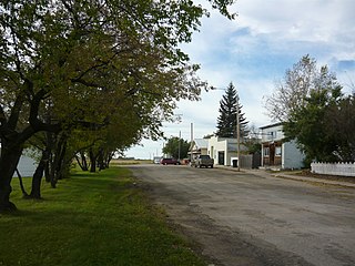
Lake Lenore is a village in the Canadian province of Saskatchewan within the Rural Municipality of St. Peter No. 369 and Census Division No. 15. The village is located 144 kilometres (89 mi) northeast of the city of Saskatoon. To the north of the village is Lenore Lake, which is designated as a migratory bird sanctuary, an Important Bird Area (IBA) of Canada, and has a National Wildlife Area on Raven Island. Services in Lake Lenore include a school, Co-op Grocery and Agro Service Station, a Credit Union, and Public Library.

St. Gregor is a village in the Canadian province of Saskatchewan within the Rural Municipality of St. Peter No. 369 and Census Division No. 15. It is approximately 20 km west of the Town of Watson on Highway 5.
Meath Park is a village in the Canadian province of Saskatchewan within the Rural Municipality of Garden River No. 490 and Census Division No. 15.
Middle Lake is a village in the Canadian province of Saskatchewan within the Rural Municipality of Three Lakes No. 400 and Census Division No. 15. The village has a public K-12 school, a nursing home, and a regional park. It is adjacent to Lucien Lake and accessed from Highway 20. The surrounding area is largely agricultural.
Highgate, Saskatchewan is an unincorporated area in the rural municipality of Battle River No. 438, Saskatchewan, in the Canadian province of Saskatchewan. Highgate is located on Saskatchewan Highway 16, the Yellowhead in north western Saskatchewan. Highgate siding, a railroad siding and post office first opened in 1919 at the legal land description of Sec.17, Twp.45, R.17, W3. The population is smaller than a hamlet, and is counted within the RM. Highgate is located just north west of North Battleford, Saskatchewan.
Fielding, Saskatchewan is an unincorporated area in the rural municipality of Mayfield No. 406, Saskatchewan, in the Canadian province of Saskatchewan. Fielding is located on Saskatchewan Highway 16, the Yellowhead in north western Saskatchewan. Fielding post office first opened in 1905 at the legal land description of Sec.18, Twp.41, R.11, W3. The population is smaller than a hamlet, and is counted within the Mayfield No. 406, Saskatchewan. Fielding is located just south east of North Battleford, Saskatchewan. Fielding is located within 11 kilometres (6.8 mi) of Glenburn Regional Park and within 9 kilometres (5.6 mi) of the Radisson Lake Game Preserve.

Viscount is a village in the Canadian province of Saskatchewan within the Rural Municipality of Viscount No. 341 and Census Division No. 11. Viscount is located on Saskatchewan Highway 16, the Yellowhead Highway, in central Saskatchewan east of Colonsay and west of Lanigan. As of the Canada 2016 Census, Viscount had a population of 232.

Sheho is a village in the Canadian province of Saskatchewan within the Rural Municipality of Insinger No. 275 and Census Division No. 9. Sheho is located on Saskatchewan Highway 16, in southeast Saskatchewan between Foam Lake to the west and the City of Yorkton to the east. Sheho Lake post office first opened in 1891 at the legal land description of Sec.28, Twp.30, R.9, W2 before moving slightly and changing name to Sheho.
Insinger, Saskatchewan is an unincorporated area in the rural municipality of Insinger No. 275, Saskatchewan, in the Canadian province of Saskatchewan. Insinger is located on Saskatchewan Highway 16, the Yellowhead in south eastern Saskatchewan. Lawrie post office first opened in 1898 at the legal land description of Sec.6, Twp.29, R.7, W2. It changed names in 1907 to Insinger and moved to Sec.21, Twp.29, R.8, W2. The population is smaller than a hamlet, and is counted within the Insinger No. 275, Saskatchewan, however it is still listed as a village at Geonames. Insinger is located between Yorkton and Foam Lake. Insinger is located within 14 kilometres (8.7 mi) of Whitesand Regional Park.

Theodore is a village in the Canadian province of Saskatchewan within the Rural Municipality of Insinger No. 275 and Census Division No. 9. Theodore is located on Saskatchewan Highway 16, the Yellowhead Highway, in southeastern Saskatchewan. The Theodore post office first opened in 1893 at the legal land description of Sec.1, Twp.28, R.7, W2. Theodore is located between Yorkton and Foam Lake.
Valparaiso is a village in the Canadian province of Saskatchewan within the Rural Municipality of Star City No. 428 and Census Division No. 14. The village is located at the junction of Highway 3 and Range Road No. 160, approximately 20 km east of the City of Melfort. The name comes from that of Valparaíso in Chile.
Mount Carmel is a hamlet in Humboldt Rural Municipality No. 370, Saskatchewan, Canada. The hamlet is located 5 km south of Highway 5, and about 11 km southwest of the City of Humboldt. Mount Carmel is also known as Carmel, Saskatchewan.
Corinne is an unincorporated community in Rural Municipality of Bratt's Lake No. 129, Saskatchewan, Canada. The community is located at the intersections of Highway 6, Highway 39 and Highway 334 about 11 kilometres (7 mi) northwest of Milestone.
