Arrondissements of the Loiret department

Last updated
Map of arrondissements of the Loiret department. Departement Loiret Arrondissement 2019.png
Map of arrondissements of the Loiret department.

The 3 arrondissements of the Loiret department are: [1]

  1. Arrondissement of Montargis, (subprefecture: Montargis) with 125 communes. [2] The population of the arrondissement was 170,285 in 2016.
  2. Arrondissement of Orléans, (prefecture of the Loiret department: Orléans) with 121 communes. The population of the arrondissement was 440,562 in 2016.
  3. Arrondissement of Pithiviers, (subprefecture: Pithiviers) with 79 communes. The population of the arrondissement was 63,483 in 2016.

History

In 1800 the arrondissements of Orléans, Gien, Montargis and Pithiviers were established. The arrondissements of Gien and Pithiviers were disbanded in 1926, and Pithiviers was restored in 1942. [3]

Related Research Articles

<span class="mw-page-title-main">Loiret</span> Department in Centre-Val de Loire, France

Loiret is a department in the Centre-Val de Loire region of north-central France. It takes its name from the river Loiret, which is contained wholly within the department. In 2019, Loiret had a population of 680,434.

<span class="mw-page-title-main">La Chapelle-Saint-Sépulcre</span> Commune in Centre-Val de Loire, France

La Chapelle-Saint-Sépulcre is a commune in the Loiret department in north-central France. It is part of the canton of Courtenay and of the arrondissement of Montargis.
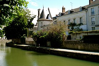
<span class="mw-page-title-main">Arrondissements of the Ain department</span>

The 4 arrondissements of the Ain department are:

  1. Arrondissement of Belley, with 105 communes. The population of the arrondissement was 120,594 in 2016.
  2. Arrondissement of Bourg-en-Bresse, with 199 communes. The population of the arrondissement was 331,400 in 2016.
  3. Arrondissement of Gex, with 27 communes. The population of the arrondissement was 93,027 in 2016.
  4. Arrondissement of Nantua, with 62 communes. The population of the arrondissement was 93,404 in 2016.
<span class="mw-page-title-main">Arrondissements of the Pas-de-Calais department</span>

The 7 arrondissements of the Pas-de-Calais department are:

  1. Arrondissement of Arras, with 357 communes. The population of the arrondissement was 248,929 in 2016.
  2. Arrondissement of Béthune, with 104 communes. The population of the arrondissement was 293,991 in 2016.
  3. Arrondissement of Boulogne-sur-Mer, with 74 communes. The population of the arrondissement was 159,748 in 2016.
  4. Arrondissement of Calais, with 52 communes. The population of the arrondissement was 158,492 in 2016.
  5. Arrondissement of Lens, with 50 communes. The population of the arrondissement was 367,839 in 2016.
  6. Arrondissement of Montreuil, with 164 communes. The population of the arrondissement was 112,118 in 2016.
  7. Arrondissement of Saint-Omer, with 89 communes. The population of the arrondissement was 129,608 in 2016.

The Canton of Puiseaux is a former canton of the Loiret département, in the Centre région, in France. Since 1800 it has been a part of the Arrondissement of Pithiviers. Between 1926 and 1942 it was part of the Arrondissement of Montargis. It was disbanded following the French canton reorganisation which came into effect in March 2015. It consisted of 13 communes, which joined the canton of Le Malesherbois in 2015.

The following is a list of the 21 cantons of the Loiret department, in France, following the French canton reorganisation which came into effect in March 2015:

<span class="mw-page-title-main">Arrondissements of the Manche department</span>

The 4 arrondissements of the Manche department are:

  1. Arrondissement of Avranches, with 134 communes. The population of the arrondissement was 123,523 in 2013.
  2. Arrondissement of Cherbourg, with 144 communes. The population of the arrondissement was 190,262 in 2013.
  3. Arrondissement of Coutances, with 81 communes. The population of the arrondissement was 84,327 in 2013.
  4. Arrondissement of Saint-Lô, with 87 communes. The population of the arrondissement was 101,807 in 2013.
<span class="mw-page-title-main">Arrondissements of the Seine-et-Marne department</span>

The 5 arrondissements of the Seine-et-Marne department are:

  1. Arrondissement of Fontainebleau, with 85 communes. The population of the arrondissement was 156,193 in 2016.
  2. Arrondissement of Meaux, with 142 communes. The population of the arrondissement was 343,169 in 2016.
  3. Arrondissement of Melun, with 59 communes. The population of the arrondissement was 278,808 in 2016.
  4. Arrondissement of Provins, with 176 communes. The population of the arrondissement was 187,405 in 2016.
  5. Arrondissement of Torcy, with 45 communes. The population of the arrondissement was 432,090 in 2016.
<span class="mw-page-title-main">Pithiviers</span> Subprefecture and commune in Centre-Val de Loire, France

Pithiviers is a commune in the Loiret department, north central France. It is one of the subprefectures of Loiret. It is twinned with Ashby-de-la-Zouch in Leicestershire, England and Burglengenfeld in Bavaria, Germany.

<span class="mw-page-title-main">Gien</span> Commune in Centre-Val de Loire, France

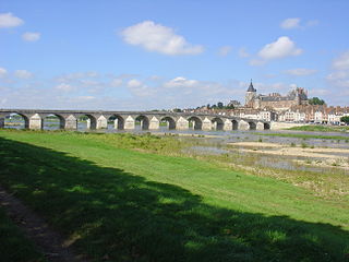
Gien is a commune in the Loiret department in north-central France.

<span class="mw-page-title-main">Arrondissements of the Côte-d'Or department</span>

The 3 arrondissements of the Côte-d'Or department are:

  1. Arrondissement of Beaune, with 222 communes. The population of the arrondissement was 111,295 in 2016.
  2. Arrondissement of Dijon, with 224 communes. The population of the arrondissement was 361,844 in 2016.
  3. Arrondissement of Montbard, with 252 communes. The population of the arrondissement was 60,074 in 2016.
<span class="mw-page-title-main">Arrondissements of the Côtes-d'Armor department</span>

The four arrondissements of the Côtes-d'Armor department are:

  1. Arrondissement of Dinan, with 67 communes. The population of the arrondissement was 102,698 in 2016.
  2. Arrondissement of Guingamp, with 111 communes. The population of the arrondissement was 125,567 in 2016.
  3. Arrondissement of Lannion, with 57 communes. The population of the arrondissement was 99,903 in 2016.
  4. Arrondissement of Saint-Brieuc, with 113 communes. The population of the arrondissement was 270,785 in 2016.
<span class="mw-page-title-main">Arrondissements of the Dordogne department</span>

The 4 arrondissements of the Dordogne department are:

  1. Arrondissement of Bergerac, with 130 communes. The population of the arrondissement was 102,859 in 2016.
  2. Arrondissement of Nontron, with 94 communes. The population of the arrondissement was 54,758 in 2016.
  3. Arrondissement of Périgueux, with 143 communes. The population of the arrondissement was 175,309 in 2016.
  4. Arrondissement of Sarlat-la-Canéda, with 138 communes. The population of the arrondissement was 81,863 in 2016.
<span class="mw-page-title-main">Arrondissements of the Finistère department</span>

The 4 arrondissements of the Finistère department are:

  1. Arrondissement of Brest, with 77 communes. The population of the arrondissement was 374,276 in 2016.
  2. Arrondissement of Châteaulin, with 57 communes. The population of the arrondissement was 82,403 in 2016.
  3. Arrondissement of Morlaix, with 59 communes. The population of the arrondissement was 128,830 in 2016.
  4. Arrondissement of Quimper, with 84 communes. The population of the arrondissement was 322,740 in 2016.
<span class="mw-page-title-main">Arrondissements of the Gironde department</span>

The 6 arrondissements of the Gironde department are:

  1. Arrondissement of Arcachon, with 17 communes. The population of the arrondissement was 150,979 in 2016.
  2. Arrondissement of Blaye, with 62 communes. The population of the arrondissement was 90,090 in 2016.
  3. Arrondissement of Bordeaux, with 82 communes. The population of the arrondissement was 950,099 in 2016.
  4. Arrondissement of Langon, with 196 communes. The population of the arrondissement was 132,346 in 2016.
  5. Arrondissement of Lesparre-Médoc, with 49 communes. The population of the arrondissement was 89,098 in 2016.
  6. Arrondissement of Libourne, with 129 communes. The population of the arrondissement was 154,067 in 2016.
<span class="mw-page-title-main">Arrondissements of the Maine-et-Loire department</span>

The 4 arrondissements of the Maine-et-Loire department are:

  1. Arrondissement of Angers, with 66 communes. The population of the arrondissement was 380,215 in 2016.
  2. Arrondissement of Cholet, with 32 communes. The population of the arrondissement was 224,581 in 2016.
  3. Arrondissement of Saumur, with 52 communes. The population of the arrondissement was 135,333 in 2016.
  4. Arrondissement of Segré, with 27 communes. The population of the arrondissement was 70,805 in 2016.
<span class="mw-page-title-main">Arrondissements of the Puy-de-Dôme department</span>

The 5 arrondissements of the Puy-de-Dôme department are:

  1. Arrondissement of Ambert, with 58 communes. The population of the arrondissement was 27,606 in 2016.
  2. Arrondissement of Clermont-Ferrand, with 74 communes. The population of the arrondissement was 354,048 in 2016.
  3. Arrondissement of Issoire, with 133 communes. The population of the arrondissement was 77,561 in 2016.
  4. Arrondissement of Riom, with 155 communes. The population of the arrondissement was 135,164 in 2016.
  5. Arrondissement of Thiers, with 44 communes. The population of the arrondissement was 56,321 in 2016.
<span class="mw-page-title-main">Arrondissement of Montargis</span> Arrondissement in Centre-Val de Loire, France

The arrondissement of Montargis is an arrondissement of France in the Loiret department in the Centre-Val de Loire region. It has 125 communes. Its population is 170,285 (2016), and its area is 2,657.2 km2 (1,026.0 sq mi).

<span class="mw-page-title-main">Arrondissement of Pithiviers</span> Arrondissement in Centre-Val de Loire, France

The arrondissement of Pithiviers is an arrondissement of France in the Loiret department in the Centre-Val de Loire region. It has 79 communes. Its population is 63,483 (2016), and its area is 1,192.7 km2 (460.5 sq mi).

<span class="mw-page-title-main">Autry-le-Châtel</span> Commune in Centre-Val de Loire, France

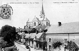
Autry-le-Châtel is a commune in the Loiret department in north-central France.

References

  1. "Populations légales 2016" (PDF). INSEE. December 2018. Retrieved 2019-10-24.
  2. "Arrondissement de Montargis (451)". INSEE . Retrieved 2019-10-01.
  3. Historique du Loiret