Aslacton

Last updated

Aslacton
Aslacton-g4.jpg
Aslacton St Michael
Norfolk UK location map.svg
Red pog.svg
Aslacton
Location within Norfolk
Area4.88 km2 (1.88 sq mi)
Population434 (2011)
  Density 89/km2 (230/sq mi)
OS grid reference TM156911
Civil parish
  • Aslacton
District
Shire county
Region
Country England
Sovereign state United Kingdom
Post town NORWICH
Postcode district NR15
Dialling code 01379
Police Norfolk
Fire Norfolk
Ambulance East of England
UK Parliament
Website http://aslactonpc.wixsite.com/aslactonpc
List of places
UK
England
Norfolk
52°28′31″N1°10′23″E / 52.47522°N 1.17316°E / 52.47522; 1.17316 Coordinates: 52°28′31″N1°10′23″E / 52.47522°N 1.17316°E / 52.47522; 1.17316
Aslacton Mill Aslacton Mill.jpg
Aslacton Mill

Aslacton is a village and civil parish in the English county of Norfolk. It is situated between Norwich and Diss, and is near Great Moulton. The closest town to Aslacton is Long Stratton.

Contents

The village name means 'Aslakr's farm/settlement'.

The civil parish has an area of 4.88 square kilometres and in the 2001 census had a population of 416 in 161 households, the population increasing to 434 at the 2011 census [1] , then to 445 at the 2021 census. For the purposes of local government, the parish falls within the district of South Norfolk.

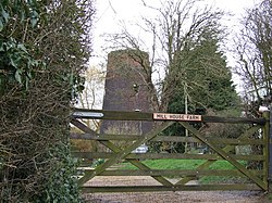
Its church, dating from 996AD, St Michael is one of 124 existing round-tower churches in Norfolk.

Aslacton has a primary school. It used to have a pub, now the building is used as a private residence. The village post office has closed. As of recent, it also has floristry services.

See also

Related Research Articles

<span class="mw-page-title-main">Dilham</span> Human settlement in England

Dilham is a village and civil parish in The Broads of Norfolk, England. At the 2001 census it covered an area of 6.55 km2 (2.53 sq mi) with a population of 301 in 128 homes, increasing to a population of 319 at the 2011 Census. It is on the River Ant just off the A149 road, near Stalham. The name means 'Dill homestead/village' or 'hemmed-in land where dill grows'. It is the limit of Broads navigation for larger boats, but small boats, and especially non-powered boats, can travel on the North Walsham & Dilham Canal until Honing.

<span class="mw-page-title-main">Denton, Norfolk</span> Human settlement in England

Denton is a village and civil parish in the county of Norfolk, England. At the 2001 census it had a population of 352 inhabitants living in 149 dwellings, reducing to a population of 326 at the 2011 census,. Located on the southern edge of the county, Denton has an area of 10.11 km2 (3.90 sq mi). The nearest towns are Harleston and Bungay. To the south lies the river Waveney, to the west Alburgh, to the north Topcroft and Bedingham and to the east Earsham.

<span class="mw-page-title-main">West Dereham</span> Human settlement in England

West Dereham is a village and civil parish in the English county of Norfolk. It covers an area of 13.51 km2 (5.22 sq mi) and had a population of 440 in 176 households as of the 2001 census, the population increasing to 450 at the 2011 Census. For the purposes of local government, it falls within the district of King's Lynn and West Norfolk.

<span class="mw-page-title-main">Titchwell</span> Human settlement in England

Titchwell is a village and civil parish in Norfolk, England. It is situated on the north Norfolk coast some 2 km (1.2 mi) west of the village of Brancaster, 9 km (5.6 mi) north-east of the seaside resort of Hunstanton, 30 km (19 mi) north of the town of King's Lynn and 70 km (43 mi) north-west of the city of Norwich.

<span class="mw-page-title-main">Quidenham</span> Human settlement in England

Quidenham is a small rural village and civil parish in the English county of Norfolk. It covers an area of 22.51 km2 (8.69 sq mi) and had a population of 576 in 183 households at the 2001 census, falling to a population of 560 living in 189 households at the 2011 Census. For the purposes of local government, it falls within the district of Breckland.

<span class="mw-page-title-main">Ashmanhaugh</span> Human settlement in England

Ashmanhaugh is a village and civil parish in the English county of Norfolk, situated some 20 km north east of Norwich. See Inside the churches of St Swithins here & Beeston St Lawrence here. Apart from Ashmanhaugh village itself, the parish also includes Beeston St Lawrence, which was a separate parish until 1935.

<span class="mw-page-title-main">Keswick, South Norfolk</span> Human settlement in England

Keswick is a village in the civil parish of Keswick and Intwood, in Norfolk, England. It is situated some 3 miles (4.8 km) to the south of the city of Norwich. It should not be mistaken for the coastal settlement of Keswick, near Bacton, which is also in Norfolk.

<span class="mw-page-title-main">Yaxham</span> Human settlement in England

Yaxham is a village and civil parish in centre of the English county of Norfolk. The parish includes the village of Yaxham, together with the neighbouring community of Clint Green. Together, they lay some 2 miles (3.2 km) south of Dereham and 20 miles (32 km) west of Norwich.

<span class="mw-page-title-main">Wramplingham</span> Human settlement in England

Wramplingham is a village and civil parish in the English county of Norfolk. It is situated on the River Tiffey some 4 miles (6.4 km) north of Wymondham and 7 miles (11 km) west of Norwich. The civil parish has an area of 3.47 square kilometres and in 2001 had a population of 110 in 44 households, increasing to a population of 115 in 51 households at the 2011 Census. For the purposes of local government, the parish falls within the district of South Norfolk.

<span class="mw-page-title-main">Witton, North Norfolk</span> Human settlement in England

Witton is a village and civil parish in the English county of Norfolk. It is located 8 km (5.0 mi) east of the town of North Walsham and 30 km (19 mi) north of the city of Norwich. It should not be confused with the quite different Norfolk village of similar name in the parish of Postwick with Witton, some 8 km (5.0 mi) east of Norwich.

<span class="mw-page-title-main">Morningthorpe</span> Human settlement in England

Morningthorpe is a village in the civil parish of Morningthorpe and Fritton in Norfolk, England. It is situated some 20 kilometres (12 mi) south of the city of Norwich. The parish includes the villages of Morningthorpe and Fritton. The two villages are 1 km apart.

<span class="mw-page-title-main">Mautby</span> Human settlement in England

Mautby is a village and civil parish in the English county of Norfolk, in the East Flegg Hundred. The parish comprises a largely rural area along the north bank of the River Bure, and also includes the small villages of Runham and Thrigby. It is located some 10 km (6.2 mi) northwest of the town of Great Yarmouth and 30 km (19 mi) east of the city of Norwich.

<span class="mw-page-title-main">Rollesby</span> Human settlement in England

Rollesby is a village and civil parish in the English county of Norfolk. It is situated on the A149 road, adjacent to Rollesby Broad and Ormesby Broad, about 12 km (7.5 mi) north-west of the town of Great Yarmouth and 30 km (19 mi) east of the city of Norwich.

<span class="mw-page-title-main">Somerton, Norfolk</span> Human settlement in England

Somerton is a civil parish in the English county of Norfolk. It comprises the twin villages of East Somerton and West Somerton and is situated some 14 km (8.7 mi) north of the town of Great Yarmouth, 35 km (22 mi) north-east of the city of Norwich, and 2 km (1.2 mi) from the sea.

<span class="mw-page-title-main">Burnham Norton</span> Village in Norfolk, England

Burnham Norton is a village and civil parish in the English county of Norfolk, one of the Burnhams, an adjacent group in the northernmost part of Norfolk, on the A149 some 2 km north of the larger village of Burnham Market, 35 km north-east of King's Lynn and 60 km north-west of Norwich. "Burnham" means "Homestead/village on the River Burn" or perhaps, "hemmed-in land on the River Burn". "Norton", meaning "North farm/settlement", distinguishes it from the other Norfolk Burnhams.

<span class="mw-page-title-main">Framingham Earl</span> Human settlement in England

Framingham Earl is a small village situated south of Norwich, in the English county of Norfolk. It is next to Poringland and Framingham Pigot. It covers an area of 2.56 km2 (0.99 sq mi) and had a population of 834 in 354 households at the 2001 census, increasing to a population of 871 in 363 households at the 2011 Census.

<span class="mw-page-title-main">East Walton</span> Human settlement in England

East Walton is a civil parish in the English county of Norfolk. It covers an area of 10.81 km2 (4.17 sq mi) and had a population of 94 in 40 households at the 2001 census. At the 2011 Census the population remained less than 100 and was included in the civil parish of West Acre. For the purposes of local government, it falls within the district of King's Lynn and West Norfolk.

Ilketshall St Margaret Human settlement in England

Ilketshall St Margaret is a village and civil parish in the north of the English county of Suffolk. It is 3 miles (4.8 km) south of the market town of Bungay in the East Suffolk district. The parish is part of the area known as the Saints and had a population of 160 at the 2011 United Kingdom census.

<span class="mw-page-title-main">Topcroft</span> Human settlement in England

Topcroft is a village and a civil parish in the English county of Norfolk. The village is around 7 miles (11 km) north-west of Bungay and 14 miles (23 km) south of Norwich in the South Norfolk district. The village lies close to the B1527 road.

<span class="mw-page-title-main">Little Snoring</span> Village in Norfolk, England

Little Snoring is a village and a civil parish in Norfolk, England.

References

  1. "Parish Population 2011" . Retrieved 6 September 2015.[ permanent dead link ]

http://kepn.nottingham.ac.uk/map/place/Norfolk/Aslacton