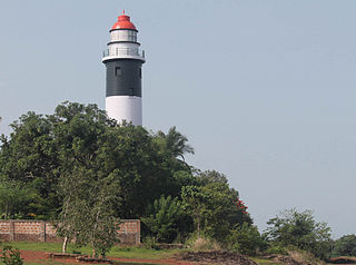
Godhra is a road and rail junction and a commercial centre for timber and agricultural produce. Industries include oilseed pressing, flour milling, and glass manufacture. Godhra is a municipality in Panchmahal district in Indian state of Gujarat. It is the administrative headquarters of the Panchmahal district. Originally the name came from gou which means "cow" and dhara which has two meanings: one in Sanskrit which means "hold" or "land" and the other in Hindi which means "flow": It means the Land of the Cow.

Jhalrapatan is a town in Jhalawar district in the south of Rajasthan state in India. Its population is approximately 37,506. The former Chief Minister of Rajasthan, Vasundhara Raje, has been three times elected as MLA from this town. The name may be derived from "city of [temple] bells", or from the Jhala tribe of regent Jalim Singh. The first municipality was established in Jhalrapatan. India's last fort was built here.

Marthandam is a major trade centre in Kuzhithuraii municipality across National Highway in the Kanyakumari district of Tamil Nadu, India. Earlier days it was known by the name Thoduvetty, it was a portion of Kanyakumari district which was added to the state of Tamil Nadu on 1 November 1956.

Nahan is a town in Himachal Pradesh in India and is the headquarters of the Sirmaur District It was the capital of the former Sirmur princely state.

Kanyakumari district is one of the 38 districts in Tamil Nadu state and the southernmost district in mainland India. It stands second in terms of population density among the districts of Tamil Nadu and the second most urbanized, next only to Chennai district. It is also the richest district in Tamil Nadu in terms of per capita income, and also tops the state in Human Development Index (HDI), literacy, and education. The district's headquarters is Nagercoil.

Tikamgarh district is one of the 52 districts of Madhya Pradesh state in central India. Tikamgarh town is the district headquarters. The district is part of Sagar Division.

Khamgaon is a city in Buldhana District, Maharashtra, India. It is the largest town in Buldhana district. It is well connected to all other big cities of India as well as Maharashtra with a National Highway 6. The city also has a railway network to connect with the rest of India; this was connected in 1870. Khamgaon Terminal has a single platform from where a local train runs five times daily to the main Mumbai–Kolkata line. The city needs express connectivity, so Indian Railways has decided to give halt to some express trains at Jalamb Junction so people can travel accordingly. The city has a big market as well. The city imports and exports many goods. Daily freight trains depart from and arrive in the city.

Koyilandy is a municipality in the taluk of the same name in Kozhikode district, Kerala on the Malabar Coast. The town is located between Kozhikode (Calicut) and Vadakara (Badagara) on National Highway 66.. Koyilandy harbour is the largest fishing harbour in the Asia. The northern part of Pulimuttu is 1600 m long and the southern part is 915 m long. The picturesque Kappad beach lies near Koyilandy. India's first mangrove museum is situated in Koyilandy. Koyilandy is well connected to major towns like Kozhikode, Vatakara, Thamarassery, Balussery & Perambra.

Thiruverkadu is a western suburb of Chennai, Tamil Nadu. It comes under Thiruvallur district administration. It is famous for its Devi Karumariamman Temple. There is also Vedapureeswarar Temple in Thiruverkadu, where Lord Shiva and Goddess Parvathi are seen in their wedding pose inside the sanctum sanctorum. As of 2011, the town had a population of 62,289.

Authoor is a panchayat town in Thoothukudi district of the Indian state of Tamil Nadu.

Dongargarh is a city and municipality in Rajnandgaon District in the state of Chhattisgarh, India and the site of the Bambleshwari Temple. A prominent pilgrim destination in Rajnandgaon District, the city lies about 35 kilometres (22 mi) west from Rajnandgaon, 67 kilometres (42 mi) west from Durg and 132 kilometres (82 mi) east from Bhandara which are situated on National Highway 6. Featuring majestic mountains and ponds, Dongargarh is derived from the words: Dongarh meaning 'mountains' and garh meaning 'fort'.

Edathala is a Gram panchayat near Aluva town. It is also a village in Aluva taluk of Ernakulam district, in the state of Kerala, India.

Gormi is a town and a nagar panchayat in Bhind district in the Indian state of Madhya Pradesh. Gormi is located at 26.6°N 78.52°E.

Kanore is a town in Udaipur district in the Indian state of Rajasthan.

Mallasamudram is a small town in Thiruchengode taluk, Namakkal district in the Indian state of Tamil Nadu. Mallasamudram is also known as "Mallai village", "Mallai", Mallasamudram is about 25 km from Salem on the Salem - Tiruchengode Road, via Attayampatti. It has an average elevation of 22048 metres.

Moolakaraipatti is a Panchayat town in Tirunelveli district in the Indian state of Tamil Nadu. It's an ancient town from the days of Pandyas. Now a Days Class Municipality. The old temple relics in that area speaks for itself. The Muslim and Christian settlement here is also from old days. The main communities here are reddyiar,Konar, Nadars,Sambavars,Parayars,Thevar and Muslims along with other backward communities. People are very hardworking. The Konthankulam Bird Sanctuary is 4 km from here. A British English School, The Reach School. A Higher Secondary School and a Polytechnic adorns this township. A petrol pump is a km away. A good hospital, TNEB distribution station, a solar power station, Police Station and large number of shops constituting a bazaar lies in the main centre. Agriculture is the main income. A good cinema hall lies closed because of the general public non interest in such entertainments. The richness of the soil here produce the best rice, dal, pies, tapioca, plantains, sweet potato, all vegetables, which are sold at Tirunelveli and Valliyoor Market. Cattle rearing and Milk produce are also a business here.

Nainwan is a tehsil of Bundi district and a municipality in the Hadoti region of the state of Rajasthan in India.

Kulasekharam is a town located in the district of Kanyakumari, Tamil Nadu, India. It is one of the most important business centres in the district, after Marthandam. It is assumed that the overall daily money exchange within Kulasekharam is more than 5 crores.

Vadugam is a panchayat village in Namakkal district in the Indian state of Tamil Nadu. It is 32 km from Salem, 333 km southwest of Chennai, 242 km south of Bangalore and 118 km northwest of Tiruchirapalli (Trichy). Mr.M.Balan,B.Sc., is the current Panchayat President of Vadugam.
Patanvav is a large village 23 km from Dhoraji Town, 13 km from Upleta, 21 km from Manavadar, and 115 km from Rajkot by good motarable roads. It is in Dhoraji taluka of Rajkot district in Gujarat. Patanvav is at an elevation of 68 meters above mean sea level. Postal code is 360430. Dhoraji and Upleta towns are connected by railways on Rajkot-Jetalsar-Porbandar line. Village is situated in the foothills of the Osham Hills.


