
Clarence Valley Council is a local government area in the Northern Rivers region of New South Wales, Australia.

Port Macquarie-Hastings Council is a local government area in the mid north coast region of New South Wales, Australia.

Tweed Shire is a local government area located in the Northern Rivers region of New South Wales, Australia. The shire is located adjacent to the border with Queensland where it meets the Tasman Sea coast. The shire, administered from the town of Murwillumbah, covers an area of 1,321.0 square kilometres (510.0 sq mi), and has existed as a local government entity since 1947. It was named for the Tweed River.

Langhorne Creek is a town in South Australia. At the 2016 census, Langhorne Creek had a population of 427.

Kyogle Council is a local government area in the Northern Rivers region of New South Wales, Australia.

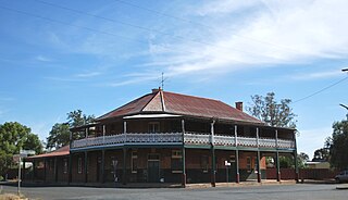
Boree Creek is a town in the Riverina district of New South Wales, Australia. The town is located 539 kilometres (335 mi) south west of the state capital, Sydney and 82 kilometres (51 mi) west of the regional centre, Wagga Wagga. Boree Creek is situated in the Federation Council local government area but is closer to the town of Lockhart. At the 2016 census, Boree Creek had a population of 64.
Yerong Creek is a town in the Riverina area of southern New South Wales, Australia. It is about 46 kilometres (29 mi) south-west of Wagga Wagga on the Olympic Highway. At the 2016 census, Yerong Creek had a population of 173.

Moggs Creek is an Australian coastal hamlet on the Great Ocean Road between Aireys Inlet and Lorne. In the 2016 census, Moggs Creek had a population of 89 people.
Bouldercombe is a rural town and locality in the Rockhampton Region, Queensland, Australia. In the 2016 census, Bouldercombe had a population of 1,085 people.

Spring Creek is a locality split between the Toowoomba Region and the Southern Downs Region, Queensland, Australia.

Queanbeyan–Palerang Regional Council is a local government area located in the Southern Tablelands region of New South Wales, Australia. The council was formed on 12 May 2016 through a merger of the City of Queanbeyan and Palerang Council.
Pierces Creek is a rural locality in the Toowoomba Region, Queensland, Australia. It was formerly known as Virginia. In the 2016 census, Pierces Creek had a population of 70 people.

Back Forest is a locality in the City of Shoalhaven in New South Wales, Australia. It lies to the north of the Shoalhaven River and to the east of Broughton Creek. It is northeast of Nowra. At the 2016 census, it had a population of 84.
Grahams Creek is a rural locality in the Fraser Coast Region, Queensland, Australia. In the 2016 census, Grahams Creek had a population of 157 people.
Coles Creek is a rural locality in the Gympie Region, Queensland, Australia. In the 2016 census, Coles Creek had a population of 44 people.
Cressbrook Creek is a rural locality in the Toowoomba Region, Queensland, Australia. In the 2016 census, Cressbrook Creek had a population of 20 people.
Doctor Creek is a rural locality in the Toowoomba Region, Queensland, Australia. In the 2016 census, Doctor Creek had a population of 37 people.
Upper Cooyar Creek is a rural locality in the Toowoomba Region, Queensland, Australia. In the 2016 census, Upper Cooyar Creek had a population of 17 people.
Emu Creek is a rural locality in the Toowoomba Region, Queensland, Australia. In the 2016 census, Emu Creek had a population of 80 people.
Merritts Creek is a rural locality in the Toowoomba Region, Queensland, Australia. In the 2016 census, Merritts Creek had a population of 88 people.
