
Clarence Valley Council is a local government area in the Northern Rivers region of New South Wales, Australia.

Copley is a town in the Australian state of South Australia. At the 2006 census, Copley had a population of 104.
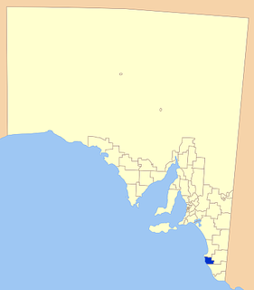
The District Council of Robe is a local government area located in the Limestone Coast area of South Australia. The main offices are in Robe, the town after which the council is named. The district relies on a mix of agriculture, fisheries and tourism as major components of its economy.

Carlton is a suburb in southern Sydney, in the state of New South Wales, Australia. Carlton is located 15 kilometres south of the Sydney central business district and is part of the St George area. Carlton lies across the boundary of two local government areas, the Georges River Council and the Bayside Council.
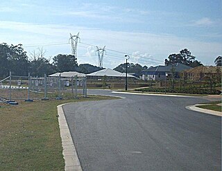
Warner is a suburb in the Moreton Bay Region, Queensland, Australia. In the 2016 census, Warner had a population of 11,411 people.

Tweed Shire is a local government area located in the Northern Rivers region of New South Wales, Australia. The shire is located adjacent to the border with Queensland where it meets the Tasman Sea coast. The shire, administered from the town of Murwillumbah, covers an area of 1,321.0 square kilometres (510.0 sq mi), and has existed as a local government entity since 1947. It was named for the Tweed River.
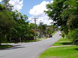
Bray Park is a suburb of Moreton Bay Region, Queensland, Australia. It is a part of Brisbane metropolitan area. In the 2016 census, Bray Park had a population of 10,246 people.
Yerong Creek is a town in the Riverina area of southern New South Wales, Australia. It is about 46 kilometres (29 mi) south-west of Wagga Wagga on the Olympic Highway. At the 2016 census, Yerong Creek had a population of 173.

Brendale is a suburb in the Moreton Bay Region, Queensland, Australia. In the 2016 census, Brendale had a population of 2,758 people.
England Creek is a rural locality split between Somerset Region and City of Brisbane, Queensland, Australia. In the 2016 census England Creek had a population of 33 people.

Price is a town and locality on Yorke Peninsula in South Australia. It is within the Yorke Peninsula Council local government area and is 131 kilometres (81 mi) north west of the centre of state capital, Adelaide.

Laceys Creek is a rural locality in the Moreton Bay Region, Queensland, Australia. In the 2016 census, Laceys Creek had a population of 278 people.
Bray is a locality in South Australia. It is roughly contiguous with the land administration division, the Hundred of Bray, after which it was named.
Cattle Creek is a rural locality in the Toowoomba Region, Queensland, Australia. In the 2016 census Cattle Creek had a population of 19 people.
Pierces Creek is a rural locality in the Toowoomba Region, Queensland, Australia. It was formerly known as Virginia. In the 2016 census, Pierces Creek had a population of 70 people.
Cherry Creek is a rural locality in the Toowoomba Region, Queensland, Australia. In the 2016 census Cherry Creek had a population of 49 people.>
Googa Creek is a rural locality in the Toowoomba Region, Queensland, Australia. In the 2016 census Googa Creek had a population of 43 people.
Coles Creek is a rural locality in the Gympie Region, Queensland, Australia. In the 2016 census, Coles Creek had a population of 44 people.
Doctor Creek is a rural locality in the Toowoomba Region, Queensland, Australia. In the 2016 census, Doctor Creek had a population of 37 people.
Merritts Creek is a rural locality in the Toowoomba Region, Queensland, Australia. In the 2016 census, Merritts Creek had a population of 88 people.
