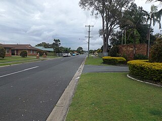
The town is part of the Tweed Shire local Government area. Its postcode is 2486. Two schools are located there - Terranora Public School and the senior campus of Lindisfarne Anglican Grammar School.
Well known children's author, Hesba Fay Brinsmead, made her home in Terranora from 1976 until the early 2000s (she died in nearby Murwillumbah).
Terranora is also home to Luke Garner, Penrith Panthers Second-rower and St Kilda Saints FC player Sam Gilbert who became the 30th player to play 200 games for the club in its 145 year history.
Demographics
At the 2021 census, Terranora recorded a population of 3,365 people, 49.4% male and 50.6% female.
The median age was 42, 4 years above the national median of 38.
82.3% of people living in Terranora were born in Australia. The other top responses for country of birth were England 4.0%, New Zealand 2.4%, India 0.6%, South Africa 0.4%, and Philippines 0.4%.
91.8% of people spoke only English at home; the next most common languages were 0.3% German, 0.3% Russian, 0.3% Malayalam, 0.3% Punjabi, and 0.3% Thai.
Berwick is a suburb in Melbourne, Victoria, Australia, 41 kilometres (25 mi) south-east of Melbourne's central business district, located within the City of Casey local government area. Berwick recorded a population of 50,298 at the 2021 census.
Eurobodalla Shire is a local government area located in the South Coast region of New South Wales, Australia. The Shire is located in a largely mountainous coastal region and situated adjacent to the Tasman Sea, the Princes Highway and the Kings Highway.
Liverpool Plains Shire is a local government area located in the North West Slopes region of New South Wales, Australia. The Shire was formed on 17 March 2004 by the amalgamation of Quirindi Shire with parts of Parry, Murrurundi and Gunnedah shires.
Tweed Heads is a town on the east coast of Australia. It is located on the Tweed River in the Northern Rivers region of New South Wales, in the Tweed Shire, next to the border with Queensland and is adjacent to its "twin town" of Coolangatta, which is a suburb of the Gold Coast. It is often referred to as a town where people can change time zones – even celebrate New Year twice within an hour – simply by crossing the street, due to its proximity to the Queensland border, and the fact that New South Wales observes daylight saving whereas Queensland does not.
Murwillumbah is a town in the Northern Rivers region of New South Wales, Australia, in the Tweed Shire, on the Tweed River. Sitting on the south eastern foothills of the McPherson Range in the Tweed Volcano valley, Murwillumbah is 848 km north-east of Sydney, 13 km south of the Queensland border and 132 km south of Brisbane.
Uki is a village situated near Mount Warning in the Tweed Valley of far northern New South Wales, Australia in the Tweed Shire. At the 2011 census, Uki had a population of 765 people. Its name may have come from an aboriginal word for "small water plant with a yellow flower and edible root".
St Arnaud is a town in the Wimmera region of Victoria, Australia, 244 kilometres north west of the capital Melbourne. It is in the Shire of Northern Grampians local government area. At the 2021 census, St Arnaud had a population of 2,318.
Gwydir Shire is a local government area located in the New England region of New South Wales, Australia. The northern boundary of the Shire is located adjacent to the border between New South Wales and Queensland.
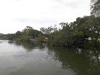
Tweed Shire is a local government area located in the Northern Rivers region of New South Wales, Australia. It is adjacent to the border with Queensland, where that meets the Tasman Sea. Administered from the town of Murwillumbah, Tweed Shire covers an area of 1,321 square kilometres (510 sq mi), and has existed as a local government entity since 1947. It was named for the Tweed River.
Banora Point is a suburb located in the Northern Rivers region of New South Wales, Australia in Tweed Shire. Together with Tweed Heads South and Terranora it had a combined population of 27,368 in 2001, including 21,457 (78.4%) Australian-born persons and 525 (1.9%) indigenous persons. In the 2016 census, Banora Point had a population of 16,167.
Byron Shire is a local government area located in the Northern Rivers region of New South Wales, Australia. The shire is located adjacent to the Coral Sea about 50 kilometres (31 mi) south of the Queensland border. The shire, administered from the town of Mullumbimby, covers an area of 566.7 square kilometres (218.8 sq mi), and has existed as a local government entity since 1906. The shire was named for Cape Byron, itself named by Captain James Cook in May 1770 in honour of Vice-Admiral John Byron.
Ballina Shire is a local government area in the Northern Rivers region of New South Wales, Australia. The Shire was formed on 1 January 1977 by the amalgamation of the Municipality of Ballina and Tintenbar Shire. The Shire is located adjacent to the Tasman Sea and the Pacific Highway. The council seat is located in the town of Ballina. The population of the Ballina Shire area was 44,208 in June 2018.
Bellingen Shire is a local government area in the Mid North Coast region of New South Wales, Australia. The shire is located adjacent to the Pacific Highway, Waterfall Way and the North Coast railway line.
Chinderah is a town in the Tweed Shire. It is located south of Tweed Heads and next to the seaside township of Kingscliff. An industrial estate, golf course and small shopping precinct are located within the area.
Tweed Heads South is a suburb located on the Tweed River in the Northern Rivers region of New South Wales, Australia, in the Tweed Shire.
Tweed Heads West is a suburb of Tweed Heads, located on the Tweed River in north-eastern New South Wales, Australia, in Tweed Shire along the Queensland and New South Wales border.
Bilambil is a town located in north-eastern New South Wales, Australia, in the Tweed Shire.
Cudgen is a town located in north-eastern New South Wales, Australia, in the Tweed Shire. It is built on the former land of the Coodjingburra clan of the Minyungbal. There is a primary school on Collier Street, the Cudgen Public School.
Round Mountain is a town located in north-eastern New South Wales, Australia, in the Tweed Shire.
Dungay is a town located in north-eastern New South Wales, Australia, in the Tweed Shire.
This page is based on this Wikipedia article Text is available under the CC BY-SA 4.0 license; additional terms may apply. Images, videos and audio are available under their respective licenses.