Hertford County is a county located in the U.S. state of North Carolina. As of the 2010 census, the population was 24,669. Its county seat is Winton. It is classified within the region known in the 21st century as the Inner Banks.

Gates County is a small, rural county located in the northeast portion of the U.S. state of North Carolina, on the border with Virginia. As of the 2010 census, the population was 12,197. Its county seat is Gatesville.

Chowan County is one of the 100 counties located in the U.S. state of North Carolina. As of the 2010 census, the population was 14,793. Its county seat is Edenton. The county was created between 1668 and 1671 as Shaftesbury Precinct and later renamed Chowan Precinct. It gained county status in 1739.

Bertie County is a county located in the northeast area of the U.S. state of North Carolina. As of the 2010 census, the population was 21,282. Its county seat is Windsor. The county was created in 1722 as Bertie Precinct and gained county status in 1739.

Edenton is a town in and the county seat of Chowan County, North Carolina, United States, on Albemarle Sound. The population was 5,004 at the 2010 census. Edenton is located in North Carolina's Inner Banks region. In recent years Edenton has become a popular retirement location and a destination for heritage tourism.

Murfreesboro is a town in Hertford County, North Carolina, United States. The population was 2,835 at the 2010 census. The town is home to Chowan University.

Clarence Valley Council is a local government area in the Northern Rivers region of New South Wales, Australia.
The Nottoway River is a river in the U.S. State of Virginia and northeastern North Carolina that is 155 miles in length. It begins in Prince Edward County and flows to create the Chowan River. The river is part of the Chowan River system, which flows into Albemarle Sound in North Carolina.

Tweed Shire is a local government area located in the Northern Rivers region of New South Wales, Australia. The shire is located adjacent to the border with Queensland where it meets the Tasman Sea coast. The shire, administered from the town of Murwillumbah, covers an area of 1,321.0 square kilometres (510.0 sq mi), and has existed as a local government entity since 1947. It was named for the Tweed River.

The Chowan River is a blackwater river formed with the merging of Virginia's Blackwater and Nottoway rivers near the stateline between Virginia and North Carolina. According to the USGS a variant name is Choan River.

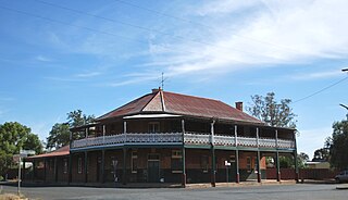
Yerong Creek is a town in the Riverina area of southern New South Wales, Australia. It is about 46 kilometres (29 mi) south-west of Wagga Wagga on the Olympic Highway. At the 2016 census, Yerong Creek had a population of 173.
The Chowanoke, also spelled Chowanoc, are an Algonquian-language Native American tribe who historically inhabited the coastal area of the Upper South of the United States. At the time of the first English contacts in 1585/6, they were the largest and most powerful Algonquian tribe in present-day North Carolina, occupying most or all of the coastal banks of the Chowan River in the northeastern part of the state. Their peoples had occupied their main town since 825 AD. Earlier indigenous cultures occupied the area from 4500 BC.

Spring Creek is a locality split between the Toowoomba Region and the Southern Downs Region, Queensland, Australia.

Pierces Creek is a rural locality in the Toowoomba Region, Queensland, Australia. It was formerly known as Virginia. In the 2016 census, Pierces Creek had a population of 70 people.

Coles Creek is a rural locality in the Gympie Region, Queensland, Australia. In the 2016 census, Coles Creek had a population of 44 people.

Cressbrook Creek is a rural locality in the Toowoomba Region, Queensland, Australia. In the 2016 census, Cressbrook Creek had a population of 20 people.

Doctor Creek is a rural locality in the Toowoomba Region, Queensland, Australia. In the 2016 census, Doctor Creek had a population of 37 people.

Upper Cooyar Creek is a rural locality in the Toowoomba Region, Queensland, Australia. In the 2016 census, Upper Cooyar Creek had a population of 17 people.

Emu Creek is a rural locality in the Toowoomba Region, Queensland, Australia. In the 2016 census, Emu Creek had a population of 80 people.

Merritts Creek is a rural locality in the Toowoomba Region, Queensland, Australia. In the 2016 census, Merritts Creek had a population of 88 people.


