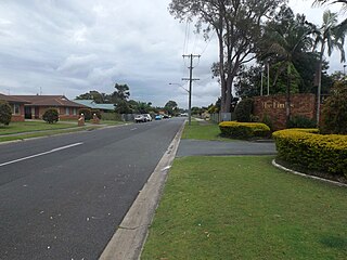
Melton is a suburb on the outskirts of Melbourne, Victoria. The suburb is located 47 kilometres (29 mi) west of Melbourne's Central Business District on the city's western rural-urban fringe. It is the administrative centre of the City of Melton local government area. As of the 2021 Australian census, the suburb has a population of 7,953.

Berwick is a large suburb in Melbourne, Victoria, Australia, 41 kilometres (25 mi) south-east of Melbourne's central business district, located within the City of Casey local government area. Berwick recorded a population of 50,298 at the 2021 census.

Tweed Heads is a coastal city at the mouth of the Tweed River in the Northern Rivers region of the state of New South Wales, Australia. Tweed Heads is the northernmost town in New South Wales, and is located in the Tweed Shire local government area. It is situated 830 km (520 mi) north of Sydney and 103 km (64 mi) south of Brisbane. The town is next to the border with Queensland and is adjacent to its "twin town" of Coolangatta, which is a suburb of the Gold Coast in Queensland.

Murwillumbah is a town in the Northern Rivers region of New South Wales, Australia, in the Tweed Shire, on the Tweed River. Sitting on the south eastern foothills of the McPherson Range in the Tweed Volcano valley, Murwillumbah is 848 km north-east of Sydney, 13 km south of the Queensland border and 132 km south of Brisbane.
Medowie is a suburb of the Port Stephens local government area in the Hunter Region of New South Wales, Australia. It is located approximately 34 km (21 mi) by road north of Newcastle, not far from RAAF Base Williamtown and is home to many of the personnel stationed there. The Worimi people are the traditional owners of the Port Stephens area.

Rosebery is an inner southern suburb of Sydney, in the state of New South Wales, Australia. It is 6 kilometres south of the Sydney central business district and is part of the local government areas of the City of Sydney and the Bayside Council.

Maroochydore is a coastal town in the Sunshine Coast Region, Queensland, Australia. In the 2021 census, the urban area of Maroochydore had a population of 63,673 people.

Tweed Shire is a local government area located in the Northern Rivers region of New South Wales, Australia. It is adjacent to the border with Queensland, where that meets the Coral Sea. Administered from the town of Murwillumbah, Tweed Shire covers an area of 1,321 square kilometres (510 sq mi), and has existed as a local government entity since 1947. It was named for the Tweed River.

Raymond Terrace, locally known as "The Terrace”, is a town in the Hunter Region of New South Wales, Australia, about 26 km (16 mi) by road north of Newcastle on the Pacific Highway. Established in 1837 it is situated at the confluence of the Hunter and Williams rivers. The town was named after Lieutenant Raymond, who had explored the Hunter River in 1797 and described the terraced appearance of trees in the area. Governor Lachlan Macquarie camped in the area in 1818, using "Raymond's Terrace" as the name for the place where his party had camped.

Killarney Vale is a suburb of the Central Coast region of New South Wales, Australia, located approximately 5 kilometres south of The Entrance. It is part of the Central Coast Council local government area.

Barooga is a border town in the Murray region of New South Wales, Australia, located in the Berrigan Shire local government area. It is situated just north of the Murray River which forms the border with Victoria. Barooga's population at the 2021 census was 1,888.

Pottsville is a town in the Northern Rivers region of New South Wales, Australia in Tweed Shire. At the 2021 Census, Pottsville had a population of 7,209. Bill Potts owned the first house in Pottsville around and the location was initially named Potts Point. Soon though, the town was renamed Pottsville to alleviate any confusion with the place of the same name in Sydney.

Twin Waters is a coastal suburb of Maroochydore in the Sunshine Coast Region, Queensland, Australia. In the 2021 census, Twin Waters had a population of 2,966 people.

Queanbeyan East is a suburb of Queanbeyan in New South Wales, Australia. It is on the north eastern side of the Queanbeyan River, with the river forming its western boundary. At the 2021 census, it had a population of 4,240.

Clear Island Waters is a suburb of the City of Gold Coast in Queensland, Australia. In the 2021 census, Clear Island Waters had a population of 4,395 people.

Saint Joseph's College (SJC) is an independent Roman Catholic co-educational secondary day school, located in Banora Point, near Tweed Heads, the Northern Rivers region of New South Wales, Australia. Founded in 1993, the college is administered by the Roman Catholic Diocese of Lismore and associated with the Parish of St Joseph, along with St Joseph's Primary School and St James' Primary School, the latter of which is situated on the same campus. The college first opened in 1993 alongside St James' Primary School, with 115 students.

Tweed Heads South is a suburb located on the Tweed River in the Northern Rivers region of New South Wales, Australia, in the Tweed Shire.
Cudgen is a town located in north-eastern New South Wales, Australia, in the Tweed Shire. It is built on the former land of the Coodjingburra clan of the Minyungbal. There is a primary school on Collier Street, the Cudgen Public School.

Rosslea is a suburb of Townsville in the City of Townsville, Queensland, Australia. In the 2021 census, Rosslea had a population of 1,903 people.

Town Common is a coastal suburb of Townsville in the City of Townsville, Queensland, Australia. In the 2021 census, Town Common had "no people or a very low population".


