
Seaforth is a suburb of Northern Sydney, in the state of New South Wales, Australia. Seaforth is located 12 kilometres north-east of the Sydney central business district in the local government area of Northern Beaches Council and is part of the Northern Beaches region.

Neutral Bay is a suburb on the Lower North Shore of Sydney, New South Wales, Australia. Neutral Bay is around 1.5 kilometres north of the Sydney central business district, in the local government area of North Sydney Council.
Dural is a semi rural suburb of Sydney, in the state of New South Wales, Australia 36 kilometres north-west of the Sydney central business district in the local government areas of Hornsby Shire and The Hills Shire. Dural is part of the Hills District. Round Corner is a locality in the south-western part of Dural.

Holbrook is a small town on the traditional lands of the Wiradjuri people in Southern New South Wales, Australia. It is on the Hume Highway, 384 kilometres (239 mi) by road North East of Melbourne and 492 kilometres (306 mi) by road south-west of Sydney between Tarcutta and Albury. The town is in the Greater Hume Shire which was established in May 2004 from the merger of Culcairn Shire with the majority of Holbrook Shire and part of the Hume Shire. At the 2016 census, Holbrook had a population of 1,715 people. The district around Holbrook is renowned for local produce including merino wool, wheat and other grains, lucerne, fat cattle and lamb.

City of Cessnock is a local government area in the Hunter region of New South Wales, Australia. The area under administration is located to the west of Newcastle. The largest population centre and council seat is the city of Cessnock.

Bass Hill, a suburb of local government area City of Canterbury-Bankstown, is located 23 kilometres south-west of the Sydney central business district, in the state of New South Wales, Australia, and is a part of the South-western Sydney region.
Glenwood is a suburb of Sydney, in the state of New South Wales, Australia. Glenwood is located 33 kilometres north-west of the Sydney central business district in the local government area of the City of Blacktown. Glenwood is part of the Hills District within the Greater Western Sydney region.

Silverwater is a suburb in western Sydney, in the state of New South Wales, Australia. Silverwater is located 15 kilometres west of the Sydney central business district on the southern bank of the Parramatta River within the local government area of City of Parramatta.

Rushcutters Bay is a harbourside inner-east suburb of Sydney, in the state of New South Wales, Australia 3 kilometres east of the Sydney central business district, in the local government area of the City of Sydney.

Denistone West is a suburb in Northern Sydney, in the state of New South Wales, Australia. Denistone West is located 16 kilometres north-west of the Sydney central business district in the local government area of the City of Ryde. Denistone and Denistone East are separate suburbs; Denistone West was gazetted as a suburb in its own right on 5 February 1999.

Glenmore Park is a suburb of Sydney, in the state of New South Wales, Australia. Glenmore Park is located 54 kilometres (34 mi) west of the Sydney central business district, in the local government area of the City of Penrith and is part of the Greater Western Sydney region.

Lane Cove North is a suburb on the Lower North Shore of Sydney, in the state of New South Wales, Australia. Lane Cove North is located 11 kilometres north-west of the Sydney central business district, in the local government areas of the Municipality of Lane Cove and the City of Willoughby. Lane Cove and Lane Cove West are separate suburbs.

Tweed Shire is a local government area located in the Northern Rivers region of New South Wales, Australia. It is adjacent to the border with Queensland, where that meets the Coral Sea. Administered from the town of Murwillumbah, Tweed Shire covers an area of 1,321 square kilometres (510 sq mi), and has existed as a local government entity since 1947. It was named for the Tweed River.

Byron Shire is a local government area located in the Northern Rivers region of New South Wales, Australia. The shire is located adjacent to the Coral Sea about 50 kilometres (31 mi) south of the Queensland border. The shire, administered from the town of Mullumbimby, covers an area of 566.7 square kilometres (218.8 sq mi), and has existed as a local government entity since 1906. The shire was named for Cape Byron, itself named by Captain James Cook in May 1770 in honour of Vice-Admiral John Byron.

Telegraph Point is a small village on the North Coast of New South Wales, Australia. It is located on the Pacific Highway north of Port Macquarie, and on the North Coast railway line. The village spans both sides of the Wilson River.
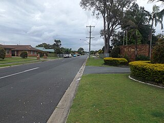
Tweed Heads South is a suburb located on the Tweed River in the Northern Rivers region of New South Wales, Australia, in the Tweed Shire.
Bilambil Heights is a town located in north-eastern New South Wales, Australia, in the Tweed Shire.
Casuarina is a town located in north-eastern New South Wales, Australia, in the Tweed Shire.
Cudgen is a town located in north-eastern New South Wales, Australia, in the Tweed Shire. It is built on the former land of the Coodjingburra clan of the Minyungbal. There is a primary school on Collier Street, the Cudgen Public School.
South Murwillumbah is a locality located in north-eastern New South Wales, Australia, in the Tweed Shire.
