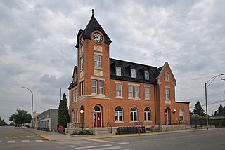
Battleford is a town located across the North Saskatchewan River from the city of North Battleford, in Saskatchewan, Canada.
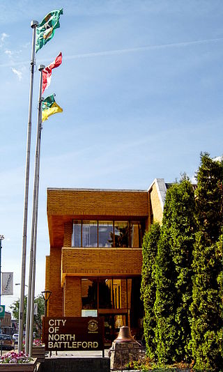
North Battleford is a city in west-central Saskatchewan, Canada. It is the seventh largest city in the province and is directly across the North Saskatchewan River from the Town of Battleford. Together, the two communities are known as "The Battlefords". North Battleford borders the Rural Municipality of North Battleford No. 437, as well as the North Battleford Crown Colony.
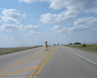
Highway 16 is a provincial highway in the Canadian province of Saskatchewan. It is the Saskatchewan section of the Yellowhead Highway, and also the Trans-Canada Highway Yellowhead section. The main purpose of this highway is to connect Saskatchewan with Canadian cities such as Edmonton and Winnipeg. The highway runs from the Alberta boundary in Lloydminster to the Manitoba boundary near Marchwell. Major cities it passes through are Saskatoon, North Battleford in the central part of the province, Yorkton in the far east and Lloydminster to the far west.

The Western Development Museum is a network of four museums in Saskatchewan, Canada preserving and recording the social and economic development of the province. The museum has branches in Moose Jaw, North Battleford, Saskatoon and Yorkton. Respectively, each branch focuses on a different theme: transportation, agriculture, economy, and people. The museum is affiliated with the Canadian Museums Association, the Canadian Heritage Information Network, and Virtual Museum of Canada.

Warman (/ˈwɔrmən/) is the ninth-largest city in the Canadian province of Saskatchewan. It is located approximately 20 kilometres (12 mi) north of the city of Saskatoon, and 5 kilometres (3.1 mi) northeast of the city of Martensville. According to the 2021 census, Warman is the fastest growing municipality in Saskatchewan, and was the fastest growing municipality in Canada between 2011 and 2016. Warman is a bedroom community of Saskatoon. The current mayor is Gary Philipchuk.

St. Walburg is a town in west-central Saskatchewan's prairie region on Highway 26. St. Walburg is surrounded by the Rural Municipality of Frenchman Butte No. 501. The Bronson Provincial Forest is about 10 kilometres (6.2 mi) to the north.

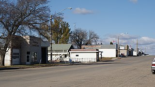
Turtleford is a town in the Rural Municipality of Mervin No. 499, in the Canadian province of Saskatchewan. Turtleford is located on Highway 26 near the intersection / concurrency with Highway 3 and Highway 303. The nearest cities are North Battleford and Lloydminster. The Turtlelake River runs through Turtleford, and nearby are Brightsand Lake and Turtle Lake.

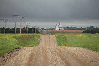
Girvin is a former village of 20 people in Saskatchewan, Canada. It is located midway between Regina and Saskatoon on Highway 11 between the towns of Davidson and Craik. The village was formally dissolved in 2005; its remaining population is now counted as part of the rural municipality of Arm River.
Hafford is a town in the RM of Redberry, Saskatchewan, Canada, consisting of 414 residents at the 2021 Canadian census. It is near the salt water Redberry Lake.
Saskatchewan has a transportation infrastructure system of roads, highways, freeways, airports, ferries, pipelines, trails, waterways, and railway systems serving a population of approximately 1,132,505 inhabitants year-round.

Maymont is a village in the Canadian province of Saskatchewan within the Rural Municipality of Mayfield No. 406 and Census Division No. 16. It is 90 kilometres (56 mi) north-west of the city of Saskatoon.
Highgate, Saskatchewan is an unincorporated area in the rural municipality of Battle River No. 438, Saskatchewan, in the Canadian province of Saskatchewan. Highgate is located on Saskatchewan Highway 16, the Yellowhead in north western Saskatchewan. Highgate siding, a railroad siding and post office first opened in 1919 at the legal land description of Sec.17, Twp.45, R.17, W3. The population is smaller than a hamlet, and is counted within the RM. Highgate is located just north west of North Battleford, Saskatchewan.
Fielding, Saskatchewan is an unincorporated area in the rural municipality of Mayfield No. 406, Saskatchewan, in the Canadian province of Saskatchewan. Fielding is located on Saskatchewan Highway 16, the Yellowhead in north western Saskatchewan. Fielding post office first opened in 1905 at the legal land description of Sec.18, Twp.41, R.11, W3. The population is smaller than a hamlet, and is counted within the Mayfield No. 406, Saskatchewan. Fielding is located just south east of North Battleford, Saskatchewan. Fielding is located within 11 kilometres (6.8 mi) of Glenburn Regional Park and within 9 kilometres (5.6 mi) of the Radisson Lake Game Preserve.
Anerley is an unincorporated community in the western region of Saskatchewan located about 4 km north of Highway 44, about 20 km southwest of the Outlook and is about 125 km south west of Saskatoon.
Sonningdale is a hamlet in Rural Municipality of Eagle Creek No. 376, Saskatchewan, Canada. The hamlet is located on Highway 376 about 90 km (56 mi) northwest of Saskatoon and 84 km (52 mi) southeast of North Battleford. The hamlet with a population of less than 50 people as of January 2010. School students are bused to the nearby town of Maymont, which is about 20 kilometers north. Sonningdale has a church, post office, community complex, seniors centre, a library, and a firehall. The two story school had an enrollment of 33 in 2005, and was closed in June 2006. Two relocatable classrooms were moved away in 2009.

Hughton is a hamlet in Monet No. 257, Saskatchewan, Canada. The hamlet is located at along Highway 44 approximately 158 km (98 mi) southwest of the City of Saskatoon.

Cando is a hamlet in Rosemount Rural Municipality No. 378, Saskatchewan, Canada.
Leney is an unincorporated community in Perdue Rural Municipality No. 346, Saskatchewan, Canada. The community had a population of 30 in 2001. It previously held the status of a village until December 31, 1971. The hamlet is located 68 km west of the City of Saskatoon on highway 655 3 km south the town of Perdue and highway 14 on the Canadian National Railway.
Phippen, Saskatchewan is an unincorporated community, school site, and elevator site on the Canadian Pacific line running east–west between Wilkie, Saskatchewan and Unity, Saskatchewan.

