
Bhatar is a community development block that forms an administrative division in Bardhaman Sadar North subdivision of Purba Bardhaman district in the Indian state of West Bengal.
Monteswar is a community development block that forms an administrative division in Kalna subdivision of Purba Bardhaman district in the Indian state of West Bengal.

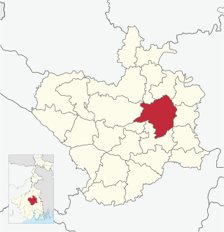
Bardhaman Sadar North subdivision is an administrative subdivision of the Purba Bardhaman district in the state of West Bengal, India.
Bhatar is a village in Bhatar CD block in Bardhaman Sadar North subdivision of Purba Bardhaman district in the state of West Bengal, India.

Burdwan I is a community development block that forms an administrative division in Bardhaman Sadar North subdivision of Purba Bardhaman district in the Indian state of West Bengal.
Selenda is a village in Bhatar CD block in Bardhaman Sadar North subdivision of Purba Bardhaman district in the state of West Bengal, India.
Santoshpur is a village in Bhatar CD block in Bardhaman Sadar North subdivision of Purba Bardhaman district in the state of West Bengal, India.
Salkuni is a village in Bhatar CD block in Bardhaman Sadar North subdivision of Purba Bardhaman district in the state of West Bengal, India.
Ramchandrapur is a village in Bhatar CD block in Bardhaman Sadar North subdivision of Purba Bardhaman district in the state of West Bengal, India.
Orgram is a village in Bhatar CD block in Bardhaman Sadar North subdivision of Purba Bardhaman district in the state of West Bengal, India.
Nasigram is a village in Bhatar CD block in Bardhaman Sadar North subdivision of Purba Bardhaman district in the state of West Bengal, India with total 1,708 families residing. It is located about 38.8 kilometres (24.1 mi) from West Bengal on National Highway towards Purba Bardhaman.
Mahata is a village in Bhatar CD block in Bardhaman Sadar North subdivision of Purba Bardhaman district in the state of West Bengal, India with total 1,311 families residing. It is located about 9.7 kilometres (6.0 mi) from West Bengal on National Highway towards Purba Bardhaman.
Karjjana is a village in Bhatar CD block in Bardhaman Sadar North subdivision of Purba Bardhaman district in the state of West Bengal, India with total 990 families residing. It is located about 12 kilometres (7.5 mi) from West Bengal on National Highway towards Purba Bardhaman.
Belenda is a village in Bhatar CD block in Bardhaman Sadar North subdivision of Purba Bardhaman district in the state of West Bengal, India with total 863 families. It is located about 20 kilometres (12 mi) from West Bengal on National Highway towards Purba Bardhaman.
Kherur is a village in Bhatar CD block in Bardhaman Sadar North subdivision of Purba Bardhaman district in the state of West Bengal, India with total 877 families residing. It is located about 34 kilometres (21 mi) from West Bengal on National Highway towards Purba Bardhaman.
Bigra is a village in Bhatar CD block in Bardhaman Sadar North subdivision of Purba Bardhaman district in the state of West Bengal, India with total 434 families residing. It is located about 10 kilometres (6.2 mi) from West Bengal on National Highway towards Purba Bardhaman.
Erachya is a village in Bhatar CD block in Bardhaman Sadar North subdivision of Purba Bardhaman district in the state of West Bengal, India with total 609 families residing. It is located about 20 kilometres (12 mi) from West Bengal on National Highway towards Purba Bardhaman.
Narjja is a village in Bhatar CD block in Bardhaman Sadar North subdivision of Purba Bardhaman district in the state of West Bengal, India with total 301 families residing. It is located about 18 kilometres (11 mi) from West Bengal on National Highway towards Purba Bardhaman.
Jhujkadanga is a village in Bhatar CD block in Bardhaman Sadar North subdivision of Purba Bardhaman district in the state of West Bengal, India with total 187 families residing. It is located about 27 kilometres (17 mi) from West Bengal on National Highway towards Purba Bardhaman.
Gramdihi is a village in Bhatar CD block in Bardhaman Sadar North subdivision of Purba Bardhaman district in the state of West Bengal, India with total 544 families residing. It is located about 10 kilometres (6.2 mi) from West Bengal on National Highway towards Guskara.


