Badla, Purba Bardhaman

Last updated

Badla
Village
West Bengal location map.svg
Red pog.svg
Badla
Location in West Bengal, India
India location map.svg
Red pog.svg
Badla
Badla (India)
Coordinates: 23°09′24″N88°16′54″E / 23.1567°N 88.2816°E / 23.1567; 88.2816 Coordinates: 23°09′24″N88°16′54″E / 23.1567°N 88.2816°E / 23.1567; 88.2816
CountryFlag of India.svg  India
State West Bengal
District Purba Bardhaman
Population
 (2011)
  Total1,935
Languages
  Official Bengali, English
Time zone UTC+5:30 (IST)
Lok Sabha constituency Bardhaman Purba
Vidhan Sabha constituency Kalna
Website purbabardhaman.gov.in

Badla is a village in Kalna II CD block in Kalna subdivision of Purba Bardhaman district in the Indian state of West Bengal.

Contents

Geography

Cities and towns in the Kalna subdivision of Purba Bardhaman district
M: municipal city/ town, CT: census town, R: rural/ urban centre, H: historical/ religious centre, C: craft centre.
Owing to space constraints in the small map, the actual locations in a larger map may vary slightly

Location

Badla is located at 23°09′24″N88°16′54″E / 23.1567°N 88.2816°E / 23.1567; 88.2816 . Badla is located near Singarkone, where the CD block offices of Kalna II CD block are there.

Urbanisation

87.00% of the population of Kalna subdivision live in the rural areas. Only 13.00% of the population live in the urban areas. [1] The map alongside presents some of the notable locations in the subdivision. All places marked in the map are linked in the larger full screen map.

Demographics

As per the 2011 Census of India, Badla had a total population of 1,935 of which 950 (49%) were males and 985 (51%) were females. Population below 6 years was 187. The total number of literates in Badla was 1,307 (74.77% of the population over 6 years). [2]

Transport

Pandua-Singarkone Road links Badla to Boinchi-Kalna Road. [3]

Education

Badla Vivekananda B.Ed. College was established in 2015. [4]

Culture

Baidyapur Jora Deul, a monument of national importance, is located nearby. [5]

Healthcare

Badla block primary health centre at Badla, PO Chagram (with 15 beds) is the main medical facility in Kalna II CD block. There are primary health centres at Akalpoush (with 6 beds), Angarson, PO Pindra (with 2 beds), Baidyapur (with 15 beds) and Tehatta (with 2 beds). [6] In 2012, the average monthly patients attending Badla BPHC were 4,684 and average monthly admissions were 115. It handled 1,222 annual emergency admissions. [7]

See also - Healthcare in West Bengal

Related Research Articles

Dainhat is a town and a Municipality under Katwa police station of Katwa subdivision, in Purba Bardhaman district in the state of West Bengal, India.

Srirampur is a census town in Purbasthali I CD Block in Kalna subdivision of Purba Bardhaman in the Indian state of West Bengal.

Kalna subdivision is an administrative subdivision of the Purba Bardhaman district in the state of West Bengal, India.

Bardhaman Sadar North subdivision is an administrative subdivision of the Purba Bardhaman district in the state of West Bengal, India.

Monteswar is a village situated in Manteswar CD block in Kalna subdivision of Purba Bardhaman district in the Indian state of West Bengal.

<span class="mw-page-title-main">Srikhanda</span> Village in West Bengal, India

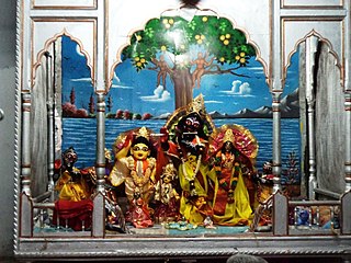
Srikhanda is a village in Srikhanda gram panchayat in Katwa I CD block in Katwa subdivision of Purba Bardhaman district. It is about 8 km (5.0 mi) distance from Katwa and 48 km (30 mi) distance from Burdwan.

Khandaghosh is a village in Khandaghosh CD block in Bardhaman Sadar South subdivision of Purba Bardhaman district in the state of West Bengal, India.

Kalna I is a community development block that forms an administrative division in Kalna subdivision of Purba Bardhaman district in the Indian state of West Bengal.

Kalna II is a community development block that forms an administrative division in Kalna subdivision of Purba Bardhaman district in the Indian state of West Bengal.

Ketugram is a village in Ketugram II CD block in Katwa subdivision of Purba Bardhaman district in the state of West Bengal, India.

Kurmun is a village in Burdwan I CD block in Bardhaman Sadar North subdivision of Purba Bardhaman district in the state of West Bengal, India.

<span class="mw-page-title-main">Baidyapur</span> Village in West Bengal, India

Baidyapur is a village in Kalna II CD block in Kalna subdivision of Purba Bardhaman district, West Bengal, India.

Jamtara is a village located in the Ausgram II CD Block in Bardhaman Sadar North subdivision of the Purba Bardhaman district, in West Bengal, India.

<span class="mw-page-title-main">Barshul</span> Village in West Bengal, India

Barsul is a village in Burdwan II CD block in Bardhaman Sadar North subdivision of Purba Bardhaman district in the state of West Bengal, India.

Mongalkote is a village in Mongalkote CD block in Katwa subdivision of Purba Bardhaman district in the state of West Bengal, India.

Nutanhat is a village in Mongalkote CD block in Katwa subdivision of Purba Bardhaman district in the state of West Bengal, India.

Singarkone is a village in Kalna II CD block in Kalna subdivision of Purba Bardhaman district in the state of West Bengal, India.

Hatgobindapur is a village in Burdwan II CD block in Bardhaman Sadar North subdivision of Purba Bardhaman district in the state of West Bengal, India.

Atgharia is a village and a gram panchayat in Kalna I CD block in Kalna subdivision of Purba Bardhaman district in the Indian state of West Bengal.

Adrahati is a village in Galsi II CD Block in Bardhaman Sadar North subdivision of Purba Bardhaman district in the Indian state of West Bengal.

References

  1. "District Statistical Handbook 2014 Bardhaman". Table 2.2. Department of Statistics and Programme Implementation, Government of West Bengal. Archived from the original on 21 January 2019. Retrieved 25 January 2019.
  2. "C.D. Block Wise Primary Census Abstract Data(PCA)". 2011 census: West Bengal – District-wise CD Blocks. Registrar General and Census Commissioner, India. Retrieved 23 January 2019.
  3. Google maps
  4. "Badla Vivekananda B.Ed. College". BVBEdC. Retrieved 23 January 2019.
  5. "List of Ancient Monuments and Archaeological Sites and Remains of West Bengal - Archaeological Survey of India". Item no. 46. ASI. Retrieved 25 January 2020.
  6. "Health & Family Welfare Department". Health Statistics. Government of West Bengal. Retrieved 19 January 2019.
  7. "Performancee of Block Primary Health Centres (BPHC) in West Bengal during 2012 (January to December)" (PDF). Health & Family Welfare Department, Government of West Bengal. Retrieved 9 March 2019.