Kalna subdivision

Last updated

Kalna subdivision
Subdivision
Kalna (subdivision) in Purba Bardhaman (West Bengal).svg
Coordinates: 23°13′N88°10′E / 23.22°N 88.17°E / 23.22; 88.17
CountryFlag of India.svg  India
State West Bengal
District Purba Bardhaman
Headquarters Kalna
Area
  Total993.75 km2 (383.69 sq mi)
Population
 (2011)
  Total1,097,732
  Density1,100/km2 (2,900/sq mi)
Languages
  Official Bengali, English
Time zone UTC+5:30 (IST)
ISO 3166 code ISO 3166-2:IN
Website http://bardhaman.gov.in/

Kalna subdivision is an administrative subdivision of the Purba Bardhaman district in the state of West Bengal, India.

Contents

Overview

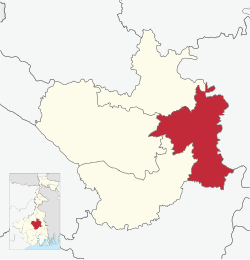
Kalna subdivision is spread mostly across the Bhagirathi basin, with its western part intruding into the Bardhaman plain, the central plain area of the district. [1]

Subdivisions

Purba Bardhaman district is divided into the following administrative subdivisions: [2] [3]

Purba Bardhaman Subdivision Map (en).svg
SubdivisionHeadquarters
Area
km2
Population
(2011)
Rural
Population %
(2011)
Urban
Population %
(2011)
Bardhaman Sadar North Bardhaman 1,958.431,586,62373.5826.42
Bardhaman Sadar South Memari 1,410.031,198,15595.544.46
Katwa Katwa 1,070.48963,02288.4411.56
Kalna Kalna 993.751,087,73287.0013.00
Purba Bardhaman district Bardhaman 5,432.694,835,53284.9815.02

Administrative units

Kalna subdivision
Invisible Square.svg
Mapscaleline.svg
8km
5miles
Khari River
River
Hooghly
Patuli
R
Invisible Square.svg
Samudragarh
C
Invisible Square.svg
Badla
R
Invisible Square.svg
Atgharia
R
Invisible Square.svg
Parulia
R
Invisible Square.svg
Singarkone
R
Invisible Square.svg
Rangapara
R
Invisible Square.svg
Monteswar
R
Invisible Square.svg
Purbasthali
R
Invisible Square.svg
Nadanghat
R
Invisible Square.svg
Shashpur
CT
Invisible Square.svg
Uttar Goara
CT
Invisible Square.svg
Piarinagar
CT
Invisible Square.svg
Dhatrigram
CT
Invisible Square.svg
Nasratpur
CT
Invisible Square.svg
Gopinathpur
CT
Invisible Square.svg
Jaluidanga
CT
Invisible Square.svg
Hatsimla
CT
Invisible Square.svg
Srirampur
CT
Invisible Square.svg
Cities and towns in the Kalna subdivision of Purba Bardhaman district
M: municipal city/ town, CT: census town, R: rural/ urban centre.
Owing to space constraints in the small map, the actual locations in a larger map may vary slightly

Kalna subdivision has 4 police stations, 5 community development blocks, 5 panchayat samitis, 47 gram panchayats, 543 mouzas, 525 inhabited villages, 1 municipality and 9 census towns. The single municipality is at Kalna. The census towns are: Srirampur, Hatsimla, Jaluidanga, Gopinathpur, Nasratpur, Dhatrigram, Piarinagar, Uttar Goara and Shashpur. The subdivision has its headquarters at Kalna. [4] [5]

Demographics

As per the 2011 Census of India data Kalna subdivision, after bifurcation of Bardhaman district in 2017, had a total population of 1,087,732. There were 556,573 (51%) males and 531,159 (49%) females. Population below 6 years was 113,711. [6]

As per the 2011 census data the total number of literates in Kalna subdivision, after bifurcation of Bardhaman district in 2017, was 732,111 (75.16% of the population over 6 years) out of which males numbered 402,516 (80.70% of the male population over 6 years) and females numbered 329,595 (69.35% of the female population over 6 years). [6]

See also – List of West Bengal districts ranked by literacy rate

Religion in Kalna subdivision
Hindu
70.44%
Muslim
28.17%
Christian
0.17%
Others
1.22%

In the 2011 census Hindus numbered 766,230 and formed 70.44% of the population in Kalna subdivision. Muslims numbered 306,360 and formed 28.17% of the population. Christians numbered 1,859 and formed 0.17% of the population. Others numbered 13,283 and formed 1.22% of the population. [7]

Police stations

Police stations in Kalna subdivision have the following features and jurisdiction: [8] [9]

Police stationArea covered
km2
Municipal townCD Block
Nadanghat 60- Purbasthali I (part), Purbasthali II (part)
Purbasthali 180.3 Purbasthali I (part), Purbasthali II (part)
Kalna 347.6 Kalna Kalna I, Kalna II
Monteswar 354.04- Manteswar

Blocks

Community development blocks in Kalna subdivision are: [2] [10]

Purba Bardhaman Tehsil Map (en).svg
CD BlockHeadquarters
Area
km2
Population
(2011)
SC  % ST  % Hindus  % Muslims  %Literacy
Rate %
Census
Towns
Purbasthali I Srirampur 148.44206,97725.463.6874.7024.9577.595
Purbasthali II Patuli 192.47212,35526.113.7368.0631.6070.35-
Kalna I Rangapara 169.08206,94528.6310.1368.6029.0075.813
Kalna II Singarkone 172.17167,33536.6117.2980.3215.3476.251
Manteswar Monteswar 305.19237,39823.952.9357.6941.7773.08-

Gram panchayats

The subdivision contains 47 gram panchayats under 5 community development blocks: [5]

Economy

Agriculture

In the erstwhile Bardhaman district agriculture was the pre-dominant economic activity and the main source of livelihood for the rural people. The soil and climate favours the production of food grains. Cash crops are also grown. Irrigation facilities had contributed in a major way towards higher agricultural productivity. Amongst the districts of West Bengal, Bardhaman district had maximum irrigated land under cultivation. [11] Given below is an overview of the agricultural production (all data in tonnes) for Bardhaman Sadar North subdivision, other subdivisions and the Purba Bardhaman district, after bifurcation of the erstwhile Bardhaman district, with data for the year 2013-14. [12]

CD Block/ SubdivisionRiceWheatJutePulsesOil seedsPotatoesSugarcane
Purbasthali 51,66166935,103282,6801,649-
Purbasthali II 2,7152,774104,8351252,7032,774-
Kalna I 57,151-23,08484,64723,876-
Kalna II 49,981316,0053275--
Manteswar 95,64115348-1,12028,709565
Kalna subdivision257,1493,461179,37516411,425159,659565
Katwa 509,61063865,1682177,43251,92897,483
Bardhaman Sadar North 688,626908-1083,059105,1821,802
Bardhaman Sadar South 441,6451,758331,37514,619883,4571,192
Purba Bardhaman district 1,897,0306,765244,5761,86436,5351,200,226101,042

Education

Given in the table below (data in numbers) is a comprehensive picture of the education scenario in Purba Bardhaman district, after bifurcation of Bardhaman district in 2017, with data for the year 2013-14: [13]

SubdivisionPrimary
School
Middle
School
High
School
Higher Secondary
School
General
College, Univ
Technical /
Professional Instt
Non-formal
Education
InstitutionStudentInstitutionStudentInstitutionStudentInstitutionStudentInstitutionStudentInstitutionStudentInstitutionStudent
Bardhaman Sadar North 94783,083423,01912272,9819294,260824,612387,6662,33181,318
Bardhaman Sadar South 78759,920383,13810359,6806062,37159,52172,0692,06764,473
Katwa 60152,239211,6377445,7044244,64537,96581,1901,41264,979
Kalna67354,249261,9847455,9645165,33449,59476631,76167,996
Purba Bardhaman district 3,008249,4911279,778373234,329245266,6102051,6926011,5887,571277,766

Note: Primary schools include junior basic schools; middle schools, high schools and higher secondary schools include madrasahs; technical schools include junior technical schools, junior government polytechnics, industrial technical institutes, industrial training centres, nursing training institutes etc.; technical and professional colleges include engineering colleges, medical colleges, para-medical institutes, management colleges, teachers training and nursing training colleges, law colleges, art colleges, music colleges etc. Special and non-formal education centres include sishu siksha kendras, madhyamik siksha kendras, centres of Rabindra mukta vidyalaya, recognised Sanskrit tols, institutions for the blind and other handicapped persons, Anganwadi centres, reformatory schools etc. [13]

The following institutions are located in Kalna subdivision:

Healthcare

The table below (all data in numbers) presents an overview of the medical facilities available and patients treated in the hospitals, health centres and sub-centres in 2014 in Purba Bardhaman district, after bifurcation of the erstwhile Bardhaman district in 2017, with data for the year 2013-14. [18]

SubdivisionHealth & Family Welfare Deptt, WB Other
State
Govt
Deptts
Local
bodies
Central
Govt
Deptts /
PSUs
NGO /
Private
Nursing
Homes
TotalTotal
Number
of
Beds
Total
Number
of
Doctors
Indoor
Patients
Outdoor
Patients
Hospitals
Rural
Hospitals
Block
Primary
Health
Centres
Primary
Health
Centres
Bardhaman Sadar North 125232-1691032,915554156,7262,525,789
Bardhaman Sadar South -1521---123937441209,6401,619,459
Katwa 11513---8284525965,0551,291,942
Kalna11417---20436194549,6401,186,491
Purba Bardhaman district 3519742-11092134,360699481,0616,623,681

Medical facilities available in Kalna subdivision are as follows:

Hospitals: (Name, location, beds) [19]
Kalna Subdivisional Hospital, Kalna, 200 beds
Indian Red Cross Society, Kalna, 8 beds
Rural Hospitals: (Name, CD block, location, beds) [19]
Srirampur Rural Hospital, Purbasthali I CD block, Srirampur, PO Vidyanagar, 30 beds
Purbasthali Rural Hospital, Purbasthali II CD block, Purbasthali, 30 beds
Atgharia Rural Hospital, Kalna I CD block, Atgharia, 30 beds
Monteswar Rural Hospital, Manteswar CD block, Monteswar, 30 beds
Block Primary Health Centre: (Name, block, location, beds) [19]
Badla BPHC, Kalna II, Badla, PO Chagram, 15 beds
Primary Health Centres: (CD block-wise)(CD block, PHC location, beds) [19]
Kalna I: Baghnapara (10), Sahajpur (6), Sultanpur (10)
Kalna II: Akalpoush (6), Angarson, PO Pindra (2), Baidyapur (15), Tehatta (2)
Manteswar: Dhanyakherur, PO Majhergram (10), Moinampur, PO Katsihi (6), Putsuri (6)
Purbasthali I: Dogachhia, PO Rai Dogachhia (4), Nadanghat (10), Nowapara (4)
Purbasthali II: Kubajpur, PO Rai Dogachhia (4), Nimdah, PO Belerhat (6), Patuli (10), Singari, PO Laxmipur (10)

Electoral constituencies

Lok Sabha (parliamentary) and Vidhan Sabha (state assembly) constituencies in Kalna subdivision were as follows: [20]

Lok Sabha constituencyReservationVidhan Sabha constituencyReservationCD Block and/or Gram panchayats and/or municipal areas
Bardhaman Purba Reserved for SC Kalna Reserved for SC Kalna municipality, Kalna II CD Block and Bagnapara, Hatkalna and Krishnadevpur gram panchayats of Kalna I CD Block
Purbasthali Dakshin NoneNandai, Kankuria, Begpur, Atghoria Simlan, Dhatrigram and Sultanpur gram panchayats of Kalna I CD Block and Nasratpur, Samudragarh, Bagpur, Sreerampur and Nadanghat gram panchayats of Purbasthali I CD Block
Purbasthali Uttar None Purbasthali II CD Block, Jahannagar and Dogachia gram panchayats of Purbasthali I CD Block, and Bamunpara, Mamudpur II and Putsuri gram panchayats of Manteswar CD Block
All other Vidhan Sabha segments outside Kalna subdivision
Bardhaman-Durgapur None Manteswar NoneBaghsan, Vagra Mulgram, Denur, Jamna, Kusumgram, Majhergram, Mamudpur I, Manteswar, Pipalan and Shushunia gram panchayats of Manteswar CD Block and Barapalason I, Barapalason II, Bohar I, Bohar II, Bijur I, Bijur II and Satgachhia I gram panchayats of Memari II CD Block
All other Vidhan Sabha segments outside Kalna subdivision

Related Research Articles

Hatsimla is a census town in Purbasthali I CD Block in Kalna subdivision of Purba Bardhaman district in the Indian state of West Bengal.

Patuli is a village under Purbasthali police station of Kalna subdivision in Purba Bardhaman district in the Indian state of West Bengal.

Srirampur is a census town in Purbasthali I CD Block in Kalna subdivision of Purba Bardhaman in the Indian state of West Bengal.

Uttar Goara is a census town in Kalna I CD Block in Kalna subdivision of Purba Bardhaman district in the Indian state of West Bengal.

Nadanghat is a village, with a police station, in the Purbasthali I CD block in Kalna subdivision of Purba Bardhaman district in West Bengal, India.

<span class="mw-page-title-main">Katwa subdivision</span> Subdivision in West Bengal, India

Katwa subdivision is an administrative subdivision of the Purba Bardhaman district in the state of West Bengal, India.

Monteswar is a village situated in Manteswar CD block in Kalna subdivision of Purba Bardhaman district in the Indian state of West Bengal.

<span class="mw-page-title-main">Purbasthali I</span> Community development block in West Bengal, India

Purbasthali I is a community development block that forms an administrative division in Kalna subdivision of Purba Bardhaman district in the Indian state of West Bengal.

<span class="mw-page-title-main">Baidyapur</span> Village in West Bengal, India

Baidyapur is a village in Kalna II CD block in Kalna subdivision of Purba Bardhaman district, West Bengal, India.

Samudragarh is a village in Purbasthali I CD block in Kalna subdivision of Purba Bardhaman district in the state of West Bengal, India. Nadanghat police station serves this village. It is about 15 km away from Kalna, India. It is situated on the western bank of the Bhāgirathi.

Rangpara is a village in Kalna I CD block in Kalna subdivision of Purba Bardhaman district in the state of West Bengal, India.

Singarkone is a village in Kalna II CD block in Kalna subdivision of Purba Bardhaman district in the state of West Bengal, India.

Parulia is a village in Purbasthali II CD block in Kalna subdivision of Purba Bardhaman district in the state of West Bengal, India.

Atgharia is a village and a gram panchayat in Kalna I CD block in Kalna subdivision of Purba Bardhaman district in the Indian state of West Bengal.

Jaluidanga is a census town in Purbasthali I CD Block in Kalna subdivision of Purba Bardhaman district in the Indian state of West Bengal.

Nasratpur is a census town in Purbasthali I CD Block in Kalna subdivision of Purba Bardhaman district in the Indian state of West Bengal.

Piarinagar is a census town in Kalna I CD Block in Kalna subdivision of Purba Bardhaman district in the Indian state of West Bengal.

Shashpur is a census town in Kalna II CD Block in Kalna subdivision of Purba Bardhaman district in the Indian state of West Bengal.

Badla is a village in Kalna II CD block in Kalna subdivision of Purba Bardhaman district in the Indian state of West Bengal.

<span class="mw-page-title-main">Baidyapur Jora Deul</span> Two temples in Baidyapur

Baidyapur Jora Deul is a 16th-century temple at Baidyapur in the Kalna II CD block in the Kalna subdivision of the Purba Bardhaman district in the Indian state of West Bengal.

References

  1. "Census of India 2011, West Bengal: District Census Handbook, Barddhaman" (PDF). Physiography, pages 13-14. Directorate of Census Operations, West Bengal. Retrieved 3 March 2017.
  2. 1 2 "District Statistical Handbook 2014 Burdwan". Table 2.2, 2.4(a). Department of Statistics and Programme Implementation, Government of West Bengal. Archived from the original on 29 July 2017. Retrieved 17 February 2017.{{cite web}}: CS1 maint: unfit URL (link)
  3. "পূর্ব ও পশ্চিম, আজ বর্ধমান জেলা ভাগের আনুষ্ঠানিক ঘোষনা মুখ্যমন্ত্রীর" (in Bengali). ABP Ananda. 7 April 2017. Retrieved 9 April 2017.
  4. "District Statistical Handbook 2014 Bardhaman". Table 2.1. Department of Statistics and Programme Implementation, Government of West Bengal. Archived from the original on 29 July 2017. Retrieved 23 October 2016.{{cite web}}: CS1 maint: unfit URL (link)
  5. 1 2 "Directory of District, Subdivision, Panchayat Samiti/ Block and Gram Panchayats in West Bengal". Bardhaman - Revised in March 2008. Panchayats and Rural Development Department, Government of West Bengal. Retrieved 17 February 2017.
  6. 1 2 "2011 Census - Primary Census Abstract Data Tables". West Bengal – District-wise. Registrar General and Census Commissioner, India. Retrieved 16 April 2017.
  7. "C1 Population by Religious Community". West Bengal. Registrar General and Census Commissioner, India. Retrieved 17 April 2017.
  8. "District Statistical Handbook 2014 Burdwan". Tables 2.1, 2.2. Department of Statistics and Programme Implementation, Government of West Bengal. Archived from the original on 29 July 2017. Retrieved 26 February 2017.{{cite web}}: CS1 maint: unfit URL (link)
  9. "Burdwan District Police". Police Station. West Bengal Police. Archived from the original on 21 February 2017. Retrieved 26 February 2017.
  10. "C.D. Block Wise Primary Census Abstract Data(PCA)". 2011 census: West Bengal – District-wise CD Blcks. Registrar General and Census Commissioner, India. Retrieved 24 October 2016.
  11. "District Human Development Report: Bardhaman" (PDF). Pages 50-54. Development and Planning Department, Government of West Bengal, 2011. Archived from the original (PDF) on 14 August 2017. Retrieved 23 March 2017.
  12. "District Statistical Handbook 2014 Burdwan". Tables 18.1. Data for subdivisions/ district calculated by totalling the CD Block data provided. Department of Statistics and Programme Implementation, Government of West Bengal. Archived from the original on 29 July 2017. Retrieved 23 March 2017.{{cite web}}: CS1 maint: unfit URL (link)
  13. 1 2 "District Statistical Handbook 2014 Burdwan". Basic data: Table 4.4, 4.5, Clarifications: other related tables. Department of Statistics and Programme Implementation, Government of West Bengal. Archived from the original on 29 July 2017. Retrieved 24 November 2016.{{cite web}}: CS1 maint: unfit URL (link)
  14. "Kalna College". KC. Retrieved 2 March 2017.
  15. "Purbasthali College". PC. Retrieved 2 March 2017.
  16. "Dr. Gour Mohan Roy College". GMRC. Retrieved 2 March 2017.
  17. "Badla Vivekananda B.Ed. College". BVBEdC. Retrieved 23 January 2019.
  18. "District Statistical Handbook 2014 Bardhaman". Table 3.1, 3.3. Department of Statistics and Programme Implementation, Government of West Bengal. Archived from the original on 29 July 2017. Retrieved 2 March 2017.{{cite web}}: CS1 maint: unfit URL (link)
  19. 1 2 3 4 "Health & Family Welfare Department". Health Statistics. Government of West Bengal. Retrieved 18 January 2019.
  20. "Delimitation Commission Order No. 18 15 February 2006" (PDF). West Bengal. Election Commission of India. Retrieved 25 February 2017.