Bear Island (New Brunswick)

Last updated

Bear Island, New Brunswick
Name Place
Bear Island View.jpg
View From Bear Island
Motto(s): 

1787-1800: Fortune Favours the Bold
1800-1967: More Than An Island
CountryFlag of Canada (Pantone).svg  Canada
ProvinceFlag of New Brunswick.svg  New Brunswick
County York
Parish Queensbury Parish
Time zone UTC-4 (AST)
  Summer (DST) UTC-3 (ADT)
Postal Code
E6L
Area code 506

Bear Island is a Name Place in Queensbury Parish, New Brunswick, Canada, located on the north shore of the Saint John River.

Contents

History

Named "Island of the Bear" by the Maliseet people, [1] the location takes its name from islands (Big Bear and the Little Bear Islands) in the Saint John River. One story claims that bears fished in the narrow channels between the islands, [2] while others claim that bears would frequent the butternut trees native to the islands. With the development of the downstream Mactaquac Dam in 1968 and the consequential rise in water levels, [3] Bear Island is technically a misnomer, as the islands no longer exist, and the entire area referred to as Bear Island is on the shore of the dam's 96-kilometre headpond. [4] Many of the area's homes were razed in order to make way for the headpond.

The first permanent settlement in Bear Island was by Revolutionary War Loyalist veterans who received minimum 200-acre (0.81 km2) land grants by King George III on February 2, 1787, with many soldiers arriving that spring. [5] Twelve veterans from the "Guides and Pioneers, Queensbury" and twenty-one from the "Corps of Queen's Rangers" regiments were granted land. [6] Eventually immigrants from Portugal, England, Ireland, the Netherlands, Scotland, France and Germany, and families of former slaves of African descent would find their way to Bear Island. [7]

The island itself was originally divided into 26 lots owned by settlers on the shore. Due to flooding in the spring, the island was never permanently settled, but rather used for farming purposes enhanced by the rich soil deposited after each flood. [8] Other islands in the area were used similarly.

Originally a farming community, each resident grew vegetables and raised cattle, pigs, hens and horses. [9] Although subsistent in nature, occasionally farming activities would grow into a true industry, such as during the Potato Boom of the late 1920s when residents harvested up to 100 barrels a season for sale. [10] Other residents took up maple syrup production, even forming the first Maple Syrup Association in New Brunswick in 1959, [11] while others chose to specialize in matters like chicken hatcheries and milk production. Many of these activities as a source of primary income and lifestyle ceased with the destruction of most of the arable land with the advent of the dam.

Geography and climate

Bear Island stretches along the north side of the Saint John River, with Granite Hill to the north and Lower Queensbury to the south. Weather stations in nearby Fredericton record an average of 1,093 mm of precipitation each year, including 241 cm of snow. [12] Geographic landmarks include Howland Falls, an 11-meter, tiered waterfall. [13]

Industry

Primary industries include agriculture (i.e. sugar maple farms, Goodines Poultry Farm [14] ) and tourism (Great Bear Campground & Sugarbush [15] ). As inhabitants of a rural community with limited employment opportunities, many residents are self-employed, running their own business. These businesses provide such varied services as music lessons, landscaping [16] and maid services. Bear Island is also home to the founder of Fredericton's PsInnovations Clinical Practice Solutions which offers virtual support services to professionals in the psychology field. [17]

Route 105 storm damage Bear Island Flood Damage.jpg
Route 105 storm damage

Infrastructure

The primary road through Bear Island is Route 105. Although roads in neighbouring communities are regarded as poor, often resulting in damage to local vehicles, Route 105 is respected as of a better quality. [18] However, the community's heavy reliance on Route 105 as its main artery into Fredericton can be problematic, such as after heavy rain in December 2010 caused a portion of the route to wash away. Although many communities to the north do not have cell phone coverage, Bear Island's proximity to Highway 2 and its towers gives it full cell phone coverage. [19] The area is served by highspeed fixed WiFi and satellite services through Xplornet ISP.

Culture

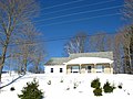
A close knit community with local events such as dances at the area community centre, Bear Island also lends its name to the Bear Island Boatworks, which built the Spirit of Canada, an open 40-foot (12 m) sailboat, launched September 22, 2001, and used by Derek Hatfield, an award-winning sailor and one of only two Canadian men to race around the world. [20]

History

Notable people

See also

Related Research Articles

<span class="mw-page-title-main">Fredericton</span> Capital city of New Brunswick, Canada

Fredericton is the capital city of the Canadian province of New Brunswick. The city is situated in the west-central portion of the province along the Saint John River, also known by its Indigenous name of Wolastoq, which flows west to east as it bisects the city. The river is the dominant natural feature of the area. One of the main urban centres in New Brunswick, the city had a population of 63,116 and a metropolitan population of 108,610 in the 2021 Canadian Census. It is the third-largest city in the province after Moncton and Saint John.

<span class="mw-page-title-main">Hartland, New Brunswick</span> Town in New Brunswick, Canada

Hartland is a town in Carleton County, New Brunswick, Canada.

<span class="mw-page-title-main">Nackawic</span> Unincorporated community in New Brunswick, Canada

Nackawic is an unincorporated community in New Brunswick, Canada. It held town status prior to 2023. It is approximately 65 km west of the city of Fredericton on the east bank of the Saint John River.

<span class="mw-page-title-main">Saint John River (Bay of Fundy)</span> River defining parts of the border of Maine and New Brunswick

The Saint John River is a 673 kilometres (418 mi) long river that flows from Northern Maine into Canada, and runs south along the western side of New Brunswick, emptying into the Atlantic Ocean in the Bay of Fundy. Eastern Canada's longest river, its drainage basin is one of the largest on the east coast at about 55,000 square kilometres (21,000 sq mi).

<span class="mw-page-title-main">UNB Reds</span> Football club

The UNB Reds are the athletic teams that represent the University of New Brunswick in Fredericton, New Brunswick, Canada.

<span class="mw-page-title-main">Kings Landing Historical Settlement</span> Historic area in New Brunswick, Canada

Kings Landing is a New Brunswick living history museum with original buildings from the period of 1820-1920. It was created around buildings that were saved and moved to make way for the headpond for the Mactaquac Dam.

<span class="mw-page-title-main">Mactaquac Dam</span> Dam in York County, New Brunswick

The Mactaquac Dam is an embankment dam used to generate hydroelectricity in Mactaquac, New Brunswick. It dams the waters of the Saint John River and is operated by NB Power with a capacity to generate 670 megawatts of electricity from 6 turbines; this represents 20 percent of New Brunswick's power demand.

<span class="mw-page-title-main">NB Power</span>

New Brunswick Power Corporation, operating as NB Power, is the primary electric utility in the Canadian province of New Brunswick. NB Power is a vertically-integrated Crown Corporation wholly owned by the Government of New Brunswick and is responsible for the generation, transmission, and distribution of electricity. NB Power serves all the residential and industrial power consumers in New Brunswick, with the exception of those in Saint John, Edmundston and Perth-Andover who are served by Saint John Energy, Energy Edmundston, and the Perth-Andover Electric Light Commission, respectively.

<span class="mw-page-title-main">Kingsclear Parish, New Brunswick</span> Parish in New Brunswick, Canada

Kingsclear is a civil parish in York County, New Brunswick, Canada.

Route 105 is a collector highway in New Brunswick running from Route 10 in Youngs Cove to Route 108 in Grand Falls, mostly along the east and north banks of the Saint John River, over a distance of 307.0 kilometres (190.8 mi). Route 105 consists largely of former alignments of Route 2 and runs parallel to Route 2 over its entire length.

Keswick Ridge is a Canadian rural community in York County, New Brunswick on Route 616.

<span class="mw-page-title-main">Mactaquac Provincial Park</span>

Mactaquac Provincial Park is a Canadian provincial park with an area of 5.25 square kilometres (2.03 sq mi). It is located on the Saint John River 15 kilometres west of Fredericton, New Brunswick in the community of Mactaquac.

<span class="mw-page-title-main">Queensbury Parish, New Brunswick</span> Parish in New Brunswick, Canada

Queensbury is a civil parish in York County, New Brunswick, Canada.

<span class="mw-page-title-main">Dumfries Parish, New Brunswick</span> Parish in New Brunswick, Canada

Dumfries is a civil parish in York County, New Brunswick, Canada.

<span class="mw-page-title-main">Southampton Parish, New Brunswick</span> Parish in New Brunswick, Canada

Southampton is a civil parish in York County, New Brunswick, Canada.

Tobique First Nation is one of six Wolastoqiyik or Maliseet Nation reserves in New Brunswick, Canada.

<span class="mw-page-title-main">Prince William Parish, New Brunswick</span> Parish in New Brunswick, Canada

Prince William is a civil parish in York County, New Brunswick, Canada.

<span class="mw-page-title-main">Bright Parish, New Brunswick</span> Parish in New Brunswick, Canada

Bright is a civil parish in York County, New Brunswick, Canada.

<span class="mw-page-title-main">Douglas Parish, New Brunswick</span> Parish in New Brunswick, Canada

Douglas is a civil parish in York County, New Brunswick, Canada.

The Becaguimec Stream is a minor tributary of the Saint John River in the Canadian Province of New Brunswick. It rises in the hilly woods along the county line dividing Carleton County, Canada from York County, Canada in the western region of the province. Its watershed is adjacent to the South Branch of the Southwest Miramichi River, the Nashwaak River, the Keswick River and the Nackawic Stream.

References

  1. Trail, Patty Gunter (2002). Bear Island: More Than an Island. Print Atlantic. p. 12. ISBN   0-9730758-0-5.
  2. Trail, Patty Gunter (2002). Bear Island: More Than an Island. Print Atlantic. p. 12. ISBN   0-9730758-0-5.
  3. "Geology of the Fredericton-Mactaquac Dam Area" (PDF). Retrieved 2009-10-09.
  4. "New Brunswick's Electrical Odyssey". Archived from the original on 21 November 2009. Retrieved 2009-10-09.
  5. Trail, Patty Gunter (2002). Bear Island: More Than an Island. Print Atlantic. p. 14. ISBN   0-9730758-0-5.
  6. Trail, Patty Gunter (2002). Bear Island: More Than an Island. Print Atlantic. pp. 19, 20. ISBN   0-9730758-0-5.
  7. Trail, Patty Gunter (2002). Bear Island: More Than an Island. Print Atlantic. p. 24. ISBN   0-9730758-0-5.
  8. Trail, Patty Gunter (2002). Bear Island: More Than an Island. Print Atlantic. p. 15. ISBN   0-9730758-0-5.
  9. Trail, Patty Gunter (2002). Bear Island: More Than an Island. Print Atlantic. p. 37. ISBN   0-9730758-0-5.
  10. Trail, Patty Gunter (2002). Bear Island: More Than an Island. Print Atlantic. p. 41. ISBN   0-9730758-0-5.
  11. Trail, Patty Gunter (2002). Bear Island: More Than an Island. Print Atlantic. p. 48. ISBN   0-9730758-0-5.
  12. "Weather Network Canada". Archived from the original on 13 October 2009. Retrieved 2009-10-09.
  13. "Waterfalls of New Brunswick" . Retrieved 2009-10-09.
  14. "Goodines Poultry Farm" . Retrieved 2009-10-09.
  15. "Great Bear Campground" . Retrieved 2009-10-09.
  16. "Aquatic Gardens" . Retrieved 2009-10-09.
  17. "PsInnovations". Archived from the original on 2011-07-06. Retrieved 2010-12-03.
  18. "Tom Caverhill's Blog". Archived from the original on 2009-02-07. Retrieved 2009-10-09.
  19. "Rogers Network Coverage Map" . Retrieved 2009-10-09.
  20. "Toronto Waterfront Magazine Derek Hatfield Article". Archived from the original on 2011-10-02. Retrieved 2009-10-09.

Coordinates: 45°55′18″N67°01′35″W / 45.9217°N 67.0264°W / 45.9217; -67.0264