
East Lindsey is a local government district in Lincolnshire, England. The population of the district council was 136,401 at the 2011 census. The council is based in Manby. Other major settlements in the district include Alford, Spilsby, Mablethorpe, Skegness, Horncastle, Chapel St Leonards and Louth. Skegness is the largest town in East Lindsey, followed by Louth and Mablethorpe.

Mablethorpe is a seaside town and civil parish in the East Lindsey district of Lincolnshire, England. The population including nearby Sutton-on-Sea was 12,531 at the 2011 census and estimated at 12,628 in 2018. The town was visited regularly by Alfred, Lord Tennyson, a 19th-century Poet Laureate of the United Kingdom. Some features of the town have been named after him, for example, Tennyson Road and Tennyson High School.

Saltfleetby is a village and civil parish in the East Lindsey district of Lincolnshire, England on the coast of the North Sea, approximately 7 miles (11 km) east from Louth and 10 miles (16 km) north from Mablethorpe. The parish had a population of 599 in the 2001 Census, decreasing to 568 at the 2011 Census.

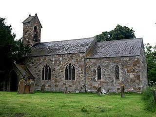
Theddlethorpe St Helen or East Theddlethorpe is a village and civil parish in the East Lindsey district of the county of Lincolnshire, England. It lies about 3 miles (5 km) north of Mablethorpe on the North Sea coast. The National Grid-owned Theddlethorpe Gas Terminal processes natural gas from the North Sea. Some seashore belongs to Saltfleetby-Theddlethorpe Dunes National Nature Reserve, consisting of sea dunes and saltwater and freshwater marshes. It is one of five UK locations where the natterjack toad is found. In 2011 the parish had a population of 525. The parish touches Gayton Le Marsh, Mablethorpe and Sutton, Theddlethorpe All Saints and Withern with Stain. Theddlethorpe St Helen shares a parish council with Theddlethorpe All Saints.

Maltby le Marsh is a village and civil parish in the East Lindsey district of Lincolnshire, England. The village is situated between Alford and Mablethorpe, and at the junction of the A1104 and A157 roads.
Aby with Greenfield is a civil parish in the East Lindsey district of Lincolnshire, England. The population of the civil parish at the 2011 Census was 196. It consists of the villages of Aby and Greenfield. The parish is situated approximately 7 miles (11 km) south-east from Louth.

Goulceby is a village and civil parish in the East Lindsey district of Lincolnshire, England. It is situated 7 miles (11 km) south-west from the market town of Louth, and lies in the Lincolnshire Wolds, an Area of Outstanding Natural Beauty.
Mablethorpe and Sutton is a civil parish and town in East Lindsey, Lincolnshire, England. It is on the North Sea coast and includes Mablethorpe, Trusthorpe, Sutton-on-Sea and Sandilands along with the inland village of Thorpe. According to the 2001 census it had a population of 11,780, increasing to 12,531 at the 2011 Census.
Brackenborough with Little Grimsby is a civil parish in the East Lindsey district of Lincolnshire, England.

Belleau is a hamlet and civil parish in the East Lindsey district of Lincolnshire, England. It is situated approximately 7 miles (11 km) south-east from Louth, and 4 miles (6 km) north-west from Alford. The Bellau parish includes the hamlet of Claythorpe.

Saleby is a village in the civil parish of Beesby with Saleby, in the East Lindsey district of Lincolnshire, England. It is on the Alford road to Louth, about 2 miles (3 km) north-east of Alford and 11 miles (18 km) south-east of Louth. The hamlet of Thoresthorpe is about 1 mile (1.6 km) south of the village.

Beesby is a village in the East Lindsey district of Lincolnshire, England.The village is situated approximately 4 miles (6 km) south-west from Mablethorpe, and just to the east of the A1104 road. Beesby is part of the civil parish of Beesby with Saleby.

Conisholme is a small settlement and civil parish in the East Lindsey district of Lincolnshire, England. It is on the Cleethorpes to Mablethorpe A1031 road, and 7 miles (11 km) north-east from Louth. The population is included in the civil parish of Grainthorpe.
Fulstow is a marsh village and civil parish in the East Lindsey district of Lincolnshire, England. It is situated 6 miles (10 km) north of Louth and 8 miles (13 km) south of Grimsby.

Edlington with Wispington is a civil parish in the East Lindsey district of Lincolnshire, England. It is situated approximately 2 miles (3 km) north-west from the town of Horncastle.

Withern is a village in the civil parish of Withern with Stain, in the East Lindsey district of Lincolnshire, England. It is situated on the A157 road, and 7 miles (11 km) south-east from Louth. Stain was once an independent parish but was combined with Withern when the old church of St John the Baptist was destroyed some centuries ago.
Marshchapel is a coastal village and civil parish in the East Lindsey district of Lincolnshire, England. It is approximately 11 miles (18 km) south-east from Grimsby and 13 miles (21 km) north-east from Louth. It includes the hamlets of West End and Eskham.
Greetham with Somersby is a civil parish in the East Lindsey district of Lincolnshire, England. It is situated approximately 3 miles (5 km) north-east from the market town of Horncastle.
Gayton le Marsh is a village and civil parish in the East Lindsey district of Lincolnshire, England It is situated 6 miles (9.7 km) south-east from the town of Louth and about 6 miles (9.7 km) north from Alford. The population of the civil parish was 155 at the 2011 census.
Branston and Mere is a civil parish in the North Kesteven district of Lincolnshire, England. It is situated some 4 miles (6 km) roughly south-east from the city and county town of Lincoln. The parish is a long strip between the RAF Waddington airfield and the River Witham near Bardney. The A15 road crosses the extreme west and the parish is bisected by the Sleaford to Lincoln railway line The civil parish was created in 1931, by merging the two former parishes of Branston and Mere.

