
Harwell is a village and civil parish in the Vale of White Horse about 2 miles (3 km) west of Didcot, 6 miles (10 km) east of Wantage and 13 miles (21 km) south of Oxford. The parish measures about 3.5 miles (6 km) north – south, and almost 2 miles (3 km) east – west at its widest point. In 1923 its area was 2,521 acres (1,020 ha). Harwell is in the historic county of Berkshire, however since 1974 it has been administered as part of Oxfordshire.

Worminghall is a village and civil parish in the Aylesbury Vale district of Buckinghamshire, England.

Pembridge is a village and civil parish in Arrow valley in Herefordshire, England. The village is on the A44 road about 6 miles (10 km) east of Kington and 7 miles (11 km) west of Leominster. The civil parish includes the hamlets of Bearwood, Lower Bearwood, Lower Broxwood, Marston, Moorcot and Weston. The 2011 Census recorded the parish population as 1,056.

Theddlethorpe consists of two adjacent civil parishes – Theddlethorpe All Saints and Theddlethorpe St Helen – in the East Lindsey district of the county of Lincolnshire, England. The villages lie about 3 miles (5 km) north of Mablethorpe on the North Sea coast. The National Grid-owned Theddlethorpe Gas Terminal processes natural gas extracted from the North Sea. Some seashore belongs to the Saltfleetby-Theddlethorpe Dunes National Nature Reserve, consisting of sea dunes and saltwater and freshwater marshes. It is one of five UK locations where the natterjack toad can be found.

Aldenham is a village and civil parish in Hertfordshire, 3.5 miles (5.6 km) north-east of Watford and 2 miles (3.2 km) southwest of Radlett. It was mentioned in the Domesday Book and is one of Hertsmere's 14 conservation areas. This secluded little village has eight pre-19th century buildings that are listed buildings and the parish itself is largely unchanged, though buildings have been rebuilt, since Saxon times when the majority of the land was owned by the abbots of Westminster Abbey.

Roughton is a village and civil parish in the East Lindsey district of Lincolnshire, England. Roughton population in 2011 was 644.

Well is a small estate village and civil parish about 1.5 miles (2.4 km) south of the town of Alford, in the East Lindsey district of Lincolnshire, England. The population of the civil parish was 166 at the 2011 census. It is situated on the foot of the east entry to the Lincolnshire Wolds. The population of 166 as at the 2011 census includes the hamlet of Claxby St. Andrew. The village provides views of the gradually sloping hills towards the west.

Grainthorpe is a small village and civil parish in the East Lindsey district of Lincolnshire, England. It is situated 7 miles (11 km) north-east from the town of Louth, and approximately 3 miles (5 km) from the Lincolnshire coast. The civil parish includes the hamlets of Wragholme to the north-west, and Ludney to the south-east. The population of Conisholme is included in the 2011 census.

Skirbeck is a suburb and former civil parish in the Borough of Boston in the county of Lincolnshire, England. Skirbeck is a long v-shaped formation wrapped around the south and east side of Boston parish. It has been incorporated into the Borough of Boston since 1932. It is in the Pilgrim ward of the Boston Borough Council. Skirbeck includes the hamlet and former civil parish of Skirbeck Quarter which was on the west side of the River Witham and was a separate parish from 1866 to 1932.

Langton by Spilsby, sometimes called Langton by Partney, is a village and civil parish in the East Lindsey district of Lincolnshire, England. It is situated approximately 4 miles (6 km) north from the town of Spilsby, Lincolnshire. The civil parish includes the hamlet of Sutterby. From the 2011 census the population is included in the civil parish of Sausthorpe.

Kettlethorpe is a village and civil parish in the West Lindsey district of Lincolnshire, England. It is situated 10 miles (16 km) west from the city of Lincoln. The villages of Drinsey Nook and Laughterton lie within Kettlethorpe parish. The population of the civil parish taken at the 2011 census was 426.

Lutton is a village and civil parish in the South Holland district of Lincolnshire, England. The population of the civil parish at the 2011 census was 1,261. It is situated about 4 miles (6 km) north-east from the town of Holbeach. The village has been known by the alternative name of Sutton St Nicholas. The civil parish comprises the village of Lutton, with Lutton Marsh to the north-east and Lutton Garnsgate to the south-west.

Market Stainton is a village and civil parish in the East Lindsey district of Lincolnshire, England. It is situated approximately 7 miles (11 km) north from the market town of Horncastle.
Mareham on the Hill is a village and civil parish about 2.5 miles (4.0 km) south-east from the town of Horncastle, Lincolnshire, England.

Newton on Trent is a village and civil parish in the West Lindsey district of Lincolnshire, England. The population of the civil parish at the 2011 census was 389. The village is situated east of the River Trent, and approximately 10 miles (16 km) south from Gainsborough, 10 miles (16 km) west from the county town of Lincoln, and at the junction of the A57 running east to west, and the A1133 running north to south.
Ranby is a village and civil parish in the East Lindsey district of Lincolnshire, England. It is situated about 6 miles (10 km) north-west from the market town of Horncastle. It is in the civil parish of Market Stainton.

Snarford is a village and civil parish in the West Lindsey district of Lincolnshire, England. It is situated approximately 9 miles (14 km) north-east from the city and county town of Lincoln and 6 miles (10 km) south-west from the town of Market Rasen. It is in the civil parish of Friesthorpe.

South Reston is a village in the East Lindsey district of Lincolnshire, England. It is situated on the A157 road 5 miles (8.0 km) south-east from the town of Louth.

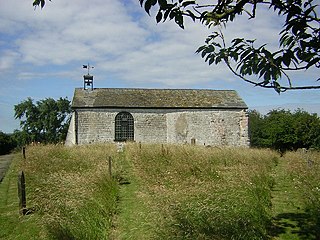
Haugh is a hamlet and civil parish in the East Lindsey district of Lincolnshire, England. It is situated about 2 miles (3 km) south-west from the town of Alford.

Sutton St Edmunds is a village and civil parish in the South Holland district of Lincolnshire, England, about 14 miles (23 km) south-east from the town of Spalding.

