Sausthorpe

Last updated • 3 min readFrom Wikipedia, The Free Encyclopedia

Sausthorpe
St. Andrew's church, Sausthorpe - geograph.org.uk - 1019335.jpg
Church of St Andrew, Sausthorpe
Lincolnshire UK location map.svg
Red pog.svg
Sausthorpe
Location within Lincolnshire
Population305 (Including Aswardby, Dalby and Langton by Spilsby. 2011) [1]
OS grid reference TF383694
  London 140 mi (230 km)  S
District
Shire county
Region
Country England
Sovereign state United Kingdom
Post town Spilsby
Postcode district PE23
Police Lincolnshire
Fire Lincolnshire
Ambulance East Midlands
UK Parliament
List of places
UK
England
Lincolnshire
53°12′11″N0°04′12″E / 53.203°N 0.070°E / 53.203; 0.070

Sausthorpe is a small village and civil parish in the East Lindsey district of Lincolnshire, England, 8 miles (13 km) east of Horncastle and 3 miles (4.8 km) north-west of Spilsby. It lies on the southern edge of the Lincolnshire Wolds – a designated Area of Outstanding Natural Beauty – in the valley of the River Lymn. Farming remains the dominant economic activity in the area. The population was 305 in the 2011 census [2] and estimated at 306 in 2019. [3]

Contents

Heritage

Derivation

The name is believed to derive from "Sauthr's thorpe", a farming settlement here in Viking times. [4]

Church

The parish church, dedicated to St Andrew, is a Grade II listed building, designed by Charles Kirk and built in 1842 on the site of an earlier medieval church. [5] [6] Its construction was sponsored by Rev. Francis A. Swan, Lord of the Manor and parish rector from 1819 until his death in 1878. [7] The spire is a prominent landmark resembling on a smaller scale that of St. James Church, Louth, 12 miles (19 km) to the north.

Pelham Dale SSC – prosecuted and imprisoned for ritualist practices in 1876 and 1880, and so regarded as a martyr by Anglo-Catholics – was the parish priest from 1881 to 1892.[ citation needed ] His grave lies under the trees on the eastern side of the churchyard. Inside the church, several Dymoke family gravestones date from the 18th century, having been transferred from the earlier church.

In 1885 Kelly's Directory recorded Rev. Charles Trollope Swan LLB as living at Sausthorpe Hall, a "modern mansion in a park of 30 acres". He had inherited the roles of Lord of the Manor and Rector from his father, Francis Swan, in 1878. He granted the rectorate, including the rectory living, residence (the Old Hall, see below) and 34 acres (0.14 km2) of glebe land, to T. Pelham Dale in 1882.

Facilities

Rev. Francis A. Swan built a National School for 50 children in 1860. It survived until 1983.

The parish of Sausthorpe had a population of 206 in 30 inhabited houses in 1831. [8]

Kelly's Directory recorded that in 1885 the area of the parish was 727 acres (2.9 km2), in which were grown wheat, barley and turnips, that Sausthorpe's population at the time of the 1881 census was 141, and that within the parish were a grocer, wheelwright, carrier, two farmers, a farmer-cum-beer retailer, and a farmer-surveyor. [9]

Sausthorpe Hall is a late 18th-century Grade II listed country house, extended and remodelled in 1822. [10]

The Old Hall is a Grade II* listed 15th-century house, with 16th and 18th-century alterations. It has rendering over red brick and the remains of a timber frame. [11]

Historically there were three principal farms in the village: East Farm (the farmhouse is set back from the main road about one mile east of the village); Grange Farm (the farmhouse is on the main road at the eastern entry to the village); and Church Farm (the farmhouse, now known as Linden House, is on the corner of the crossroads at the centre of the village).

Notable people

Transport

Sausthorpe lies on the main A158 road between Horncastle and Skegness. It is served by the Spilsby CallConnect weekday bus service, which must be ordered by phone in advance. [12] The nearest railway station is Skegness (13 miles; 21 km).

Related Research Articles

<span class="mw-page-title-main">Bolingbroke, Lincolnshire</span> Village in Lincolnshire, England

Bolingbroke, now called Old Bolingbroke, is a village and civil parish in the East Lindsey district of Lincolnshire, England. Its present boundaries were formed by the amalgamation of the Parishes of Bolingbroke and Hareby in 1739. The population at the 2011 census was 325.

<span class="mw-page-title-main">Horncastle</span> Town in Lincolnshire, England

Horncastle is a market town and civil parish in the East Lindsey district in Lincolnshire, England. It is 17 miles (27 km) east of Lincoln. Its population was 6,815 at the 2011 census and estimated at 7,123 in 2019. A section of the ancient Roman walls remains.

<span class="mw-page-title-main">Spilsby</span> Market town and civil parish in Lincolnshire, England

Spilsby is a market town and civil parish in the East Lindsey district of Lincolnshire, England. The town is adjacent to the main A16, 33 miles (53 km) east of Lincoln, 17 miles (27 km) north-east of Boston and 13 miles (21 km) north-west of Skegness. It lies at the southern edge of the Lincolnshire Wolds and north of the Fenlands.

<span class="mw-page-title-main">Moorby</span> Village in Lincolnshire, England

Moorby is a small village and former civil parish, now in the parish of Claxby with Moorby, in the East Lindsey district of Lincolnshire, England. The village is situated 4 miles (6 km) south-east from Horncastle and 1 mile (1.6 km) east from Wood Enderby. Moorby has a population of about 50 inhabitants.

<span class="mw-page-title-main">Hogsthorpe</span> Village in Lincolnshire, England

Hogsthorpe is a small village in the East Lindsey district of Lincolnshire, England. It is situated approximately 2 miles (3 km) from the North Sea and Chapel St Leonards, and about 7 miles (11 km) north from Skegness. The A52 road runs through Hogsthorpe, connecting the village to the nearby resorts of Skegness, Mablethorpe and Ingoldmells.

<span class="mw-page-title-main">Firsby</span> Small rural linear village and civil parish in the East Lindsey district of Lincolnshire, England

Firsby is a small rural linear village and civil parish in the East Lindsey district of Lincolnshire, England. It is situated 30 miles (48 km) east from the city and county town of Lincoln, 4 miles (6.4 km) south-east from the nearest market town of Spilsby, and 7 miles (11 km) inland from the holiday resort town of Skegness.

<span class="mw-page-title-main">Orby</span> Village and civil parish in the East Lindsey district of Lincolnshire, England

Orby is a village and civil parish in the East Lindsey district of Lincolnshire, England. It is situated approximately 9 miles (14 km) east from the town of Spilsby, and 5 miles (8 km) west from the seaside resort of Skegness. The civil parish includes the hamlet of Habertoft, 1.5 miles (2.4 km) to the north-west. Orby lies within the Lincolnshire coast marshes.

<span class="mw-page-title-main">Winceby</span> Village in Lincolnshire, England

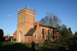
Winceby is a village in the civil parish of Lusby with Winceby, in the East Lindsey district of Lincolnshire, England. It is in the Lincolnshire Wolds, and about 5 miles (8.0 km) from both Horncastle and Spilsby. In 1971 the parish had a population of 24. On 1 April 1987 the parish was abolished to form "Lusby with Winceby".

<span class="mw-page-title-main">Irby in the Marsh</span> Village and civil parish in Lincolnshire, England

Irby in the Marsh is a village and civil parish in the East Lindsey district of Lincolnshire, England. It is situated on the B1195 road, geographically 4.5 miles (7 km) east from Spilsby and 6 miles (10 km) west from Skegness.

<span class="mw-page-title-main">A158 road</span> Road in England

The A158 road is a major route that heads from Lincoln in the west to Skegness on the east coast. The road is located entirely in the county of Lincolnshire and is single carriageway for almost its entirety. The road is approximately 40 miles (64 km) long. The road gets quite congested with holiday traffic during the summer.

<span class="mw-page-title-main">Keal Cotes</span> Small linear village in East Lindsey district of Lincolnshire, England

Keal Cotes, forming part of West Keal parish, is a small linear village in East Lindsey district of Lincolnshire, England. It is situated on the A16 road, 1 mile (1.6 km) south from West Keal and 1 mile north from Stickford. The nearest market town is Spilsby, about 6 miles (10 km) to the north. Keal Cotes market day is on Mondays.

<span class="mw-page-title-main">Friskney</span> Village and civil parish within the East Lindsey district of Lincolnshire, England

Friskney is a village and civil parish within the East Lindsey district of Lincolnshire, England.

<span class="mw-page-title-main">Fulletby</span> Village and a civil parish in the East Lindsey district of Lincolnshire, England

Fulletby is a village and a civil parish in the East Lindsey district of Lincolnshire, England. It is in the Lincolnshire Wolds, and 3 miles (5 km) north-east from Horncastle, 9 miles (14 km) south from Louth, and 8 miles (13 km) north-west from Spilsby. The parish covers approximately 1,950 acres (8 km2). At the time of the 2011 census the population remained less than 100 and is included in the civil parish of Low Toynton.

<span class="mw-page-title-main">Holton le Moor</span> Village in Lincolnshire, England

Holton le Moor is a small village and civil parish in the West Lindsey district of Lincolnshire, England.

<span class="mw-page-title-main">Raithby by Spilsby</span> Village and civil parish in the East Lindsey district of Lincolnshire, England

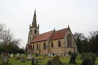
Raithby by Spilsby or Raithby is a village and civil parish in the East Lindsey district of Lincolnshire, England. It is situated about 2 miles (3.2 km) north-west from the town of Spilsby.

<span class="mw-page-title-main">Candlesby</span> Village in Lincolnshire, England

Candlesby is a village and former civil parish, now in the parish of Candlesby with Gunby, in the East Lindsey district of Lincolnshire, England. It is situated 5 miles (8 km) east from Spilsby. Gunby is a hamlet about 1 mile (1.6 km) east from Candlesby. In 1961 the parish had a population of 144.

<span class="mw-page-title-main">South Willingham</span> Village and civil parish in Lincolnshire, England

South Willingham is a village and civil parish in the East Lindsey district of Lincolnshire, England, and partly within the Lincolnshire Wolds Area of Outstanding Natural Beauty,. It is situated 1 mile (2 km) south of the A157 Lincoln to Louth road, 15 miles (24 km) west of Lincoln, where the central Lincolnshire Vale and the Lincolnshire Wolds meet. Its population was 160 at the 2011 census, down from a maximum of 341 in 1851.

<span class="mw-page-title-main">Revesby, Lincolnshire</span> Village and civil parish in Lincolnshire, England

Revesby is a village and civil parish in the East Lindsey district of Lincolnshire, England. It is 7 miles (11 km) south-east from Horncastle, 8 miles (13 km) east from Woodhall Spa and 14 miles (23 km) north from Boston, and on the A155. The parish includes the hamlet of Moorhouses 3 miles (5 km) to the south of Revesby village.

<span class="mw-page-title-main">Langton by Spilsby</span> Village and civil parish in the East Lindsey district of Lincolnshire, England

Langton by Spilsby, sometimes called Langton by Partney, is a village and civil parish in the East Lindsey district of Lincolnshire, England. It is situated approximately 4 miles (6 km) north from the town of Spilsby, Lincolnshire. The civil parish includes the hamlet of Sutterby. From the 2011 census the population is included in the civil parish of Sausthorpe.

<span class="mw-page-title-main">Toynton Fen Side</span> Hamlet and linear settlement on Fenside Road in the East Lindsey district of Lincolnshire, England

Toynton Fen Side is a hamlet and linear settlement on Fenside Road in the East Lindsey district of Lincolnshire, England. The hamlet is partly in the civil parish of Toynton St Peter, and that of Toynton All Saints. Toynton Fen Side is situated 12 miles (19 km) north from Boston and 11 miles (18 km) west from Skegness. The East Fen Catchwater Drain crosses west to east at the south of the hamlet. Bus services connect Toynton Fen Side with Horncastle, Partney, Wainfleet, Boston, Mablethorpe, and Spilsby.

References

  1. "Parish population 2011" . Retrieved 20 August 2015.
  2. "Sausthorpe (Parish, United Kingdom) - Population Statistics, Charts, Map and Location" . Retrieved 26 December 2020.
  3. "City Population" . Retrieved 20 January 2021.
  4. Cameron, Kenneth (1998); A Dictionary of Lincolnshire Place-names, English Place-Name Society. ISBN   0904889580 [ page needed ]
  5. Historic England. "St Andrews, Sausthorpe (1034892)". Research records (formerly PastScape). Retrieved 10 August 2011.
  6. Historic England. "St Andrews, Sausthorpe (1063638)". National Heritage List for England . Retrieved 10 August 2011.
  7. "Sausthorpe, St. Andrew" . Retrieved 26 October 2022.
  8. "Google Books. Retrieved 30 December 2019". 1836.
  9. Kelly's Directory of Lincolnshire with the port of Hull 1885, p. 611.
  10. Historic England. "Sausthorpe Hall (1063637)". National Heritage List for England . Retrieved 10 August 2011.
  11. Historic England. "The Old Hall, Sausthorpe (1063639)". National Heritage List for England . Retrieved 10 August 2011.
  12. "Retrieved 30 December 2019".