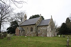
Aby is a village in the East Lindsey district of Lincolnshire, England. It is approximately 30 miles (48 km) east from the city and county town of Lincoln and 8 miles (13 km) south-east from Louth. Aby is part of the civil parish of Aby with Greenfield.

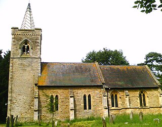
Authorpe is a village and civil parish in the East Lindsey district of north-west of Lincolnshire, England. It is situated between the A16 and the A157 roads, 6 miles (10 km) south-east from Louth and 4.5 miles (7 km) north-west from Alford.

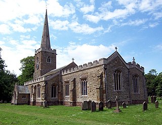
Roughton is a village and civil parish in the East Lindsey district of Lincolnshire, England. The parish population was 644 in 2011.
Brattleby is a village and civil parish in the West Lindsey district of Lincolnshire, England. The population of the civil parish at the 2011 census was 111, having slightly fallen from a figure of 113 quoted on the 2001 census. It is situated 5 miles (8 km) north of Lincoln, to the west of the A15, and near to RAF Scampton.

Holton-le-Clay is a village, civil parish and electoral ward in the East Lindsey district of Lincolnshire, England, around 5 miles (8.0 km) south of Grimsby. The village is twinned with Sargé-lès-le-Mans, Sarthe, France.

Fulletby is a village and a civil parish in the East Lindsey district of Lincolnshire, England. It is in the Lincolnshire Wolds, and 3 miles (5 km) north-east from Horncastle, 9 miles (14 km) south from Louth, and 8 miles (13 km) north-west from Spilsby. The parish covers approximately 1,950 acres (8 km2). At the time of the 2011 census the population remained less than 100 and is included in the civil parish of Low Toynton.

Withern is a village in the civil parish of Withern with Stain, in the East Lindsey district of Lincolnshire, England. It is situated on the A157 road, and 7 miles (11 km) south-east from Louth. Stain was once an independent parish but was combined with Withern when the old church of St John the Baptist was destroyed some centuries ago.
Hainton is a village and civil parish in the East Lindsey district of Lincolnshire, England. It is situated on the A157 road, 10 miles (16 km) west from Louth and 5 miles (8 km) south-east from Market Rasen.

Muckton is a village and former civil parish in the East Lindsey district of Lincolnshire, England. It lies between the A16 and A157 roads, 5 miles (8.0 km) south-east from Louth and approximately 1 mile (1.6 km) to the west of the village of Authorpe. It is in the Lincolnshire Wolds, a designated Area of Outstanding Natural Beauty. It is in the civil parish of Burwell.

Hagworthingham is a village and civil parish in the East Lindsey district of Lincolnshire, England. It is on the A158, 5 miles (8 km) east of Horncastle and 4 miles (6 km) north-west of Spilsby.

Strubby is a village in the East Lindsey district of Lincolnshire, England. It is situated just north of the A157 road, 8 miles (13 km) south-east from Louth and 4 miles (6.4 km) north from Alford. The village forms part of Strubby and Woodthorpe civil parish, with the nearby hamlet of Woodthorpe.

Ruckland is a village in the civil parish of Maidenwell, and about 6 miles (10 km) south from the town of Louth, Lincolnshire, England. It lies in the Lincolnshire Wolds, a designated Area of Outstanding Natural Beauty.

Thimbleby is a village and civil parish in the East Lindsey district of Lincolnshire, England. It is situated approximately 1 mile (1.6 km) west from the A158 road and the town of Horncastle.

Kelstern is a village in the civil parish of Calcethorpe with Kelstern, in the East Lindsey district of Lincolnshire, England.

Gayton le Wold is a village and civil parish in the East Lindsey district of Lincolnshire, England. It lies 6 miles (10 km) west from Louth, 3 miles (5 km) north from Donington on Bain, and to the south of the A157. The parish includes Biscathorpe 1 mile (1.6 km) to the south-west.

Hallington is a small village and civil parish in the East Lindsey district of Lincolnshire, England. It is situated 2 miles (3 km) south-west from the town of Louth in the Lincolnshire Wolds, a designated Area of Outstanding Natural Beauty. The population of the village is included in the civil parish of Welton Le Wold.

Skidbrooke, also called Skidbrooke cum Saltfleet, is a hamlet in the East Lindsey district of Lincolnshire, England. It is situated 10 miles (16 km) north from the town of Alford and 7 miles (11 km) east from Louth. With the hamlet of Saltfleet Haven it forms the civil parish of Skidbrooke with Saltfleet Haven.

North Ormsby is a village and civil parish in the East Lindsey district of Lincolnshire, England. It is situated approximately 7 miles (11 km) north-west from the market town of Louth.

Waithe is a hamlet and civil parish in the East Lindsey district of Lincolnshire, England. It is on the A16, 1 mile (1.6 km) south from Holton-le-Clay and 1 mile (1.6 km) north from North Thoresby.

Girsby is a hamlet in the East Lindsey district of Lincolnshire, England. It is situated less than 1 mile (2 km) north from the A157 road, 7 miles (11 km) west from Louth and 7 miles east from Market Rasen. It lies in the civil parish of Burgh on Bain.