
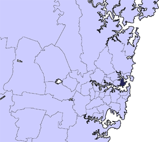
City of Cessnock is a local government area in the Hunter region of New South Wales, Australia. The area under administration is located to the west of Newcastle. The largest population centre and council seat is the city of Cessnock.

The City of Hawkesbury is a local government area of New South Wales, Australia, part of which is at the fringe of the Sydney metropolitan area, about 50 kilometres (31 mi) north-west of the Sydney central business district. Hawkesbury City is named after the Hawkesbury River.

The Lane Cove Council is a local government area located on the Lower North Shore of Sydney, New South Wales, Australia. The administrative seat of Lane Cove is located 10 kilometres (6.2 mi) north-west of the Sydney central business district.
The Mosman Council is a local government area on the Lower North Shore of Sydney, New South Wales, Australia.

Greta is a small town in the Hunter Region of New South Wales, Australia. The Traditional Owners and Custodians of the Maitland area are the Wonnarua people. The Greta area was first colonized by Europeans around Anvil Creek in the 1830s. When the town was surveyed in 1842 it was given the name Greta, possibly after a small river in Cumberland, England. Coal mining was established in the area in 1862 with the development of a railway station. In 1864 kerosene shale was discovered. By the 1870s, Greta had four hotels, four churches, a school and schools of arts. Geologist Edgeworth David discovered the Greta Coal Seam in 1886. By 1907 ten collieries were in operation. In 1939 an army training camp was established. After WWII the town's population grew as it became a migrant camp for European refugees. The small town has a large European community with many people coming from Polish, Ukrainian and German heritage. At the 2016 census the town had a population of 2,830. The Main Street of Greta, High street is a quiet stretch of road with the most popular social areas being Tattersalls Hotel Pub and the bowling club. These days it is largely a commuter town located midway between Cessnock, Singleton and Maitland. A convenient location for miners and their families to live. The town is also linked to nearby town, Branxton where you will find the nearest grocery store. Being in the Hunter Valley, Greta is close to many vineyards and wine cellars.
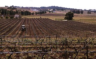
Pokolbin is a rural locality in the Hunter Region of New South Wales Australia. It is part of the Singleton Council local government area and the city of Cessnock. The area is the centre of the Lower Hunter Valley wine region. Pokolbin lies within the Hunter Valley Important Bird Area.

Abernethy is a small town in the City of Cessnock, in the Hunter Region in the state of New South Wales, Australia. Abernethy is located 8 kilometres south-east of the town of Cessnock, NSW and is adjacent to Werakata National Park and the Aberdare State Forest. The town was founded near a coal mine and some of the historic buildings remain. In 2016 348 lived there with the median age being 32 and 74.8% being born in Australia.

Aberdare is a suburb of Cessnock, a large town based on coal mining in the Lower Hunter Region, New South Wales, Australia. Aberdare is a small suburb just 15 minutes’ from beautiful wine country, 45 minutes to Newcastle and two hours to Sydney. George Brown found coal in the area in 1800's.Coal mining created the land boom of 1903-23 and by 1926 Cessnock had a population of 12,000 within a one-mile radius

Abermain is a town 8 km ENE of Cessnock and 3 km west of Weston, in New South Wales, Australia. Abermain is adjacent to Werakata National Park.
Nulkaba is a locality in the city of Cessnock, in the Hunter Region of New South Wales, Australia.
Weston is a town in the Hunter Region of New South Wales, Australia. It is part of the City of Cessnock local government area, located approximately 11 km (7 mi) from Cessnock. At the 2016 census it recorded a population of 3,693.
Laguna is a locality in the city of Cessnock, in the Hunter Region of New South Wales, Australia. It is located about 37 km (23 mi) southwest of Cessnock in the Wollombi Valley.
Watagan is a locality in the City of Cessnock, in the Hunter Region of New South Wales, Australia. It is located east of Laguna.
Cliftleigh is a small suburb, and planned development in the City of Cessnock, New South Wales, Australia. It is 27.8 kilometres (17 mi) north-west from Newcastle, and 17 kilometres (11 mi) east-northeast from Cessnock.
Allandale is a locality in Cessnock and Maitland in the Hunter Region of New South Wales, Australia. The Traditional Owners and Custodians of the Maitland area are the Wonnarua people.
Quorrobolong is a small locality in the Hunter Region of New South Wales, Australia. It is located 11 km (7 mi) southeast of the town of Cessnock and is adjacent to Watagans National Park.
Bellbird is a town and locality in the City of Cessnock in the Hunter Region of New South Wales, Australia. In 1990 a memorial was built to remember the 21 deaths from 1923 Bellbird Mining Disaster.
Bishops Bridge is a locality in the cities of Cessnock and Maitland in the Hunter Region of New South Wales, Australia. In 2016 the population was 248 with a median of 45 and 78% born in Australia.
Cedar Creek is a small rural locality 29 kilometres (18 mi) east of Cessnock in the Hunter Region of New South Wales, Australia. In 2016 the population was 33 people and the median age was 44.
