
Mandya is a city in the state of Karnataka. It is the headquarter of Mandya district, Sugar factories contribute to the major economic output. It is also called Sugar City because sugarcane is a major crop grown here. The district offices are located here. The city has been divided into 35 wards of the Mandya City Municipal Council.
Mandya district is an administrative district of Karnataka, India. The district is bordered on the south by Mysore and Chamarajangar districts, on the west by Hassan district, on the north by Tumkur district and on the east by Ramanagara district. The district Mandya was carved out of larger Mysore district in the year 1939.

Nagamangala is a PuraSabhe and a taluk in Mandya district, in the Indian state of Karnataka.
Tarikere is a town, a taluk and is one of the two Subdivisional headquarter in the Chikmagalur district of Karnataka state, India. It is popularly known as gateway of Malnad because the Malnad area starts from here. The town's name is derived from the number of water tanks which surround it.
Kabbur is a town in the southern state of Karnataka, India. It is located in the Chikodi taluk of Belgaum district in Karnataka.
Arakere is a village in the southern state of Karnataka, India. It is located in the Shrirangapattana taluk of Mandya district in Karnataka.
Belagola , sometimes referred to as Mandya Belagola to distinguish it from Shravana Belagola, is a village in the southern state of Karnataka, India. It is located about 15 kilometers north-northwest of Mysuru city in the Shrirangapattana taluk of Mandya district in Karnataka. It is around 7 km from famous K.R.S Dam.
Budanur is a village in the southern state of Karnataka, India. It is located in the Mandya taluk of Mandya district in Karnataka.
Keelara is a village in the southern state of Karnataka, India. It is located in the Mandya taluk of Mandya district. The village is around 10 km from Mandya city and 96 km from the capital city of Karnataka via NH-275.
A. Nagathihalli is a village in the southern state of Karnataka, India. It is located in the Nagamangala taluk of Mandya district in Karnataka.
A. Sriramanahalli is a village in the southern state of Karnataka, India. It is located in the Nagamangala taluk of Mandya district in Karnataka.
Adakatahalli is a village in the southern state of Karnataka, India. It is located in the Nagamangala taluk of Mandya district in Karnataka.
Advikatte is a village in the southern state of Karnataka, India. It is located in the Nagamangala taluk of Mandya district in Karnataka.
Agachahalli is a village in the southern state of Karnataka, India. It is located in the Nagamangala taluk of Mandya district in Karnataka.

Addihalli, Nagamangala is a village in the southern state of Karnataka, India. It is located in the Nagamangala taluk of Mandya district in Karnataka.

Akkihebbalu is a Hobli in the southern state of Karnataka, India. It is located in the Krishnarajpet taluk of Mandya district in Karnataka.
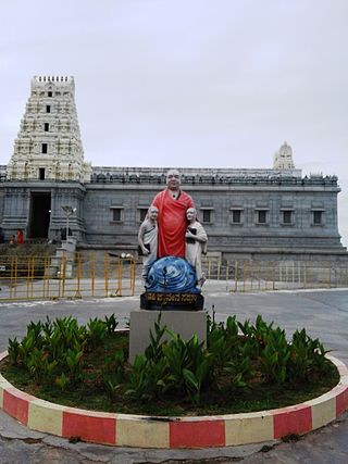
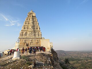
Adichunchanagiri, also called Mahasamsthana Math, is a hill township in Nagamangala Taluk, Mandya District, Karnataka State, India, 110 km west of Bangalore, the capital of Karnataka, India and 6 km from Bangalore-Mangalore National Highway 48, northerly to Bellur cross. Sri Adichunchanagiri Mahasamsthana Math is situated on a rocky hill at an altitude of about 3,300 ft. above M.s.l. It is the spiritual headquarters of the Natha Parampare and Jogi Cult of Hindus of Karnataka.
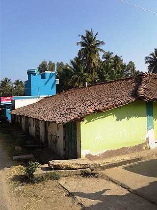
Dadaga is a village in the southern state of Karnataka, India. It is located in the Nagamangala taluk of Mandya district in Karnataka. A lake and channel of Hemavathi water acts as water supply for irrigation conducted here. Many temples can also be found in this place. Government runs a primary and middle Kannada medium school in Dadaga which educates Dadaga and neighboring villages. Coconuts, mangoes, ragi, paddy (rice), wheat, corn, onions, tomatoes, are some of the plants that are cultivated here.

Jakkanahalli is a small village in Mandya district of Karnataka state, India.

Mulleria is a small town located in Karadka Panchayath, Kasaragod district in Kerala, India.

