Billa Billa, Queensland

Last updated

Billa Billa
Queensland
Australia Queensland location map.svg
Red pog.svg
Billa Billa
Coordinates 28°09′21″S150°16′49″E / 28.1558°S 150.2802°E / -28.1558; 150.2802 (Billa Billa (centre of locality))
Population111 (2021 census) [1]
 • Density0.1832/km2 (0.4744/sq mi)
Postcode(s) 4390
Area606.0 km2 (234.0 sq mi)
Time zone AEST (UTC+10:00)
Location
LGA(s) Goondiwindi Region
State electorate(s) Southern Downs
Federal division(s) Maranoa
Suburbs around Billa Billa:
Lundavra Calingunee Yagaburne
Goodar
Lundavra
Billa Billa Yagaburne
Wyaga
Goodar Goondiwindi Wyaga

Billa Billa is a rural locality in the Goondiwindi Region, Queensland, Australia. [2] In the 2021 census, Billa Billa had a population of 111 people. [1]

Contents

Geography

Billa Billa is crossed by the Leichhardt Highway and in the south east by the Gore Highway. Yarril Creek marks a small section of the boundary in east. The Weir River roughly follows the western extent of Billa Billa. The majority of the land is used for agriculture. [3]

There are a number of lagoons in the locality:

History

The name Billa Billa means pool or reach of water in an unknown Aboriginal dialect. [2]

Demographics

In the 2016 census, Billa Billa had a population of 107 people. [7]

In the 2021 census, Billa Billa had a population of 111 people. [1]

Education

There are no schools in Billa Billa. The nearest government primary schools are: [8]

The nearest government secondary school is Goondiwindi State High School in Goondiwindi. [8]

See also

Related Research Articles

<span class="mw-page-title-main">Goondiwindi</span> Town in Queensland, Australia

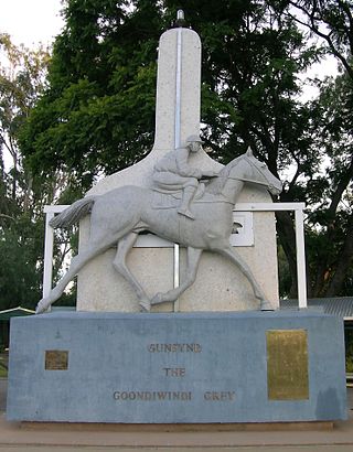
Goondiwindi is a rural town and locality in the Goondiwindi Region, Queensland, Australia. It is on the border of Queensland and New South Wales. In the 2021 census, the locality of Goondiwindi had a population of 6,230 people.

<span class="mw-page-title-main">Yelarbon</span> Town in Queensland, Australia

Yelarbon is a rural town and locality in the Goondiwindi Region, Queensland, Australia. It is on the border of Queensland and New South Wales. In the 2021 census, the locality of Yelarbon had a population of 313 people.

<span class="mw-page-title-main">Moonie, Queensland</span> Town in Queensland, Australia

Moonie is a rural town in the Western Downs Region and a locality split between the Western Downs Region and the Goondiwindi Region in Queensland, Australia. In the 2021 census, the locality of Moonie had a population of 182 people.

<span class="mw-page-title-main">Ebenezer, Queensland</span> Suburb of Ipswich, Queensland, Australia

Ebenezer is a rural locality in the City of Ipswich, Queensland, Australia. In the 2021 census, Ebenezer had a population of 301 people.

<span class="mw-page-title-main">Munbilla, Queensland</span> Town in Queensland, Australia

Munbilla is a rural town and locality in the Scenic Rim Region, Queensland, Australia. In the 2021 census, the locality of Munbilla had a population of 93 people.

<span class="mw-page-title-main">East End, Queensland</span> Suburb of Gladstone Region, Queensland, Australia

East End is a rural locality in the Gladstone Region, Queensland, Australia. In the 2021 census, East End had a population of 88 people.

Bybera is a rural locality in the Goondiwindi Region, Queensland, Australia. In the 2021 census, Bybera had "no people or a very low population".

<span class="mw-page-title-main">Beebo, Queensland</span> Suburb of Goondiwindi Region, Queensland, Australia

Beebo is a rural locality in the Goondiwindi Region, Queensland, Australia. It is on the Queensland border with New South Wales. In the 2021 census, Beebo had a population of 50 people.

Calingunee is a rural locality in the Goondiwindi Region, Queensland, Australia. In the 2021 census, Calingunee had a population of 18 people.

Daymar is a rural town and locality in the Goondiwindi Region, Queensland, Australia. In the 2021 census, the locality of Daymar had a population of 41 people.

<span class="mw-page-title-main">Glenarbon, Queensland</span> Suburb of Goondiwindi Region, Queensland, Australia

Glenarbon is a rural locality in the Goondiwindi Region, Queensland, Australia. It is on the border of Queensland and New South Wales. In the 2021 census, Glenarbon had a population of 33 people.

Goodar is a rural locality in the Goondiwindi Region, Queensland, Australia. In the 2021 census, Goodar had a population of 101 people.

Kindon is a rural locality in the Goondiwindi Region, Queensland, Australia. In the 2021 census, Kindon had a population of 20 people.

Kurumbul is a rural town and locality in the Goondiwindi Region, Queensland, Australia. It is on the border of Queensland and New South Wales. In the 2021 census, the locality of Kurumbul had a population of 36 people.

<span class="mw-page-title-main">Airville, Queensland</span> Suburb of Shire of Burdekin, Queensland, Australia

Airville is a rural locality in the Shire of Burdekin, Queensland, Australia. In the 2021 census, Airville had a population of 308 people.

<span class="mw-page-title-main">Bancroft, Queensland</span> Suburb of North Burnett Region, Queensland, Australia

Bancroft is a rural locality in the North Burnett Region, Queensland, Australia. In the 2021 census, Bancroft had a population of 98 people.

<span class="mw-page-title-main">Lockyer Waters, Queensland</span> Suburb of Lockyer Valley Region, Queensland, Australia

Lockyer Waters is a rural locality in the Lockyer Valley Region, Queensland, Australia. In the 2021 census, Lockyer Waters had a population of 538 people.

<span class="mw-page-title-main">Nandi, Queensland</span> Suburb of Western Downs Region, Queensland, Australia

Nandi is a rural locality in the Western Downs Region, Queensland, Australia. In the 2021 census, Nandi had a population of 105 people.

Humboldt is a rural locality in the Central Highlands Region, Queensland, Australia. In the 2021 census, Humboldt had a population of 49 people.

Gordonstone is a rural locality in the Central Highlands Region, Queensland, Australia. In the 2021 census, Gordonstone had a population of 32 people.

References

  1. 1 2 3 Australian Bureau of Statistics (28 June 2022). "Billa Billa (SAL)". 2021 Census QuickStats. Retrieved 28 February 2023. OOjs UI icon edit-ltr-progressive.svg
  2. 1 2 "Billa Billa – locality in Goondiwindi Region (entry 47796)". Queensland Place Names. Queensland Government . Retrieved 18 September 2020.
  3. "Queensland Globe". State of Queensland . Retrieved 18 October 2020.
  4. "Billa Billa Lagoon – waterhole in Goondiwindi Regional (entry 2575)". Queensland Place Names. Queensland Government . Retrieved 18 September 2020.
  5. "Tangan Lagoon – waterhole in Goondiwindi Regional (entry 33278)". Queensland Place Names. Queensland Government . Retrieved 18 September 2020.
  6. "Washpool Lagoon – waterhole in Goondiwindi Regional (entry 36679)". Queensland Place Names. Queensland Government . Retrieved 18 September 2020.
  7. Australian Bureau of Statistics (27 June 2017). "Billa Billa (SSC)". 2016 Census QuickStats. Retrieved 20 October 2018. OOjs UI icon edit-ltr-progressive.svg
  8. 1 2 "Layers: Locality; Schools and school catchments". Queensland Globe. Queensland Government . Retrieved 26 June 2024.