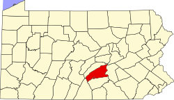
Blain, Pennsylvania | |
---|---|
Coordinates: 40°20′14″N77°30′38″W / 40.33722°N 77.51056°W | |
Country | United States |
State | Pennsylvania |
County | Perry |
Settled | 1846 |
Incorporated | 1877 |
Area | |
• Total | 0.32 sq mi (0.82 km2) |
• Land | 0.32 sq mi (0.82 km2) |
• Water | 0.00 sq mi (0.00 km2) |
Elevation [2] (center of borough) | 705 ft (215 m) |
Highest elevation [2] (northern boundary) | 730 ft (220 m) |
Lowest elevation [2] (Sherman Creek) | 675 ft (206 m) |
Population | |
• Total | 229 |
• Density | 720.13/sq mi (278.47/km2) |
Time zone | UTC-5 (Eastern (EST)) |
• Summer (DST) | UTC-4 (EDT) |
Zip code | 17006 |
Area codes | 717 and 223 |
FIPS code | 42-06824 |
Blain is a borough in Perry County, Pennsylvania, United States. The population was 227 at the 2020 census. [4] It is part of the Harrisburg metropolitan area. Blain is located in a valley region known as Sherman's Valley.
Early settlement began around the mill built by James Blaine in 1778, from whom the borough took its name. The final "e" was dropped at some point, although there are records of county newspapers using the "Blaine" spelling until at least 1868. Early in the 1800s, Blaine's mill came into the possession of William Douglas, who had a post office established with the name "Douglas' Mills". A subsequent owner of the mill, Anthony Black, had the name of the post office changed to "Multicaulisville", after the mulberry tree ( morus multicaulis ), in which he had a financial interest during a speculative bubble in the tree. Lots were platted for sale in 1846 and the name of the post office was changed to "Blain".
At one time, Blain was noted for being the smallest borough in Pennsylvania to own its own water plant and electric street lighting system. Jacob Wentz was instrumental in the construction of the first water plant in about 1869 or 1870. The borough was incorporated by an order of the Perry county court on November 3, 1877. [5]
Blain is located at 40°20′14″N77°30′38″W / 40.33722°N 77.51056°W (40.337233, -77.510525). [6]
According to the United States Census Bureau, the borough has a total area of 0.3 square miles (0.78 km2), all land. Population is 286 (2000). Its highest point is Conegeuege Mountain (1872 feet); the elevation is 750 feet on average.
Census | Pop. | Note | %± |
---|---|---|---|
1880 | 270 | — | |
1890 | 249 | −7.8% | |
1900 | 326 | 30.9% | |
1910 | 326 | 0.0% | |
1920 | 310 | −4.9% | |
1930 | 291 | −6.1% | |
1940 | 280 | −3.8% | |
1950 | 315 | 12.5% | |
1960 | 336 | 6.7% | |
1970 | 287 | −14.6% | |
1980 | 274 | −4.5% | |
1990 | 266 | −2.9% | |
2000 | 252 | −5.3% | |
2010 | 263 | 4.4% | |
2020 | 227 | −13.7% | |
2021 (est.) | 226 | [4] | −0.4% |
Sources: [7] [8] [9] [10] [3] |
As of the census [8] of 2000, there were 252 people, 96 households, and 67 families living in the borough. The population density was 714.1 inhabitants per square mile (275.7/km2). There were 102 housing units at an average density of 289.1 per square mile (111.6/km2). The racial makeup of the borough was 96.43% White and 3.57% African American.
There were 96 households, out of which 30.2% had children under the age of 18 living with them, 58.3% were married couples living together, 11.5% had a female householder with no husband present, and 29.2% were non-families. 22.9% of all households were made up of individuals, and 12.5% had someone living alone who was 65 years of age or older. The average household size was 2.63 and the average family size was 3.15.
In the borough the population was spread out, with 28.2% under the age of 18, 4.0% from 18 to 24, 29.0% from 25 to 44, 23.0% from 45 to 64, and 15.9% who were 65 years of age or older. The median age was 36 years. For every 100 females, there were 98.4 males. For every 100 females age 18 and over, there were 103.4 males.
The median income for a household in the borough was $32,500, and the median income for a family was $39,750. Males had a median income of $35,313 versus $21,875 for females. The per capita income for the borough was $16,223. About 11.6% of families and 12.6% of the population were below the poverty line, including 18.3% of those under the age of eighteen and 10.3% of those 65 or over.
St. Clairsville is a borough in Bedford County, Pennsylvania, United States. The population was 76 at the 2020 census.
Blooming Valley is a borough in Crawford County, Pennsylvania, United States. The population was 342 at the 2020 census, up from 337 at the 2010 census.
Townville is a borough in Crawford County, Pennsylvania, United States. The population was 326 at the 2020 census, up from 323 at the 2010 census.
Mill Village is a borough in Erie County, Pennsylvania, United States. The population was 394 at the 2020 census, down from 412 during the 2010 census. It is part of the Erie Metropolitan Statistical Area.
Mifflin is a borough in Juniata County, Pennsylvania, United States. The population was 534 at the 2020 census.
Mifflintown is a borough in and the county seat of Juniata County, Pennsylvania, United States. The population was 842 at the 2020 census.
Port Royal is a borough in Juniata County, Pennsylvania, United States. The population was 815 at the 2020 census.
Thompsontown is a borough in Juniata County, Pennsylvania, United States. The population was 629 at the 2020 census.
Bessemer is a borough in western Lawrence County, Pennsylvania, United States. The population was 1,073 at the 2020 census. It is part of the Pittsburgh metropolitan area.
Perry Township is a township in Lawrence County, Pennsylvania, United States. The population was 1,854 at the time of the 2020 census, a decline from the figure of 1,938 tabulated in 2010.
Cleona is a borough in Lebanon County, Pennsylvania, United States. It is part of the Lebanon, Pennsylvania Metropolitan Statistical Area. The population was 2,005 at the 2020 census.
Green Lane is a borough in Montgomery County, Pennsylvania. The population was 490 at the 2020 census. It is part of the Upper Perkiomen School District and Boyertown Area School District.
Bloomfield, commonly known as New Bloomfield, is a borough in, and the county seat of, Perry County, Pennsylvania, United States. It is part of the Harrisburg–Carlisle metropolitan statistical area. The population was 1,244 at the 2020 census.
Duncannon is a borough in Perry County, Pennsylvania, United States. The population was 1,473 at the 2020 census. It is part of the Harrisburg–Carlisle Metropolitan Statistical Area. The center of population of Pennsylvania is located in Duncannon. Lightning Guider Sleds were manufactured in Duncannon from 1904 until 1988. The Appalachian Trail makes its way through the town, going on various streets, and runs mainly along North High Street. It comes off the mountain at 40.3813, -77.0292 lat/long, onto Inn Road.
Landisburg is a borough in Perry County, Pennsylvania, United States. The population was 220 at the 2010 census. It is part of the Harrisburg–Carlisle Metropolitan Statistical Area.
Marysville is a borough in Perry County, Pennsylvania, United States. The population was 2,652 at the 2020 census. It is part of the Harrisburg–Carlisle Metropolitan Statistical Area.
Millerstown is a borough in northern Perry County, Pennsylvania, United States, located 29 miles (47 km) northwest of Harrisburg and 29 miles (47 km) southwest of Selinsgrove. The population was 688 at the 2020 Census. The borough is part of the Harrisburg–Carlisle Metropolitan Statistical Area.
New Buffalo is a borough in Perry County, Pennsylvania, United States. The population was 124 at the time of the 2020 census.
Galeton is a borough in Potter County, Pennsylvania. It is located 50 miles (80 km) southeast of Bradford, Pennsylvania. Light industries, including knitting mills and a tannery have existed in Galeton. The population declined to 993 people in 2020.
Hartleton is a borough in Union County, Pennsylvania, United States. The population was 247 at the 2020 census. The borough, as well as the adjoining township of Hartley, are both named for Colonel Thomas Hartley, American politician and Revolutionary War leader, and local landowner. An alternative name was Hartleyton and later shortened to the present name. The original name was Kester's, and named for Peter Kester who was the first tenant of Hartley. Kester's was at the intersection of "great Reuben Haines road" from Northumberland through Dry Valley, New Berlin and the Penns Valley Narrows, and the first public road laid out in the area by Northumberland County court from Northumberland through Derrstown (Lewisburg) and Mifflinburg. Hartley never lived there, as his home was in York, PA. Hartley acquired the land in 1784 from original purchaser Colonel Philip Cole after Cole left the area because of the "Big Runaway" of 1778. Cole purchased the land in 1773, and was living there in 1775. Hartley laid out a town as early as 1798, and the first lot sold in 1799.