A ZIP Code is a system of postal codes used by the United States Postal Service (USPS). Introduced on July 1, 1963, the basic format consisted of five digits. In 1983, an extended ZIP+4 code was introduced; it included the five digits of the ZIP Code, followed by a hyphen and four digits that designated a more specific location.
Cadyville is a hamlet in Clinton County, New York, United States. The community is located along the Saranac River and New York State Route 374, 8.8 miles (14.2 km) west of Plattsburgh. Cadyville has a post office with ZIP code 12918, which opened on July 25, 1840.
Eldred is a rural hamlet located in the central part of the town of Highland, Sullivan County, New York, United States. The community is located along New York State Route 55, approximately 13.5 miles (21.7 km) southwest of Monticello. Eldred has a post office, which opened on October 5, 1831, with the current ZIP code as 12732. Other points of interest in the hamlet include the Highland Town Hall, Sunshine Hall Free Library, a firehouse, several churches and parks, and a Dollar General store. Public education in Eldred is serviced through the Eldred Central School District.

DeKalb Junction is a hamlet and census-designated place located in the town of DeKalb in Saint Lawrence County, New York, United States. Its population was 519 as of the 2010 census. DeKalb Junction has a post office with ZIP code 13630. U.S. Route 11 passes through the community.
Johnson is a hamlet in Orange County, New York, United States. The community is located near New York State Route 284 and is 7 miles (11 km) southwest of Middletown. Johnson has a post office with ZIP code 10933.
Round Top is a hamlet in Greene County, New York, United States. The community is 9.1 miles (14.6 km) west-northwest of Catskill. Round Top has a post office with ZIP code 12473, which opened on January 3, 1910.
South Cairo is a hamlet in Greene County, New York, United States. The community is located along Catskill Creek and New York State Route 23, 6.3 miles (10.1 km) northwest of Catskill. South Cairo has a post office with ZIP code 12482.
Hankins is a hamlet in Sullivan County, New York, United States. The community is located along New York State Route 97 and the Delaware River, 8.2 miles (13.2 km) west-northwest of Jeffersonville. Hankins has a post office with ZIP code 12741.
Kauneonga Lake is a hamlet in Sullivan County, New York, United States. The community is located along New York State Route 55, 8 miles (13 km) west-northwest of Monticello. Kauneonga Lake has a post office with ZIP code 12749.

Lake Huntington is a hamlet in the Town of Cochecton in Sullivan County, New York, United States. The community is located along New York State Route 52, 15.8 miles (25.4 km) west of Monticello. Lake Huntington has a post office with ZIP code 12752, which opened on February 2, 1893.
Mongaup Valley is a hamlet in Sullivan County, New York, United States. The community is located along New York State Route 17B 5 miles (8.0 km) west of Monticello, and along the Mongaup River. Mongaup Valley has a post office with ZIP code 12762, which opened on June 22, 1848.
King Ferry is a hamlet in the town of Genoa, Cayuga County, New York, United States. The community is located at the intersection of New York State Route 90 and New York State Route 34B, 16.4 miles (26.4 km) north of Ithaca. King Ferry has a post office with ZIP code 13081, which opened on December 15, 1807.
Stittville is a hamlet in the town of Marcy in Oneida County, New York, United States. The community is located along New York State Route 291, 9 miles (14 km) north-northwest of Utica. Stittville has a post office with ZIP code 13469.
Mount Vision is a hamlet in Otsego County, New York, United States. According to the 2010 U.S. Census, Mount Vision had a population of 1,018. The community is located along New York State Route 205, 8.7 miles (14.0 km) north of Oneonta. Mount Vision has a post office with ZIP code 13810. Mount Vision was formerly known as Jacksonville. A tuberculosis sanatorium was located here in the early 20th century.
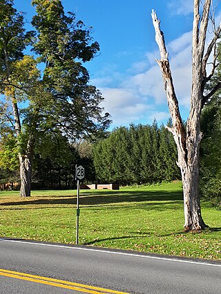
Portlandville is a hamlet in Otsego County, New York, United States. The community is located along the Susquehanna River and New York State Route 28, 7.3 miles (11.7 km) northeast of Oneonta. Portlandville has a post office with ZIP code 13834, which opened on April 9, 1828.
Wells Bridge is a hamlet in Otsego County, New York, United States. The community is located along the Susquehanna River and New York State Route 7, 4.2 miles (6.8 km) west-southwest of Otego. Wells Bridge has a post office with ZIP code 13859.

Hartwick Seminary is a hamlet in Otsego County, New York, United States. The community is located along New York State Route 28, 5 miles (8.0 km) south of Cooperstown. Hartwick Seminary is served by ZIP code 13326.
West Clarksville is a hamlet in Allegany County, New York, United States. The community is located along New York State Route 305, 6.4 miles (10.3 km) south-southeast of Cuba. West Clarksville has a post office with ZIP code 14786.

Brooktondale is a hamlet in Tompkins County, New York, United States. The community is 7 miles (11 km) southeast of Ithaca. Brooktondale has a post office with ZIP code 14817, which opened on July 30, 1832.
Jacksonville is a hamlet in Tompkins County, New York, United States. The community is located within the Town of Ulysses, along New York State Route 96. It is 3.5 miles (5.6 km) southeast of Trumansburg. Jacksonville has a post office with ZIP code 14854, which opened on February 25, 1820.


