This article does not cite any sources .(December 2009) (Learn how and when to remove this template message) |

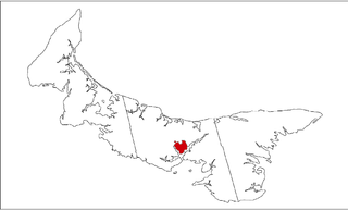
The community of Brackley Beach, formerly Brackley Point, is a small Canadian rural farming community located in central Prince Edward Island on the province's north shore, approximately 10 km north of the community of Brackley, from which it derives its name.

Canada is a country in the northern part of North America. Its ten provinces and three territories extend from the Atlantic to the Pacific and northward into the Arctic Ocean, covering 9.98 million square kilometres, making it the world's second-largest country by total area. Canada's southern border with the United States is the world's longest bi-national land border. Its capital is Ottawa, and its three largest metropolitan areas are Toronto, Montreal, and Vancouver. As a whole, Canada is sparsely populated, the majority of its land area being dominated by forest and tundra. Consequently, its population is highly urbanized, with over 80 percent of its inhabitants concentrated in large and medium-sized cities, many near the southern border. Canada's climate varies widely across its vast area, ranging from arctic weather in the north, to hot summers in the southern regions, with four distinct seasons.
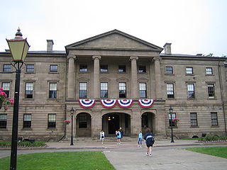
Prince Edward Island is a province of Canada consisting of the Atlantic island of the same name along with several much smaller islands nearby. PEI is one of the three Maritime Provinces. It is the smallest province of Canada in both land area and population, but it is the most densely populated. Part of the traditional lands of the Mi'kmaq, it became a British colony in the 1700s and was federated into Canada as a province in 1873. Its capital is Charlottetown. According to the 2016 census, the province of PEI has 142,907 residents.

Brackley is a rural municipality in Prince Edward Island, Canada. It is located on the northern boundary of Charlottetown, adjoining the Charlottetown Airport that is in the neighbourhood of Sherwood. Brackley originally incorporated in 1983. It absorbed the adjacent former municipality of Winsloe South via amalgamation on December 15, 2017.
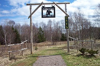
Brackley Beach is bordered on the north by the Prince Edward Island National Park of Canada which is home to sand dunes, barrier islands and sandspits, beaches, sandstone cliffs, wetlands and forests. These diverse habitats provide a home for a variety of plants and animals, including the threatened Gulf of Saint Lawrence Aster and the endangered Piping Plover.

Prince Edward Island National Park is a National Park of Canada located in the province of Prince Edward Island. Situated along the island's north shore, fronting the Gulf of St. Lawrence, the park measures approximately 60 km (37 mi) in length and ranges from several hundred metres to several kilometres in width. Established in 1937, the park's mandate includes the protection of many broad sand beaches, sand dunes and both freshwater wetlands and saltmarshes. The park's protected beaches provide nesting habitat for the endangered piping plover; the park has been designated a Canadian Important Bird Area.
The Brackley Beach area became a popular vacation spot in the late 19th century, and its shoreline was designated as part of the national park in 1937. Activities include deep sea fishing, bike, canoe and kayak rentals, horseback riding, campgrounds, several restaurants and dairy bars as well as Prince Edward Island's only drive-in theater.

A drive-in theater or drive-in cinema is a form of cinema structure consisting of a large outdoor movie screen, a projection booth, a concession stand and a large parking area for automobiles. Within this enclosed area, customers can view movies from the privacy and comfort of their cars. Some drive-ins have small playgrounds for children and a few picnic tables or benches.
Coordinates: 46°25′52″N63°12′58″W / 46.43111°N 63.21611°W

A geographic coordinate system is a coordinate system that enables every location on Earth to be specified by a set of numbers, letters or symbols. The coordinates are often chosen such that one of the numbers represents a vertical position and two or three of the numbers represent a horizontal position; alternatively, a geographic position may be expressed in a combined three-dimensional Cartesian vector. A common choice of coordinates is latitude, longitude and elevation. To specify a location on a plane requires a map projection.
| This Prince Edward Island location article is a stub. You can help Wikipedia by expanding it. |