
Mossel Bay is a harbour town of about 120,000 people on the Southern Cape of South Africa. It is an important tourism and farming region of the Western Cape Province. Mossel Bay lies 400 kilometres east of the country's seat of parliament, Cape Town, and 400 km west of Port Elizabeth, the largest city in the Eastern Cape. The older parts of the town occupy the north-facing side of the Cape St Blaize Peninsula, whilst the newer suburbs straddle the Peninsula and have spread eastwards along the sandy shore of the Bay.
The Garden Route is a 300-kilometre (190 mi) stretch of the south-eastern coast of South Africa which extends from Witsand in the Western Cape to the border of Tsitsikamma Storms River in the Eastern Cape. The name comes from the verdant and ecologically diverse vegetation encountered here and the numerous estuaries and lakes dotted along the coast. It includes towns such as Witsand, Heidelberg, Riversdale, Stilbaai, Albertinia, Gouritsmond, Knysna, Plettenberg Bay, Mossel Bay, Oudtshoorn, Great Brak River, Little Brak River, Wilderness, Sedgefield and Nature's Valley; with George, the Garden Route's largest city and main administrative centre.

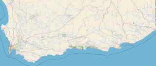
Mossel Bay Municipality is a local municipality within the Garden Route District Municipality, in the Western Cape province of South Africa. As of 2011, the population was 89,430.
The R327 is a Regional Route in South Africa. Its a regional route in the Western Province and connects Mossel Bay to Ladismith and part of the northern route is a gravel road.
The R328 is a Regional Route in Western Cape, South Africa that connects Mossel Bay in the south to Prince Albert in the north via Oudtshoorn.

The Langeberg Range is a mountain range in the Western Cape province of South Africa. Its highest peak is Keeromsberg at 2,075 m that lies 15 km northeast of the town of Worcester. Some of the highest peaks of the range are located just to the north of Swellendam, in a subrange known as the Clock Peaks whose highest point is the 1,710 m high Misty Point. Local lore states one can tell the time by means of the shadows cast by the seven summits of the Clock Peaks.

Kfm 94.5 is an adult contemporary radio station based in Cape Town, South Africa
The Great Brak River is a river in the Western Cape, South Africa. The mouth of the river lies at the town of Great Brak River which falls under the Mossel Bay Municipality. The nearest towns are Mossel Bay, 24 km to the west, and the largest town in the southern Cape George, 34 km to the east by road.
Gouritsmond is a small South African tourist town in the municipality of Hessequa, Garden Route District, Western Cape Province. It is situated about 36 road kilometres south-east of Albertinia. Gouritsmond is located just on the west side of the Gouritz River estuary and on the Indian Ocean. In 2011, Gouritsmond had 515 inhabitants in 206 households.

Great Brak River is a coastal village in the Mossel Bay Local Municipality in the Western Cape province of South Africa. It is a historic village built around the lagoon of the Great Brak River, 17 kilometres (11 mi) north-northeast of the town of Mossel Bay.

The South African Railways Class GK 2-6-2+2-6-2 of 1923 was an articulated steam locomotive from the New Cape Central Railway era.

Vleesbaai, a seaside vacation town, situated between Mossel Bay and Gouritsmond in Western Cape, South Africa.
Hoërskool Brandwag is an Afrikaans medium school in Uitenhage, South Africa, with an academic orientation. The school opened in 1937, and is named after a peak in the Drakensberg in Golden Gate Highlands National Park, called "The Sentinel" in English, which appears on the school's emblem. Its motto is "U dienswillige dienaar", which was the title of the autobiography of Afrikaans literary figure Cornelis Jacobus Langenhoven.

Mossel Bay Commando was a light infantry regiment of the South African Army. It formed part of the South African Army Infantry Formation as well as the South African Territorial Reserve.

The Buffelskloof Formation is a geological formation found in the Western Cape province in South Africa. It is the uppermost of the four formations found within the Uitenhage Group of the Algoa Basin. It is considered an informal formation by some of the literature as it is very thin and only outcrops as isolated horizons in the Oudshoorn-Gamtoos, Herbertsdale-Mossel Bay, and Heidelberg-Riversdale Basins. Along the Worcester-Pletmos Basin, it occurs in patches along the southern flanks of the Langeberg mountain range - from Worcester in the west and as far as Mossel Bay in the east. From Mossel Bay this formation is inter fingered by the informal Hartenbos Formation. The Buffelskloof and Hartenbos Formations only occur in the Oudshoorn-Gamtoos and Herbertsdale-Mossel Bay basins and seem to correlate to the Sundays River Formation in age.
There are at least three statues of Bartolomeu Dias, the first European to sail around the southernmost tip of Africa. This exploration, in 1488, led to the discovery of a sea route from Europe to Asia.
Ockert Stefanus "Okkie" Terblanche is a South African politician and retired police general serving as the Shadow Deputy Minister of Police since June 2019. He has been a Member of the National Assembly since May 2019. He represented the Western Cape in the National Council of Provinces (NCOP) from October 2015 to May 2019. Terblanche is a member of the Democratic Alliance (DA).
Mossel is a surname. Notable people with the surname include:

Ruiterbos is a village in the Mossel Bay Local Municipality in the Western Cape province of South Africa. As of 2011, the village had a population of 937 living in 310 households. The village is situaded at the foot of the Robinson Pass between Mossel Bay and Oudtshoorn. The settlement is about 22 km north of Mossel Bay, 12 km north of Brandwag and 10 km west of Friemersheim. The R328 passes through the town. The village is home to the Drie Magrietjies Padstal. Next to the village is the Ruitersbos Nature Reserve.


