
Interstate 43 (I-43) is a 191.55-mile-long (308.27 km) Interstate Highway located entirely within the US state of Wisconsin, connecting I-39/I-90 in Beloit with Milwaukee and I-41, U.S. Highway 41 (US 41) and US 141 in Green Bay. State Trunk Highway 32 (WIS 32) runs concurrently with I-43 in two sections and I-94, I-894, US 10, US 41, US 45, and WIS 57 overlap I-43 once each. There are no auxiliary or business routes connected to I-43, though an alternate route to direct traffic during road closures is signed along local and state highways from Milwaukee County north into Brown County.

Mossel Bay is a harbour town of about 120,000 people on the Southern Cape of South Africa. It is an important tourism and farming region of the Western Cape Province. Mossel Bay lies 400 kilometres east of the country's seat of parliament, Cape Town, and 400 km west of Port Elizabeth, the largest city in the Eastern Cape. The older parts of the town occupy the north-facing side of the Cape St Blaize Peninsula, whilst the newer suburbs straddle the Peninsula and have spread eastwards along the sandy shore of the Bay.
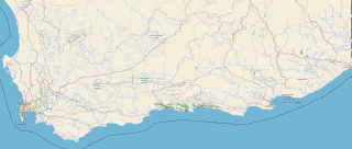
The Garden Route is a 300-kilometre (190 mi) stretch of the south-eastern coast of South Africa which extends from Witsand in the Western Cape to the border of Tsitsikamma Storms River in the Eastern Cape. The name comes from the verdant and ecologically diverse vegetation encountered here and the numerous estuaries and lakes dotted along the coast. It includes towns such as Witsand, Heidelberg, Riversdale, Stilbaai, Albertinia, Gouritsmond, Knysna, Plettenberg Bay, Mossel Bay, Oudtshoorn, Great Brak River, Little Brak River, Wilderness, Sedgefield and Nature's Valley; with George, the Garden Route's largest city and main administrative centre.

Mossel Bay Municipality is a local municipality within the Garden Route District Municipality, in the Western Cape province of South Africa. As of 2011, the population was 89,430.

The R102 is a Regional Route in South Africa. It is the route designation for all old sections of the N2, thus it is a discontinuous road that resumes in areas where a new N2 has been constructed.
The R327 is a Regional Route in South Africa. Its a regional route in the Western Province and connects Mossel Bay to Ladismith and part of the northern route is a gravel road.
The R328 is a Regional Route in Western Cape, South Africa that connects Mossel Bay in the south to Prince Albert in the north via Oudtshoorn.

The N2 is a national route in South Africa that runs from Cape Town through George, Gqeberha, East London, Mthatha, Port Shepstone and Durban to Ermelo. It is the main highway along the Indian Ocean coast of the country. Its current length of 2,255 kilometres (1,401 mi) makes it the longest numbered route in South Africa.

The Langeberg Range is a mountain range in the Western Cape province of South Africa. Its highest peak is Keeromsberg at 2,075 m that lies 15 km northeast of the town of Worcester. Some of the highest peaks of the range are located just to the north of Swellendam, in a subrange known as the Clock Peaks whose highest point is the 1,710 m high Misty Point. Local lore states one can tell the time by means of the shadows cast by the seven summits of the Clock Peaks.

Privett is a small village and former civil parish, now in the parish of Froxfield and Privett, in the East Hampshire district of Hampshire, England. It is 5 miles (8.0 km) northwest of Petersfield, just off the A272 road. Its principal feature is Holy Trinity Church, designed by Arthur Blomfield and built at the expense of local landowner, businessman and M.P. William Nicholson. Nicholson was also responsible for building in the village a number of dwellings for workers on his Basing Park estate. In 1931 the parish had a population of 172.
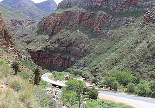
Meiringspoort is a South African mountain pass on the N12 national road, where it crosses the Swartberg mountain range.
The Great Brak River is a river in the Western Cape, South Africa. The mouth of the river lies at the town of Great Brak River which falls under the Mossel Bay Municipality. The nearest towns are Mossel Bay, 24 km to the west, and the largest town in the southern Cape George, 34 km to the east by road.
Boggomsbaai is a coastal holiday village in Mossel Bay Municipality in the Western Cape province of South Africa.

Great Brak River is a coastal village in the Mossel Bay Local Municipality in the Western Cape province of South Africa. It is a historic village built around the lagoon of the Great Brak River, 17 kilometres (11 mi) north-northeast of the town of Mossel Bay.
Herbertsdale is a settlement in Garden Route District Municipality in the Western Cape province of South Africa.

Mossel Bay Yacht and Boat Club, / Mosselbaai Seiljag- en Bootklub (Afrikaans), established in 1956, was a yacht club in South Africa. It is located in the harbour city of Mossel Bay on the Garden Route in the Western Cape Province.

109 Squadron SAAF was initially established as 109 Air Commando. It was a Citizen Force squadron of the South African Air Force, established on 24 September 1963 at Mossel Bay. The unit was staffed by volunteer aircrew flying privately owned civilian aircraft. On 1 October 1968 control of 109 Air Commando was passed from the South African Army to the Air Force and the name was changed to 109 Squadron. The squadron stopped flying on 31 January 1993 and was disbanded on 31 March 1993. Its pilots were transferred to 105 and 108 Commando Squadrons.

Vleesbaai, a seaside vacation town, situated between Mossel Bay and Gouritsmond in Western Cape, South Africa.
Brandwag is a town in Mossel Bay Local Municipality in the Western Cape province of South Africa.

Mossel Bay Commando was a light infantry regiment of the South African Army. It formed part of the South African Army Infantry Formation as well as the South African Territorial Reserve.


