
Brewster is a town in Barnstable County, Massachusetts, United States, Barnstable County being coextensive with Cape Cod. The population of Brewster was 10,318 at the 2020 census.

Mossel Bay is a harbour town of about 120,000 people on the Southern Cape of South Africa. It is an important tourism and farming region of the Western Cape Province. Mossel Bay lies 400 kilometres east of the country's seat of parliament, Cape Town, and 400 km west of Port Elizabeth, the largest city in the Eastern Cape. The older parts of the town occupy the north-facing side of the Cape St Blaize Peninsula, whilst the newer suburbs straddle the Peninsula and have spread eastwards along the sandy shore of the Bay.

Karamea is a town on the West Coast of the South Island of New Zealand. It is the northernmost settlement of any real size on the West Coast, and is located 96 kilometres (60 mi) northeast by road from Westport. Apart from a narrow coastal strip, the town of Karamea and its local area are completely surrounded to the south, east and north by Kahurangi National Park.

Margate is a coastal resort town in the KwaZulu-Natal province, about 20 kilometres south-west of Port Shepstone and 127 kilometres south-west of Durban. The river which flows into the sea at Margate is called "Nkhongweni" (place of entreaty) as the original inhabitants of the area were reputed to be so mean resulting in travellers begging for hospitality.
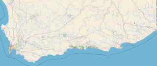
The Garden Route is a 300-kilometre (190 mi) stretch of the south-eastern coast of South Africa which extends from Witsand in the Western Cape to the border of Tsitsikamma Storms River in the Eastern Cape. The name comes from the verdant and ecologically diverse vegetation encountered here and the numerous estuaries and lakes dotted along the coast. It includes towns such as Witsand, Heidelberg, Riversdale, Stilbaai, Albertinia, Gouritsmond, Knysna, Plettenberg Bay, Mossel Bay, Oudtshoorn, Great Brak River, Little Brak River, Wilderness, Sedgefield and Nature's Valley; with George, the Garden Route's largest city and main administrative centre.

Mossel Bay Municipality is a local municipality within the Garden Route District Municipality, in the Western Cape province of South Africa. As of 2011, the population was 89,430.
Hessequa Municipality, known before 24 June 2005 as Langeberg Municipality, is a local municipality within the Garden Route District Municipality, in the Western Cape province of South Africa. It is flanked by the lower Breede River to the west and the Gourits River to the east. As of 2011, the population was 52,642. Its municipality code is WC042. The name Hessequa, meaning "people of the trees", refers to the indigenous Khoikhoi people.

Jeffreys Bay is a town of 27,107 inhabitants as of the 2011 census in the Eastern Cape province of South Africa. It Is the seat of the Kouga municipality and is famous amongst surfers as a surf capital due to the right-hand point break at Supertubes Beach. The town is situated just off the N2 Highway, about 75 kilometres southwest of Port Elizabeth.

George is the second largest city in the Western Cape province of South Africa. The city is a popular holiday and conference centre, as well as the administrative and commercial hub and the seat of the Garden Route District Municipality. It is named after the British Monarch George III.

Helderberg refers to a planning district of the City of Cape Town metropolitan municipality, the mountain after which it is named, a wine-producing area in the Western Cape province of South Africa, or a small census area in Somerset West.

Southwest Alaska is a region of the U.S. state of Alaska. The area is not exactly defined by any governmental administrative region(s); nor does it always have a clear geographic boundary.

The East Coast Trail (ECT) is a long-distance coastal footpath located in the Canadian province of Newfoundland and Labrador. It is a developed trail over 336 kilometres (209 mi) long, creation of which began in 1994. It is made up of 25 linked wilderness paths and passes through more than 30 communities. It was named one of the best adventure destinations by National Geographic in 2012 and is extended and improved yearly.
Patonga is a small beach side fishing and holiday village which is part of the Central Coast region of New South Wales, Australia, located on the edge of Brisk Bay and near the mouth of the Hawkesbury River. It is part of the Central Coast Council local government area. Patonga is the southern most village of the Central Coast.

Gourits River, sometimes spelled 'Gouritz River', is situated in the Western Cape, South Africa.
The Great Brak River is a river in the Western Cape, South Africa. The mouth of the river lies at the town of Great Brak River which falls under the Mossel Bay Municipality. The nearest towns are Mossel Bay, 24 km to the west, and the largest town in the southern Cape George, 34 km to the east by road.

Albertinia is a settlement in the Hessequa Municipality in the Western Cape province of South Africa.

Great Brak River is a coastal village in the Mossel Bay Local Municipality in the Western Cape province of South Africa. It is a historic village built around the lagoon of the Great Brak River, 17 kilometres (11 mi) north-northeast of the town of Mossel Bay.

Vleesbaai, a seaside vacation town, situated between Mossel Bay and Gouritsmond in Western Cape, South Africa.
The Gouritz Cluster Biosphere Reserve is located in the Western Cape of South Africa. It is the 7th and largest of South Africa’s biosphere reserves; divided into four connected sectors ranging from sea level to 2,240 metres. The area is the only place in the world where three recognised biodiversity hotspots converge. The site is characterised by high endemism of plant species and threatened invertebrates including seven endemic species of the enigmatic beetle genus Colophon and 14 butterfly species. It provides a migratory route for large mammals such as the leopard and serves as a nursery for marine species.

The Gouritz River Bridge on the N2 route between Cape Town and Port Elizabeth is a rigid-frame bridge which crosses the Gouritz River 34 kilometres (21 mi) west of Mossel Bay in the Western Cape.


